top of page
Atlantic Ocean - Published 1941
National Geographic
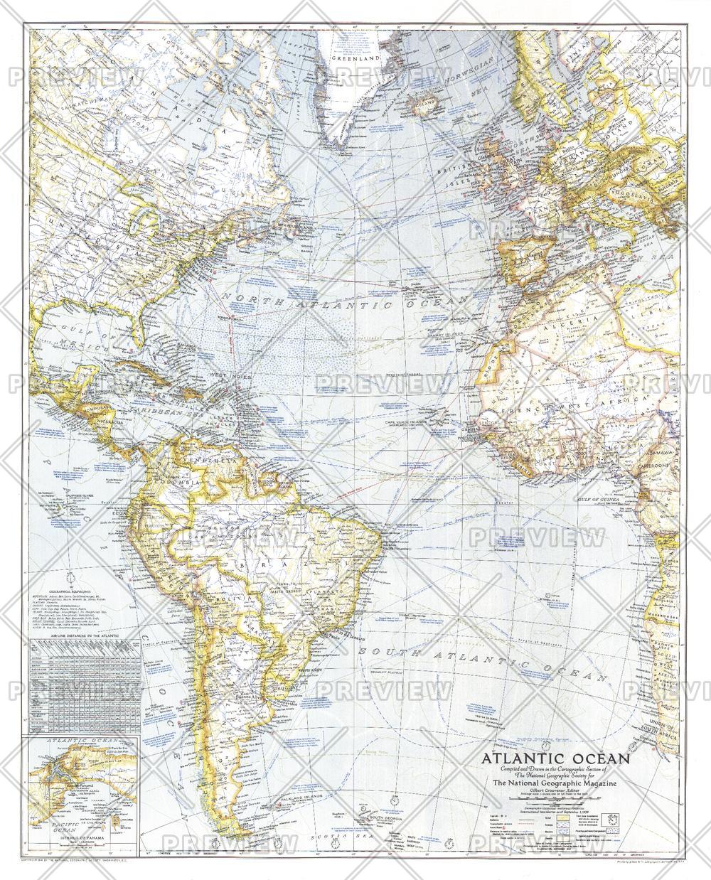
Published in September 1941, this map paints a striking portrait of the Atlantic Ocean on the verge of the US involvement in World War II. Naval bases, dates and locations of war-time events, time zone boundaries, shipping routes and air travel distances, as well as wind, current, and storm information, make this map a unique window into the turbulent times and the desire for a greater understanding of the Atlantic and its significance for travel, trade, and national security.
Page Size: 25.25 x 31.25 in (640 x 792 mm)
Buy this map on MapTrove.ca or MapTrove.com
bottom of page