Africa Classic
National Geographic
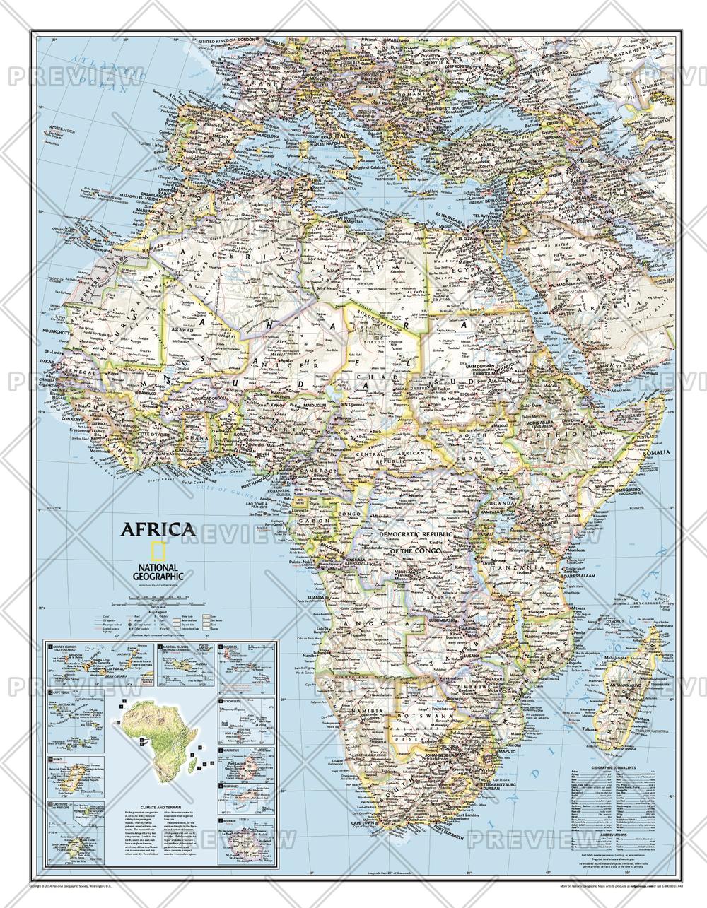
Our classic political map of Africa features country boundaries, place names, bodies of water, airports, major highways and roads, and much more. Includes the most accurate and up to date boundaries and names for all countries including Algeria, Angola, Benin, Botswana, Burkina Faso, Burundi, Cameroon, Cape Verde, Central African Republic, Chad, Democratic Republic of the Congo, Republic of Congo, Côte d'Ivoire, Djibouti, Egypt, Equatorial Guinea, Eritrea, Ethiopia, Gabon, Gambia, Ghana, Guinea, Guinea-Bissau, Kenya, Liberia, Libya, Madagascar, Malawi, Mali, Mauritania, Morocco, Mozambique, Namibia, Niger, Nigeria, Rwanda, Senegal, Sierra Leone, Somalia, South Africa, Sudan, South Sudan, Tanzania, Togo, Tunisia, Uganda, Zambia, Zimbabwe and the island nations off the coast of Africa.
Page Size: 24 x 31 in (610 x 784 mm)
Buy this map on MapTrove.ca or MapTrove.com