top of page
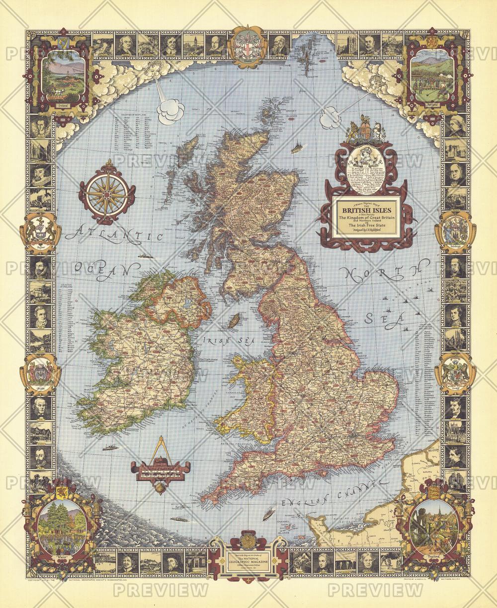
A Modern Pilgrim's Map of the British Isles - Published 1937
National Geographic
Published in June 1937, this whimsical map of the British Isles features colorful illustrations, county indexes, and thousands of places of interest in England, Wales, Scotland, and Ireland. The illustrated border contains sketches of historical figures and locations of interest. The unique artistic craftsmanship of this colorful and vibrant map make it a wonderful gift for those who love the British Isles.
Page Size: 31 x 38 in (785 x 961 mm)
Buy this map on MapTrove.ca or MapTrove.com
bottom of page