


MapSherpa

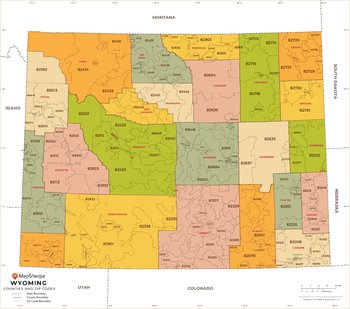
Wyoming ZIP Code Map with Counties - Extra Large
This map has been created exclusively for MapSherpa, and designed for business or reference use. Clear and clean colors & fonts matched with cartographic research makes this map of Wyoming's counties and ZIP codes easily readable and useful.
Page Size: 60 x 53.25 in (1524 x 1348 mm)

Wyoming ZIP Code Map with Counties - Large
This map has been created exclusively for MapSherpa, and designed for business or reference use. Clear and clean colors & fonts matched with cartographic research makes this map of Wyoming's counties and ZIP codes easily readable and useful.
Page Size: 48 x 42.5 in (1219 x 1078 mm)
Wyoming ZIP Code Map with Counties - Standard
This map has been created exclusively for MapSherpa, and designed for business or reference use. Clear and clean colors & fonts matched with cartographic research makes this map of Wyoming's counties and ZIP codes easily readable and useful.
Page Size: 36 x 32 in (914 x 809 mm)
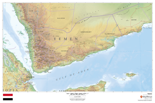
Yemen
This beautiful map shows physical and political features for Yemen and surrounding areas. Relief shading and the use of different colours by height above sea level are both informative and attractive.
Page Size: 36 x 24 in (914 x 610 mm)
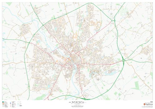
York
This map of York shows detailed street level information including extensive street labelling. Ideal for planning of deliveries, home services, sales territories, real estate and much more.
Page Size: 47 x 33.25 in (1189 x 841 mm)
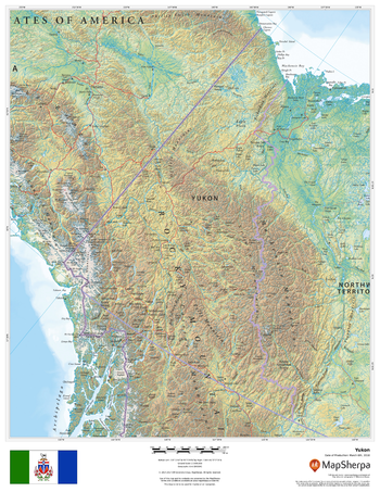
Yukon
This beautiful map shows physical and political features for the Yukon surrounding areas. Relief shading and the use of different colours by height above sea level are both informative and attractive.
Page Size: 17 x 22 in (432 x 559 mm)
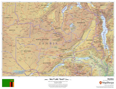
Zambia
This beautiful map shows physical and political features for Zambia and surrounding areas. Relief shading and the use of different colours by height above sea level are both informative and attractive.
Page Size: 22 x 17 in (559 x 432 mm)
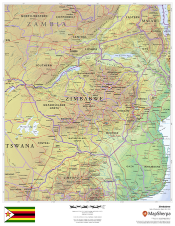
Zimbabwe
This beautiful map shows physical and political features for Zimbabwe and surrounding areas. Relief shading and the use of different colours by height above sea level are both informative and attractive.
Page Size: 17 x 22 in (432 x 559 mm)