


MapSherpa
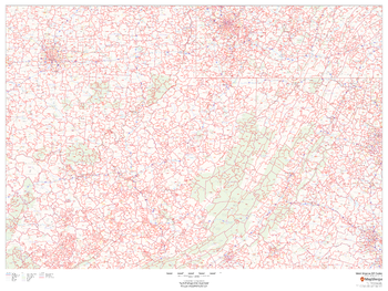
West Virginia ZIP Code Map
This map of West Virginia shows ZIP codes overlaid on a road map. Base map features include municipality and county boundaries, major road network features, and state and national parks and conservation areas.
Page Size: 48 x 36 in (1219 x 914 mm)
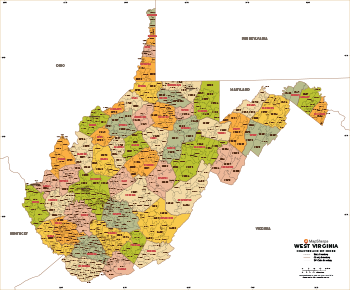
West Virginia ZIP Code Map with Counties - Extra Large
This map has been created exclusively for MapSherpa, and designed for business or reference use. Clear and clean colors & fonts matched with cartographic research makes this West Virginia Zip Code Map with Counties easily readable and useful. The map shows the 55 counties of West Virginia and the borders of the over 700 zip codes across the Mountain State.
Page Size: 60 x 49.75 in (1524 x 1262 mm)

West Virginia ZIP Code Map with Counties - Large
This map has been created exclusively for MapSherpa, and designed for business or reference use. Clear and clean colors & fonts matched with cartographic research makes this West Virginia Zip Code Map with Counties easily readable and useful. The map shows the 55 counties of West Virginia and the borders of the over 700 zip codes across the Mountain State.
Page Size: 48 x 39.75 in (1219 x 1010 mm)

West Virginia ZIP Code Map with Counties - Standard
This map has been created exclusively for MapSherpa, and designed for business or reference use. Clear and clean colors & fonts matched with cartographic research makes this West Virginia Zip Code Map with Counties easily readable and useful. The map shows the 55 counties of West Virginia and the borders of the over 700 zip codes across the Mountain State.
Page Size: 36 x 30 in (914 x 757 mm)
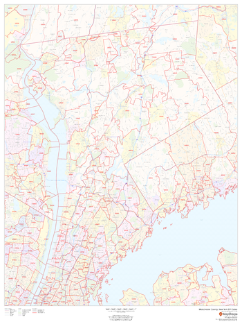
Westchester County, New York
This map of Westchester County, New York shows regional level information. Base map features include highways and major roads with labelling; neighborhood names; railways; high level land use such as parks and recreation areas, industrial areas and hospital campuses; and a selection of points of interest including transportation hubs like airports and train stations, tourist information, police stations and shopping centres. ZIP code boundaries are shown as a secondary map feature.
Page Size: 36 x 48 in (914 x 1219 mm)
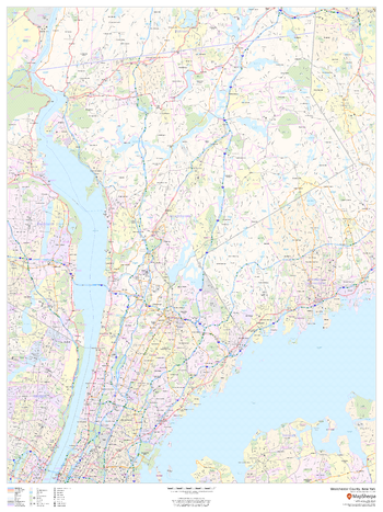
Westchester County, New York ZIP Codes
This map of Westchester County, New York shows ZIP code areas overlaid on a road map. Ideal for planning of deliveries, home services, sales territories, real estate and much more. Base map features include all roads with major roads and highways labelled; neighborhood names; railways; and high level land use such as parks and recreation areas, industrial areas and hospital campuses.
Page Size: 36 x 48 in (914 x 1219 mm)
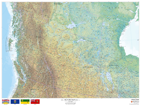
Western Canada
This beautiful map shows physical and political features for Western Canada. Relief shading and the use of different colours by height above sea level are both informative and attractive.
Page Size: 48 x 36 in (1219 x 914 mm)
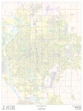
Wichita, Kansas Inner Metro - Landscape
This landscape-oriented map of central Wichita, Kansas shows detailed street level information including extensive street labeling. Ideal for planning of deliveries, home services, sales territories, real estate and much more. Base map features include all roads with major roads and highways labelled; neighborhood names; railways; high level land use such as parks and recreation areas, industrial areas and hospital campuses; and a variety of points of interest including schools, libraries, stadiums, museums, border crossings and more.
Page Size: 48 x 36 in (1219 x 914 mm)
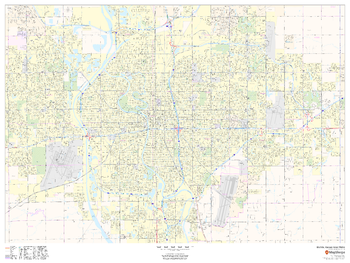
Wichita, Kansas Inner Metro - Portrait
This portrait-oriented map of central Wichita, Kansas shows detailed street level information including extensive street labeling. Ideal for planning of deliveries, home services, sales territories, real estate and much more. Base map features include all roads with major roads and highways labelled; neighborhood names; railways; high level land use such as parks and recreation areas, industrial areas and hospital campuses; and a variety of points of interest including schools, libraries, stadiums, museums, border crossings and more.
Page Size: 36 x 48 in (914 x 1219 mm)
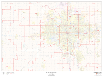
Wichita, Kansas ZIP Codes
This map of Wichita, Kansas shows ZIP code areas overlaid on a road map. Ideal for planning of deliveries, home services, sales territories, real estate and much more. Base map features include all roads with major roads and highways labelled; neighborhood names; railways; and high level land use such as parks and recreation areas, industrial areas and hospital campuses.
Page Size: 48 x 36 in (1219 x 914 mm)
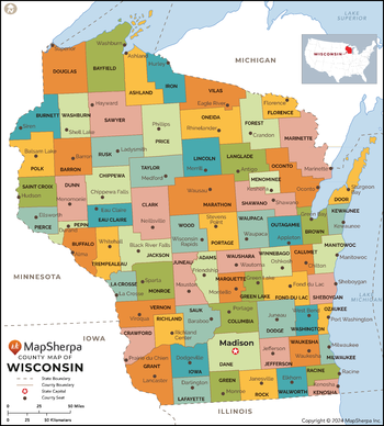
Wisconsin Counties Map - Extra Large
This map has been created exclusively for MapSherpa, and designed for reference or business use. Clear and clean colors & fonts matched with cartographic research makes this map of the 72 Wisconsin counties easily readable and useful.
Page Size: 60 x 66.75 in (1524 x 1689 mm)

Wisconsin Counties Map - Large
This map has been created exclusively for MapSherpa, and designed for reference or business use. Clear and clean colors & fonts matched with cartographic research makes this map of the 72 Wisconsin counties easily readable and useful.
Page Size: 48 x 53.25 in (1219 x 1351 mm)

Wisconsin Counties Map - Standard
This map has been created exclusively for MapSherpa, and designed for reference or business use. Clear and clean colors & fonts matched with cartographic research makes this map of the 72 Wisconsin counties easily readable and useful.
Page Size: 36 x 40 in (914 x 1014 mm)
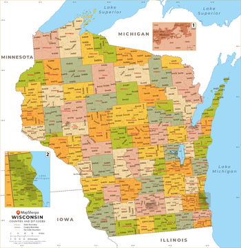
Wisconsin ZIP Code Map
This map of Wisconsin shows ZIP codes overlaid on a road map. Base map features include county boundaries, major road network features, and state and national parks and conservation areas.
Page Size: 36 x 48 in (914 x 1219 mm)
Wisconsin ZIP Code Map with Counties - Extra Large
This map has been created exclusively for MapSherpa, and designed for business or reference use. Clear and clean colors & fonts matched with cartographic research makes this map of Wisconsin's counties and ZIP codes easily readable and useful.
Page Size: 60 x 62 in (1524 x 1569 mm)

Wisconsin ZIP Code Map with Counties - Large
This map has been created exclusively for MapSherpa, and designed for business or reference use. Clear and clean colors & fonts matched with cartographic research makes this map of Wisconsin's counties and ZIP codes easily readable and useful.
Page Size: 48 x 49.5 in (1219 x 1255 mm)

Wisconsin ZIP Code Map with Counties - Standard
This map has been created exclusively for MapSherpa, and designed for business or reference use. Clear and clean colors & fonts matched with cartographic research makes this map of Wisconsin's counties and ZIP codes easily readable and useful.
Page Size: 36 x 37.25 in (914 x 941 mm)
Wolverhampton
This map of Wolverhampton shows detailed street level information including extensive street labelling. Ideal for planning of deliveries, home services, sales territories, real estate and much more.
Page Size: 47 x 33.25 in (1189 x 841 mm)
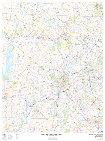
Worcester County, Massachusetts
This map of Worcester County, Massachusetts shows regional level information. Base map features include highways and major roads with labelling; neighborhood names; railways; high level land use such as parks and recreation areas, industrial areas and hospital campuses; and a selection of points of interest including transportation hubs like airports and train stations, tourist information, police stations and shopping centres. ZIP code boundaries are shown as a secondary map feature.
Page Size: 36 x 48 in (914 x 1219 mm)
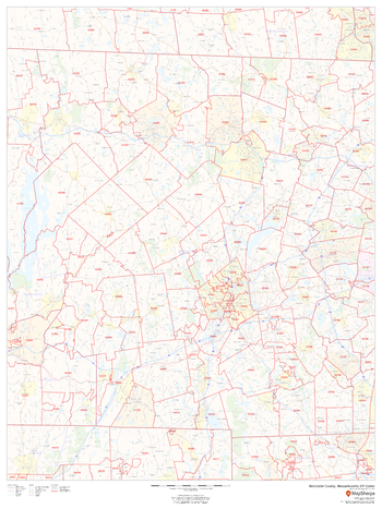
Worcester County, Massachusetts ZIP Codes
This map of Worcester County, Massachusetts shows ZIP code areas overlaid on a road map. Ideal for planning of deliveries, home ervices, sales territories, real estate and much more. Base map features include all roads with major roads and highways labelled; neighborhood names; railways; and high level land use such as parks and recreation areas, industrial areas and hospital campuses.
Page Size: 36 x 48 in (914 x 1219 mm)