


MapSherpa
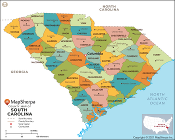
South Carolina Counties Map - Standard
This map has been created exclusively for MapSherpa, and designed for reference or business use. Clear and clean colors & fonts matched with cartographic research makes this map of South Carolina Counties Map easily readable and useful. The map shows the 46 counties of South Carolina and their borders across the Palmetto State.
Page Size: 36 x 29 in (914 x 732 mm)
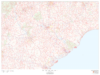
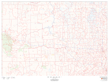
South Carolina ZIP Code Map
This map of South Carolina shows ZIP codes overlaid on a road map. Base map features include municipality and county boundaries, major road network features, and state and national parks and conservation areas.
Page Size: 48 x 36 in (1219 x 914 mm)

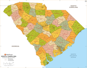
South Carolina ZIP Code Map with Counties - Extra Large
This map has been created exclusively for MapSherpa, and designed for business or reference use. Clear and clean colors & fonts matched with cartographic research makes this South Carolina Zip Code Map with Counties easily readable and useful. The map shows the 46 counties of South Carolina and the borders of the 421 zip codes across the Palmetto State.
Page Size: 60 x 47.5 in (1524 x 1204 mm)
South Carolina ZIP Code Map with Counties - Large
This map has been created exclusively for MapSherpa, and designed for business or reference use. Clear and clean colors & fonts matched with cartographic research makes this South Carolina Zip Code Map with Counties easily readable and useful. The map shows the 46 counties of South Carolina and the borders of the 421 zip codes across the Palmetto State.
Page Size: 48 x 38 in (1219 x 963 mm)

South Carolina ZIP Code Map with Counties - Standard
This map has been created exclusively for MapSherpa, and designed for business or reference use. Clear and clean colors & fonts matched with cartographic research makes this South Carolina Zip Code Map with Counties easily readable and useful. The map shows the 46 counties of South Carolina and the borders of the 421 zip codes across the Palmetto State.
Page Size: 36 x 28.5 in (914 x 722 mm)
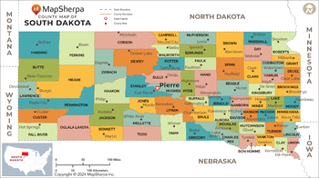
South Dakota Counties Map - Extra Large
This map has been created exclusively for MapSherpa, and designed for reference or business use. Clear and clean colors & fonts matched with cartographic research makes this map of the 66 South Dakota counties easily readable and useful.
Page Size: 60 x 33.75 in (1524 x 853 mm)

South Dakota Counties Map - Large
This map has been created exclusively for MapSherpa, and designed for reference or business use. Clear and clean colors & fonts matched with cartographic research makes this map of the 66 South Dakota counties easily readable and useful.
Page Size: 48 x 27 in (1219 x 682 mm)

South Dakota Counties Map - Standard
This map has been created exclusively for MapSherpa, and designed for reference or business use. Clear and clean colors & fonts matched with cartographic research makes this map of the 66 South Dakota counties easily readable and useful.
Page Size: 36 x 20.25 in (914 x 512 mm)
South Dakota ZIP Code Map
This map of South Dakota shows ZIP codes overlaid on a road map. Base map features include municipality and county boundaries, major road network features, and state and national parks and conservation areas.
Page Size: 48 x 36 in (1219 x 914 mm)
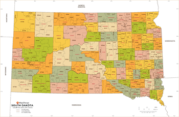
South Dakota ZIP Code Map with Counties - Extra Large
This map has been created exclusively for MapSherpa, and designed for business or reference use. Clear and clean colors & fonts matched with cartographic research makes this map of South Dakota's counties and ZIP codes easily readable and useful.
Page Size: 60 x 39.5 in (1524 x 1000 mm)

South Dakota ZIP Code Map with Counties - Large
This map has been created exclusively for MapSherpa, and designed for business or reference use. Clear and clean colors & fonts matched with cartographic research makes this map of South Dakota's counties and ZIP codes easily readable and useful.
Page Size: 48 x 31.75 in (1219 x 800 mm)

South Dakota ZIP Code Map with Counties - Standard
This map has been created exclusively for MapSherpa, and designed for business or reference use. Clear and clean colors & fonts matched with cartographic research makes this map of South Dakota's counties and ZIP codes easily readable and useful.
Page Size: 36 x 23.75 in (914 x 600 mm)
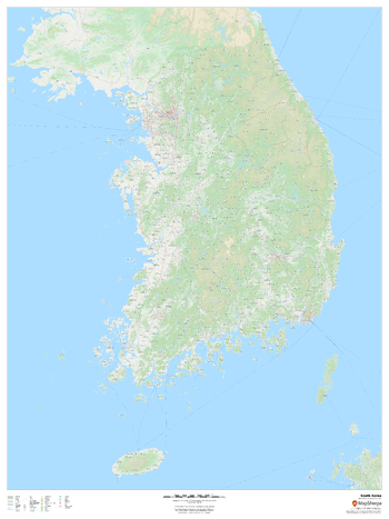
South Korea
This map provides an overview of South Korea, highlighting key cities and towns, road network and waterways, with a backdrop of the geographic relief and land use of the country.
Page Size: 36 x 48 in (914 x 1219 mm)
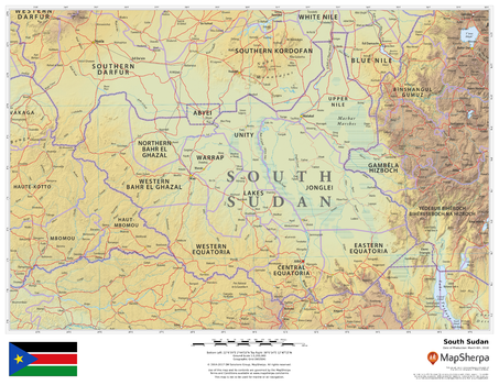
South Sudan
This beautiful map shows physical and political features for South Sudan and surrounding areas. Relief shading and the use of different colours by height above sea level are both informative and attractive.
Page Size: 22 x 17 in (559 x 432 mm)
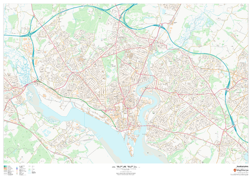
Southampton
This map of Southampton shows detailed street level information including extensive street labelling. Ideal for planning of deliveries, home services, sales territories, real estate and much more.
Page Size: 47 x 33.25 in (1189 x 841 mm)
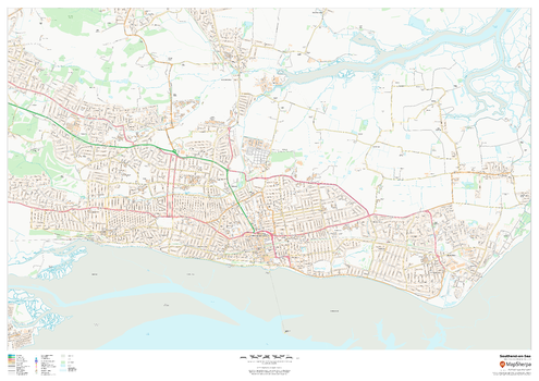
Southend-on-Sea
This map of Southend-on-Sea shows detailed street level information including extensive street labelling. Ideal for planning of deliveries, home services, sales territories, real estate and much more.
Page Size: 47 x 33.25 in (1189 x 841 mm)
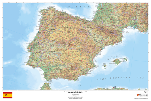
Spain
This beautiful map shows physical and political features for Spain and surrounding areas. Relief shading and the use of different colours by height above sea level are both informative and attractive.
Page Size: 36 x 24 in (914 x 610 mm)
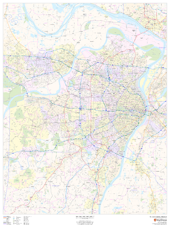
St. Louis County, Missouri
This map of St. Louis County, Missouri shows regional level information. Base map features include highways and major roads with labelling; neighborhood names; railways; high level land use such as parks and recreation areas, industrial areas and hospital campuses; and a selection of points of interest including transportation hubs like airports and train stations, tourist information, police stations and shopping centres. ZIP code boundaries are shown as a secondary map feature.
Page Size: 36 x 48 in (914 x 1219 mm)
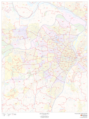
St. Louis County, Missouri ZIP Codes
This map of St. Louis County, Missouri shows ZIP code areas overlaid on a road map. Ideal for planning of deliveries, home services, sales territories, real estate and much more. Base map features include all roads with major roads and highways labelled; neighborhood names; railways; and high level land use such as parks and recreation areas, industrial areas and hospital campuses.
Page Size: 36 x 48 in (914 x 1219 mm)
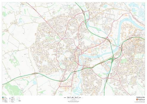
Stockton-on-Tees
This map of Stockton-on-Tees shows detailed street level information including extensive street labelling. Ideal for planning of deliveries, home services, sales territories, real estate and much more.
Page Size: 47 x 33.25 in (1189 x 841 mm)