


MapSherpa
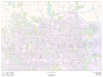
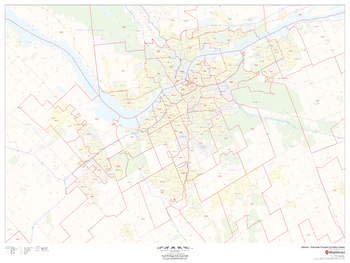
Omaha, Nebraska Inner Metro - Landscape
This landscape-oriented map of central Omaha, Nebraska shows detailed street level information including extensive street labeling. Ideal for planning of deliveries, home services, sales territories, real estate and much more. Base map features include all roads with major roads and highways labelled; neighborhood names; railways; high level land use such as parks and recreation areas, industrial areas and hospital campuses; and a variety of points of interest including schools, libraries, stadiums, museums, border crossings and more.
Page Size: 48 x 36 in (1219 x 914 mm)
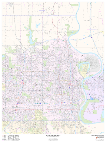
Omaha, Nebraska Inner Metro - Portrait
This portrait-oriented map of central Omaha, Nebraska shows detailed street level information including extensive street labeling. Ideal for planning of deliveries, home services, sales territories, real estate and much more. Base map features include all roads with major roads and highways labelled; neighborhood names; railways; high level land use such as parks and recreation areas, industrial areas and hospital campuses; and a variety of points of interest including schools, libraries, stadiums, museums, border crossings and more.
Page Size: 36 x 48 in (914 x 1219 mm)
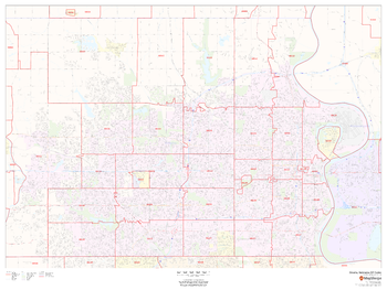
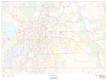
Omaha, Nebraska ZIP Codes
This map of Omaha, Nebraska shows ZIP code areas overlaid on a road map. Ideal for planning of deliveries, home services, sales territories, real estate and much more. Base map features include all roads with major roads and highways labelled; neighborhood names; railways; and high level land use such as parks and recreation areas, industrial areas and hospital campuses.
Page Size: 48 x 36 in (1219 x 914 mm)
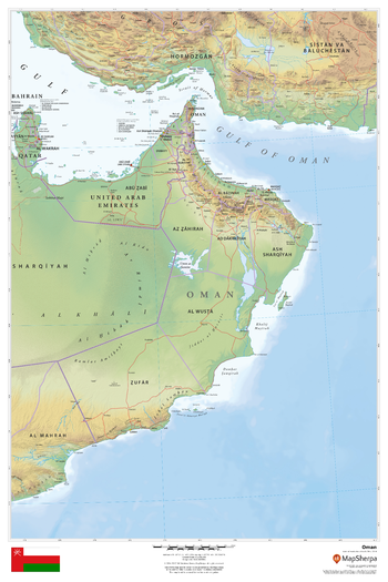
Oman
This beautiful map shows physical and political features for Oman and surrounding areas. Relief shading and the use of different colours by height above sea level are both informative and attractive.
Page Size: 24 x 36 in (610 x 914 mm)
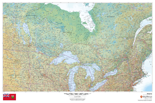
Ontario
This beautiful map shows physical and political features for Ontario and surrounding areas. Relief shading and the use of different colours by height above sea level are both informative and attractive.
Page Size: 36 x 24 in (914 x 610 mm)
Operational Navigation Charts
Published by the United States government in the 1980s and 1990s, Operational Navigation Charts are topographic maps with aeronautical information overlain. The maps show cities, main roads, important landscape features, railway lines, forests and waters. Relief is illustrated by highlights, contour lines (distances in feet ) and shading. Coverage includes the Mediterranean, Africa, the Middle East, across the Himalayas to Japan. Individual map sheets have been combined into a seamless layer. Suitable for print maps between 1:500,000 and 1:1,500,000.
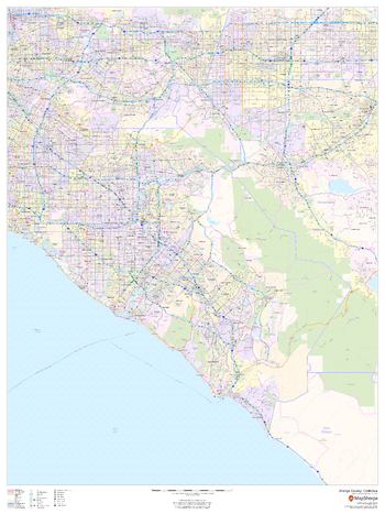
Orange County, California
This map of Orange County, California shows regional level information. Base map features include highways and major roads with labelling; railways; high level land use such as parks and recreation areas; and a selection of points of interest including transportation hubs like airports and train stations, tourist information and police stations. ZIP code boundaries are shown as a secondary map feature.
Page Size: 36 x 48 in (914 x 1219 mm)
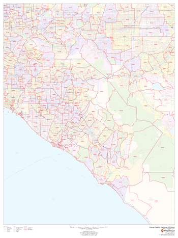
Orange County, California ZIP Codes
This map of Orange County, California shows ZIP code areas overlaid on a road map. Ideal for planning of deliveries, home services, sales territories, real estate and much more. Base map features include all roads with major roads and highways labelled; neighborhood names; railways; and high level land use such as parks and recreation areas, industrial areas and hospital campuses.
Page Size: 36 x 48 in (914 x 1219 mm)
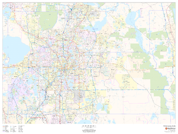
Orange County, Florida
This map of Orange County, Florida shows regional level information. Base map features include highways and major roads with labelling; neighborhood names; railways; high level land use such as parks and recreation areas, industrial areas and hospital campuses; and a selection of points of interest including transportation hubs like airports and train stations, tourist information, police stations and shopping centres. ZIP code boundaries are shown as a secondary map feature.
Page Size: 48 x 36 in (1219 x 914 mm)
Orange County, Florida ZIP Codes
This map of Orange County, Florida shows ZIP code areas overlaid on a road map. Ideal for planning of deliveries, home services, sales territories, real estate and much more. Base map features include all roads with major roads and highways labelled; neighborhood names; railways; and high level land use such as parks and recreation areas, industrial areas and hospital campuses.
Page Size: 48 x 36 in (1219 x 914 mm)

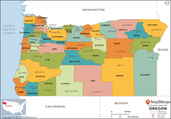
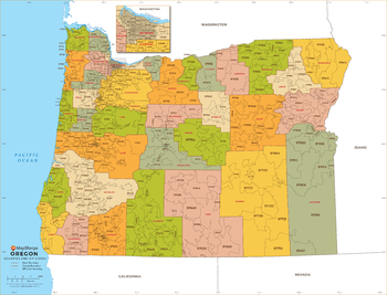
Oregon Counties Map - Extra Large
This map has been created exclusively for MapSherpa, and designed for reference or business use. Clear and clean colors & fonts matched with cartographic research makes this map of Oregon Counties Map easily readable and useful. The map shows the 36 counties of Oregon and their borders across the Beaver State.
Page Size: 60 x 41.75 in (1524 x 1060 mm)
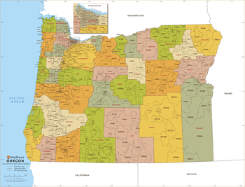
Oregon Counties Map - Large
This map has been created exclusively for MapSherpa, and designed for reference or business use. Clear and clean colors & fonts matched with cartographic research makes this map of Oregon Counties Map easily readable and useful. The map shows the 36 counties of Oregon and their borders across the Beaver State.
Page Size: 48 x 33.5 in (1219 x 848 mm)

Oregon Counties Map - Standard
This map has been created exclusively for MapSherpa, and designed for reference or business use. Clear and clean colors & fonts matched with cartographic research makes this map of Oregon Counties Map easily readable and useful. The map shows the 36 counties of Oregon and their borders across the Beaver State.
Page Size: 36 x 25.25 in (914 x 636 mm)
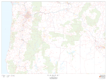
Oregon ZIP Code Map
This map of Oregon shows ZIP codes overlaid on a road map. Base map features include county boundaries, major road network features, and state and national parks and conservation areas.
Page Size: 48 x 36 in (1219 x 914 mm)
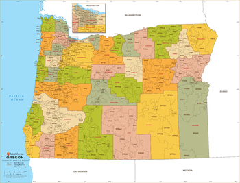
Oregon ZIP Code Map with Counties - Extra Large
This map has been created exclusively for MapSherpa, and designed for business or reference use. Clear and clean colors & fonts matched with cartographic research makes this Oregon Zip Code Map with Counties easily readable and useful. The map shows the 36 counties of Oregon and the borders of the over 400 zip codes across the Beaver State.
Page Size: 60 x 46 in (1524 x 1164 mm)
Oregon ZIP Code Map with Counties - Large
This map has been created exclusively for MapSherpa, and designed for business or reference use. Clear and clean colors & fonts matched with cartographic research makes this Oregon Zip Code Map with Counties easily readable and useful. The map shows the 36 counties of Oregon and the borders of the over 400 zip codes across the Beaver State.
Page Size: 48 x 36.75 in (1219 x 931 mm)
Oregon ZIP Code Map with Counties - Standard
This map has been created exclusively for MapSherpa, and designed for business or reference use. Clear and clean colors & fonts matched with cartographic research makes this Oregon Zip Code Map with Counties easily readable and useful. The map shows the 36 counties of Oregon and the borders of the over 400 zip codes across the Beaver State.
Page Size: 36 x 27.5 in (914 x 698 mm)
Ottawa - Gatineau Postal Code Forward Sortation Areas
This map of the urban core of Ottawa-Gatineau shows postal code forward sortation areas overlaid on a road map. Ideal for planning of deliveries, home services, sales territories, real estate and much more. Base map features include all roads with major roads and highways labelled; neighbourhood names; railways; and high level land use such as parks and recreation areas, industrial areas and hospital campuses.
Page Size: 48 x 36 in (1219 x 914 mm)
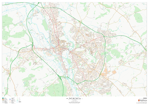
Oxford
This map of Oxford shows detailed street level information including extensive street labelling. Ideal for planning of deliveries, home services, sales territories, real estate and much more.
Page Size: 47 x 33.25 in (1189 x 841 mm)
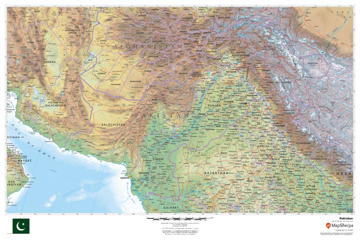
Pakistan
This beautiful map shows physical and political features for Pakistan and surrounding areas. Relief shading and the use of different colours by height above sea level are both informative and attractive.
Page Size: 36 x 24 in (914 x 610 mm)