top of page
Kids Cartoon Map of the World
Maps International
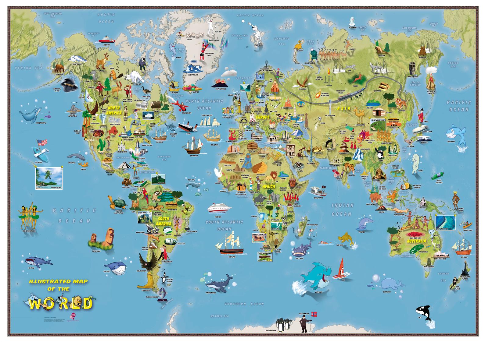
This is a fantastic fun Children's Illustrated Map of the World perfect for Children aged 5 upwards. The detailed illustrations show people and local culture, animals and marine life, famous natural features and manmade landmarks plus a range of other fun illustrations. Find the Polar Bears playing catch or the Aborigines dancing to the didgeridoo, plus learn where the Victoria Falls or Mount Everest are in the world. The World Map itself show the Continents, Sea and Ocean names and also shows hill and sea shading.
Page Size: 33.25 x 23.5 in (841 x 594 mm)
Buy this map on MapTrove.ca or MapTrove.com
bottom of page