Mapping Specialists
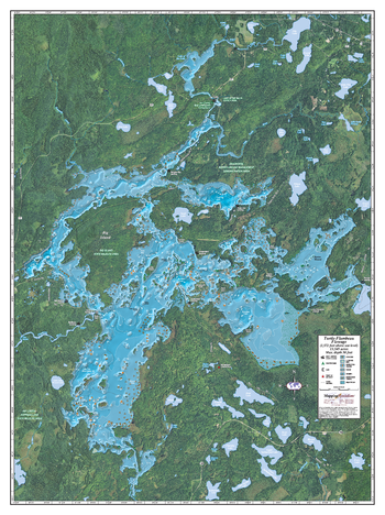
Turtle-Flambeau Flowage
An Attractive map of the lake showing a visual 3D representation of the lake bottom. Includes boat launches, rock area and vegetation. Land area is high resolution aerial imagery.
Page Size: 27.75 x 37.25 in (705 x 943 mm)
US Travelers Atlas - Alaska
Alaska Regional data based on a 1:5 million scale dataset. Perfect for the creation of regional and state level maps. Includes highways, cities & towns, points of interest, and shaded relief. Each map includes projection information and scale.
US Travelers Atlas - Continental US
U.S. Regional data based on a 1:1 million scale dataset. Perfect for the creation of regional and state level maps. Includes highways, cities & towns, points of interest, and shaded relief. Each map includes projection information and scale.
US Travelers Atlas - Hawaii
Hawaii Regional data based on a 1:1 million scale dataset. Perfect for the creation of regional and state level maps. Includes highways, cities & towns, points of interest, and shaded relief. Each map includes projection information and scale.
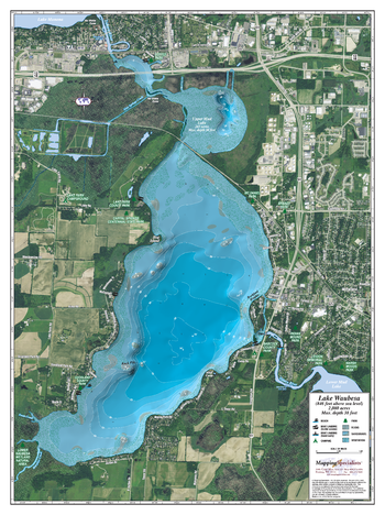
Waubesa Lake
An Attractive map of the lake showing a visual 3D representation of the lake bottom. Includes boat launches, rock area and vegetation. Land area is high resolution aerial imagery.
Page Size: 27.75 x 37.25 in (705 x 943 mm)
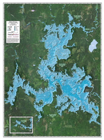
Willow Reservoir
An Attractive map of the lake showing a visual 3D representation of the lake bottom. Includes boat launches, rock area and vegetation. Land area is high resolution aerial imagery.
Page Size: 27.75 x 37.25 in (704 x 943 mm)