Lucidmap
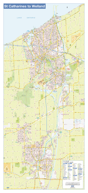
St Catharines/Welland Wall Map - Street Detail
This wall map shows highly detailed local information for the city of St Catharines/Welland. Full street labeling along with transit information, parks, schools, churches and landmarks throughout the city are displayed.
The map has been designed in a very clear and legible manner with a traditional Canadian street map style embraced by map buyers over many years.
Page Size: 24 x 54 in (610 x 1372 mm)
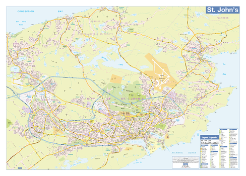
St John's Wall Map - Street Detail
This wall map shows highly detailed local information for the city of St John's. Full street labeling along with transit information, parks, schools, churches and landmarks throughout the city are displayed.
The map has been designed in a very clear and legible manner with a traditional Canadian street map style embraced by map buyers over many years.
Page Size: 38 x 27 in (965 x 686 mm)
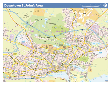
St. John's Downtown - Compact
Map of downtown St. John's showing all roads, road names, political boundaries, transit, points of interest, parks, schools, churches, public buildings and landmarks.
Page Size: 21.5 x 16.25 in (546 x 413 mm)
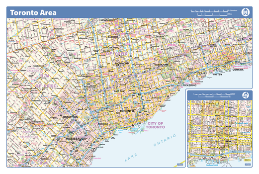
Toronto Area - Compact
Map of the Toronto area showing major roads, major road names, political boundaries, major points of interest, parks, public buildings and landmarks.
Page Size: 21.5 x 14.25 in (546 x 362 mm)

Toronto City
Map of Toronto showing all roads, road names, political boundaries, transit, points of interest, parks, schools, churches, public buildings and landmarks.
Page Size: 40 x 28 in (1016 x 711 mm)
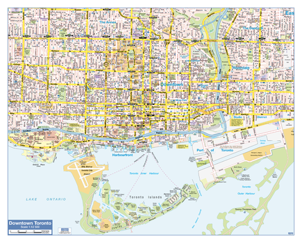
Toronto Downtown
Map of downtown Toronto showing all roads, road names, political boundaries, transit, points of interest, parks, schools, churches, public buildings and landmarks.
Page Size: 30 x 24 in (762 x 610 mm)
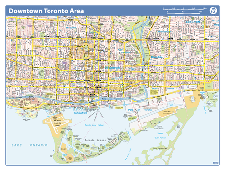
Toronto Downtown - Compact
Map of downtown Toronto showing all roads, road names, political boundaries, transit, points of interest, parks, schools, churches, public buildings and landmarks.
Page Size: 21.5 x 16.25 in (546 x 413 mm)
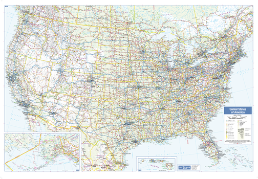
USA Wall Map
This wall map of USA shows political boundaries, place names, highways, major parks and conservation areas, and points of interest.
The map has been designed with a traditional Canadian style embraced by map buyers over many years.
Page Size: 39.5 x 27.25 in (1003 x 692 mm)
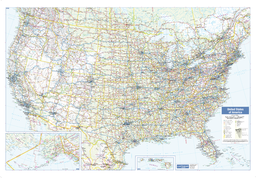
USA Wall Map - Large
This large wall map of USA shows political boundaries, place names, highways, major parks and conservation areas, and points of interest.
The map has been designed with a traditional Canadian style embraced by map buyers over many years.
Page Size: 54 x 37.5 in (1372 x 953 mm)
Vancouver - Agassiz
Create custom street maps in Vancouver centred on your business, home or other key point of interest. Maps are developed from Lucidmap’s iconic Canadian street mapping cartography. Map coverage ranges west along the Fraser River from Agassiz to the Straight of Georgia. Native scale is 1:25,000.
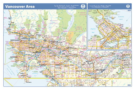
Vancouver Area - Compact
Map of the Vancouver area showing major roads, major road names, political boundaries, major points of interest, parks, public buildings and landmarks.
Page Size: 21.5 x 14.25 in (546 x 362 mm)
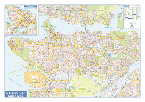
Vancouver Downtown
Map of downtown Vancouver showing all roads, road names, political boundaries, transit, points of interest, parks, schools, churches, public buildings and landmarks.
Page Size: 40 x 28 in (1016 x 711 mm)
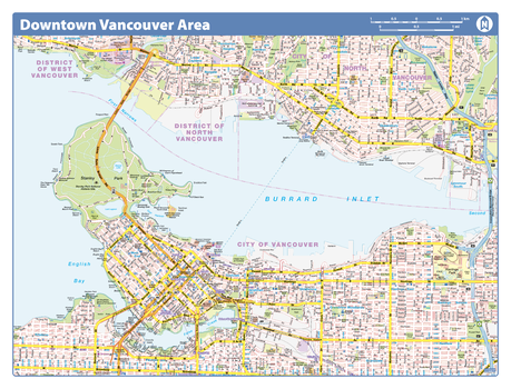
Vancouver Downtown - Compact
Map of downtown Vancouver showing all roads, road names, political boundaries, transit, points of interest, parks, schools, churches, public buildings and landmarks.
Page Size: 21.5 x 16.25 in (546 x 413 mm)
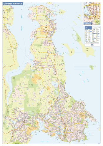
Victoria Wall Map - Street Detail - Large
This large wall map shows highly detailed local information of the city of Victoria. Full street labeling along with transit information, parks, schools, churches and landmarks throughout the city are displayed.
The map has been designed in a very clear and legible manner with a traditional Canadian street map style embraced by map buyers over many years.
Page Size: 37.25 x 53.5 in (942 x 1357 mm)
Western New Brunswick
Create custom regional maps in Canada from this series of attractive detailed road maps covering most of the populated areas across Canada. Maps are developed from Lucidmap’s iconic Canadian cartography. Map coverage is of western New Brunswick. Eastern-most communities include Saint John, Minto, Doaktown, and Doyleville. Native scale is 1:250,000.
Western Ontario
Create custom regional maps in Canada from this series of attractive detailed road maps covering most of the populated areas across Canada. Maps are developed from Lucidmap’s iconic Canadian cartography. Coverage includes southern Ontario west of Cobourg. The northern map limit is around Highway 17, and includes Sudbury and Manitoulin Island. The north-western corner of the coverage contains Sault Ste. Marie. Native scale is 1:250,000.
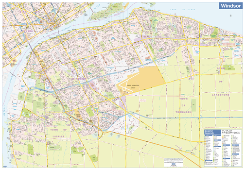
Windsor Wall Map - Street Detail
This wall map shows highly detailed local information for the city of Windsor. Full street labeling along with transit information, parks, schools, churches and landmarks throughout the city are displayed.
The map has been designed in a very clear and legible manner with a traditional Canadian street map style embraced by map buyers over many years.
Page Size: 54 x 37.5 in (1372 x 953 mm)
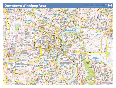
Winnipeg Downtown - Compact
Map of downtown Winnipeg showing all roads, road names, political boundaries, transit, points of interest, parks, schools, churches, public buildings and landmarks.
Page Size: 21.5 x 16.25 in (546 x 413 mm)
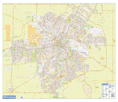
Winnipeg Wall Map - Street Detail
This wall map shows highly detailed local information of the city of Winnipeg. Full street labeling along with transit information, parks, schools, churches and landmarks throughout the city are displayed.
The map has been designed in a very clear and legible manner with a traditional Canadian street map style embraced by map buyers over many years.
Page Size: 43.5 x 37 in (1103 x 940 mm)
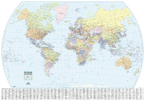
World Wall Map - English and French
This world wall map has been designed with all text in both French and English, making this an ideal product in Canada for schools, businesses and public areas.
This political map, with a useful place name index, is ideal for classrooms and other public areas.
Page Size: 39.5 x 27.25 in (1003 x 692 mm)