top of page
Ukraine Transportation Network Wall Map - Large
Kartographia
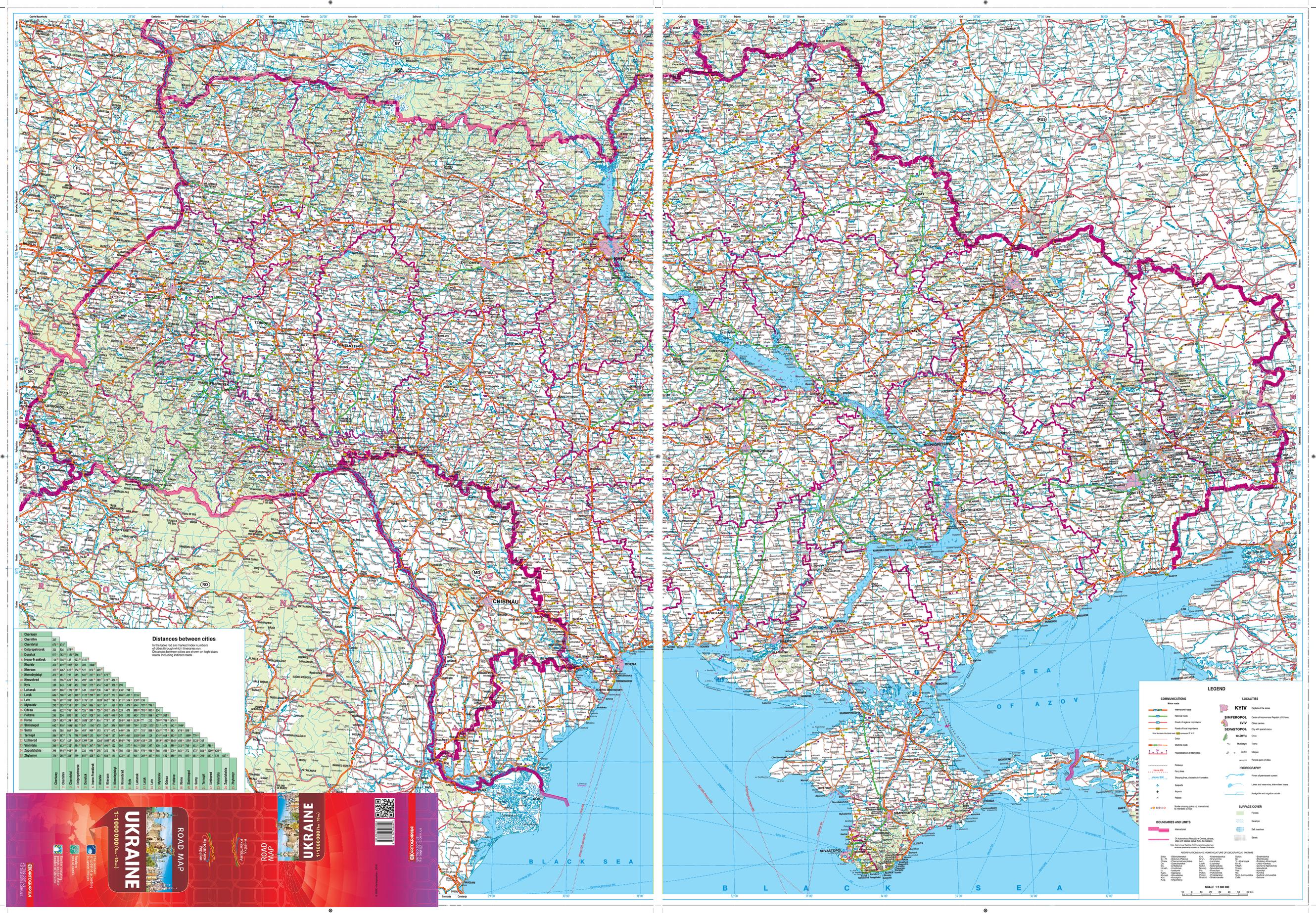
This large wall map shows detailed road network and transportation information of the Ukraine. Information on the map includes features such as road classification, customs checkpoints, fuel stops and distances along roads. The map uses the modern classification of roads for the Ukraine. Recent updating of information using aerial surveys ensures the information on the map is current.
Place names on this map are written in the Ukrainian Latin alphabet (Latynka). The map legend is in English.
Page Size: 55 x 38.25 in (1396 x 966 mm)
Buy this map on MapTrove.ca
bottom of page