Hema Maps
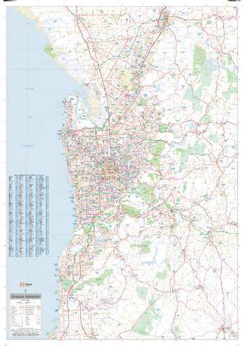
Adelaide Supermap
A large map of the Greater Adelaide region that is ideal as a reference and for planning sales and delivery zones.
Page Size: 39.5 x 56.25 in (1000 x 1429 mm)
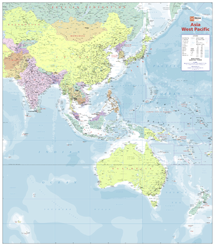
Asia West Pacific Political Wall Map
This beautifully presented political map is the only map that looks at this region to this extent. Covering India, Japan, the Pacific, Australia, New Zealand and Papua New Guinea, it is truly unique in its coverage. Its level of detail is ideal for education purposes.
Page Size: 39.5 x 34.5 in (1000 x 875 mm)
Australia Handy Map
A country map of Australia that includes city maps for compact travel use.
ISBN 9781925195538
Page Size: 30.25 x 25.25 in (766 x 641 mm)
Australia Large Map
This popular wall map of Australia provides details of the national road network. Towns and rail lines are easy to identify. Suitable for both business and home.
ISBN 9781925195514
Page Size: 40 x 35.25 in (1016 x 891 mm)
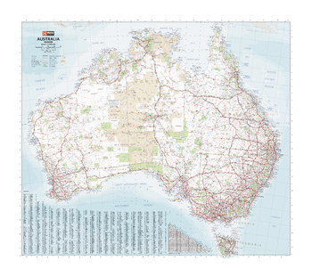
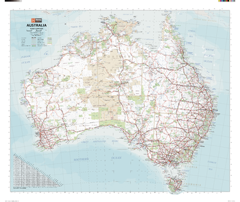
Australia Mega Map
A giant comprehensive road map of Australia that differentiates between major, minor, sealed and unsealed roads to make an intricately relevant account of Australia for travellers and tourers.
Page Size: 65.5 x 57.5 in (1660 x 1455 mm)
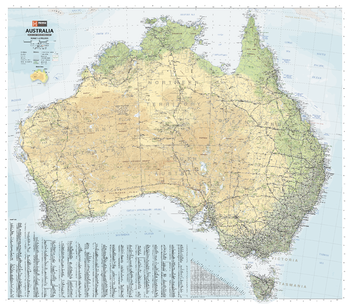
Australia Road & Terrain Mega Map
A picturesque map of Australia that is ideal as a wall map for trip planning, decoration and education. Climate zones are coloured to easily show the variances in temperature and rainfall across the country.
Page Size: 65.5 x 57.5 in (1660 x 1455 mm)
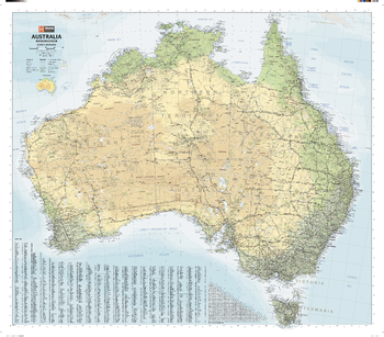
Australia Road & Terrain Wall Map
A large map of Australia with the country's major road networks shown, along with Outback fuel, distances and major national parks. Climate zones are coloured to easily show the variances in temperature and rainfall across the country.
Ideal gift for a traveller to Australia who recently experienced the incredible variety of sites around the country.
ISBN 9781925195552
Page Size: 40 x 35.25 in (1016 x 891 mm)
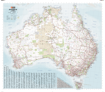
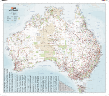
Australia Supermap
An extra-large map of Australia that is perfect for education, reference and decorative purposes. Ideal as a reference and trip planning tool, with the country's major road networks featured along with Outback fuel, distances and major national parks marked on the map.
Page Size: 54.75 x 48 in (1386 x 1216 mm)
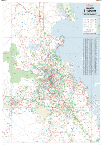
Brisbane & Region Supermap
A large map of Brisbane and its surrounding regions that features suburbs and postcodes, marked camping areas, caravan parks, fuel supplies, major national parks and an index.
ISBN 9781925195576
Page Size: 39.5 x 56.25 in (1000 x 1428 mm)
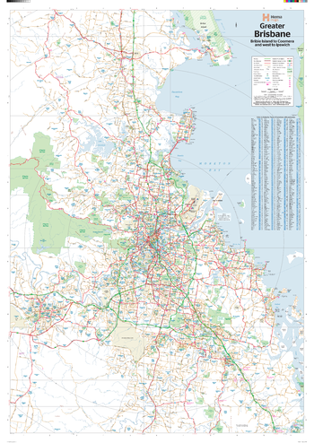
Brisbane & Region Wall Map
A map of Brisbane and its surrounding regions that features suburbs and postcodes, marked camping areas, caravan parks, fuel supplies, major national parks and an index.
Page Size: 27.75 x 39.5 in (700 x 1000 mm)
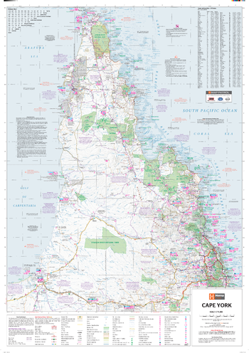
Cape York Supermap
A large map of Cape York that features 4WD tracks, touring information, points of interest, facilities and distances, making it the perfect trip planning tool and reference map.
ISBN 9781925195583
Page Size: 38.75 x 55.25 in (980 x 1400 mm)
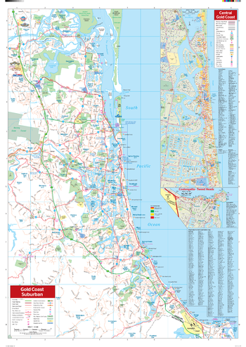
Gold Coast Wall Map
A map of the Gold Coast and its surrounding regions that features suburbs and postcodes, marked camping areas, caravan parks, fuel supplies, major national parks and an index.
Page Size: 27.75 x 39.5 in (700 x 1000 mm)
Hema DIY Map
The most up-to-date street network. Our Hema DIY Map product provides high resolution printed maps with a clean cartographic style suited to urban areas. The road network is highly detailed and updated frequently (map data © 1987-2014 HERE). Custom maps can have a scale from approximately 1:2,000 to 1:5,000,000. Each map contains UTM-based grid lines, projection information, scale bars (in kilometres and miles), geographic extents, data attribution and a land feature symbol Legend.
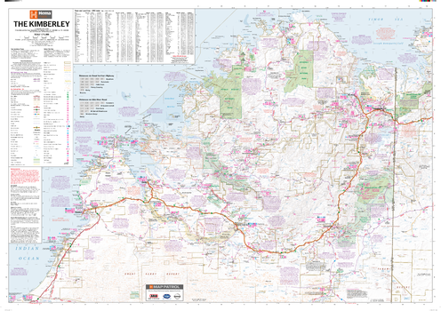
Kimberley Supermap
A large map of the Kimberley that features 4WD tracks, touring information, points of interest, facilities and distances, making it the perfect trip planning tool and reference map.
ISBN 9781925195606
Page Size: 55.25 x 38.75 in (1400 x 980 mm)
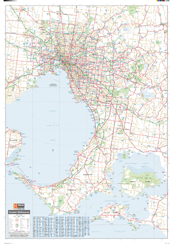
Melbourne & Region Supermap
A large map of the Greater Melbourne region that is ideal as a reference and for planning sales and delivery zones.
ISBN 9781925195620
Page Size: 39.5 x 56.25 in (1000 x 1429 mm)
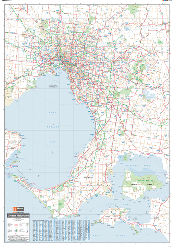
Melbourne & Region Wall Map
A map of the Greater Melbourne region that is ideal as a reference and for planning sales and delivery zones.
ISBN 9781925195613
Page Size: 27.75 x 39.5 in (700 x 1000 mm)
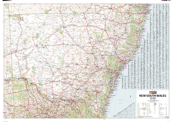
New South Wales State Wall Map
A state map of New South Wales accompanied by touring information and relevant regional and city maps.
ISBN 9781925195644
Page Size: 40 x 28.25 in (1016 x 716 mm)
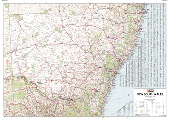
New South Wales Supermap
A large state map of New South Wales accompanied by touring information and relevant regional and city maps.
ISBN 9781925195637
Page Size: 55.75 x 39.25 in (1416 x 996 mm)
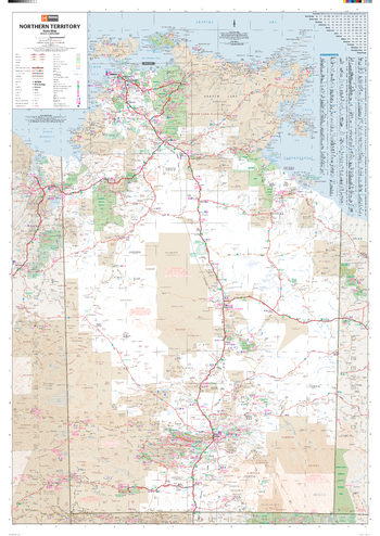
Northern Territory State Wall Map
A map of the Northern Territory that is an ideal travel reference and wall map.
Page Size: 27.75 x 39.5 in (700 x 1000 mm)
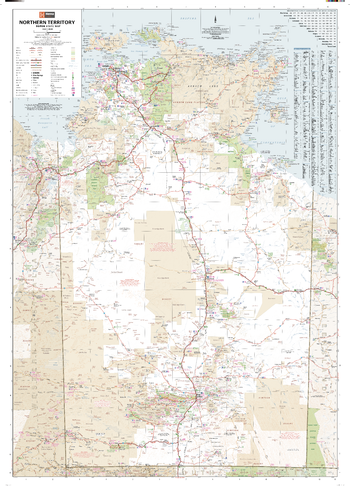
Northern Territory Supermap
A large map of the Northern Territory that is an ideal travel reference and wall map.
Page Size: 40 x 55.75 in (1016 x 1416 mm)