Texas State Wall Map
Globe Turner
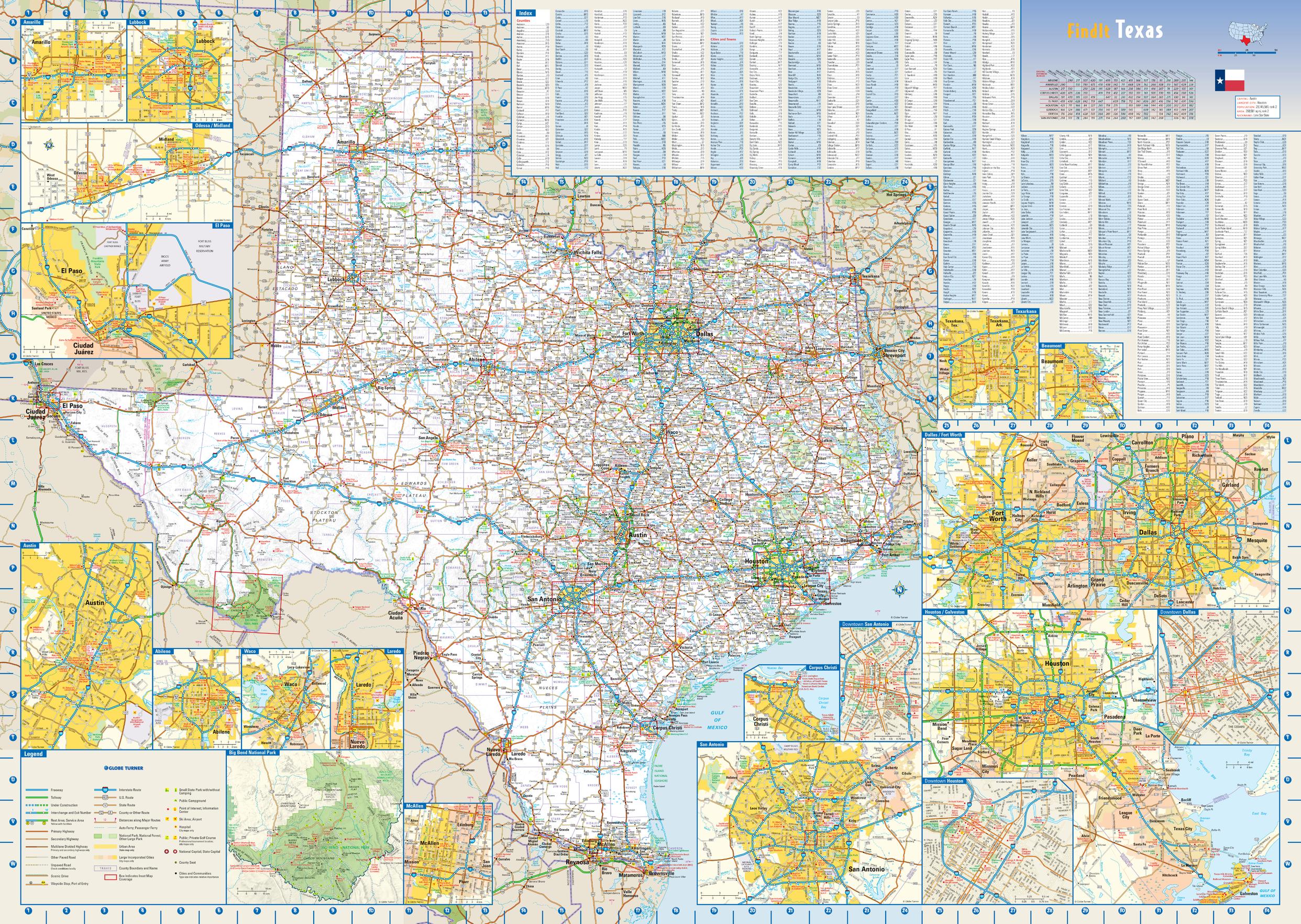
This colorful, easy-to-read state map of Texas identifies all major thoroughfares, secondary roads, freeway interchanges, rest areas, distance markers, landmarks, recreational areas, and more. Shaded relief on the state map provides a three-dimensional sense of Texas' topography. Detailed city inset maps of Abilene, Amarillo, Austin, Beaumont, Corpus Christi, Dallas / Fort Worth, El Paso, Houston / Galveston, Laredo, Lubbock, McAllen, Odessa / Midland, San Antonio, Texarkana, and Waco are based on the latest street information from our cartographic experts. The map also includes up-to-date insets of downtown Dallas, downtown Houston, downtown San Antonio, and Big Bend National Park. County and city indices make it simple to locate even the smallest town.
Page Size: 34.5 x 24.75 in (876 x 622 mm)
Buy this map on MapTrove.ca or MapTrove.com