Pennsylvania State Wall Map
Globe Turner
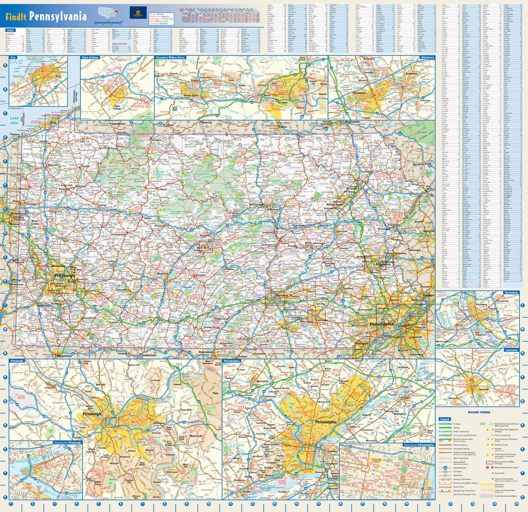
This colorful, easy-to-read state map of Pennsylvania identifies all major thoroughfares, secondary roads, freeway interchanges, rest areas, distance markers, landmarks, recreational areas, and more. Shaded relief on the state map provides a three-dimensional sense of Pennsylvania's topography. Detailed city inset maps of Allentown, Erie, Harrisburg, Lancaster, Philadelphia, Pittsburgh, Scranton/Wilkes-Barre, and State College are based on the latest street information from our cartographic experts. Up-to-date insets of center city Philadelphia and downtown Pitttsburgh provide must-see information on these tourist areas. County and city indices make it simple to locate even the smallest town.
Page Size: 25 x 24 in (629 x 610 mm)
Buy this map on MapTrove.ca or MapTrove.com