Louisiana State Wall Map
Globe Turner
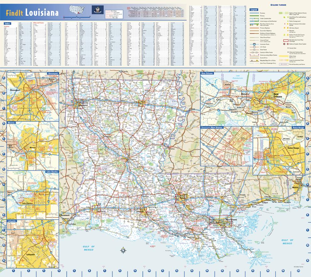
This colorful, easy-to-read state map of Louisiana identifies all major thoroughfares, secondary roads, freeway interchanges, rest areas, distance markers, landmarks, recreational areas, and more. Shaded relief on the state map provides a three-dimensional sense of Louisiana’s topography. Detailed city inset maps of Baton Rouge, Lafayette, Lake Charles, Monroe, and New Orleans are based on the latest street information from our cartographic experts. An up-to-date inset of the French Quarter and Central Business District provides must-see information on downtown New Orleans. County and city indices make it simple to locate even the smallest town. City type sizes reflect the 2020 U.S. Census.
Page Size: 20.75 x 18.5 in (524 x 467 mm)
Buy this map on MapTrove.ca or MapTrove.com