Kentucky State Wall Map
Globe Turner
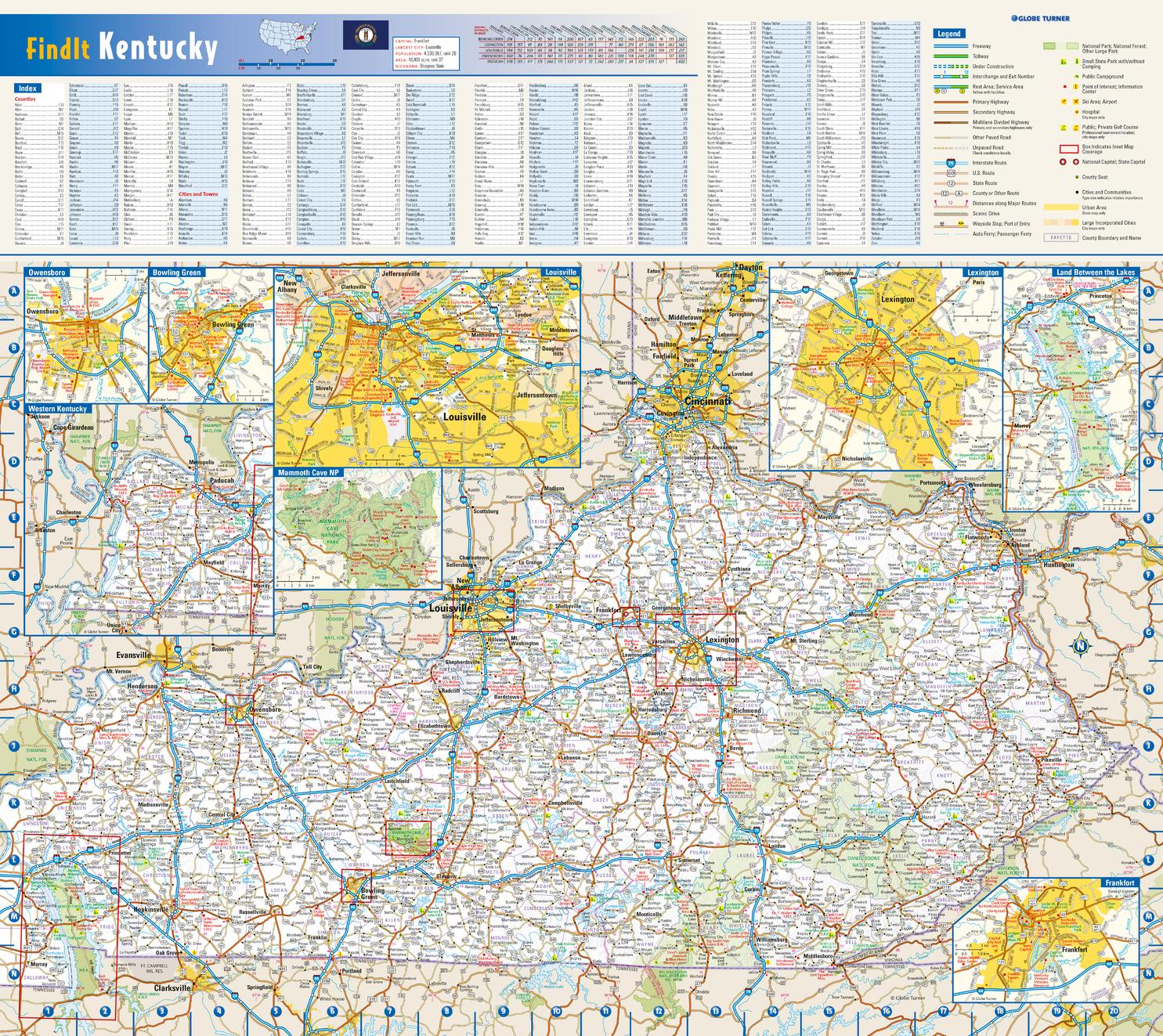
This colorful, easy-to-read state map of Kentucky identifies all major thoroughfares, secondary roads, freeway interchanges, rest areas, distance markers, landmarks, recreational areas, and more. Shaded relief on the state map provides a three-dimensional sense of Kentucky's topography. Detailed city inset maps of Bowling Green, Frankfort, Lexington, Louisville, and Owensboro are based on the latest street information from our cartographic experts. Up-to-date insets of Mammoth Cave National Park and Land Between the Lakes National Recreation Area provide must-see information on these tourist areas. County and city indices make it simple to locate even the smallest town.
Page Size: 20.75 x 18.5 in (524 x 467 mm)
Buy this map on MapTrove.ca or MapTrove.com