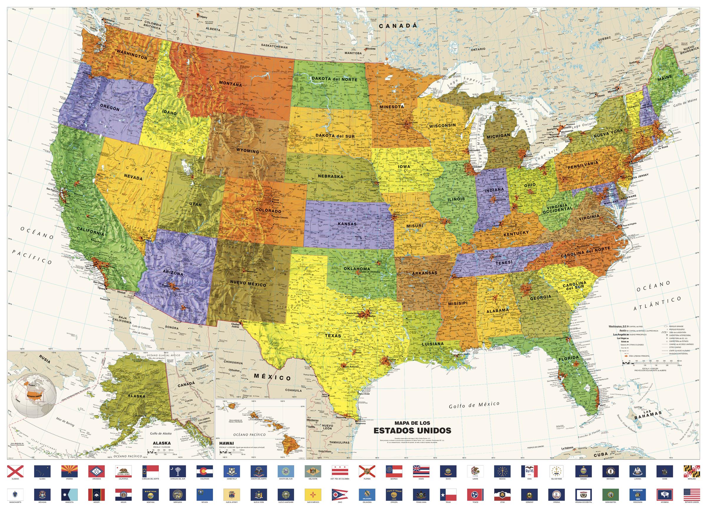
Contemporary USA Wall Map in Spanish with Flags, Mapa Mural Contemporáneo de EE.UU. en Español con Banderas - Large
Globe Turner
Perfect for home, business, or school, this Contemporary USA Wall Map combines bright, attractive colors with highly-detailed cartography. Features displayed on the map include state boundaries and capitals along with other major cities and towns; physical geography such as mountain ranges, mountain peaks, seas, gulfs, rivers, and lakes; the Interstate Highway System and other major roads; and sites maintained by the National Park Service and other federal and state agencies. Data from the 2020 U.S. Census is used to show the relative sizes of cities in the United States along with the latest census information from neighboring countries. Special features include ivory-colored oceans and a black decorative border. This map of the United States uses the Albers Equal Area projection. The most significant highway update for this 2024 edition shows the completion of I-49 in northwest Arkansas and southwest Missouri. The flag set includes the new state flags for Minnesota and Utah that were adopted in 2024.
Perfecto para el hogar, la empresa o la escuela, este Mapa de pared contemporáneo de EE.UU. combina colores vivos y atractivos con una cartografía muy detallada. Las características que se muestran en el mapa incluyen las fronteras y capitales de los estados junto con otras ciudades y pueblos importantes; geografía física como cadenas montañosas, picos de montañas, mares, golfos, ríos y lagos; el sistema de autopistas interestatales y otras carreteras principales; y sitios mantenidos por el Servicio de Parques Nacionales y otras agencias federales y estatales. Los datos del Censo de EE.UU. de 2020 se utilizan para mostrar el tamaño relativo de las ciudades de Estados Unidos junto con la información censal más reciente de los países vecinos. Las características especiales incluyen océanos de color marfil y un borde decorativo negro. Este mapa de Estados Unidos utiliza la proyección Albers Equal Area. La actualización de carreteras más significativa de esta edición de 2024 muestra la finalización de la I-49 en el noroeste de Arkansas y el suroeste de Misuri. Las banderas están ordenadas alfabéticamente en español. Se incluyen las nuevas banderas estatales de Minesota y Utah, que se hicieron oficiales en 2024.
Traducción realizada con la versión gratuita del traductor DeepL.com
Page Size: 50 x 36 in (1270 x 914 mm)
Buy this map on MapTrove.ca


