Arizona State Wall Map
Globe Turner
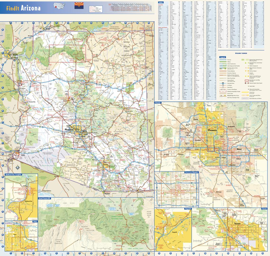
This colorful, easy-to-read state map of Arizona identifies all major thoroughfares, secondary roads, freeway interchanges, rest areas, distance markers, landmarks, recreational areas, and more. Shaded relief on the state map provides a three-dimensional sense of Arizona’s topography. Detailed inset maps of Bullhead City, Flagstaff, Phoenix, Tucson, and Yuma are based on the latest street information from our cartographic experts. An up-to-date inset of Grand Canyon National Park provides must-see information on this popular tourist destination. County and city indices make it simple to locate even the smallest town. City type sizes reflect the 2020 U.S. Census.
Page Size: 23.75 x 22.5 in (603 x 572 mm)
Buy this map on MapTrove.ca or MapTrove.com