top of page
Africa Political & Physical Continent Map with Country Flags
Globe Turner
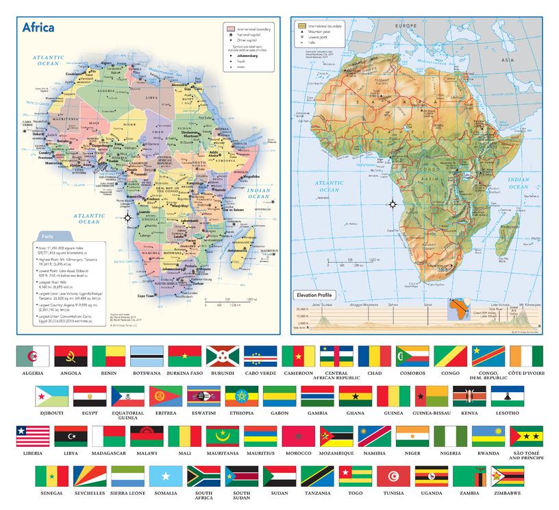
This map of the African continent combines two maps in one - a vivid political map of Africa showing all of the countries and major cities as well as a colorful topographic physical map depicting all of the major physical features in Africa, including a cross-continent elevation profile. The political map includes a call-out box with interesting facts about the continent. The map also includes all 54 flags each African country.
Page Size: 17 x 15.5 in (432 x 394 mm)
Buy this map on MapTrove.ca
bottom of page