Cosmographics
Pacific Centred Time Zone Wall Map of the World
Centered on the Pacific Ocean a colourful yet informative map. Combined with a detailed political map of the world, contrasting colours are used to accurately depict the different time zones, both on land and in the oceans.
Page Size: 40.25 x 23.5 in (1022 x 595 mm)
Pacific Centred Time Zone Wall Map of the World - Large
Centered on the Pacific Ocean a colourful yet informative map. Combined with a detailed political map of the world, contrasting colours are used to accurately depict the different time zones, both on land and in the oceans. Includes an additional map showing countries/states that adopt daylight saving hours.
Page Size: 53.5 x 31 in (1356 x 787 mm)
Pacific Centred Time Zone Wall Map of the World - Poster
Centered on the Pacific Ocean a colourful yet informative map. Combined with a detailed political map of the world, contrasting colours are used to accurately depict the different time zones, both on land and in the oceans.
Page Size: 39 x 22.75 in (991 x 575 mm)
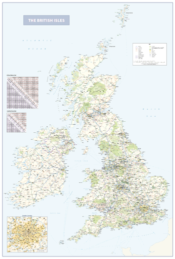
The British Isles
An informative and attractive map of the British Isles showing main roads, railways, ferries , counties, towns and cities by population, National Parks and Areas of Outstanding Natural Beauty. There is also the option to include a road distance charts for the UK and Ireland on your print. Ideal for the office or home. Designed to be fully inclusive and work for everyone, including those with colour vision deficiency (CVD).
Page Size: 29.5 x 43.5 in (745 x 1100 mm)
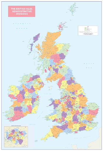
The British Isles Administrative Divisions
An informative and attractive map of the British Isles showing the administrative divisions. Clearly shows the counties and regions in the United Kingdom and Ireland. Ideal for the office or home. Designed to be fully inclusive and to work for everyone, including those with colour vision deficiency (CVD).
Page Size: 29.5 x 43.5 in (745 x 1099 mm)
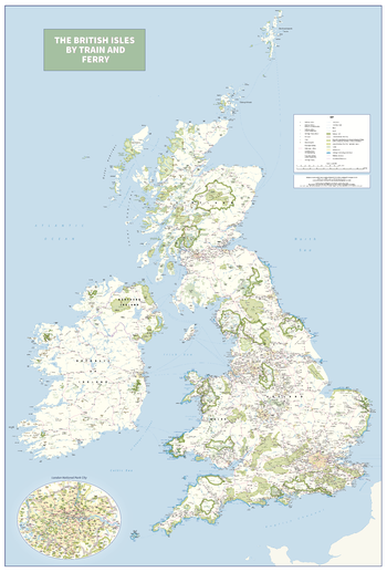
The British Isles by Train and Ferry
Plan your journey and explore the British Isles by train and ferry. This attractive, detailed map shows how the rail network, along with ferries to the more isolated areas, allows you to travel to places right across the British Isles and take in the beautiful scenery. The map clearly shows National Parks, Areas of Outstanding Natural Beauty, forest and woodland areas and the Heritage Coast in England and Wales, much of which is accessible by train and ferry. The rail network includes seasonal and heritage railways. There is also a more detailed map of the London National Park City, the world’s first National Park City. Designed to be fully inclusive and accessible for everyone, including those with colour vision deficiency (CVD).
Page Size: 29.5 x 43.5 in (745 x 1100 mm)
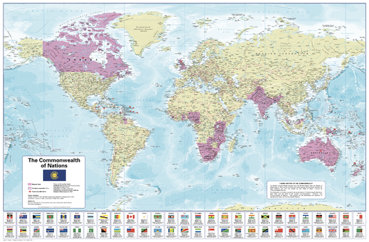
The Commonwealth of Nations
Commonwealth of Nations World map clearly showing the Member States and Commonwealth Realms. Includes flags and interesting facts on each member and also lists former members and applicants. Ideal for the office or school classroom.
Page Size: 40.25 x 26.5 in (1020 x 670 mm)

The European Union
Map of Europe showing European Union member states, and countries that have applied for membership. Also includes a timeline showing the development of the EEC/EU since 1958 and the United Kingdom leaving in January 2020. The table at the bottom contains flags and useful facts about each of the countries in the EU, plus the United Kingdom. Ideal for office or classroom.
Page Size: 32.5 x 30.75 in (820 x 780 mm)
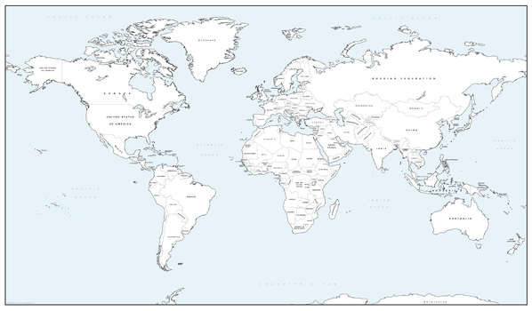
The World - colour blind friendly political world map
There is likely to be at least one child in every classroom that is colour blind. Designed especially to help work with any form of colour blindness, this colourful, easy to read children's map of the World shows countries, capitals, a selection of cities and main towns and ocean depths. Ideal for the classroom or office.
Page Size: 54 x 39.5 in (1372 x 1000 mm)
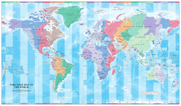
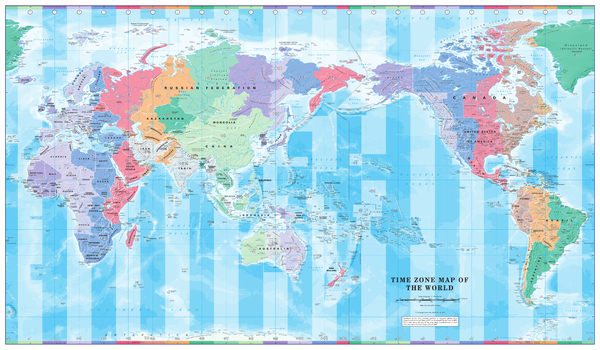
Time Zone Wall Map of the World
Colourful yet informative map. Combined with a detailed political map of the world, contrasting colours are used to accurately depict the different time zones, both on land and in the oceans.
Page Size: 40.25 x 23.5 in (1022 x 595 mm)
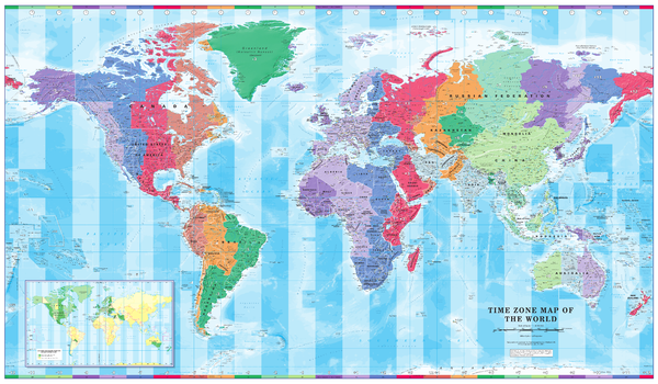
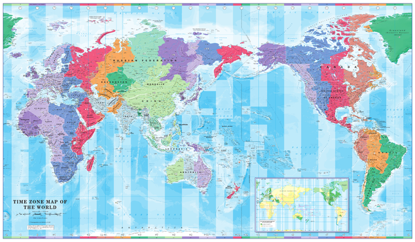
Time Zone Wall Map of the World - Large
Colourful yet informative map. Combined with a detailed political map of the world, contrasting colours are used to accurately depict the different time zones, both on land and in the oceans. Includes an additional map showing countries/states that adopt daylight saving hours.
Page Size: 53.75 x 31.5 in (1365 x 797 mm)
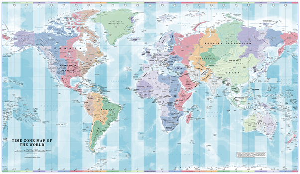
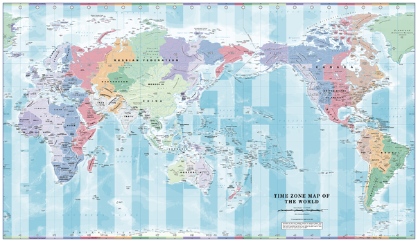
Time Zone Wall Map of the World - Poster
Colourful, informative map. Combined with a detailed political map of the world, contrasting colours are used to accurately depict the different time zones, both on land and in the oceans.
Page Size: 39 x 22.75 in (991 x 575 mm)
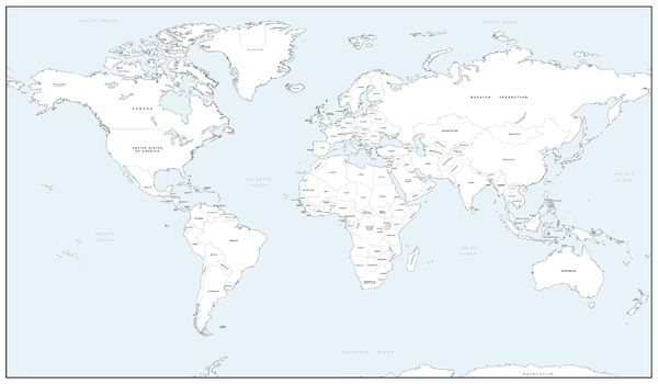
World Colouring Map - Big
Make learning fun and be creative. Buy this simple World map as a gift, or for you and your family to colour and help learn the countries at the same time.
Page Size: 27.75 x 16.25 in (700 x 410 mm)
World Colouring Map - Giant
Make learning fun and be creative. Buy this simple World map as a gift, or for you and your family to colour and help learn the countries at the same time.
Page Size: 53.5 x 31.25 in (1355 x 790 mm)

World Colouring Map - Large
Make learning fun and be creative. Buy this simple World map as a gift, or for you and your family to colour and help learn the countries at the same time.
Page Size: 40.25 x 23.5 in (1020 x 595 mm)