top of page
Historic Map of Dominion of Canada (1898)
Collins
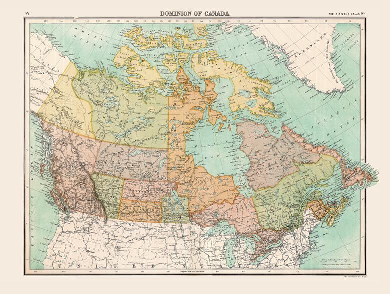
Full colour historical map of the Dominion of Canada from The Citizen's Atlas, published by John Bartholomew and Co. Ltd. in 1898. The map provides a snapshot of Canada after the British colonies of North America were granted autonomy under the Crown in 1867, in this case as the Dominion of Canada. Many of the territorial names on this map are recognizable today while others, including Assiniboia and Athabasca, are less familiar. This map is part of a fascinating collection from the last 150 years of world atlases.
Page Size: 16.25 x 12.5 in (413 x 312 mm)
Buy this map on MapTrove.ca
bottom of page