Historic Map of Central Europe and The Mediterranean (1898)
Collins
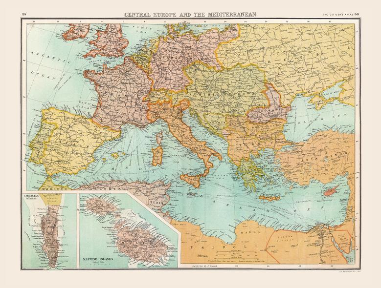
Full colour historical map of Central Europe and the Mediterranean from The Citizen's Atlas, published by John Bartholomew and Co. Ltd. in 1898. A pre-World War One map, the international borders shown here would not last for very long. Changes are especially visible when comparing regions such as Austro-Hungary, the German Empire and Russian Empire with maps of today. Borders are clearly marked, and individual countries are rendered in alternate colours for clarity. Oceans, rivers, mountain ranges and shipping routes are also visible and labelled. Two additional maps of Gibraltar and the Maltese Islands provide further information about these regions. This map is part of a fascinating collection from the last 150 years of world atlases.
Page Size: 16.25 x 12.5 in (412 x 312 mm)
Buy this map on MapTrove.ca