Historic Map of Central Africa (1898)
Collins
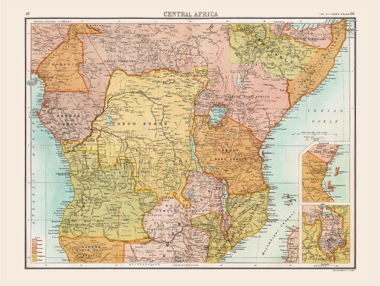
Full colour historical map of Central Africa from The Citizen's Atlas, published by John Bartholomew and Co. Ltd. in 1898. This map of Africa shows the continent at the height of the colonial era, only Liberia on the west coast and Abyssinia (now Ethiopia) in the east were free from European control. The situation reflects the result of the Scramble for Africa which occurred in the late nineteenth century. Britain, France and Germany were the dominant players in this partitioning, but the map’s key shows that other nations were also involved. Additional inset maps provide further details about the Shire Highlands, and the islands of Zanzibar and Pemba. This map is part of a fascinating collection from the last 150 years of world atlases.
Page Size: 16.5 x 12.5 in (413 x 312 mm)
Buy this map on MapTrove.ca