top of page
Historic Map of Asia (1898)
Collins
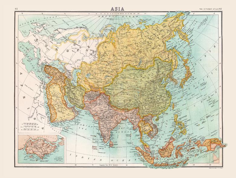
Full colour historical map of Asia from The Citizen's Atlas, published by John Bartholomew and Co. Ltd. in 1898. Dominated by Russia and China, this historical map shows Asia in the midst of change as Empires rose and fell, and territories exchanged hands. International borders are clearly marked, and individual countries are rendered in alternate colours for clarity. Oceans, rivers, mountain ranges and shipping routes are also visible and labelled. An additional inset map provides further details of the Island of Singapore. This map is part of a fascinating collection from the last 150 years of world atlases.
Page Size: 16.5 x 12.5 in (413 x 312 mm)
Buy this map on MapTrove.ca
bottom of page