Collins Scotland of Old Map
Collins
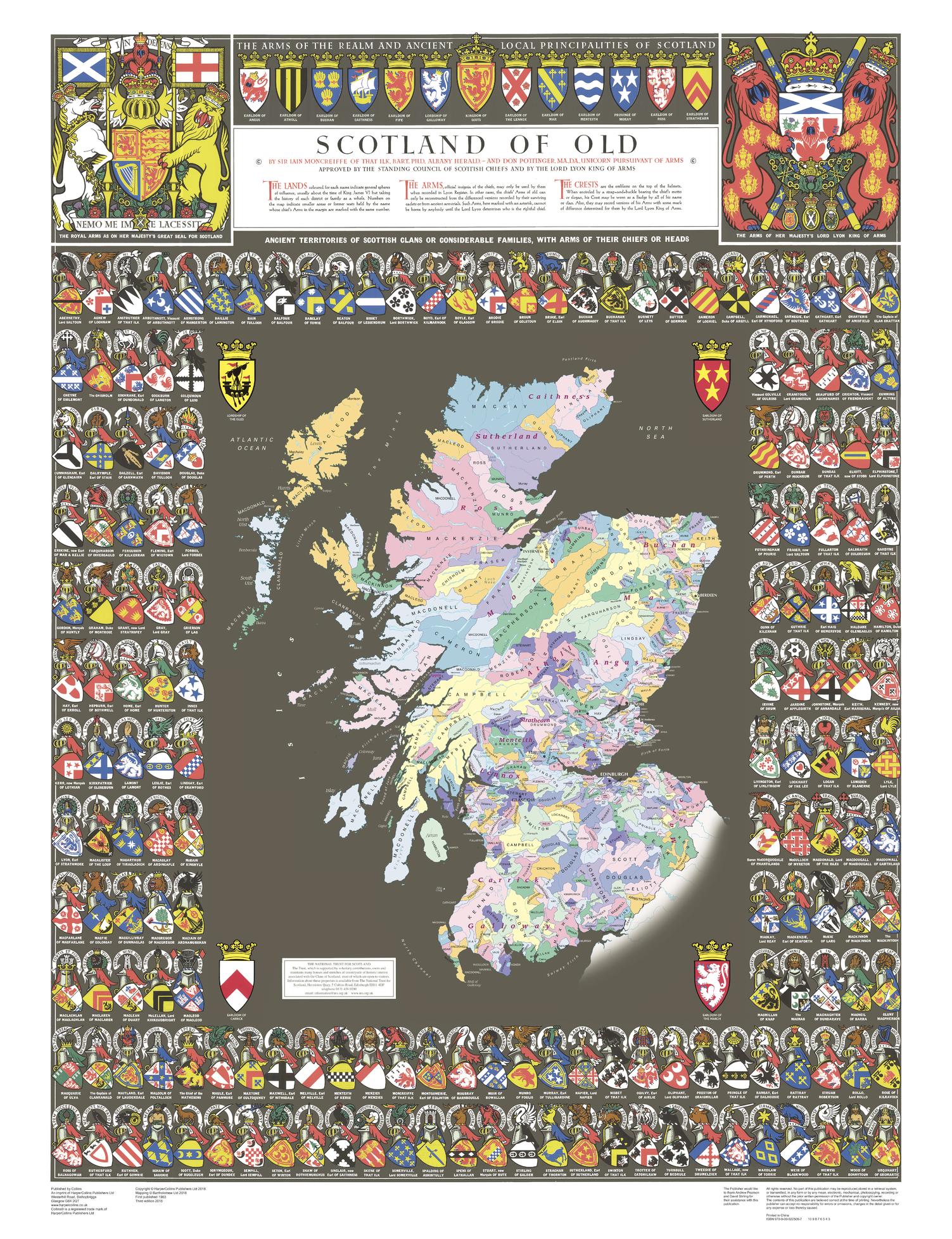
The Collins Scotland of Old Clans Map is a unique pictorial map showing the ancient territories of the principal Scottish clans in the 17th century, and features Don Pottinger’s (Islay Herald of Arms) distinctive and original artwork of Scottish arms and crest badges.
The map includes:
- Over 170 arms, the official insignia of clan chiefs, and crest badges
- Territories map of principal clans at the beginning of the 17th century
- Arms of the ancient Scottish principalities
- Locations of the ancient territories held by the clans around the time of King James VI
The map is ideal for those those with an interest in Scottish heraldry, clans and family history. The map is based on the map originally conceived and illustrated by the late Sir Iain Moncreiffe of that Ilk, Bart., C.V.O., Q.C., Ph.D., Albany Herald of Arms, and the late Don Pottinger, C.V.O., M.A., D.A., Islay Herald of Arms.
Page Size: 30.75 x 40 in (775 x 1015 mm)
Buy this map on MapTrove.ca