


Backroad Mapbooks

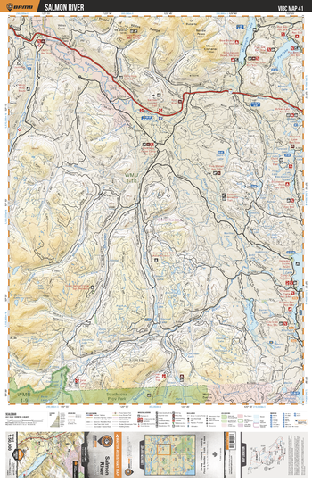
VIBC41 Salmon River - Vancouver Island BC Topo
This recreation topographic map for Salmon River highlights all the logging roads, trails and recreational Points of Interest including hunting, camping, hiking, mountain biking, canoeing, kayaking, backcountry skiing, wildlife viewing, ATVing, snowmobiling and more. No other map for the area provides you with this level of recreational or topographic detail. Covering 1,090 km2 (420 mi2) in total, this 1:50,000 scale map measures 29 x 38 km (18 x 24 mi) and covers Salmon River, McCreight Lake, Pye Lake, Memekay River, Brewster Lake, White River, Cooper Creek, Strathcona Provincial Park and more!
Page Size: 24 x 37 in (610 x 940 mm)
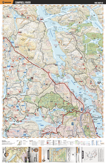
VIBC42 Campbell River - Vancouver Island BC Topo
This recreation topographic map for Campbell River highlights all the logging roads, trails and recreational Points of Interest including hunting, camping, hiking, mountain biking, canoeing, kayaking, backcountry skiing, wildlife viewing, ATVing, snowmobiling and more. No other map for the area provides you with this level of recreational or topographic detail. Covering 1,090 km2 (420 mi2) in total, this 1:50,000 scale map measures 29 x 38 km (18 x 24 mi) and covers Campbell River, Discovery Passage, Main Lake Provincial Park, Small Inlet Provincial Park, Snowden Demonstration Forest and more!
Page Size: 24 x 37 in (610 x 940 mm)
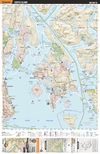
VIBC43 Cortes Island - Vancouver Island BC Topo
This recreation topographic map for Cortes Island highlights all the logging roads, trails and recreational Points of Interest including hunting, camping, hiking, mountain biking, canoeing, kayaking, backcountry skiing, wildlife viewing, ATVing, snowmobiling and more. No other map for the area provides you with this level of recreational or topographic detail. Covering 1,090 km2 (420 mi2) in total, this 1:50,000 scale map measures 29 x 38 km (18 x 24 mi) and covers Cortes Island, Ha'thayim Provincial Park, Read Island Provincial Park, Mansons Landing Provincial Park, Smelt Bay Provincial Park and more!
Page Size: 24 x 37 in (610 x 940 mm)
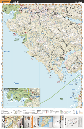
VIBC44 Holberg - Vancouver Island BC Topo
This recreation topographic map for Holberg highlights all the logging roads, trails and recreational Points of Interest including hunting, camping, hiking, mountain biking, canoeing, kayaking, backcountry skiing, wildlife viewing, ATVing, snowmobiling and more. No other map for the area provides you with this level of recreational or topographic detail. Covering 1,090 km2 (420 mi2) in total, this 1:50,000 scale map measures 29 x 38 km (18 x 24 mi) and covers Holdberg, Cape Scott Provincial Park, Raft Cove Provincial Marine Park, Macjack River, Winter Harbour, Holberg Inlet and more!
Page Size: 24 x 37 in (610 x 940 mm)
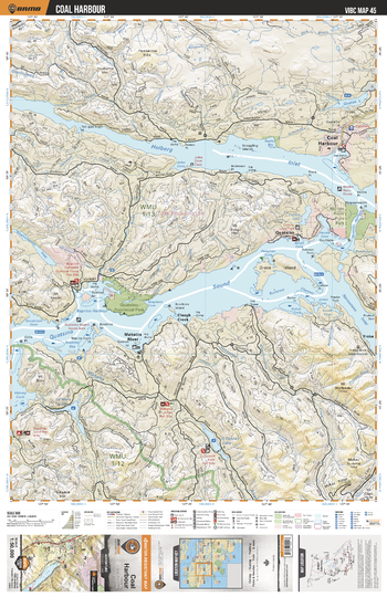
VIBC45 Coal Harbour - Vancouver Island BC Topo
This recreation topographic map for Coal Harbour highlights all the logging roads, trails and recreational Points of Interest including hunting, camping, hiking, mountain biking, canoeing, kayaking, backcountry skiing, wildlife viewing, ATVing, snowmobiling and more. No other map for the area provides you with this level of recreational or topographic detail. Covering 1,090 km2 (420 mi2) in total, this 1:50,000 scale map measures 29 x 38 km (18 x 24 mi) and covers Coal Harbour, Holberg Inlet, Koprino River, Marble River Provincial Park, Quatsino Provincial Park, Mahatta River and more!
Page Size: 24 x 37 in (610 x 940 mm)
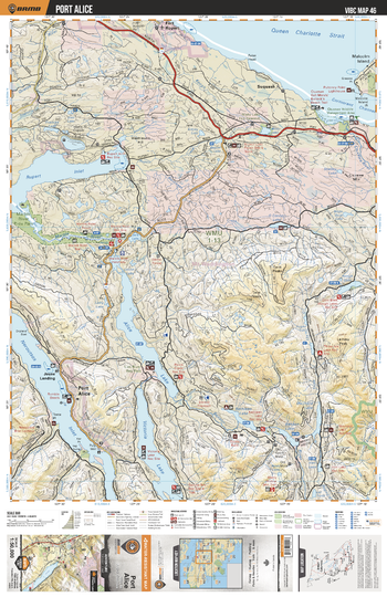
VIBC46 Port Alice - Vancouver Island BC Topo
This recreation topographic map for Port Alice highlights all the logging roads, trails and recreational Points of Interest including hunting, camping, hiking, mountain biking, canoeing, kayaking, backcountry skiing, wildlife viewing, ATVing, snowmobiling and more. No other map for the area provides you with this level of recreational or topographic detail. Covering 1,090 km2 (420 mi2) in total, this 1:50,000 scale map measures 29 x 38 km (18 x 24 mi) and covers Port Alice, Alice Lake, Marble River Provincial Park, Benson River, Victoria Lake, Neroutsos Inlet, Marble River, Rupert Inlet and more!
Page Size: 24 x 37 in (610 x 940 mm)
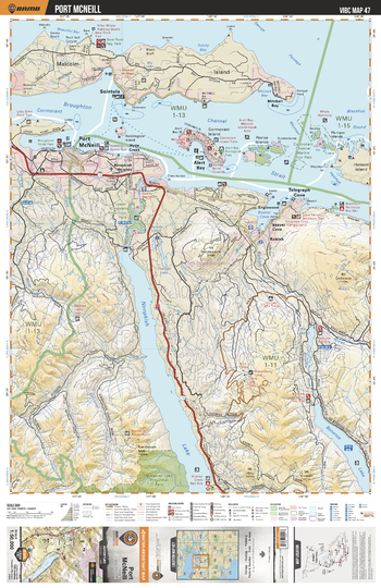
VIBC47 Port McNeill - Vancouver Island BC Topo
This recreation topographic map for Port McNeill highlights all the logging roads, trails and recreational Points of Interest including hunting, camping, hiking, mountain biking, canoeing, kayaking, backcountry skiing, wildlife viewing, ATVing, snowmobiling and more. No other map for the area provides you with this level of recreational or topographic detail. Covering 1,090 km2 (420 mi2) in total, this 1:50,000 scale map measures 29 x 38 km (18 x 24 mi) and covers Port Mcneil, Telegraph Cove, Lower Nimpkish Provincial Park, Nimpkish Lake Provincial Park, Bonanza Lake, Kokish Lake and more!
Page Size: 24 x 37 in (610 x 940 mm)
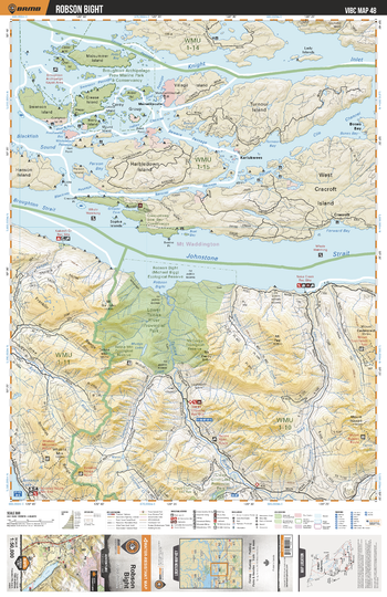
VIBC48 Robson Bight - Vancouver Island BC Topo
This recreation topographic map for Robson Bight highlights all the logging roads, trails and recreational Points of Interest including hunting, camping, hiking, mountain biking, canoeing, kayaking, backcountry skiing, wildlife viewing, ATVing, snowmobiling and more. No other map for the area provides you with this level of recreational or topographic detail. Covering 1,090 km2 (420 mi2) in total, this 1:50,000 scale map measures 29 x 38 km (18 x 24 mi) and covers Robson Bight, Broughton Archipelago Provincial Marine Park And Conservancy, Robson Bight Ecological Reserve and more!
Page Size: 24 x 37 in (610 x 940 mm)
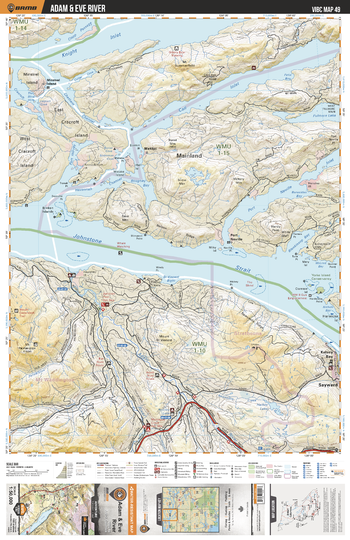
VIBC49 Adam and Eve River - Vancouver Island BC Topo
This recreation topographic map for Adam and Eve River highlights all the logging roads, trails and recreational Points of Interest including hunting, camping, hiking, mountain biking, canoeing, kayaking, backcountry skiing, wildlife viewing, ATVing, snowmobiling and more. No other map for the area provides you with this level of recreational or topographic detail. Covering 1,090 km2 (420 mi2) in total, this 1:50,000 scale map measures 29 x 38 km (18 x 24 mi) and covers Adam And Eve River, Knight Inlet, Call Inlet, Port Neville, Johnstone Strait, Kelsey Bay, Sayward and more!
Page Size: 24 x 37 in (610 x 940 mm)
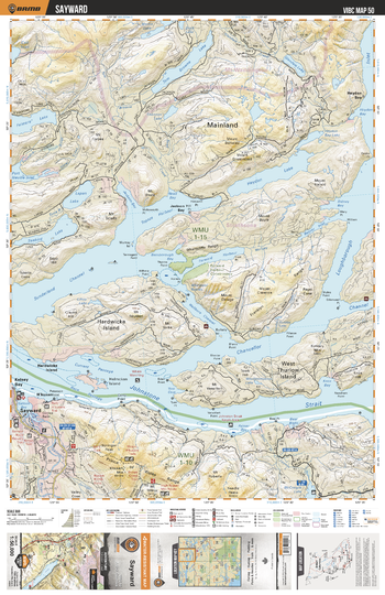
VIBC50 Sayward - Vancouver Island BC Topo
This recreation topographic map for Sayward highlights all the logging roads, trails and recreational Points of Interest including hunting, camping, hiking, mountain biking, canoeing, kayaking, backcountry skiing, wildlife viewing, ATVing, snowmobiling and more. No other map for the area provides you with this level of recreational or topographic detail. Covering 1,090 km2 (420 mi2) in total, this 1:50,000 scale map measures 29 x 38 km (18 x 24 mi) and covers Sayward, Tom Browne Lake, Seabird Lake, Heydon Lake, Salmon River, Woolloompoloo Lake, Hardwicke Island and more!
Page Size: 24 x 37 in (610 x 940 mm)
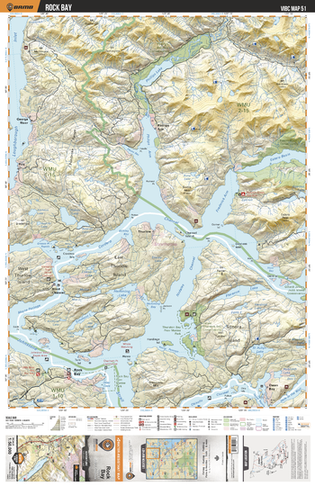
VIBC51 Rock Bay - Vancouver Island BC Topo
This recreation topographic map for Rock Bay highlights all the logging roads, trails and recreational Points of Interest including hunting, camping, hiking, mountain biking, canoeing, kayaking, backcountry skiing, wildlife viewing, ATVing, snowmobiling and more. No other map for the area provides you with this level of recreational or topographic detail. Covering 1,090 km2 (420 mi2) in total, this 1:50,000 scale map measures 29 x 38 km (18 x 24 mi) and covers Rock Bay, Thurston Bay Provincial Marine Park, Estero-Basin Conservancy, Phillips Estuary Conservancy, Phillips Arm, Loughborough Inlet and more!
Page Size: 24 x 37 in (610 x 940 mm)
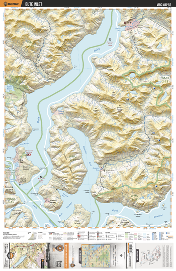
VIBC52 Ramsay Arm - Vancouver Island BC Topo
This recreation topographic map for Ramsay Arm highlights all the logging roads, trails and recreational Points of Interest including hunting, camping, hiking, mountain biking, canoeing, kayaking, backcountry skiing, wildlife viewing, ATVing, snowmobiling and more. No other map for the area provides you with this level of recreational or topographic detail. Covering 1,090 km2 (420 mi2) in total, this 1:50,000 scale map measures 29 x 38 km (18 x 24 mi) and covers Ramsay Arm, Bute Inlet, Homathko River, Orford River, Apple River, Stafford River, Phillips River, Jewakwa River, Heakamie River and more!
Page Size: 24 x 37 in (610 x 940 mm)
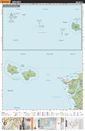
VIBC53 Cape Scott - Vancouver Island BC Topo
This recreation topographic map for Cape Scott highlights all the logging roads, trails and recreational Points of Interest including hunting, camping, hiking, mountain biking, canoeing, kayaking, backcountry skiing, wildlife viewing, ATVing, snowmobiling and more. No other map for the area provides you with this level of recreational or topographic detail. Covering 1,090 km2 (420 mi2) in total, this 1:50,000 scale map measures 29 x 38 km (18 x 24 mi) and covers Cape Scott Provincial Park, Hansen Lagoon, Scott Channel, Scott Islands, Lanz and Cox Islands and more!
Page Size: 24 x 37 in (610 x 940 mm)
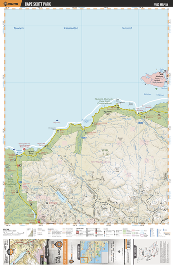
VIBC54 Cape Scott Park - Vancouver Island BC Topo
This recreation topographic map for Cape Scott Park highlights all the logging roads, trails and recreational Points of Interest including hunting, camping, hiking, mountain biking, canoeing, kayaking, backcountry skiing, wildlife viewing, ATVing, snowmobiling and more. No other map for the area provides you with this level of recreational or topographic detail. Covering 1,090 km2 (420 mi2) in total, this 1:50,000 scale map measures 29 x 38 km (18 x 24 mi) and covers Cape Scott Provincial Park, Hope Island, Nissen Bight, William Lake, Stranby River, Nahwitti River and more!
Page Size: 24 x 37 in (610 x 940 mm)
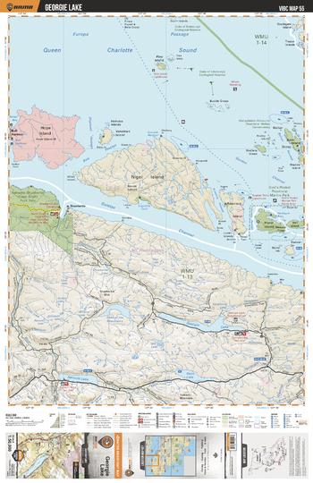
VIBC55 Georgie Lake - Vancouver Island BC Topo
This recreation topographic map for Georgie Lake highlights all the logging roads, trails and recreational Points of Interest including hunting, camping, hiking, mountain biking, canoeing, kayaking, backcountry skiing, wildlife viewing, ATVing, snowmobiling and more. No other map for the area provides you with this level of recreational or topographic detail. Covering 1,090 km2 (420 mi2) in total, this 1:50,000 scale map measures 29 x 38 km (18 x 24 mi) and covers Georgie Lake, God's Pocket Provincial Marine Park, Lake Of the Mountains, Georgie Lake, Kains Lake, Nahwitti River, North Coast Trail and more!
Page Size: 24 x 37 in (610 x 940 mm)
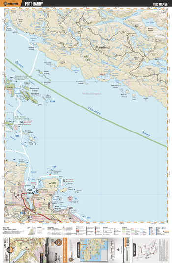
VIBC56 Port Hardy - Vancouver Island BC Topo
This recreation topographic map for Port Hardy highlights all the logging roads, trails and recreational Points of Interest including hunting, camping, hiking, mountain biking, canoeing, kayaking, backcountry skiing, wildlife viewing, ATVing, snowmobiling and more. No other map for the area provides you with this level of recreational or topographic detail. Covering 1,090 km2 (420 mi2) in total, this 1:50,000 scale map measures 29 x 38 km (18 x 24 mi) and covers Port Hardy, Mahpahkum-Ankwuna Deserters Walker Conservancy, God's Pocket Provincial Marine Park and more!
Page Size: 24 x 37 in (610 x 940 mm)
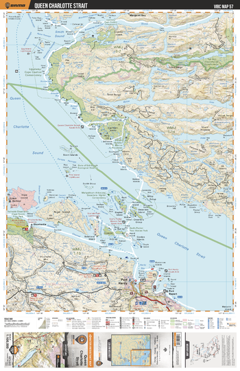
VIBC57 Queen Charlotte Strait - Vancouver Island BC Topo
This recreation topographic map for Queen Charlotte Strait highlights all the logging roads, trails and recreational Points of Interest including hunting, camping, hiking, mountain biking, canoeing, kayaking, backcountry skiing, wildlife viewing, ATVing, snowmobiling and more. No other map for the area provides you with this level of recreational or topographic detail. Covering 1,090 km2 (420 mi2) in total, this 1:100,000 scale map measures 29 x 38 km (18 x 24 mi) and covers Queen Charlotte Strait, Tsa-latl Smokehouse Conservacy, Ugwiwey Cape Caution Conservancy, God's Pocket Provincial Marine Park, Port Hardy and more!
Page Size: 24 x 37 in (610 x 940 mm)
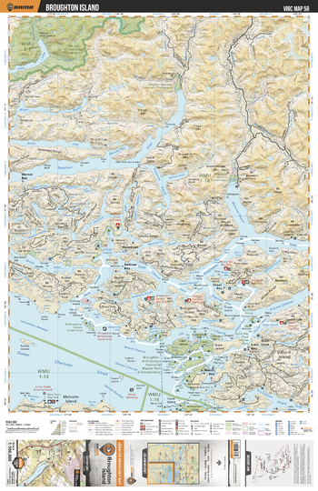
VIBC58 Broughton Island - Vancouver Island BC Topo
This recreation topographic map for Broughton Island highlights all the logging roads, trails and recreational Points of Interest including hunting, camping, hiking, mountain biking, canoeing, kayaking, backcountry skiing, wildlife viewing, ATVing, snowmobiling and more. No other map provides you with this level of recreational and topographic detail for the Broughton Island area. Covering 4,315 km2 (1,665 mi2) in total, 1:100,000 scale map measures 57 x 75 km (35 x 46.5 mi) and covers Broughton Archipelago Provincial Marine Park, Drury Inlet, Echo Bay, Health Bay, Hopetown, Kingcome Inlet, Polkinghorne Island Conservancy, Queen Charlotte Strait, Seymour Inlet, Warner Bay, Wakeman Sound and more!
Page Size: 24 x 37 in (610 x 940 mm)
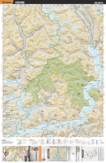
VIBC59 Kingcome - Vancouver Island BC Topo
This recreation topographic map for Kingcome highlights all the logging roads, trails and recreational Points of Interest including hunting, camping, hiking, mountain biking, canoeing, kayaking, backcountry skiing, wildlife viewing, ATVing, snowmobiling and more. No other map for the area provides you with this level of recreational or topographic detail. Covering 4,315 km2 (1,665 mi2) in total, 1:100,000 scale map measures 57 x 75 km (35 x 46.5 mi) and covers Kingcome, Hunwadi Ahnuhati - Bald Conservancy, Knight Inlet, Satsalla River, Kingcome River, Kinaklini River, Franklin River, Kingcome Inlet and more!
Page Size: 24 x 37 in (610 x 940 mm)
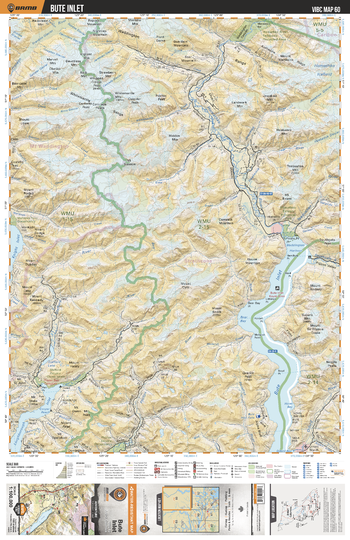
VIBC60 Bute Inlet - Vancouver Island BC Topo
This recreation topographic map for Bute Inlet highlights all the logging roads, trails and recreational Points of Interest including hunting, camping, hiking, mountain biking, canoeing, kayaking, backcountry skiing, wildlife viewing, ATVing, snowmobiling and more. No other map for the area provides you with this level of recreational or topographic detail. Covering 4,315 km2 (1,665 mi2) in total, 1:100,000 scale map measures 57 x 75 km (35 x 46.5 mi) and covers Bute Inlet, Homathko River, Orford River, Apple River, Stafford River, Phillips River, Jewakwa River, Heakamie River and more!
Page Size: 24 x 37 in (610 x 940 mm)