


Backroad Mapbooks

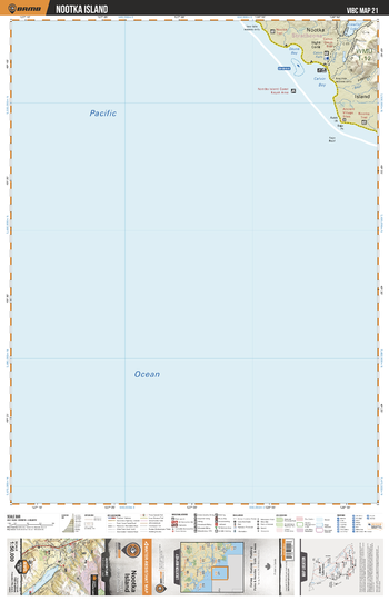
VIBC21 Nootka Island - Vancouver Island BC Topo
This recreation topographic map for Nootka Island highlights all the logging roads, trails and recreational Points of Interest including hunting, camping, hiking, mountain biking, canoeing, kayaking, backcountry skiing, wildlife viewing, ATVing, snowmobiling and more. No other map for the area provides you with this level of recreational or topographic detail. Covering 1,090 km2 (420 mi2) in total, this 1:50,000 scale map measures 29 x 38 km (18 x 24 mi) and covers Nootka Island, Crawfish Lake, Skuna Bay, Calvin Creek, Bajo Creek, Nootka Trail and more!
Page Size: 24 x 37 in (610 x 940 mm)
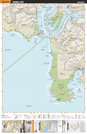
VIBC22 Friendly Cove - Vancouver Island BC Topo
This recreation topographic map for Friendly Cove highlights all the logging roads, trails and recreational Points of Interest including hunting, camping, hiking, mountain biking, canoeing, kayaking, backcountry skiing, wildlife viewing, ATVing, snowmobiling and more. No other map for the area provides you with this level of recreational or topographic detail. Covering 1,090 km2 (420 mi2) in total, this 1:50,000 scale map measures 29 x 38 km (18 x 24 mi) and covers Friendly Cove, Bligh Island, Bligh Island Provincial Marine Park, Nootka Island, Hesquiat Peninsula Provincial Park, Yuquot and more!
Page Size: 24 x 37 in (610 x 940 mm)
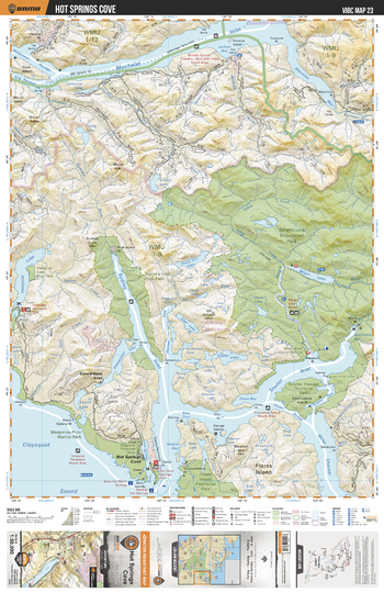
VIBC23 Hot Springs Cove - Vancouver Island BC Topo
This recreation topographic map for Hot Springs Cove highlights all the logging roads, trails and recreational Points of Interest including hunting, camping, hiking, mountain biking, canoeing, kayaking, backcountry skiing, wildlife viewing, ATVing, snowmobiling and more. No other map for the area provides you with this level of recreational or topographic detail. Covering 1,090 km2 (420 mi2) in total, this 1:50,000 scale map measures 29 x 38 km (18 x 24 mi) and covers Hot Springs Cove, Flores Island Provincial Park, Sydney Inlet, Shelter Inlet, Sydney Inlet Provincial Park, Strathcona Provincial Park and more!
Page Size: 24 x 37 in (610 x 940 mm)
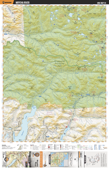
VIBC24 Moyeha River - Vancouver Island BC Topo
This recreation topographic map for Moyeha River highlights all the logging roads, trails and recreational Points of Interest including hunting, camping, hiking, mountain biking, canoeing, kayaking, backcountry skiing, wildlife viewing, ATVing, snowmobiling and more. No other map for the area provides you with this level of recreational or topographic detail. Covering 1,090 km2 (420 mi2) in total, this 1:50,000 scale map measures 29 x 38 km (18 x 24 mi) and covers Moyeha River, Strathcona Provincial Park, Burman River, Bedwell River, Herbert Inlet, Bedwell Sound, Burman Lake and more!
Page Size: 24 x 37 in (610 x 940 mm)
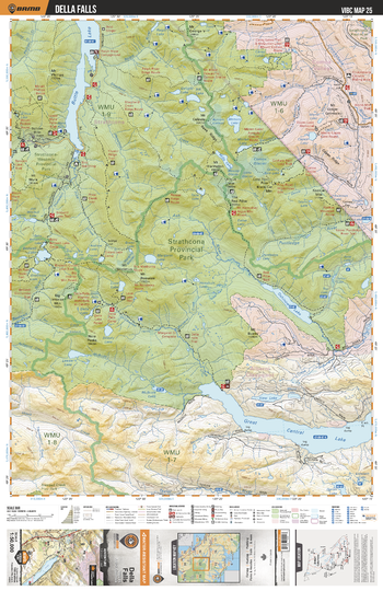
VIBC25 Della Falls - Vancouver Island BC Topo
This recreation topographic map for Della Falls highlights all the logging roads, trails and recreational Points of Interest including hunting, camping, hiking, mountain biking, canoeing, kayaking, backcountry skiing, wildlife viewing, ATVing, snowmobiling and more. No other map for the area provides you with this level of recreational or topographic detail. Covering 1,090 km2 (420 mi2) in total, this 1:50,000 scale map measures 29 x 38 km (18 x 24 mi) and covers Della Falls, Strathcona Provincial Park, Buttle Lake, Oshinow Lake, Great Central Lake, Ash River, Cruickshank River and more!
Page Size: 24 x 37 in (610 x 940 mm)
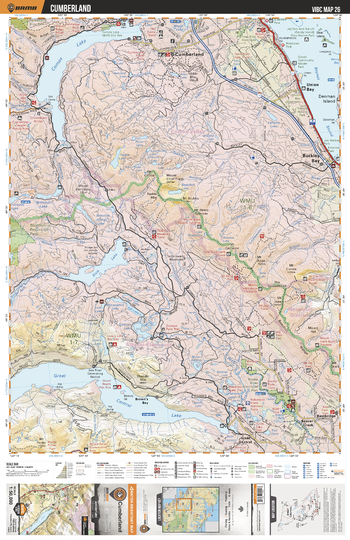
VIBC26 Cumberland - Vancouver Island BC Topo
This recreation topographic map for Cumberland highlights all the logging roads, trails and recreational Points of Interest including hunting, camping, hiking, mountain biking, canoeing, kayaking, backcountry skiing, wildlife viewing, ATVing, snowmobiling and more. No other map for the area provides you with this level of recreational or topographic detail. Covering 1,090 km2 (420 mi2) in total, this 1:50,000 scale map measures 29 x 38 km (18 x 24 mi) and covers Cumberland, Comox Lake, Elsie Lake, Great Central Lake, Asj River, Stamp River, Buckley Bay, Glover Community Nature Park and more!
Page Size: 24 x 37 in (610 x 940 mm)
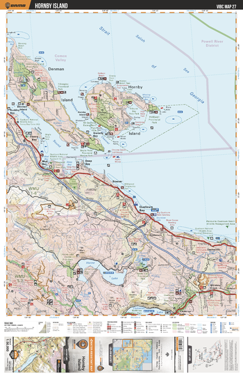
VIBC27 Hornby Island - Vancouver Island BC Topo
This recreation topographic map for Hornby Island highlights all the logging roads, trails and recreational Points of Interest including hunting, camping, hiking, mountain biking, canoeing, kayaking, backcountry skiing, wildlife viewing, ATVing, snowmobiling and more. No other map for the area provides you with this level of recreational or topographic detail. Covering 1,090 km2 (420 mi2) in total, this 1:50,000 scale map measures 29 x 38 km (18 x 24 mi) and covers Hornby Island, Denman Island, Boyle Point Provincial Marine Park, Horne Lake, Cameron Lake, Qualicum River, Little Qulicum Falls Provincial Park and more!
Page Size: 24 x 37 in (610 x 940 mm)
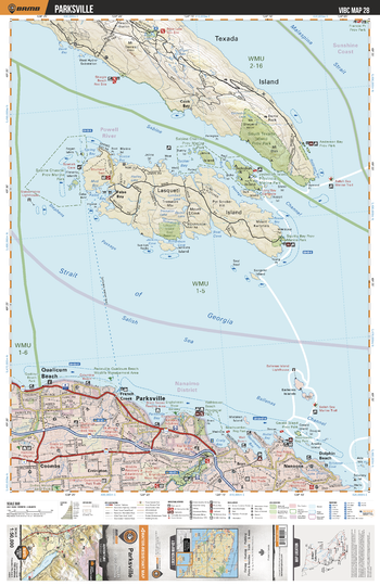
VIBC28 Parksville - Vancouver Island BC Topo
This recreation topographic map for Parksville highlights all the logging roads, trails and recreational Points of Interest including hunting, camping, hiking, mountain biking, canoeing, kayaking, backcountry skiing, wildlife viewing, ATVing, snowmobiling and more. No other map for the area provides you with this level of recreational or topographic detail. Covering 1,090 km2 (420 mi2) in total, this 1:50,000 scale map measures 29 x 38 km (18 x 24 mi) and covers Parksville, Qualicum Beach, Coombs, Englishman River, Qualicum Beach Park, Rathtrevor Beach Provinical Park, Beachcomber Regional Park and more!
Page Size: 24 x 37 in (610 x 940 mm)
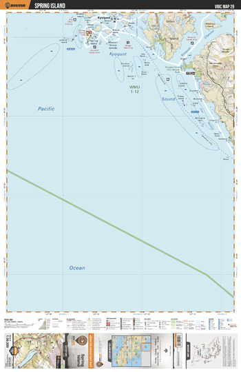
VIBC29 Spring Island - Vancouver Island BC Topo
This recreation topographic map for Spring Island highlights all the logging roads, trails and recreational Points of Interest including hunting, camping, hiking, mountain biking, canoeing, kayaking, backcountry skiing, wildlife viewing, ATVing, snowmobiling and more. No other map for the area provides you with this level of recreational or topographic detail. Covering 1,090 km2 (420 mi2) in total, this 1:50,000 scale map measures 29 x 38 km (18 x 24 mi) and covers Spring Island, Kyuquot, Union Island, Union Lake, Rugged Point Provincial Marine Park and more!
Page Size: 24 x 37 in (610 x 940 mm)
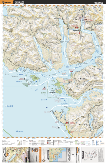
VIBC30 Zeballos - Vancouver Island BC Topo
This recreation topographic map for Zeballos highlights all the logging roads, trails and recreational Points of Interest including hunting, camping, hiking, mountain biking, canoeing, kayaking, backcountry skiing, wildlife viewing, ATVing, snowmobiling and more. No other map for the area provides you with this level of recreational or topographic detail. Covering 1,090 km2 (420 mi2) in total, this 1:50,000 scale map measures 29 x 38 km (18 x 24 mi) and covers Zeballos, Zeballos Inlet, Espinosa Inlet, Port Eliza, Cartala Island Provincial marine Park, Nuchatilitz Provincial Park, Nootka Island and more!
Page Size: 24 x 37 in (610 x 940 mm)
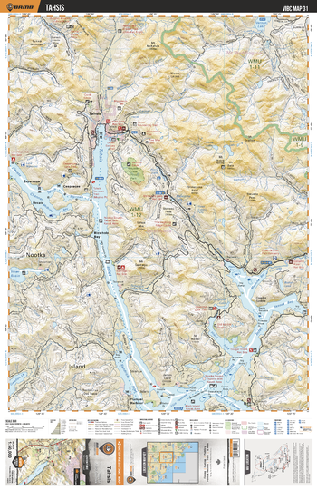
VIBC31 Tahsis - Vancouver Island BC Topo
This recreation topographic map for Tahsis highlights all the logging roads, trails and recreational Points of Interest including hunting, camping, hiking, mountain biking, canoeing, kayaking, backcountry skiing, wildlife viewing, ATVing, snowmobiling and more. No other map for the area provides you with this level of recreational or topographic detail. Covering 1,090 km2 (420 mi2) in total, this 1:50,000 scale map measures 29 x 38 km (18 x 24 mi) and covers Tahsis, Tahsis Inlet, Weymer Creek Provincial Park, Tsowwin River, Sucowoa River, Tahsis River, Conuma River and more!
Page Size: 24 x 37 in (610 x 940 mm)
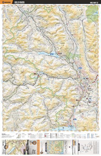
VIBC32 Gold River - Vancouver Island BC Topo
This recreation topographic map for Gold River highlights all the logging roads, trails and recreational Points of Interest including hunting, camping, hiking, mountain biking, canoeing, kayaking, backcountry skiing, wildlife viewing, ATVing, snowmobiling and more. No other map for the area provides you with this level of recreational or topographic detail. Covering 1,090 km2 (420 mi2) in total, this 1:50,000 scale map measures 29 x 38 km (18 x 24 mi) and covers Gold River, Muchalat Lake, Nimpkish River, Gold Muchalat Provincial Park, Strathcona Provincial Park, Muchalat Inlet and more!
Page Size: 24 x 37 in (610 x 940 mm)
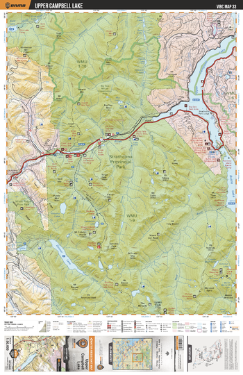
VIBC33 Upper Campbell Lake - Vancouver Island BC Topo
This recreation topographic map for Upper Campbell Lake highlights all the logging roads, trails and recreational Points of Interest including hunting, camping, hiking, mountain biking, canoeing, kayaking, backcountry skiing, wildlife viewing, ATVing, snowmobiling and more. No other map for the area provides you with this level of recreational or topographic detail. Covering 1,090 km2 (420 mi2) in total, this 1:50,000 scale map measures 29 x 38 km (18 x 24 mi) and covers Upper Campbell Lake, Heber River, Strathcona Provincial Park, Buttle Lake, White Ridge Provincial Park, Donner Lake and more!
Page Size: 24 x 37 in (610 x 940 mm)
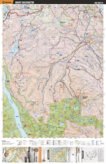
VIBC34 Mount Washington - Vancouver Island BC Topo
This recreation topographic map for Mount Washington highlights all the logging roads, trails and recreational Points of Interest including hunting, camping, hiking, mountain biking, canoeing, kayaking, backcountry skiing, wildlife viewing, ATVing, snowmobiling and more. No other map for the area provides you with this level of recreational or topographic detail. Covering 1,090 km2 (420 mi2) in total, this 1:50,000 scale map measures 29 x 38 km (18 x 24 mi) and covers Mount Washington, Oyster River, Upper Quinsam Lake, Buttle Lake, Strathcona Provincial Park, Pearl Lake, Moat Lake and more!
Page Size: 24 x 37 in (610 x 940 mm)
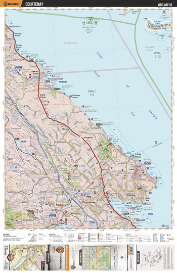
VIBC35 Courtenay - Vancouver Island BC Topo
This recreation topographic map for Courtenay highlights all the logging roads, trails and recreational Points of Interest including hunting, camping, hiking, mountain biking, canoeing, kayaking, backcountry skiing, wildlife viewing, ATVing, snowmobiling and more. No other map for the area provides you with this level of recreational or topographic detail. Covering 1,090 km2 (420 mi2) in total, this 1:50,000 scale map measures 29 x 38 km (18 x 24 mi) and covers Courtnenay, Oyster River, Tsolum River, Seal Bay Nature Park, Kitty Coleman Beach Park, Nymph Falls Regional Park and more!
Page Size: 24 x 37 in (610 x 940 mm)
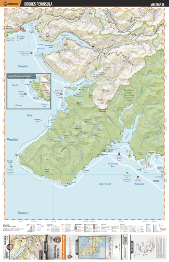
VIBC36 Brooks Peninsula - Vancouver Island BC Topo
This recreation topographic map for Brooks Peninsula highlights all the logging roads, trails and recreational Points of Interest including hunting, camping, hiking, mountain biking, canoeing, kayaking, backcountry skiing, wildlife viewing, ATVing, snowmobiling and more. No other map for the area provides you with this level of recreational or topographic detail. Covering 1,090 km2 (420 mi2) in total, this 1:50,000 scale map measures 29 x 38 km (18 x 24 mi) and covers Brooks Peninsula, Brooks Peninsula Provincial Park, Mahatta River, Klaskino River, Lawn Point Provinical Park and more!
Page Size: 24 x 37 in (610 x 940 mm)
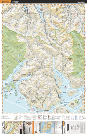
VIBC37 Kyuquot - Vancouver Island BC Topo
This recreation topographic map for Kyuquot highlights all the logging roads, trails and recreational Points of Interest including hunting, camping, hiking, mountain biking, canoeing, kayaking, backcountry skiing, wildlife viewing, ATVing, snowmobiling and more. No other map for the area provides you with this level of recreational or topographic detail. Covering 1,090 km2 (420 mi2) in total, this 1:50,000 scale map measures 29 x 38 km (18 x 24 mi) and covers Kyuquot, Victoria Lake, Brooks Peninsula Provincial Park, Tahsish-Kwois Provincial Park, Malksope Inlet, Ououkinsh Inlet and more!
Page Size: 24 x 37 in (610 x 940 mm)
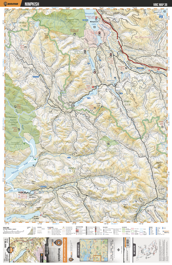
VIBC38 Nimpkish - Vancouver Island BC Topo
This recreation topographic map for Nimpkish highlights all the logging roads, trails and recreational Points of Interest including hunting, camping, hiking, mountain biking, canoeing, kayaking, backcountry skiing, wildlife viewing, ATVing, snowmobiling and more. No other map for the area provides you with this level of recreational or topographic detail. Covering 1,090 km2 (420 mi2) in total, this 1:50,000 scale map measures 29 x 38 km (18 x 24 mi) and covers Nimpkish, Nimpish Lake Provincial Park, Tahsish-Kwois Provincial Park, Artlish Caves Provincial Park, Kaouk River and more!
Page Size: 24 x 37 in (610 x 940 mm)
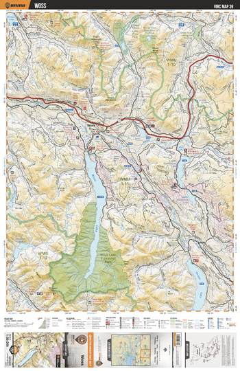
VIBC39 Woss - Vancouver Island BC Topo
This recreation topographic map for Woss highlights all the logging roads, trails and recreational Points of Interest including hunting, camping, hiking, mountain biking, canoeing, kayaking, backcountry skiing, wildlife viewing, ATVing, snowmobiling and more. No other map for the area provides you with this level of recreational or topographic detail. Covering 1,090 km2 (420 mi2) in total, this 1:50,000 scale map measures 29 x 38 km (18 x 24 mi) and covers Woss, Woss Lake, Nimpkish River, Vernon Lake, Woss Lake Provincial Park, Bonanza River, Tsitka River, Nomash River and more!
Page Size: 24 x 37 in (610 x 940 mm)
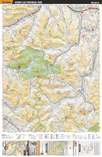
VIBC40 Schoen Lake Provincial Park - Vancouver Island BC Topo
This recreation topographic map for Schoen Lake Provincial Park highlights all the logging roads, trails and recreational Points of Interest including hunting, camping, hiking, mountain biking, canoeing, kayaking, backcountry skiing, wildlife viewing, ATVing, snowmobiling and more. No other map for the area provides you with this level of recreational or topographic detail. Covering 1,090 km2 (420 mi2) in total, this 1:50,000 scale map measures 29 x 38 km (18 x 24 mi) and covers Schoen Lake Provincial Park, Mount Cain Provinical Park, Adam River, Eve River, Nimpkish River and more!
Page Size: 24 x 37 in (610 x 940 mm)