


Backroad Mapbooks

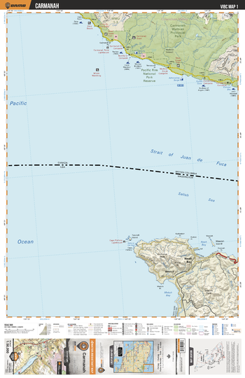
VIBC01 Carmanah - Vancouver Island BC Topo
This recreation topographic map for Carmanah highlights all the logging roads, trails and recreational Points of Interest including hunting, camping, hiking, mountain biking, canoeing, kayaking, backcountry skiing, wildlife viewing, ATVing, snowmobiling and more. No other map provides you with this level of recreational and topographic detail for the Carmanah area. Covering 1,090 km2 (420 mi2) in total, this 1:50,000 scale map measures 29 x 38 km (18 x 24 mi) and covers Carmanah Giant, Carmanah Walbran Provincial Park, Dare Beach, Juan De Fuca Strait, Pacific Rim National Park Reserve, Sad Lake, Walbran Canyon, West Coast Trail and more!
Page Size: 24 x 37 in (610 x 940 mm)
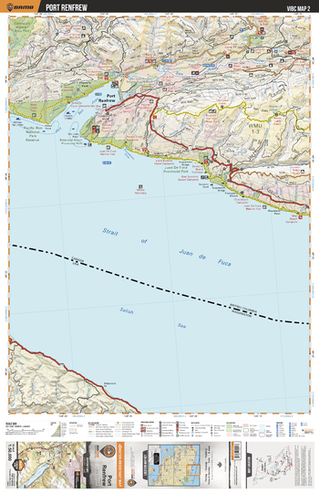
VIBC02 Port Renfrew - Vancouver Island BC Topo
This recreation topographic map for Port Renfrew highlights all the logging roads, trails and recreational Points of Interest including hunting, camping, hiking, mountain biking, canoeing, kayaking, backcountry skiing, wildlife viewing, ATVing, snowmobiling and more. No other map for the area provides you with this level of recreational or topographic detail. Covering 1,090 km2 (420 mi2) in total, this 1:50,000 scale map measures 29 x 38 km (18 x 24 mi) and covers Port Renfrew, Pacific Rim National Park Reserve, Juan De Fuca Provincial Park, San Juan River, Gordon River, Port San Juan and more!
Page Size: 24 x 37 in (610 x 940 mm)
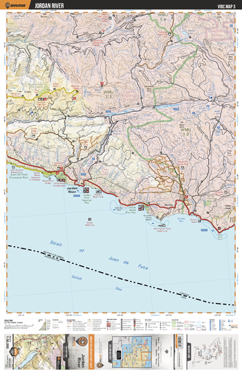
VIBC03 Jordan River - Vancouver Island BC Topo
This recreation topographic map for Jordan River highlights all the logging roads, trails and recreational Points of Interest including hunting, camping, hiking, mountain biking, canoeing, kayaking, backcountry skiing, wildlife viewing, ATVing, snowmobiling and more. No other map for the area provides you with this level of recreational or topographic detail. Covering 1,090 km2 (420 mi2) in total, this 1:50,000 scale map measures 29 x 38 km (18 x 24 mi) and covers Jordan River, Juan De Fuca Provincial Park, China Beach Provincial Park, French Beach Provincial Park, Bear Creek Resevoir and more!
Page Size: 24 x 37 in (610 x 940 mm)
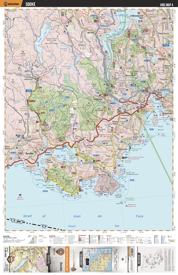
VIBC04 Sooke - Vancouver Island BC Topo
This recreation topographic map for Sooke highlights all the logging roads, trails and recreational Points of Interest including hunting, camping, hiking, mountain biking, canoeing, kayaking, backcountry skiing, wildlife viewing, ATVing, snowmobiling and more. No other map for the area provides you with this level of recreational or topographic detail. Covering 1,090 km2 (420 mi2) in total, this 1:50,000 scale map measures 29 x 38 km (18 x 24 mi) and covers Sooke, Sea to Sea Park Reserve, Sooke Hills Wilderness Provincial Park, East Sooke Regional Park, Esquimalt and more!
Page Size: 24 x 37 in (610 x 940 mm)
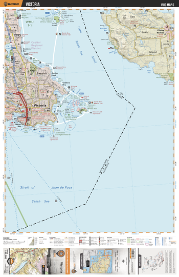
VIBC05 Victoria - Vancouver Island BC Topo
This recreation topographic map for Victoria highlights all the logging roads, trails and recreational Points of Interest including hunting, camping, hiking, mountain biking, canoeing, kayaking, backcountry skiing, wildlife viewing, ATVing, snowmobiling and more. No other map for the area provides you with this level of recreational or topographic detail. Covering 1,090 km2 (420 mi2) in total, this 1:50,000 scale map measures 29 x 38 km (18 x 24 mi) and covers Victoria, Island View Beach Regional Park, Gulf Islands National Park Reserve, Saanich, Gold Stream Provinical Park and more!
Page Size: 24 x 37 in (610 x 940 mm)
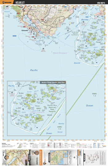
VIBC06 Ucluelet - Vancouver Island BC Topo
This recreation topographic map for Ucluelet highlights all the logging roads, trails and recreational Points of Interest including hunting, camping, hiking, mountain biking, canoeing, kayaking, backcountry skiing, wildlife viewing, ATVing, snowmobiling and more. No other map for the area provides you with this level of recreational or topographic detail. Covering 1,090 km2 (420 mi2) in total, this 1:50,000 scale map measures 29 x 38 km (18 x 24 mi) and covers Broken Group Islands, Pacific Rim National Park, Ucluelet, Barkley Sound, Mount Ozzard, Florencia Bay, Ucluelet Inlet and more!
Page Size: 24 x 37 in (610 x 940 mm)
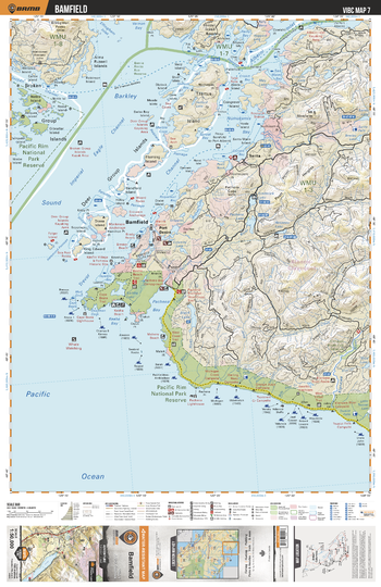
VIBC07 Bamfield - Vancouver Island BC Topo
This recreation topographic map for Bamfield highlights all the logging roads, trails and recreational Points of Interest including hunting, camping, hiking, mountain biking, canoeing, kayaking, backcountry skiing, wildlife viewing, ATVing, snowmobiling and more. No other map for the area provides you with this level of recreational or topographic detail. Covering 1,090 km2 (420 mi2) in total, this 1:50,000 scale map measures 29 x 38 km (18 x 24 mi) and covers Bamfield, Trevor Channel, Tzartus Island, Pacific Rim National Park, Pachena Bay, Black Lake, Numukamis Bay and more!
Page Size: 24 x 37 in (610 x 940 mm)
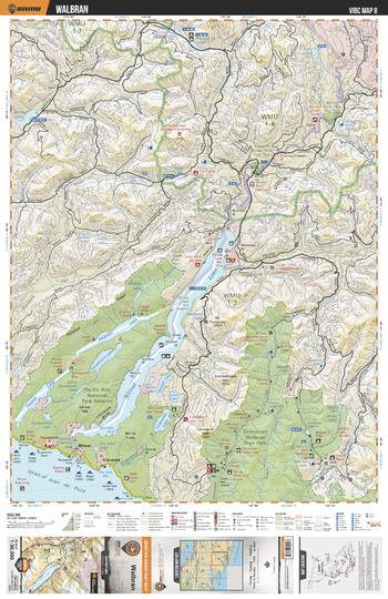
VIBC08 Walbran - Vancouver Island BC Topo
This recreation topographic map for Walbran highlights all the logging roads, trails and recreational Points of Interest including hunting, camping, hiking, mountain biking, canoeing, kayaking, backcountry skiing, wildlife viewing, ATVing, snowmobiling and more. No other map for the area provides you with this level of recreational or topographic detail. Covering 1,090 km2 (420 mi2) in total, this 1:50,000 scale map measures 29 x 38 km (18 x 24 mi) and covers Walbran, Pacific Rim National Park, Carmanah Walbran Provincial Park, Nitinat Lake, Nitnat River, Habiten Lake and more!
Page Size: 24 x 37 in (610 x 940 mm)
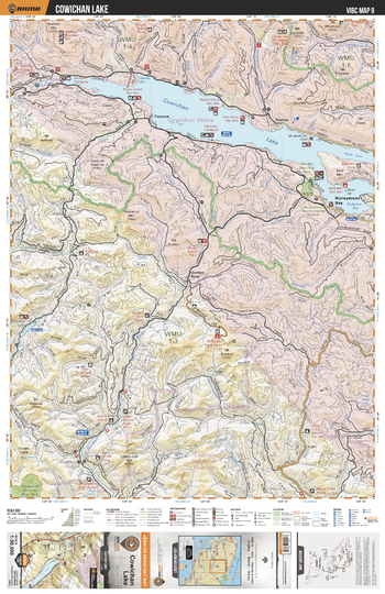
VIBC09 Cowichan Lake - Vancouver Island BC Topo
This recreation topographic map for Cowichan Lake highlights all the logging roads, trails and recreational Points of Interest including hunting, camping, hiking, mountain biking, canoeing, kayaking, backcountry skiing, wildlife viewing, ATVing, snowmobiling and more. No other map for the area provides you with this level of recreational or topographic detail. Covering 1,090 km2 (420 mi2) in total, this 1:50,000 scale map measures 29 x 38 km (18 x 24 mi) and covers Cowichan Lake, Gordon Bay Provincial Park, Honeymoon Bay, Gordon River, Sutton Creek, McClure Lake and more!
Page Size: 24 x 37 in (610 x 940 mm)
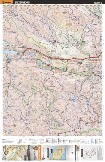
VIBC10 Lake Cowichan - Vancouver Island BC Topo
This recreation topographic map for Lake Cowichan highlights all the logging roads, trails and recreational Points of Interest including hunting, camping, hiking, mountain biking, canoeing, kayaking, backcountry skiing, wildlife viewing, ATVing, snowmobiling and more. No other map for the area provides you with this level of recreational or topographic detail. Covering 1,090 km2 (420 mi2) in total, this 1:50,000 scale map measures 29 x 38 km (18 x 24 mi) and covers Lake Cowichan, Cowichan River, Chemainus River, Koksilah River Provincial Park, Fleet River, Robertson River and more!
Page Size: 24 x 37 in (610 x 940 mm)
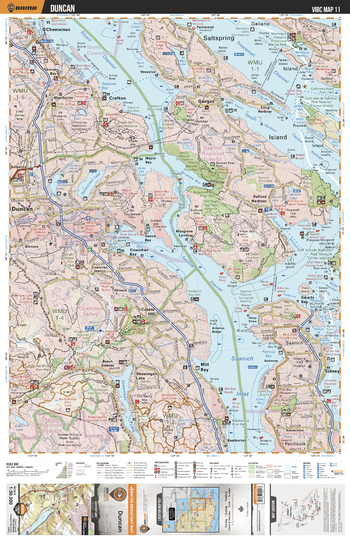
VIBC11 Duncan - Vancouver Island BC Topo
This recreation topographic map for Duncan highlights all the logging roads, trails and recreational Points of Interest including hunting, camping, hiking, mountain biking, canoeing, kayaking, backcountry skiing, wildlife viewing, ATVing, snowmobiling and more. No other map for the area provides you with this level of recreational or topographic detail. Covering 1,090 km2 (420 mi2) in total, this 1:50,000 scale map measures 29 x 38 km (18 x 24 mi) and covers Duncan, Saltspring Island, Maple Mountain Forest Reserve, Stuart Channel, Satelite Channel, Mount Maxwell Provincial Park and more!
Page Size: 24 x 37 in (610 x 940 mm)
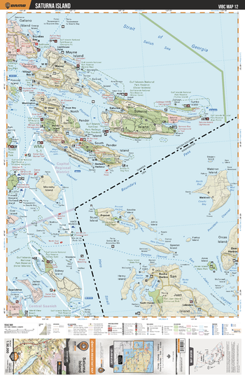
VIBC12 Saturna Island - Vancouver Island BC Topo
This recreation topographic map for Saturna Island highlights all the logging roads, trails and recreational Points of Interest including hunting, camping, hiking, mountain biking, canoeing, kayaking, backcountry skiing, wildlife viewing, ATVing, snowmobiling and more. No other map for the area provides you with this level of recreational or topographic detail. Covering 1,090 km2 (420 mi2) in total, this 1:50,000 scale map measures 29 x 38 km (18 x 24 mi) and covers Saturna Island, Gulf Islands National Park Reserve, Sturdies Bay, Village Bay, Swanson Channel, Plumper Sound and more!
Page Size: 24 x 37 in (610 x 940 mm)
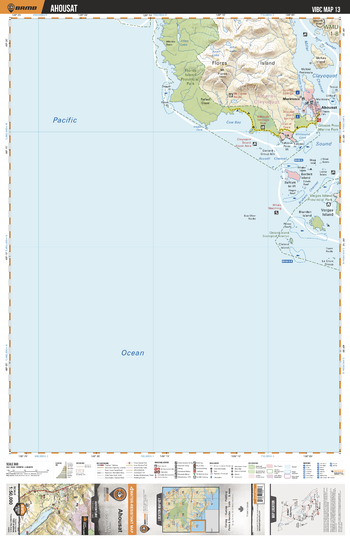
VIBC13 Ahousat - Vancouver Island BC Topo
This recreation topographic map for Ahousat highlights all the logging roads, trails and recreational Points of Interest including hunting, camping, hiking, mountain biking, canoeing, kayaking, backcountry skiing, wildlife viewing, ATVing, snowmobiling and more. No other map for the area provides you with this level of recreational or topographic detail. Covering 1,090 km2 (420 mi2) in total, this 1:50,000 scale map measures 29 x 38 km (18 x 24 mi) and covers Friendly Cove, Flores Island, Flores Island Provincial Park, Vargas Island, Vargas Island Provincial Park, Cow Bay, Ahousaht , Wild Side Trail and more!
Page Size: 24 x 37 in (610 x 940 mm)
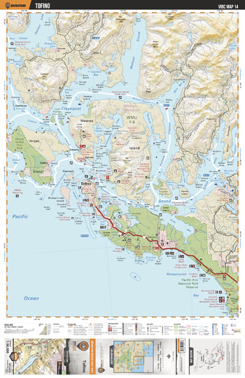
VIBC14 Tofino - Vancouver Island BC Topo
This recreation topographic map for Tofino highlights all the logging roads, trails and recreational Points of Interest including hunting, camping, hiking, mountain biking, canoeing, kayaking, backcountry skiing, wildlife viewing, ATVing, snowmobiling and more. No other map for the area provides you with this level of recreational or topographic detail. Covering 1,090 km2 (420 mi2) in total, this 1:50,000 scale map measures 29 x 38 km (18 x 24 mi) and covers Tofino, Clayoquot Sound, Meares Island Tribal Park, Bewley Passage Provincial Park, Pacific Rim National Park, Vargas Island Provincial Park and more!
Page Size: 24 x 37 in (610 x 940 mm)
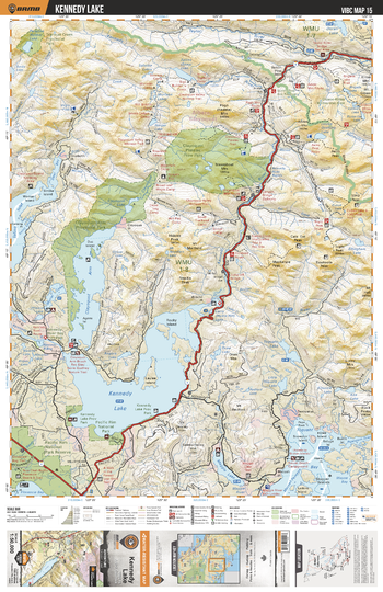
VIBC15 Kennedy Lake - Vancouver Island BC Topo
This recreation topographic map for Kennedy Lake highlights all the logging roads, trails and recreational Points of Interest including hunting, camping, hiking, mountain biking, canoeing, kayaking, backcountry skiing, wildlife viewing, ATVing, snowmobiling and more. No other map for the area provides you with this level of recreational or topographic detail. Covering 1,090 km2 (420 mi2) in total, this 1:50,000 scale map measures 29 x 38 km (18 x 24 mi) and covers Kennedy Lake, Clayoquot Arm, Clayoquot Arm Provincial Park, Clayoquot Plateau Provincial Park, Toquart Bay, Pacific Rim National Park and more!
Page Size: 24 x 37 in (610 x 940 mm)
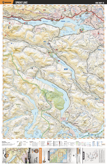
VIBC16 Sproat Lake - Vancouver Island BC Topo
This recreation topographic map for Sproat Lake highlights all the logging roads, trails and recreational Points of Interest including hunting, camping, hiking, mountain biking, canoeing, kayaking, backcountry skiing, wildlife viewing, ATVing, snowmobiling and more. No other map for the area provides you with this level of recreational or topographic detail. Covering 1,090 km2 (420 mi2) in total, this 1:50,000 scale map measures 29 x 38 km (18 x 24 mi) and covers Sproat Lake, Taylor Arm, Nahmint Lake, Henderson Lake, Effingham Inlet, Nahmint River, Gracie Lake, Two Rivers Arm and more!
Page Size: 24 x 37 in (610 x 940 mm)
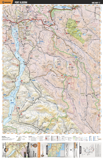
VIBC17 Port Alberni - Vancouver Island BC Topo
This recreation topographic map for Port Alberni highlights all the logging roads, trails and recreational Points of Interest including hunting, camping, hiking, mountain biking, canoeing, kayaking, backcountry skiing, wildlife viewing, ATVing, snowmobiling and more. No other map for the area provides you with this level of recreational or topographic detail. Covering 1,090 km2 (420 mi2) in total, this 1:50,000 scale map measures 29 x 38 km (18 x 24 mi) and covers Port Alberni, Alberni Inlet, Cameron River, Englishman River, Cameron Lake, Mount Arrowsmith Regional Park, MacMillan Provincial Park and more!
Page Size: 24 x 37 in (610 x 940 mm)
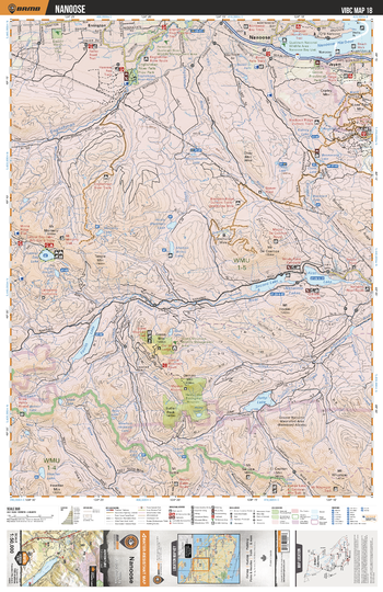
VIBC18 Nanoose - Vancouver Island BC Topo
This recreation topographic map for Nanoose highlights all the logging roads, trails and recreational Points of Interest including hunting, camping, hiking, mountain biking, canoeing, kayaking, backcountry skiing, wildlife viewing, ATVing, snowmobiling and more. No other map for the area provides you with this level of recreational or topographic detail. Covering 1,090 km2 (420 mi2) in total, this 1:50,000 scale map measures 29 x 38 km (18 x 24 mi) and covers Nanoose, Nanoose Harbour, Englishman River, Nanaimo River, Fourth Lake, Second Lake, Jump Lake, Dudley Marsh Land Trust and more!
Page Size: 24 x 37 in (610 x 940 mm)
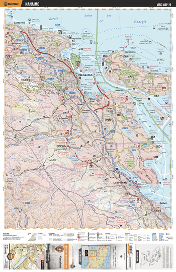
VIBC19 Nanaimo - Vancouver Island BC Topo
This recreation topographic map for Nanaimo highlights all the logging roads, trails and recreational Points of Interest including hunting, camping, hiking, mountain biking, canoeing, kayaking, backcountry skiing, wildlife viewing, ATVing, snowmobiling and more. No other map for the area provides you with this level of recreational or topographic detail. Covering 1,090 km2 (420 mi2) in total, this 1:50,000 scale map measures 29 x 38 km (18 x 24 mi) and covers Nanaimo, Millstone River, Petroglyph Provincial Park, Nanaimo River, Ladysmith Harbour, Roberts Memorial Provincial Park and more!
Page Size: 24 x 37 in (610 x 940 mm)
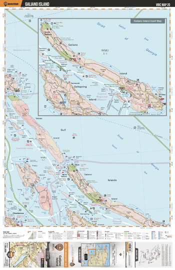
VIBC20 Galiano Island - Vancouver Island BC Topo
This recreation topographic map for Galiano Island highlights all the logging roads, trails and recreational Points of Interest including hunting, camping, hiking, mountain biking, canoeing, kayaking, backcountry skiing, wildlife viewing, ATVing, snowmobiling and more. No other map for the area provides you with this level of recreational or topographic detail. Covering 1,090 km2 (420 mi2) in total, this 1:50,000 scale map measures 29 x 38 km (18 x 24 mi) and covers Galiano Island, Whaleboat Island Marine Park, Dionso Point Provincial Park, Bodge Ridge Provincial Park, Thetis Island, Gulf Islands and more!
Page Size: 24 x 37 in (610 x 940 mm)