


Backroad Mapbooks

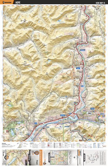
VCBC15 Hope - Vancouver Coast & Mountains BC Topo
This recreation topographic map for the Hope area highlights all the logging roads, trails and recreational Points of Interest including hunting, camping, hiking, mountain biking, canoeing, kayaking, backcountry skiing, wildlife viewing, ATVing, snowmobiling and more. No other map for the area provides you with this level of recreational or topographic detail. Covering 1,090 km2 (420 mi2), this 1:50,000 scale map measures 29 x 38 km (18 x 24 mi) and covers Hope, Coquihalla River, Sollicum Lake, Deer Lake, Hicks Lake, Sasquatch Provincial Park, Coquihalla Canyon Provincial Park and more!
Page Size: 24 x 37 in (610 x 940 mm)
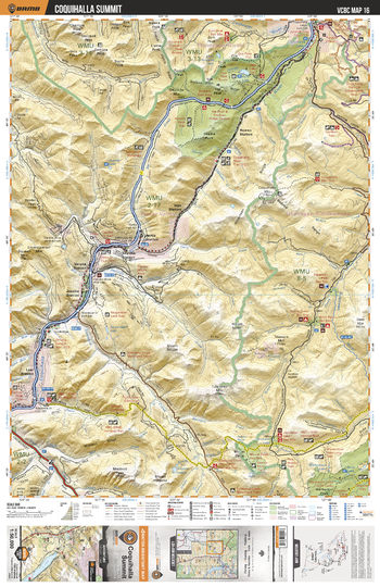
VCBC16 Coquihalla Summit - Vancouver Coast & Mountains BC Topo
This recreation topographic map for the Coquihalla Summit area highlights all the logging roads, trails and recreational Points of Interest including hunting, camping, hiking, mountain biking, canoeing, kayaking, backcountry skiing, wildlife viewing, ATVing, snowmobiling and more. No other map for the area provides you with this level of recreational or topographic detail. Covering 1,090 km2 (420 mi2), this 1:50,000 scale map measures 29 x 38 km (18 x 24 mi) and covers Coquihalla Summit Recreational Area, Falls Lake, Coldwater River, Coquihalla River, Tulameen River, Serpentine Lake, Anderson River and more!
Page Size: 24 x 37 in (610 x 940 mm)
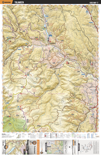
VCBC17 Tulameen - Vancouver Coast & Mountains BC Topo
This recreation topographic map for the Tulameen area highlights all the logging roads, trails and recreational Points of Interest including hunting, camping, hiking, mountain biking, canoeing, kayaking, backcountry skiing, wildlife viewing, ATVing, snowmobiling and more. No other map for the area provides you with this level of recreational or topographic detail. Covering 1,090 km2 (420 mi2), this 1:50,000 scale map measures 29 x 38 km (18 x 24 mi) and covers Tulameen, Otter Lake, Tulameen River, Arrastra Creek, Murphy Lakes, Otter Lake Provincial Park, Manning Park, Whipsaw Creek and more!
Page Size: 24 x 37 in (610 x 940 mm)
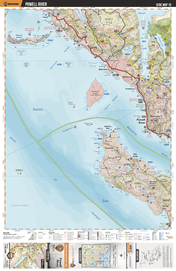
VCBC18 Powell River - Vancouver Coast & Mountains BC Topo
This recreation topographic map for the Powell River area highlights all the logging roads, trails and recreational Points of Interest including hunting, camping, hiking, mountain biking, canoeing, kayaking, backcountry skiing, wildlife viewing, ATVing, snowmobiling and more. No other map for the area provides you with this level of recreational or topographic detail. Covering 1,090 km2 (420 mi2), this 1:50,000 scale map measures 29 x 38 km (18 x 24 mi) and covers Powell River, Powell Lake, Sliammon Lake, Inland Lake, Inland Lake Provincial Park, Priest Lake, Okeover Arm Provincial Park and more!
Page Size: 24 x 37 in (610 x 940 mm)
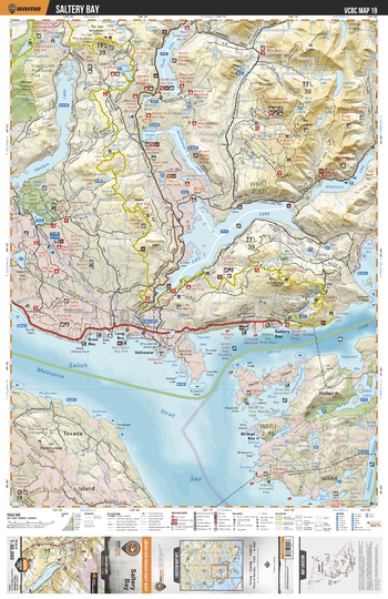
VCBC19 Saltery Bay - Vancouver Coast & Mountains BC Topo
This recreation topographic map for the Saltery Bay area highlights all the logging roads, trails and recreational Points of Interest including hunting, camping, hiking, mountain biking, canoeing, kayaking, backcountry skiing, wildlife viewing, ATVing, snowmobiling and more. No other map for the area provides you with this level of recreational or topographic detail. Covering 1,090 km2 (420 mi2), this 1:50,000 scale map measures 29 x 38 km (18 x 24 mi) and covers Saltery Bay, Lois Lake, Khartoum Lake, Haslam Lake, Inland Lake Provicnial Park, Saltery Bay Provincial Park, Sunshine Coast Trail and more!
Page Size: 24 x 37 in (610 x 940 mm)
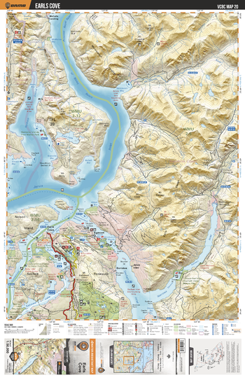
VCBC20 Earls Cove - Vancouver Coast & Mountains BC Topo
This recreation topographic map for the Earls Cove area highlights all the logging roads, trails and recreational Points of Interest including hunting, camping, hiking, mountain biking, canoeing, kayaking, backcountry skiing, wildlife viewing, ATVing, snowmobiling and more. No other map for the area provides you with this level of recreational or topographic detail. Covering 1,090 km2 (420 mi2), this 1:50,000 scale map measures 29 x 38 km (18 x 24 mi) and covers Earl's Cove, Sakinaw Lake, Spipiyus Provincial Park, Skookumchuck Narrows Provincial Park, Freil Lake, Ruby Lake, Edgemont Point Park and more!
Page Size: 24 x 37 in (610 x 940 mm)
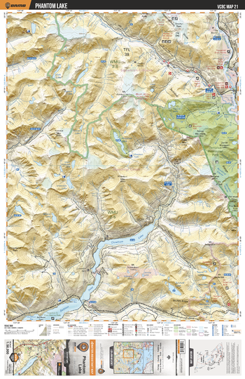
VCBC21 Phantom Lake - Vancouver Coast & Mountains BC Topo
This recreation topographic map for the Phantom Lake area highlights all the logging roads, trails and recreational Points of Interest including hunting, camping, hiking, mountain biking, canoeing, kayaking, backcountry skiing, wildlife viewing, ATVing, snowmobiling and more. No other map for the area provides you with this level of recreational or topographic detail. Covering 1,090 km2 (420 mi2), this 1:50,000 scale map measures 29 x 38 km (18 x 24 mi) and covers Phantom Lake, Clowhom Lake, Tantalus Provincial Park, Salmon Inlet, Clowhom River, Tzoonie River, Squamish River, Ashlu Creek and more!
Page Size: 24 x 37 in (610 x 940 mm)
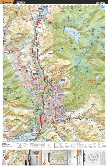
VCBC22 Squamish - Vancouver Coast & Mountains BC Topo
This recreation topographic map for the Squamish area highlights all the logging roads, trails and recreational Points of Interest including hunting, camping, hiking, mountain biking, canoeing, kayaking, backcountry skiing, wildlife viewing, ATVing, snowmobiling and more. No other map for the area provides you with this level of recreational or topographic detail. Covering 1,090 km2 (420 mi2), this 1:50,000 scale map measures 29 x 38 km (18 x 24 mi) and covers Squamish, Alice Lake Provincial Park, Garibaldi Provincial Park, Tantalus Provincial Park, Cheakamus River, Garibaldi Lake, Mamquam River and more!
Page Size: 24 x 37 in (610 x 940 mm)
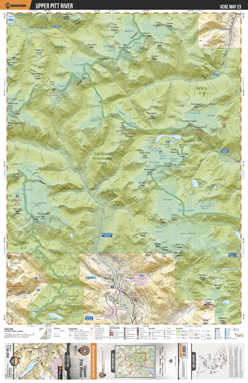
VCBC23 Upper Pitt River - Vancouver Coast & Mountains BC Topo
This recreation topographic map for the Upper Pitt River area highlights all the logging roads, trails and recreational Points of Interest including hunting, camping, hiking, mountain biking, canoeing, kayaking, backcountry skiing, wildlife viewing, ATVing, snowmobiling and more. No other map for the area provides you with this level of recreational or topographic detail. Covering 1,090 km2 (420 mi2), this 1:50,000 scale map measures 29 x 38 km (18 x 24 mi) and covers Garibaldi Provincial Park, Pinecone Burke Provincial Park, Golden Ears Provincial Park, Pitt River, Pinecone Lake, Snowcap Lake and more!
Page Size: 24 x 37 in (610 x 940 mm)
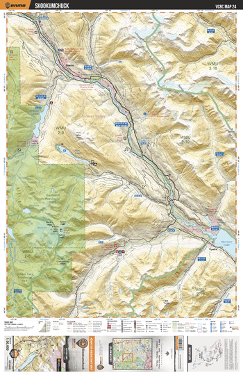
VCBC24 Skookumchuck - Vancouver Coast & Mountains BC Topo
This recreation topographic map for the Skookumchuck area highlights all the logging roads, trails and recreational Points of Interest including hunting, camping, hiking, mountain biking, canoeing, kayaking, backcountry skiing, wildlife viewing, ATVing, snowmobiling and more. No other map for the area provides you with this level of recreational or topographic detail. Covering 1,090 km2 (420 mi2), this 1:50,000 scale map measures 29 x 38 km (18 x 24 mi) and covers Skatin, Skookumchuck Hot Springs, Garibaldi Provincial Park, Lillooet River, Harrison Lake, Fire Lake, Stave River, Sloquet Creek and more!
Page Size: 24 x 37 in (610 x 940 mm)
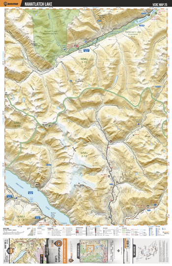
VCBC25 Nahatlatch Lake - Vancouver Coast & Mountains BC Topo
This recreation topographic map for the Nahatlatch Lake area highlights all the logging roads, trails and recreational Points of Interest including hunting, camping, hiking, mountain biking, canoeing, kayaking, backcountry skiing, wildlife viewing, ATVing, snowmobiling and more. No other map for the area provides you with this level of recreational or topographic detail. Covering 1,090 km2 (420 mi2), this 1:50,000 scale map measures 29 x 38 km (18 x 24 mi) and covers Nahatlatch Lake, Nahatlatch Lake Provincial Park, Nahatlatch River, Mehatl Creek Provincial Park, Harrison Lake, Big Silver Creek and more!
Page Size: 24 x 37 in (610 x 940 mm)
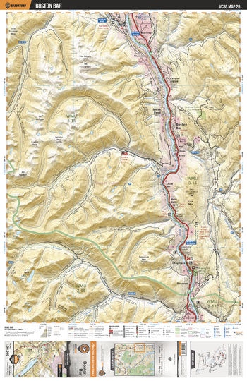
VCBC26 Boston Bar - Vancouver Coast & Mountains BC Topo
This recreation topographic map for the Boston Bar area highlights all the logging roads, trails and recreational Points of Interest including hunting, camping, hiking, mountain biking, canoeing, kayaking, backcountry skiing, wildlife viewing, ATVing, snowmobiling and more. No other map for the area provides you with this level of recreational or topographic detail. Covering 1,090 km2 (420 mi2), this 1:50,000 scale map measures 29 x 38 km (18 x 24 mi) and covers Boston Bar, Fraser River, Anderson River, Urquhart Creek, Alexandra Bridge Provincial Park, Scuzzy Creek, Kookipi Creek and more!
Page Size: 24 x 37 in (610 x 940 mm)
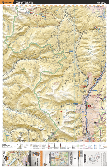
VCBC27 Coldwater River - Vancouver Coast & Mountains BC Topo
This recreation topographic map for the Coldwater River area highlights all the logging roads, trails and recreational Points of Interest including hunting, camping, hiking, mountain biking, canoeing, kayaking, backcountry skiing, wildlife viewing, ATVing, snowmobiling and more. No other map for the area provides you with this level of recreational or topographic detail. Covering 1,090 km2 (420 mi2), this 1:50,000 scale map measures 29 x 38 km (18 x 24 mi) and covers Coldwater River, East Anderson River, Coldwater Provincial Park, Juliet Creek, Mako Creek, Uztilius Creek, Spius Creek and more!
Page Size: 24 x 37 in (610 x 940 mm)
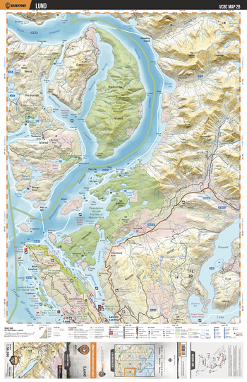
VCBC28 Lund - Vancouver Coast & Mountains BC Topo
This recreation topographic map for the Lund area highlights all the logging roads, trails and recreational Points of Interest including hunting, camping, hiking, mountain biking, canoeing, kayaking, backcountry skiing, wildlife viewing, ATVing, snowmobiling and more. No other map for the area provides you with this level of recreational or topographic detail. Covering 1,090 km2 (420 mi2), this 1:50,000 scale map measures 29 x 38 km (18 x 24 mi) and covers Lund, Desolation Sound Provincial Marine Park, Powell Lake, East Redona Island Ecological Reserve, Walsh Cove Provincial Marine Park and more!
Page Size: 24 x 37 in (610 x 940 mm)
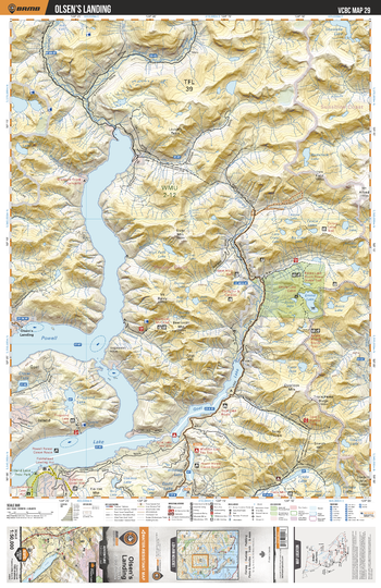
VCBC29 Owens Landing - Vancouver Coast & Mountains BC Topo
This recreation topographic map for the Owens Landing area highlights all the logging roads, trails and recreational Points of Interest including hunting, camping, hiking, mountain biking, canoeing, kayaking, backcountry skiing, wildlife viewing, ATVing, snowmobiling and more. No other map for the area provides you with this level of recreational or topographic detail. Covering 1,090 km2 (420 mi2), this 1:50,000 scale map measures 29 x 38 km (18 x 24 mi) and covers Powell Lake, Eldred River, Daniels River, Emma Lake, Frogpond Lake, Goat Lake, Freda Lake, Inland Lake Provincial Park and more!
Page Size: 24 x 37 in (610 x 940 mm)
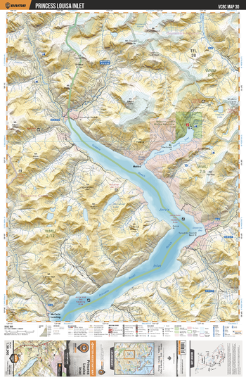
VCBC30 Princess Louisa Inlet - Vancouver Coast & Mountains BC Topo
This recreation topographic map for the Princess Louisa Inlet area highlights all the logging roads, trails and recreational Points of Interest including hunting, camping, hiking, mountain biking, canoeing, kayaking, backcountry skiing, wildlife viewing, ATVing, snowmobiling and more. No other map for the area provides you with this level of recreational or topographic detail. Covering 1,090 km2 (420 mi2), this 1:50,000 scale map measures 29 x 38 km (18 x 24 mi) and covers Princess Louisa Inlet, Princess Louisa Marine Provincial Park, Brittain River, Skwawka River, Sims Creek, Mccannel Lake and more!
Page Size: 24 x 37 in (610 x 940 mm)
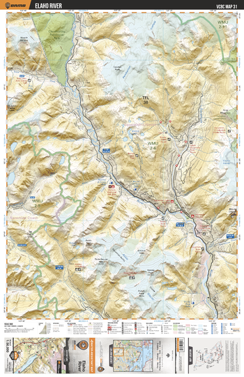
VCBC31 Elaho River - Vancouver Coast & Mountains BC Topo
This recreation topographic map for the Elaho River area highlights all the logging roads, trails and recreational Points of Interest including hunting, camping, hiking, mountain biking, canoeing, kayaking, backcountry skiing, wildlife viewing, ATVing, snowmobiling and more. No other map for the area provides you with this level of recreational or topographic detail. Covering 1,090 km2 (420 mi2), this 1:50,000 scale map measures 29 x 38 km (18 x 24 mi) and covers Elaho River, Squamish River, Desserted River, Ashlu Creek, Blanca Lake, Clendinning Provincial Park, Callaghan Conservancy and more!
Page Size: 24 x 37 in (610 x 940 mm)
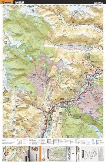
VCBC32 Whistler - Vancouver Coast & Mountains BC Topo
This recreation topographic map for the Whistler area highlights all the logging roads, trails and recreational Points of Interest including hunting, camping, hiking, mountain biking, canoeing, kayaking, backcountry skiing, wildlife viewing, ATVing, snowmobiling and more. No other map for the area provides you with this level of recreational or topographic detail. Covering 1,090 km2 (420 mi2), this 1:50,000 scale map measures 29 x 38 km (18 x 24 mi) and covers Whistler, Garibaldi Provincial Park, Brandywine Falls Provincial Park, Green Lake, Callaghan Lake Provincial Park, Soo River and more!
Page Size: 24 x 37 in (610 x 940 mm)
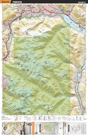
VCBC33 Pemberton - Vancouver Coast & Mountains BC Topo
This recreation topographic map for the Pemberton area highlights all the logging roads, trails and recreational Points of Interest including hunting, camping, hiking, mountain biking, canoeing, kayaking, backcountry skiing, wildlife viewing, ATVing, snowmobiling and more. No other map for the area provides you with this level of recreational or topographic detail. Covering 1,090 km2 (420 mi2), this 1:50,000 scale map measures 29 x 38 km (18 x 24 mi) and covers Pemberton, Lillooet Lake, Lillooet River, Birkenhead River, Green River, Garibaldi Provincial Park, Blackcomb Glacier Provincial Park and more!
Page Size: 24 x 37 in (610 x 940 mm)
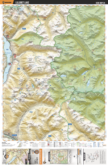
VCBC34 Lillooet Lake - Vancouver Coast & Mountains BC Topo
This recreation topographic map for the Lillooet Lake area highlights all the logging roads, trails and recreational Points of Interest including hunting, camping, hiking, mountain biking, canoeing, kayaking, backcountry skiing, wildlife viewing, ATVing, snowmobiling and more. No other map for the area provides you with this level of recreational or topographic detail. Covering 1,090 km2 (420 mi2), this 1:50,000 scale map measures 29 x 38 km (18 x 24 mi) and covers Lillooet Lake, Stein Valley Nlaka'pamux Provincial Heritage Park, Mehatl Creek Provincial Park, Nahatlatch River, Stein River and more!
Page Size: 24 x 37 in (610 x 940 mm)