


Backroad Mapbooks

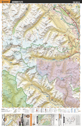
TOBC46 Jackman Flats - Thompson Okanagan BC Topo Map
This recreation topographic map for the Jackman Flats area highlights all the logging roads, trails and recreational Points of Interest including hunting, camping, hiking, mountain biking, canoeing, kayaking, backcountry skiing, snowshoeing, cross-country skiing, wildlife viewing, ATVing, snowmobiling and more. No other map for the area provides you with this level of recreational or topographic detail. Special features include private land and countless roads, trails and recreational Points of Interest. Covering 1,950 km2 (750 mi2) in total, this 1:65,000 scale map measures 38 x 51 km (23.5 x 32 mi) and includes Jackman Flats, McLennan River, Canoe River, North Thompson River, Jackman Flats Provincial Park, Kiwa Creek and more!
Page Size: 24 x 37 in (610 x 940 mm)
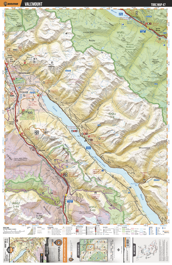
TOBC47 Valemount - Thompson Okanagan BC Topo Map
This recreation topographic map for the Valemount area highlights all the logging roads, trails and recreational Points of Interest including hunting, camping, hiking, mountain biking, canoeing, kayaking, backcountry skiing, snowshoeing, cross-country skiing, wildlife viewing, ATVing, snowmobiling and more. No other map for the area provides you with this level of recreational or topographic detail. Special features include private land and countless roads, trails and recreational Points of Interest. Covering 1,950 km2 (750 mi2) in total, this 1:65,000 scale map measures 38 x 51 km (23.5 x 32 mi) and includes Valemont, Mount Robson Provincial Park, Canoe Reach, Mount Terry Fox Provincial Park, Moose Lake, Fraser River and more!
Page Size: 24 x 37 in (610 x 940 mm)
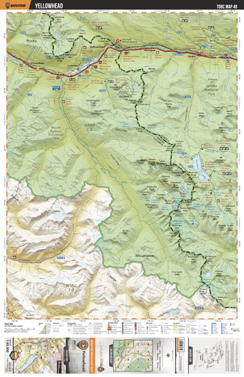
TOBC48 Yellowhead - Thompson Okanagan BC Topo Map
This recreation topographic map for the Yellowhead area highlights all the logging roads, trails and recreational Points of Interest including hunting, camping, hiking, mountain biking, canoeing, kayaking, backcountry skiing, snowshoeing, cross-country skiing, wildlife viewing, ATVing, snowmobiling and more. No other map for the area provides you with this level of recreational or topographic detail. Special features include private land and countless roads, trails and recreational Points of Interest. Covering 1,950 km2 (750 mi2) in total, this 1:65,000 scale map measures 38 x 51 km (23.5 x 32 mi) and includes Yellowhead, Mount Robson Provincial Park, Jasper National Park, Ptarmigan Creek, Amathyst Lakes, Yellowhead Lake and more!
Page Size: 24 x 37 in (610 x 940 mm)
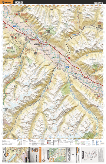
TOBC49 McBride - Thompson Okanagan BC Topo Map
This recreation topographic map for the McBride area highlights all the logging roads, trails and recreational Points of Interest including hunting, camping, hiking, mountain biking, canoeing, kayaking, backcountry skiing, snowshoeing, cross-country skiing, wildlife viewing, ATVing, snowmobiling and more. No other map for the area provides you with this level of recreational or topographic detail. Special features include private land and countless roads, trails and recreational Points of Interest. Covering 1,950 km2 (750 mi2) in total, this 1:65,000 scale map measures 38 x 51 km (23.5 x 32 mi) and includes McBride, Fraser River, Sunbeam Creek Ecological Reserve, Dore River, Raush River, Castle Creek, Holmes River and more!
Page Size: 24 x 37 in (610 x 940 mm)
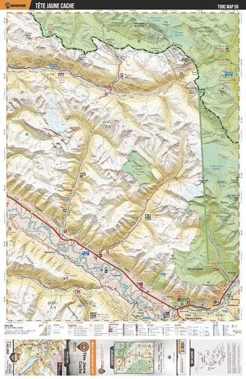
TOBC50 Tete Juane Cache - Thompson Okanagan BC Topo Map
This recreation topographic map for the Tete Juane Cache area highlights all the logging roads, trails and recreational Points of Interest including hunting, camping, hiking, mountain biking, canoeing, kayaking, backcountry skiing, snowshoeing, cross-country skiing, wildlife viewing, ATVing, snowmobiling and more. No other map for the area provides you with this level of recreational or topographic detail. Special features include private land and countless roads, trails and recreational Points of Interest. Covering 1,950 km2 (750 mi2) in total, this 1:65,000 scale map measures 38 x 51 km (23.5 x 32 mi) and includes Tete Juane Cache, Mount Robson Provincial Park, Small River Caves Provincial Park, Willmore Wilderness Provincial Park and more!
Page Size: 24 x 37 in (610 x 940 mm)
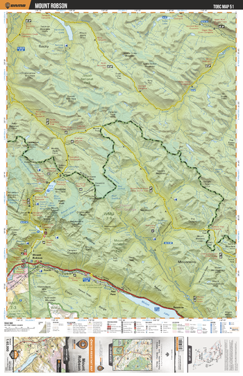
TOBC51 Mount Robson - Thompson Okanagan BC Topo Map
This recreation topographic map for the Mount Robson area highlights all the logging roads, trails and recreational Points of Interest including hunting, camping, hiking, mountain biking, canoeing, kayaking, backcountry skiing, snowshoeing, cross-country skiing, wildlife viewing, ATVing, snowmobiling and more. No other map for the area provides you with this level of recreational or topographic detail. Special features include private land and countless roads, trails and recreational Points of Interest. Covering 1,950 km2 (750 mi2) in total, this 1:65,000 scale map measures 38 x 51 km (23.5 x 32 mi) and includes Mount Robson, Fraser River, Moose Lake, Moose River, Robson River, Berg Lake, Jasper National Park, Mount Robson Corridor Protected Area and more!
Page Size: 24 x 37 in (610 x 940 mm)
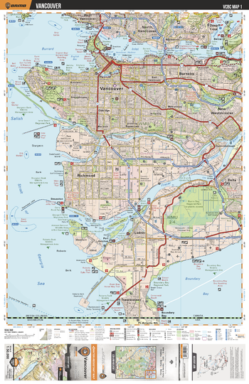
VCBC01 Vancouver - Vancouver Coast & Mountains BC Topo
This recreation topographic map for the Vancouver area highlights all the logging roads, trails and recreational Points of Interest including hunting, camping, hiking, mountain biking, canoeing, kayaking, backcountry skiing, wildlife viewing, ATVing, snowmobiling and more. No other map provides you with this level of recreational and topographic detail for the Vancouver area. Covering 1,090 km2 (420 mi2), this 1:50,000 scale map measures 29 x 38 km (18 x 24 mi) and covers Belcarra, Boundary Bay, Burnaby, Burns Bog, Burrard Inlet, Delta, Fraser River, Indian Arm, Ladner, Lynn Canyon Park, Mount Seymour Provincial Park, New Westminster, North Vancouver, Pacific Sprit Regional Park, Richmond, Stanley Park, Steveston, Tsawwassen and more!
Page Size: 24 x 37 in (610 x 940 mm)
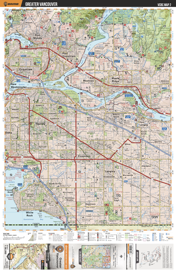
VCBC02 Greater Vancouver - Vancouver Coast & Mountains BC Topo
This recreation topographic map for the Greater Vancouver area highlights all the logging roads, trails and recreational Points of Interest including hunting, camping, hiking, mountain biking, canoeing, kayaking, backcountry skiing, wildlife viewing, ATVing, snowmobiling and more. No other map for the area provides you with this level of recreational or topographic detail. Covering 1,090 km2 (420 mi2), this 1:50,000 scale map measures 29 x 38 km (18 x 24 mi) and covers Fraser River, Pinecone Burke Provincial Park, Golden Ears Provincial Park, Cloverdale Athletic Park, Campbell Valley Regional Park and more!
Page Size: 24 x 37 in (610 x 940 mm)
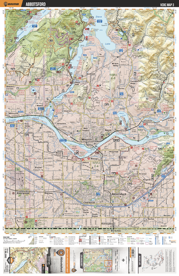
VCBC03 Abbotsford - Vancouver Coast & Mountains BC Topo
This recreation topographic map for the Abbotsford area highlights all the logging roads, trails and recreational Points of Interest including hunting, camping, hiking, mountain biking, canoeing, kayaking, backcountry skiing, wildlife viewing, ATVing, snowmobiling and more. No other map for the area provides you with this level of recreational or topographic detail. Covering 1,090 km2 (420 mi2), this 1:50,000 scale map measures 29 x 38 km (18 x 24 mi) and covers Abbotsford, Mission Interpretive Forest, Alouette Lake, Stave Lake, Hayward Lake, Hatzic Lake, Centennial Park, Aldergrove Lake Regional Park and more!
Page Size: 24 x 37 in (610 x 940 mm)
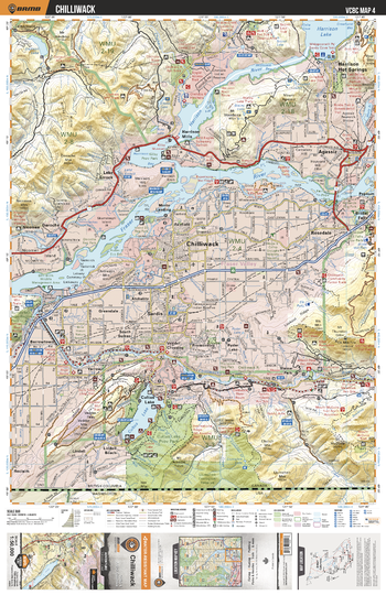
VCBC04 Chilliwack - Vancouver Coast & Mountains BC Topo
This recreation topographic map for the Chilliwack area highlights all the logging roads, trails and recreational Points of Interest including hunting, camping, hiking, mountain biking, canoeing, kayaking, backcountry skiing, wildlife viewing, ATVing, snowmobiling and more. No other map for the area provides you with this level of recreational or topographic detail. Covering 1,090 km2 (420 mi2), this 1:50,000 scale map measures 29 x 38 km (18 x 24 mi) and covers Chilliwack, Fraser River, Harrison River, Harrison Lake, Cultus Lake Provincial Park, International Ridge Recreation Area, Bridal Veil Falls Provincial Park and more!
Page Size: 24 x 37 in (610 x 940 mm)
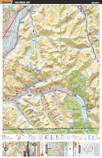
VCBC05 Chilliwack Lake - Vancouver Coast & Mountains BC Topo
This recreation topographic map for the Chilliwack Lake area highlights all the logging roads, trails and recreational Points of Interest including hunting, camping, hiking, mountain biking, canoeing, kayaking, backcountry skiing, wildlife viewing, ATVing, snowmobiling and more. No other map for the area provides you with this level of recreational or topographic detail. Covering 1,090 km2 (420 mi2), this 1:50,000 scale map measures 29 x 38 km (18 x 24 mi) and covers Chilliwack Lake, Chilliwack Lake Provincial Park, Jones Lake, Silver Lake Provincial Lake, Chilliwack River, Silverhope Creek, Laidlaw and more!
Page Size: 24 x 37 in (610 x 940 mm)
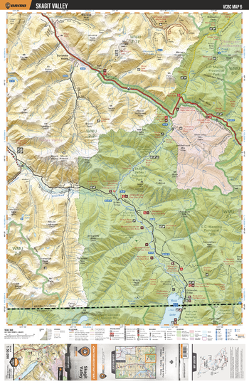
VCBC06 Skagit Valley - Vancouver Coast & Mountains BC Topo
This recreation topographic map for the Skagit Valley area highlights all the logging roads, trails and recreational Points of Interest including hunting, camping, hiking, mountain biking, canoeing, kayaking, backcountry skiing, wildlife viewing, ATVing, snowmobiling and more. No other map for the area provides you with this level of recreational or topographic detail. Covering 1,090 km2 (420 mi2), this 1:50,000 scale map measures 29 x 38 km (18 x 24 mi) and covers E.C. Manning Provincial Park, Sumallo River, Skagit River, Klesikwa River, Skagit Valley Provincial Park, Maselpanik Creek and more!
Page Size: 24 x 37 in (610 x 940 mm)
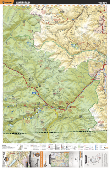
VCBC07 Manning Park - Vancouver Coast & Mountains BC Topo
This recreation topographic map for the Manning Park area highlights all the logging roads, trails and recreational Points of Interest including hunting, camping, hiking, mountain biking, canoeing, kayaking, backcountry skiing, wildlife viewing, ATVing, snowmobiling and more. No other map for the area provides you with this level of recreational or topographic detail. Covering 1,090 km2 (420 mi2), this 1:50,000 scale map measures 29 x 38 km (18 x 24 mi) and covers Manning Park, Skagit River, Similkameen River, Thunder Lake, Garrison Lakes, Nicomen Lake, Skaist River, Copper Creek and more!
Page Size: 24 x 37 in (610 x 940 mm)
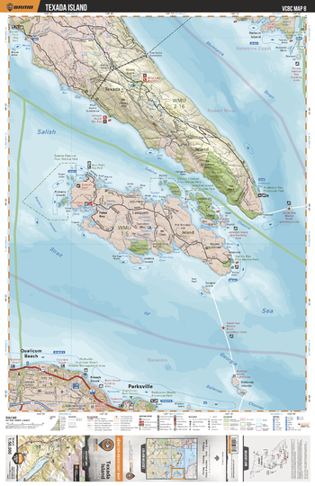
VCBC08 Texada Island - Vancouver Coast & Mountains BC Topo
This recreation topographic map for the Texada Island area highlights all the logging roads, trails and recreational Points of Interest including hunting, camping, hiking, mountain biking, canoeing, kayaking, backcountry skiing, wildlife viewing, ATVing, snowmobiling and more. No other map for the area provides you with this level of recreational or topographic detail. Covering 1,090 km2 (420 mi2), this 1:50,000 scale map measures 29 x 38 km (18 x 24 mi) and covers Malispina Strait, Sabine Channel, South Texada Island Provincial Park, Sabine Channel Provincial Park, Jedediah Island Provincial Marine Park and more!
Page Size: 24 x 37 in (610 x 940 mm)
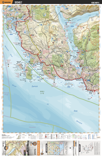
VCBC09 Sechelt - Vancouver Coast & Mountains BC Topo
This recreation topographic map for the Sechelt area highlights all the logging roads, trails and recreational Points of Interest including hunting, camping, hiking, mountain biking, canoeing, kayaking, backcountry skiing, wildlife viewing, ATVing, snowmobiling and more. No other map for the area provides you with this level of recreational or topographic detail. Covering 1,090 km2 (420 mi2), this 1:50,000 scale map measures 29 x 38 km (18 x 24 mi) and covers Schelt, Salish Sea, Spipiyus Provincial Park, Mount Richardson Provincial Park, Smuggler Cove Provincial Marine Park, Sunshine Coast Community Forest and more!
Page Size: 24 x 37 in (610 x 940 mm)
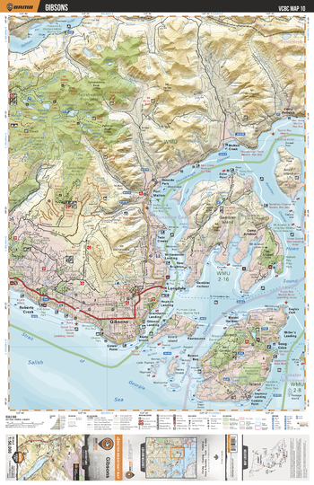
VCBC10 Gibsons - Vancouver Coast & Mountains BC Topo
This recreation topographic map for the Gibsons area highlights all the logging roads, trails and recreational Points of Interest including hunting, camping, hiking, mountain biking, canoeing, kayaking, backcountry skiing, wildlife viewing, ATVing, snowmobiling and more. No other map for the area provides you with this level of recreational or topographic detail. Covering 1,090 km2 (420 mi2), this 1:50,000 scale map measures 29 x 38 km (18 x 24 mi) and covers Gibsons, Tetrahedron Provincial Park, Salmon Inlet, Thornbrough Channel, Collingwood Channel, Mount Gardner Park and more!
Page Size: 24 x 37 in (610 x 940 mm)
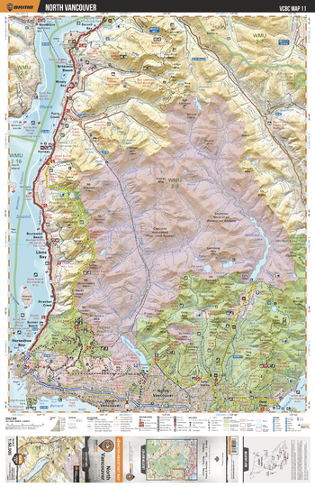
VCBC11 North Vancouver - Vancouver Coast & Mountains BC Topo
This recreation topographic map for the North Vancouver area highlights all the logging roads, trails and recreational Points of Interest including hunting, camping, hiking, mountain biking, canoeing, kayaking, backcountry skiing, wildlife viewing, ATVing, snowmobiling and more. No other map for the area provides you with this level of recreational or topographic detail. Covering 1,090 km2 (420 mi2), this 1:50,000 scale map measures 29 x 38 km (18 x 24 mi) and covers North Vancouver, Lower Seymour Conservation Reserve, Capilano Lake, Capilano River, Seymour River, Lynn Headwaters Regional Park and more!
Page Size: 24 x 37 in (610 x 940 mm)
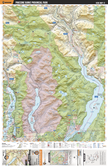
VCBC12 Pinecone Burke Provincial Park - Vancouver Coast & Mountains BC Topo
This recreation topographic map for the Pinecone Burke Provincial Park area highlights all the logging roads, trails and recreational Points of Interest including hunting, camping, hiking, mountain biking, canoeing, kayaking, backcountry skiing, wildlife viewing, ATVing, snowmobiling and more. No other map for the area provides you with this level of recreational or topographic detail. Covering 1,090 km2 (420 mi2), this 1:50,000 scale map measures 29 x 38 km (18 x 24 mi) and covers Pinecone Burke Provincial Park, Indian Arm Provincial Park, Golden Ears Provincial Park, Pitt River, Pitt Lake, Indian Arm, Coquitlam Lake and more!
Page Size: 24 x 37 in (610 x 940 mm)
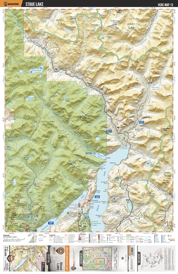
VCBC13 Stave Lake - Vancouver Coast & Mountains BC Topo
This recreation topographic map for the Stave Lake area highlights all the logging roads, trails and recreational Points of Interest including hunting, camping, hiking, mountain biking, canoeing, kayaking, backcountry skiing, wildlife viewing, ATVing, snowmobiling and more. No other map for the area provides you with this level of recreational or topographic detail. Covering 1,090 km2 (420 mi2), this 1:50,000 scale map measures 29 x 38 km (18 x 24 mi) and covers Stave Lake, Golden Ears Provincial Park, Alouette Lake, Clearwater Bay, Stave River, Tingle Creek, Thomas Lake, Salsbury Lake and more!
Page Size: 24 x 37 in (610 x 940 mm)
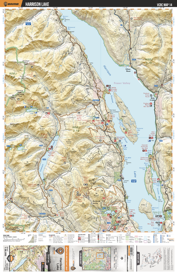
VCBC14 Harrison Lake - Vancouver Coast & Mountains BC Topo
This recreation topographic map for the Harrison Lake area highlights all the logging roads, trails and recreational Points of Interest including hunting, camping, hiking, mountain biking, canoeing, kayaking, backcountry skiing, wildlife viewing, ATVing, snowmobiling and more. No other map for the area provides you with this level of recreational or topographic detail. Covering 1,090 km2 (420 mi2), this 1:50,000 scale map measures 29 x 38 km (18 x 24 mi) and covers Harrison Lake, Chehalis Lake, Wilson Lake, Chehalis River, Statlu Lake, Long Island Bay, Rainbow Falls, Sasquatch Provincial Park and more!
Page Size: 24 x 37 in (610 x 940 mm)