


Backroad Mapbooks

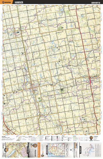
SOON50 Hanover - Southern Ontario Topo
This recreation topographic map for Hanover highlights all the logging/resource roads, hunting areas, fishing lakes & streams, campsites, paddling routes for canoeing and kayaking, wildlife viewing areas, multi-use trails for hiking, biking, horseback riding, cross-country skiing and snowshoeing, motorized trails for ATVing and snowmobiling & more. Covering 1,090 km2 (420 mi2), this 1:50,000 scale map measures 29 x 38 km (18 x 24 mi), providing you with more topographic and recreational detail for the Niagara-on-the-Lake area than any other map on the market. New features include expanded road and trail data and countless recreational Points of Interest. Included on this map are Hanover, Durham, Chesley, Allans Park Conservation Area, Kinghurst, Mulock, Saugeen River, Ayton, Mildmay and more.
Page Size: 24 x 37 in (610 x 940 mm)
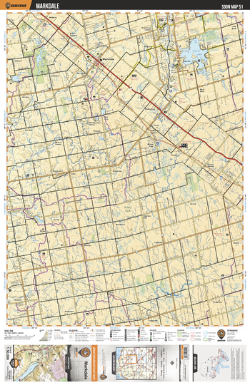
SOON51 Markdale - Southern Ontario Topo
This recreation topographic map for Markdale highlights all the logging/resource roads, hunting areas, fishing lakes & streams, campsites, paddling routes for canoeing and kayaking, wildlife viewing areas, multi-use trails for hiking, biking, horseback riding, cross-country skiing and snowshoeing, motorized trails for ATVing and snowmobiling & more. Covering 1,090 km2 (420 mi2), this 1:50,000 scale map measures 29 x 38 km (18 x 24 mi), providing you with more topographic and recreational detail for the Niagara-on-the-Lake area than any other map on the market. New features include expanded road and trail data and countless recreational Points of Interest. Included on this map are Eugene Lake, Markdale, Mount Pleasant, Bells Lake, Saugeen River, Holstein, Wilcox Lake, Beaver River, Wilder Lake, Priceville and more.
Page Size: 24 x 37 in (610 x 940 mm)
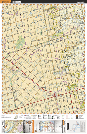
SOON52 Shelburne - Southern Ontario Topo
This recreation topographic map for Shelburne highlights all the logging/resource roads, hunting areas, fishing lakes & streams, campsites, paddling routes for canoeing and kayaking, wildlife viewing areas, multi-use trails for hiking, biking, horseback riding, cross-country skiing and snowshoeing, motorized trails for ATVing and snowmobiling & more. Covering 1,090 km2 (420 mi2), this 1:50,000 scale map measures 29 x 38 km (18 x 24 mi), providing you with more topographic and recreational detail for the Niagara-on-the-Lake area than any other map on the market. New features include expanded road and trail data and countless recreational Points of Interest. Included on this map are Shelburne, Boyne Balley Provincial Park, Mono Cliffs Provincial Park, Dundalk, Greemore, Singhampton, Saugeen River, Feversham, Noisy River Provincial Nature Reserve Park and more.
Page Size: 24 x 37 in (610 x 940 mm)
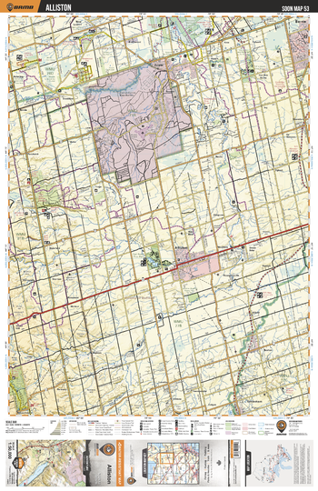
SOON53 Alliston - Southern Ontario Topo
This recreation topographic map for Alliston highlights all the logging/resource roads, hunting areas, fishing lakes & streams, campsites, paddling routes for canoeing and kayaking, wildlife viewing areas, multi-use trails for hiking, biking, horseback riding, cross-country skiing and snowshoeing, motorized trails for ATVing and snowmobiling & more. Covering 1,090 km2 (420 mi2), this 1:50,000 scale map measures 29 x 38 km (18 x 24 mi), providing you with more topographic and recreational detail for the Niagara-on-the-Lake area than any other map on the market. New features include expanded road and trail data and countless recreational Points of Interest. Included on this map are Borden, Barrie, Alliston, Beeton, Nottawasaga River, Mono Cliffs Provincial Park, Everett, Earl Rowe Provincial Park, Thornton, Minesing Swamp and more.
Page Size: 24 x 37 in (610 x 940 mm)
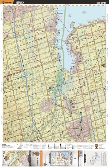
SOON54 Keswick - Southern Ontario Topo
This recreation topographic map for Keswick highlights all the logging/resource roads, hunting areas, fishing lakes & streams, campsites, paddling routes for canoeing and kayaking, wildlife viewing areas, multi-use trails for hiking, biking, horseback riding, cross-country skiing and snowshoeing, motorized trails for ATVing and snowmobiling & more. Covering 1,090 km2 (420 mi2), this 1:50,000 scale map measures 29 x 38 km (18 x 24 mi), providing you with more topographic and recreational detail for the Niagara-on-the-Lake area than any other map on the market. New features include expanded road and trail data and countless recreational Points of Interest. Included on this map are Keswick,Lake Simcoe,Holland River,Newmarket,Cook's Bay,Barrie,Holland Marsh Wildlife Area,Scanion Creek Conservation Area,Maskinonge Park and more.
Page Size: 24 x 37 in (610 x 940 mm)
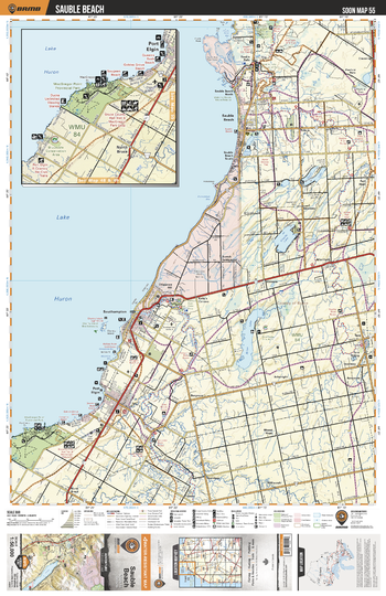
SOON55 Sauble Beach - Southern Ontario Topo
This recreation topographic map for Sauble Beach highlights all the logging/resource roads, hunting areas, fishing lakes & streams, campsites, paddling routes for canoeing and kayaking, wildlife viewing areas, multi-use trails for hiking, biking, horseback riding, cross-country skiing and snowshoeing, motorized trails for ATVing and snowmobiling & more. Covering 1,090 km2 (420 mi2), this 1:50,000 scale map measures 29 x 38 km (18 x 24 mi), providing you with more topographic and recreational detail for the Niagara-on-the-Lake area than any other map on the market. New features include expanded road and trail data and countless recreational Points of Interest. Included on this map are Lake Huron, MacGregor Point Provincial Park, Southampton, Port Elgin, Arran Lake, Saugeen River, Sauble Beach, Chesley Lake, Sauble Falls Provincial Park, Gould Lake and more.
Page Size: 24 x 37 in (610 x 940 mm)
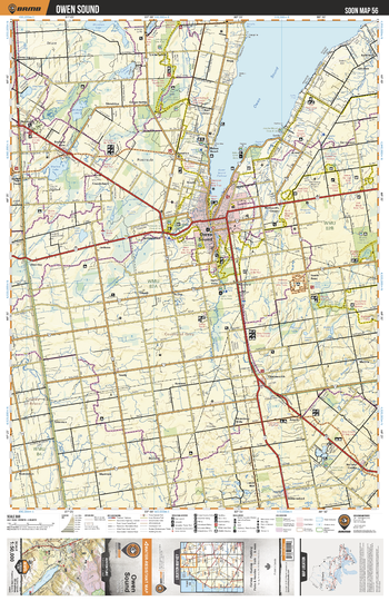
SOON56 Owen Sound - Southern Ontario Topo
This recreation topographic map for Owen Sound highlights all the logging/resource roads, hunting areas, fishing lakes & streams, campsites, paddling routes for canoeing and kayaking, wildlife viewing areas, multi-use trails for hiking, biking, horseback riding, cross-country skiing and snowshoeing, motorized trails for ATVing and snowmobiling & more. Covering 1,090 km2 (420 mi2), this 1:50,000 scale map measures 29 x 38 km (18 x 24 mi), providing you with more topographic and recreational detail for the Niagara-on-the-Lake area than any other map on the market. New features include expanded road and trail data and countless recreational Points of Interest. Included on this map are Owen Sound, McNab Lake, Shallow Lake, Inglis Falls, Chatsworth, Holland Centre, Sydenham River, Williams Lake, Bognor Marsh, Francis Lake and more.
Page Size: 24 x 37 in (610 x 940 mm)
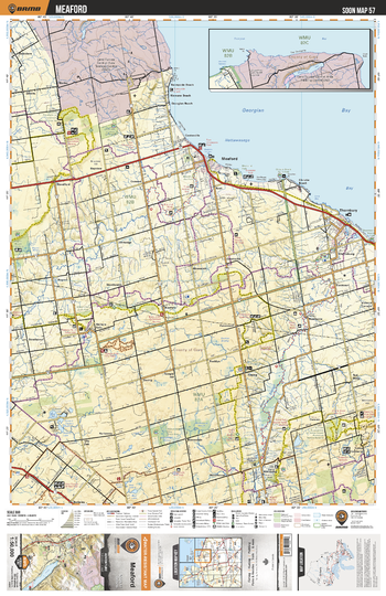
SOON57 Meaford - Southern Ontario Topo
This recreation topographic map for Meaford highlights all the logging/resource roads, hunting areas, fishing lakes & streams, campsites, paddling routes for canoeing and kayaking, wildlife viewing areas, multi-use trails for hiking, biking, horseback riding, cross-country skiing and snowshoeing, motorized trails for ATVing and snowmobiling & more. Covering 1,090 km2 (420 mi2), this 1:50,000 scale map measures 29 x 38 km (18 x 24 mi), providing you with more topographic and recreational detail for the Niagara-on-the-Lake area than any other map on the market. New features include expanded road and trail data and countless recreational Points of Interest. Included on this map are Georgian Bay, Meaford, Thornbury, Little Germany, Kimberley, Beaver River, Bighead River, Land Forces Central Area Training Center, Sunnyside Beach, Bognor Marsh and more.
Page Size: 24 x 37 in (610 x 940 mm)
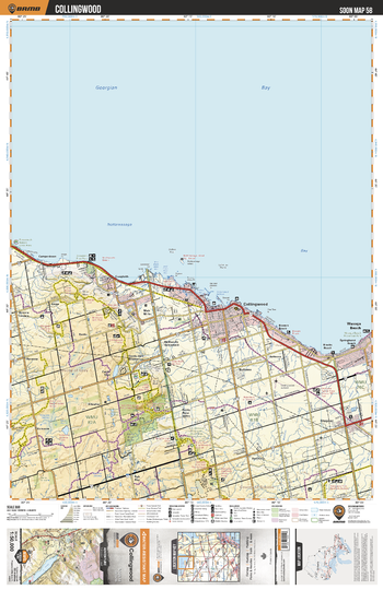
SOON58 Collingwood - Southern Ontario Topo
This recreation topographic map for Collingwood highlights all the logging/resource roads, hunting areas, fishing lakes & streams, campsites, paddling routes for canoeing and kayaking, wildlife viewing areas, multi-use trails for hiking, biking, horseback riding, cross-country skiing and snowshoeing, motorized trails for ATVing and snowmobiling & more. Covering 1,090 km2 (420 mi2), this 1:50,000 scale map measures 29 x 38 km (18 x 24 mi), providing you with more topographic and recreational detail for the Niagara-on-the-Lake area than any other map on the market. New features include expanded road and trail data and countless recreational Points of Interest. Included on this map are Georgian Bay,Nottawasaga Bay,Collingwood,Wasaga Beach,Beaver River,Wasaga Beach Provincial Park,Craigleith Provincial Park and more.
Page Size: 24 x 37 in (610 x 940 mm)
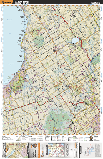
SOON59 Wasaga Beach - Southern Ontario Topo
This recreation topographic map for Wasaga Beach highlights all the logging/resource roads, hunting areas, fishing lakes & streams, campsites, paddling routes for canoeing and kayaking, wildlife viewing areas, multi-use trails for hiking, biking, horseback riding, cross-country skiing and snowshoeing, motorized trails for ATVing and snowmobiling & more. Covering 1,090 km2 (420 mi2), this 1:50,000 scale map measures 29 x 38 km (18 x 24 mi), providing you with more topographic and recreational detail for the Niagara-on-the-Lake area than any other map on the market. New features include expanded road and trail data and countless recreational Points of Interest. Included on this map are Georgian Bay, Nottawasaga Bay, Collingwood, Wasaga Beach, Stayner, Nottawa, Pretty River Valley Provinchail Park, Kolapore, Craigleith Provincial Park, Duntroon and more.
Page Size: 24 x 37 in (610 x 940 mm)
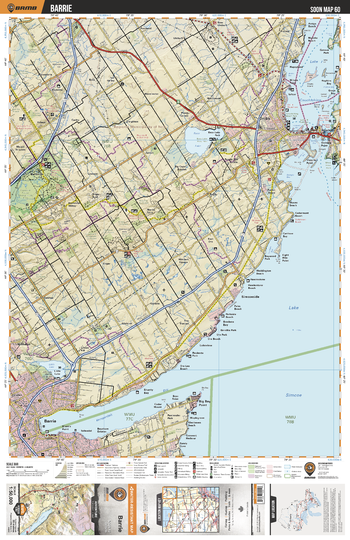
SOON60 Barrie - Southern Ontario Topo
This recreation topographic map for Barrie highlights all the logging/resource roads, hunting areas, fishing lakes & streams, campsites, paddling routes for canoeing and kayaking, wildlife viewing areas, multi-use trails for hiking, biking, horseback riding, cross-country skiing and snowshoeing, motorized trails for ATVing and snowmobiling & more. Covering 1,090 km2 (420 mi2), this 1:50,000 scale map measures 29 x 38 km (18 x 24 mi), providing you with more topographic and recreational detail for the Niagara-on-the-Lake area than any other map on the market. New features include expanded road and trail data and countless recreational Points of Interest. Included on this map are Barrie,Copeland Forest Management Area,Lake Simcoe,Lake Couchiching,Bass Lake,Bass Lake Provincial Park,Kampenfelt Bay,Orilla and more.
Page Size: 24 x 37 in (610 x 940 mm)
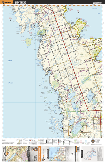
SOON61 Lion's Head - Southern Ontario Topo
This recreation topographic map for Lion's Head highlights all the logging/resource roads, hunting areas, fishing lakes & streams, campsites, paddling routes for canoeing and kayaking, wildlife viewing areas, multi-use trails for hiking, biking, horseback riding, cross-country skiing and snowshoeing, motorized trails for ATVing and snowmobiling & more. Covering 1,090 km2 (420 mi2), this 1:50,000 scale map measures 29 x 38 km (18 x 24 mi), providing you with more topographic and recreational detail for the Niagara-on-the-Lake area than any other map on the market. New features include expanded road and trail data and countless recreational Points of Interest. Included on this map are Georgian Bay, Wiarton, Boat Lake, Spry Lake, Berford Lake, Sky Lake, Isaac Lake, Hope Bay, Lion's Head, Lyal Island, Fishing Islands and more.
Page Size: 24 x 37 in (610 x 940 mm)
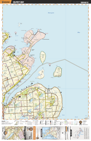
SOON62 Colpoy's Bay - Southern Ontario Topo
This recreation topographic map for Colpoy's Bay highlights all the logging/resource roads, hunting areas, fishing lakes & streams, campsites, paddling routes for canoeing and kayaking, wildlife viewing areas, multi-use trails for hiking, biking, horseback riding, cross-country skiing and snowshoeing, motorized trails for ATVing and snowmobiling & more. Covering 1,090 km2 (420 mi2), this 1:50,000 scale map measures 29 x 38 km (18 x 24 mi), providing you with more topographic and recreational detail for the Niagara-on-the-Lake area than any other map on the market. New features include expanded road and trail data and countless recreational Points of Interest. Included on this map are Colpoy's Bay, Griffith Island, Skinner's Bluff, Lake Charles, Bruce Peninsula, Neyaashiinigmiing First Nation, Melville Sound, Georgian Bay, Cape Croker Park, Dodds Hill and more.
Page Size: 24 x 37 in (610 x 940 mm)
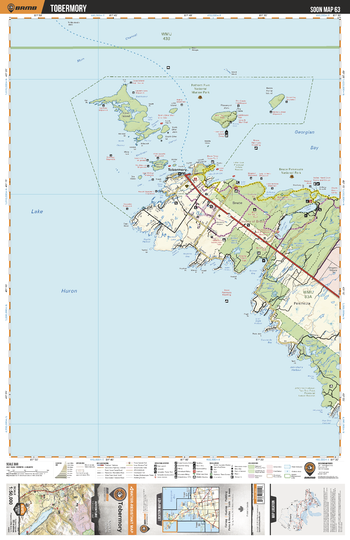
SOON63 Tobermory - Southern Ontario Topo
This recreation topographic map for Tobermory highlights all the logging/resource roads, hunting areas, fishing lakes & streams, campsites, paddling routes for canoeing and kayaking, wildlife viewing areas, multi-use trails for hiking, biking, horseback riding, cross-country skiing and snowshoeing, motorized trails for ATVing and snowmobiling & more. Covering 1,090 km2 (420 mi2), this 1:50,000 scale map measures 29 x 38 km (18 x 24 mi), providing you with more topographic and recreational detail for the Niagara-on-the-Lake area than any other map on the market. New features include expanded road and trail data and countless recreational Points of Interest. Included on this map are Cove Island, Fathom Five National Marine Park, Bear's Rump Island, Bruce Peninsula National Park, Bruce Peninsula, Tobermory, Cameron Lake, Flowerpot Island, Cyprus Lake and more.
Page Size: 24 x 37 in (610 x 940 mm)
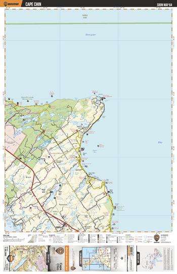
SOON64 Cape Chin - Southern Ontario Topo
This recreation topographic map for Cape Chin highlights all the logging/resource roads, hunting areas, fishing lakes & streams, campsites, paddling routes for canoeing and kayaking, wildlife viewing areas, multi-use trails for hiking, biking, horseback riding, cross-country skiing and snowshoeing, motorized trails for ATVing and snowmobiling & more. Covering 1,090 km2 (420 mi2), this 1:50,000 scale map measures 29 x 38 km (18 x 24 mi), providing you with more topographic and recreational detail for the Niagara-on-the-Lake area than any other map on the market. New features include expanded road and trail data and countless recreational Points of Interest. Included on this map are Bruce Peninsula National Park, Miller Lake, Dyer's Bay, Georgian Bay, Cape Chin, Britain Lake, Gillies Lake, McVicar and more.
Page Size: 24 x 37 in (610 x 940 mm)
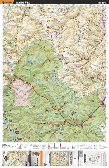
TOBC01 Manning Park - Thompson Okanagan BC Topo Map
This recreation topographic map for the Manning Park area highlights all the logging roads, trails and recreational Points of Interest including hunting, camping, hiking, mountain biking, canoeing, kayaking, backcountry skiing, snowshoeing, cross-country skiing, wildlife viewing, ATVing, snowmobiling and more. No other map provides you with this level of recreational and topographic detail for the Manning Park area. Special features include private land and countless roads, trails and recreational Points of Interest. Covering 1,950 km2 (750 mi2) in total, this 1:65,000 scale map measures 38 x 51 km (23.5 x 32 mi) and includes Dewdney Trail, Garrison Lake, Gibson Pass, Lightning Lake, Similkameen River, Skagit Provincial Forest, Skagit River, Sumallo River, Thunder Lake, Windy Joe Mountain, Whipsaw Creek and more!
Page Size: 24 x 37 in (610 x 940 mm)
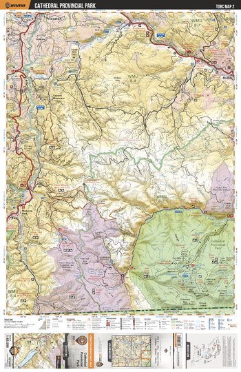
TOBC02 Cathedral Provincial Park - Thompson Okanagan BC Topo Map
This recreation topographic map for the Cathedral Provincial Park area highlights all the logging roads, trails and recreational Points of Interest including hunting, camping, hiking, mountain biking, canoeing, kayaking, backcountry skiing, snowshoeing, cross-country skiing, wildlife viewing, ATVing, snowmobiling and more. No other map for the area provides you with this level of recreational or topographic detail. Special features include private land and countless roads, trails and recreational Points of Interest. Covering 1,950 km2 (750 mi2) in total, this 1:65,000 scale map measures 38 x 51 km (23.5 x 32 mi) and includes Cathedral Provincial Park, Ashnola River, Similkameen River, Copper Mountain, Princeton, Hedley and more!
Page Size: 24 x 37 in (610 x 940 mm)
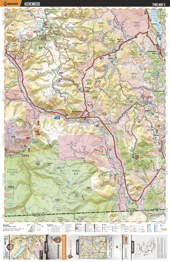
TOBC03 Keremeos - Thompson Okanagan BC Topo Map
This recreation topographic map for the Keremeos area highlights all the logging roads, trails and recreational Points of Interest including hunting, camping, hiking, mountain biking, canoeing, kayaking, backcountry skiing, snowshoeing, cross-country skiing, wildlife viewing, ATVing, snowmobiling and more. No other map for the area provides you with this level of recreational or topographic detail. Special features include private land and countless roads, trails and recreational Points of Interest. Covering 1,950 km2 (750 mi2) in total, this 1:65,000 scale map measures 38 x 51 km (23.5 x 32 mi) and includes Keremeos, Okanagan Falls Provincial Park, Skaha Lake, Similkameen River, Cathedral Provincial Park, Oliver and more!
Page Size: 24 x 37 in (610 x 940 mm)
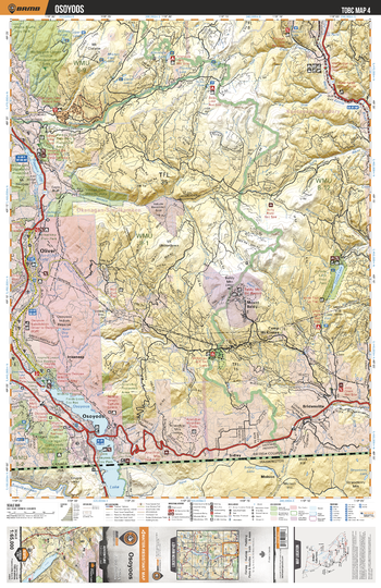
TOBC04 Osoyoos - Thompson Okanagan BC Topo Map
This recreation topographic map for the Osoyoos area highlights all the logging roads, trails and recreational Points of Interest including hunting, camping, hiking, mountain biking, canoeing, kayaking, backcountry skiing, snowshoeing, cross-country skiing, wildlife viewing, ATVing, snowmobiling and more. No other map for the area provides you with this level of recreational or topographic detail. Special features include private land and countless roads, trails and recreational Points of Interest. Covering 1,950 km2 (750 mi2) in total, this 1:65,000 scale map measures 38 x 51 km (23.5 x 32 mi) and includes Osoyoos, Okanagan River, Osoyoos Lake, Conkle Lake, Conkle Lake Provincial Park, Mount Baldy and more!
Page Size: 24 x 37 in (610 x 940 mm)
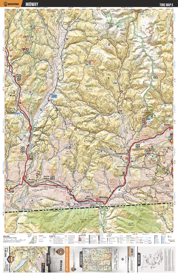
TOBC05 Midway - Thompson Okanagan BC Topo Map
This recreation topographic map for the Midway area highlights all the logging roads, trails and recreational Points of Interest including hunting, camping, hiking, mountain biking, canoeing, kayaking, backcountry skiing, snowshoeing, cross-country skiing, wildlife viewing, ATVing, snowmobiling and more. No other map for the area provides you with this level of recreational or topographic detail. Special features include private land and countless roads, trails and recreational Points of Interest. Covering 1,950 km2 (750 mi2) in total, this 1:65,000 scale map measures 38 x 51 km (23.5 x 32 mi) and includes Midway, Kettle River, Boundary Creek Provincial Park, Greenwood, Rock Creek, Kettle Valley and more!
Page Size: 24 x 37 in (610 x 940 mm)