


Backroad Mapbooks

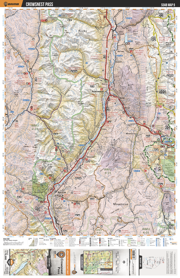
SOAB09 Crowsnest Pass - Southern Alberta Topo
This recreation topographic map for the Crowsnest Pass area highlights all the logging and resource roads, multi-use trails for hikers, mountain bikers, horseback riders, cross-country skiers and snowshoers, motorized trails for ATVers and snowmobilers, fishing lakes and rivers, recreation areas, campgrounds, day-use areas, viewpoints, backcountry campsites, work camps, oil & gas sites, backcountry huts and cabins and more. No other map for the area provides you with this level of recreational or topographic detail. Covering 2,465 km2 (950 mi2) in total, this 1:75,000 scale map measures 43 x 57 km (27 x 35.5 mi). Special features include Crown Forest Management Areas, Public Land Use Zones, labelled fish species, enhanced oil & gas data and countless roads, trails and recreational Points of Interest. This map includes Sparwood, Crowsnest, Fernie, Elk River, Ptolemy Creek, Island Lake, Tent Mtn, Hazell, Crowsnest Prov Park, Deadman Pass and more!
Page Size: 24 x 37 in (610 x 940 mm)
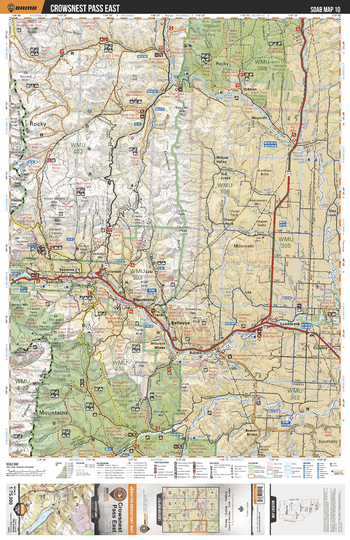
SOAB10 Crowsnest Pass East - Southern Alberta Topo
This recreation topographic map for the Crowsnest Pass East area highlights all the logging and resource roads, multi-use trails for hikers, mountain bikers, horseback riders, cross-country skiers and snowshoers, motorized trails for ATVers and snowmobilers, fishing lakes and rivers, recreation areas, campgrounds, day-use areas, viewpoints, backcountry campsites, work camps, oil & gas sites, backcountry huts and cabins and more. No other map for the area provides you with this level of recreational or topographic detail. Covering 2,465 km2 (950 mi2) in total, this 1:75,000 scale map measures 43 x 57 km (27 x 35.5 mi). Special features include Crown Forest Management Areas, Public Land Use Zones, labelled fish species, enhanced oil & gas data and countless roads, trails and recreational Points of Interest. This map includes Bob Creek Prov Park, Castle Special Management Area, Lundbreck, Bellevue, Crowsnest Pass, Blairmore, Mt Secord, Crowsnest Lake, Crowsnest River, Oldman River Reservoir and more!
Page Size: 24 x 37 in (610 x 940 mm)
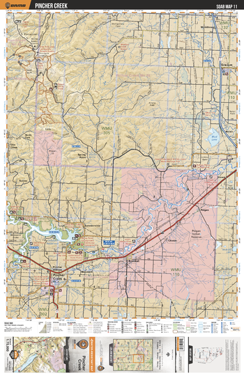
SOAB11 Pincher Creek - Southern Alberta Topo
This recreation topographic map for the Pincher Creek area highlights all the logging and resource roads, multi-use trails for hikers, mountain bikers, horseback riders, cross-country skiers and snowshoers, motorized trails for ATVers and snowmobilers, fishing lakes and rivers, recreation areas, campgrounds, day-use areas, viewpoints, backcountry campsites, work camps, oil & gas sites, backcountry huts and cabins and more. No other map for the area provides you with this level of recreational or topographic detail. Covering 2,465 km2 (950 mi2) in total, this 1:75,000 scale map measures 43 x 57 km (27 x 35.5 mi). Special features include Crown Forest Management Areas, Public Land Use Zones, labelled fish species, enhanced oil & gas data and countless roads, trails and recreational Points of Interest. This map includes Mud Lake, Oldman River, Oldman River Reservoir, Brocket, Pincher Creek, Granum, Peigan Indian Reserve, Porcupine Hills, Willow Creek, Woodhouse and more!
Page Size: 24 x 37 in (610 x 940 mm)
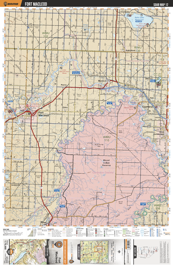
SOAB12 Fort Macleod - Southern Alberta Topo
This recreation topographic map for the Fort Macleod area highlights all the logging and resource roads, multi-use trails for hikers, mountain bikers, horseback riders, cross-country skiers and snowshoers, motorized trails for ATVers and snowmobilers, fishing lakes and rivers, recreation areas, campgrounds, day-use areas, viewpoints, backcountry campsites, work camps, oil & gas sites, backcountry huts and cabins and more. No other map for the area provides you with this level of recreational or topographic detail. Covering 2,465 km2 (950 mi2) in total, this 1:75,000 scale map measures 43 x 57 km (27 x 35.5 mi). Special features include Crown Forest Management Areas, Public Land Use Zones, labelled fish species, enhanced oil & gas data and countless roads, trails and recreational Points of Interest. This map includes Blood Indian Reserve, Coalhurst, St Mary River, Fort Macleod, Keho Lake Reservoir, Nobleford, Oldman River, West Lethbridge, Belly River, River Valley Wilderness Park and more!
Page Size: 24 x 37 in (610 x 940 mm)
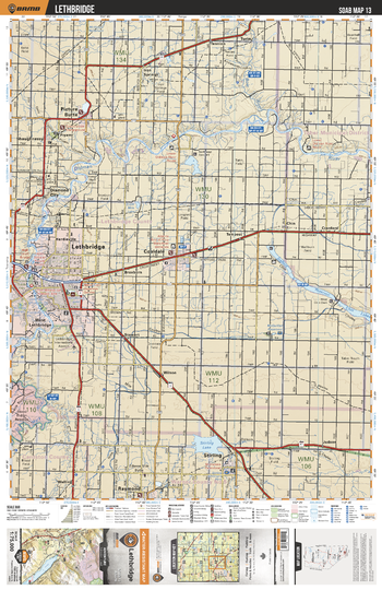
SOAB13 Lethbridge - Southern Alberta Topo
This recreation topographic map for the Lethbridge area highlights all the logging and resource roads, multi-use trails for hikers, mountain bikers, horseback riders, cross-country skiers and snowshoers, motorized trails for ATVers and snowmobilers, fishing lakes and rivers, recreation areas, campgrounds, day-use areas, viewpoints, backcountry campsites, work camps, oil & gas sites, backcountry huts and cabins and more. No other map for the area provides you with this level of recreational or topographic detail. Covering 2,465 km2 (950 mi2) in total, this 1:75,000 scale map measures 43 x 57 km (27 x 35.5 mi). Special features include Crown Forest Management Areas, Public Land Use Zones, labelled fish species, enhanced oil & gas data and countless roads, trails and recreational Points of Interest. This map includes Lethbridge, Coaldale, Picture Butte, Shaughnessy, Diamond City, Oldman River, Chin Lakes, Stirling, Stirling Lake, Iron Springs and more!
Page Size: 24 x 37 in (610 x 940 mm)
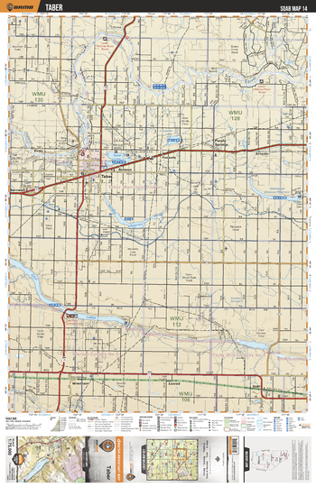
SOAB14 Taber - Southern Alberta Topo
This recreation topographic map for the Taber area highlights all the logging and resource roads, multi-use trails for hikers, mountain bikers, horseback riders, cross-country skiers and snowshoers, motorized trails for ATVers and snowmobilers, fishing lakes and rivers, recreation areas, campgrounds, day-use areas, viewpoints, backcountry campsites, work camps, oil & gas sites, backcountry huts and cabins and more. No other map for the area provides you with this level of recreational or topographic detail. Covering 2,465 km2 (950 mi2) in total, this 1:75,000 scale map measures 43 x 57 km (27 x 35.5 mi). Special features include Crown Forest Management Areas, Public Land Use Zones, labelled fish species, enhanced oil & gas data and countless roads, trails and recreational Points of Interest. This map includes Taber, Purple Springs, Chin Lakes, Horsefly Lake Reservoire, Sherburne Lake, Taber Lake, Fincastle Lake, Oldman River, Elcan, Antonio, Conrad, Skiff and more!
Page Size: 24 x 37 in (610 x 940 mm)
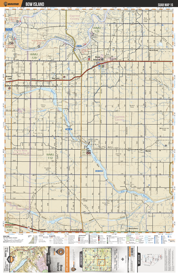
SOAB15 Bow Island - Southern Alberta Topo
This recreation topographic map for the Bow Island area highlights all the logging and resource roads, multi-use trails for hikers, mountain bikers, horseback riders, cross-country skiers and snowshoers, motorized trails for ATVers and snowmobilers, fishing lakes and rivers, recreation areas, campgrounds, day-use areas, viewpoints, backcountry campsites, work camps, oil & gas sites, backcountry huts and cabins and more. No other map for the area provides you with this level of recreational or topographic detail. Covering 2,465 km2 (950 mi2) in total, this 1:75,000 scale map measures 43 x 57 km (27 x 35.5 mi). Special features include Crown Forest Management Areas, Public Land Use Zones, labelled fish species, enhanced oil & gas data and countless roads, trails and recreational Points of Interest. This map includes South Saskatchewan River, Bow Island, Burdett, Yellow Lake, Grassy Lake, Forty Mile Regional Park, Nemiskam, Foremost, Maleb, Winnifred and more!
Page Size: 24 x 37 in (610 x 940 mm)
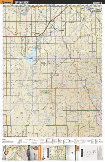
SOAB16 Seven Persons - Southern Alberta Topo
This recreation topographic map for the Seven Persons area highlights all the logging and resource roads, multi-use trails for hikers, mountain bikers, horseback riders, cross-country skiers and snowshoers, motorized trails for ATVers and snowmobilers, fishing lakes and rivers, recreation areas, campgrounds, day-use areas, viewpoints, backcountry campsites, work camps, oil & gas sites, backcountry huts and cabins and more. No other map for the area provides you with this level of recreational or topographic detail. Covering 2,465 km2 (950 mi2) in total, this 1:75,000 scale map measures 43 x 57 km (27 x 35.5 mi). Special features include Crown Forest Management Areas, Public Land Use Zones, labelled fish species, enhanced oil & gas data and countless roads, trails and recreational Points of Interest. This map includes Murray Lake, Seven Persons, Red Rock Coulee Natural Area, Seven Persons Creek, Rush Lake, Fitzgerald, Bullshead, Dunmore, Macson, Roytal and more!
Page Size: 24 x 37 in (610 x 940 mm)
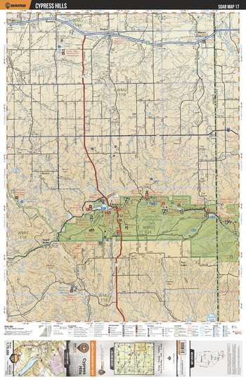
SOAB17 Cypress Hills - Southern Alberta Topo
This recreation topographic map for the Cypress Hills area highlights all the logging and resource roads, multi-use trails for hikers, mountain bikers, horseback riders, cross-country skiers and snowshoers, motorized trails for ATVers and snowmobilers, fishing lakes and rivers, recreation areas, campgrounds, day-use areas, viewpoints, backcountry campsites, work camps, oil & gas sites, backcountry huts and cabins and more. No other map for the area provides you with this level of recreational or topographic detail. Covering 2,465 km2 (950 mi2) in total, this 1:75,000 scale map measures 43 x 57 km (27 x 35.5 mi). Special features include Crown Forest Management Areas, Public Land Use Zones, labelled fish species, enhanced oil & gas data and countless roads, trails and recreational Points of Interest. This map includes Cypress Hills Interprovincial Park, Elkwater, Cypress Hills, Gros Ventre Creek, Irvine, Cavan Lake, Walsh, Fox Lake, Elkwater Lake, Battle Creek and more!
Page Size: 24 x 37 in (610 x 940 mm)
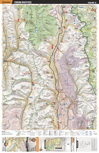
SOAB18 Fording River Pass - Southern Alberta Topo
This recreation topographic map for the Fording River Pass area highlights all the logging and resource roads, multi-use trails for hikers, mountain bikers, horseback riders, cross-country skiers and snowshoers, motorized trails for ATVers and snowmobilers, fishing lakes and rivers, recreation areas, campgrounds, day-use areas, viewpoints, backcountry campsites, work camps, oil & gas sites, backcountry huts and cabins and more. No other map for the area provides you with this level of recreational or topographic detail. Covering 2,465 km2 (950 mi2) in total, this 1:75,000 scale map measures 43 x 57 km (27 x 35.5 mi). Special features include Crown Forest Management Areas, Public Land Use Zones, labelled fish species, enhanced oil & gas data and countless roads, trails and recreational Points of Interest. This map includes Kananaskis Country, Don Getty Wildland Prov Park, Beehive Natural Area, Elkford, Elk River, Connor Lakes and more!
Page Size: 24 x 37 in (610 x 940 mm)
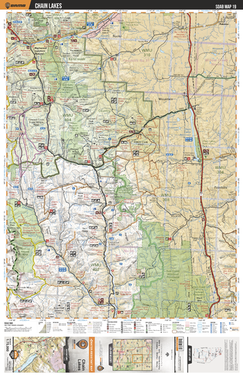
SOAB19 Chain Lakes - Southern Alberta Topo
This recreation topographic map for the Chain Lakes area highlights all the logging and resource roads, multi-use trails for hikers, mountain bikers, horseback riders, cross-country skiers and snowshoers, motorized trails for ATVers and snowmobilers, fishing lakes and rivers, recreation areas, campgrounds, day-use areas, viewpoints, backcountry campsites, work camps, oil & gas sites, backcountry huts and cabins and more. No other map for the area provides you with this level of recreational or topographic detail. Covering 2,465 km2 (950 mi2) in total, this 1:75,000 scale map measures 43 x 57 km (27 x 35.5 mi). Special features include Crown Forest Management Areas, Public Land Use Zones, labelled fish species, enhanced oil & gas data and countless roads, trails and recreational Points of Interest. This map includes Bob Creek Prov Park, Mt Livingstone, Beehive Mtn, Chain Lakes Reservoir, Plateau Mtn, Don Getty Prov Park, Highwood River, Highwood Junction, Holy Cross Mtn, Chain Lakes Prov Park and more!
Page Size: 24 x 37 in (610 x 940 mm)
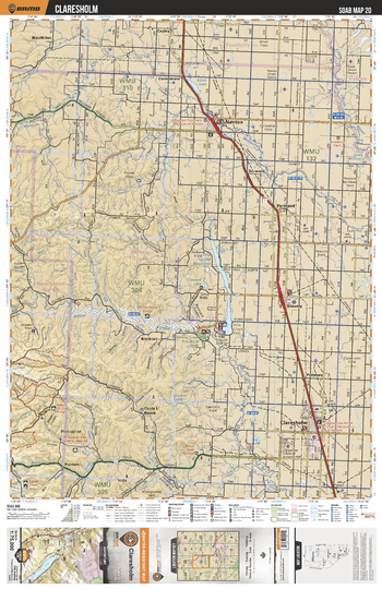
SOAB20 Claresholm - Southern Alberta Topo
This recreation topographic map for the Claresholm area highlights all the logging and resource roads, multi-use trails for hikers, mountain bikers, horseback riders, cross-country skiers and snowshoers, motorized trails for ATVers and snowmobilers, fishing lakes and rivers, recreation areas, campgrounds, day-use areas, viewpoints, backcountry campsites, work camps, oil & gas sites, backcountry huts and cabins and more. No other map for the area provides you with this level of recreational or topographic detail. Covering 2,465 km2 (950 mi2) in total, this 1:75,000 scale map measures 43 x 57 km (27 x 35.5 mi). Special features include Crown Forest Management Areas, Public Land Use Zones, labelled fish species, enhanced oil & gas data and countless roads, trails and recreational Points of Interest. This map includes Nanton, Claresholm, Silver Lake, Mosquito Creek, Little Bow River, MacMillan, Blacktail, Stavely, Willow Creek Prov Park, Furman and more!
Page Size: 24 x 37 in (610 x 940 mm)
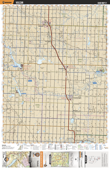
SOAB21 Vulcan - Southern Alberta Topo
This recreation topographic map for the Vulcan area highlights all the logging and resource roads, multi-use trails for hikers, mountain bikers, horseback riders, cross-country skiers and snowshoers, motorized trails for ATVers and snowmobilers, fishing lakes and rivers, recreation areas, campgrounds, day-use areas, viewpoints, backcountry campsites, work camps, oil & gas sites, backcountry huts and cabins and more. No other map for the area provides you with this level of recreational or topographic detail. Covering 2,465 km2 (950 mi2) in total, this 1:75,000 scale map measures 43 x 57 km (27 x 35.5 mi). Special features include Crown Forest Management Areas, Public Land Use Zones, labelled fish species, enhanced oil & gas data and countless roads, trails and recreational Points of Interest. This map includes Little Bow River, Vulcan, Clear Lake, Little Bow Prov Park, Travers Reservoir, Carmangay, Kirkcaldy, Champion, Barons, Hay Lake and more!
Page Size: 24 x 37 in (610 x 940 mm)
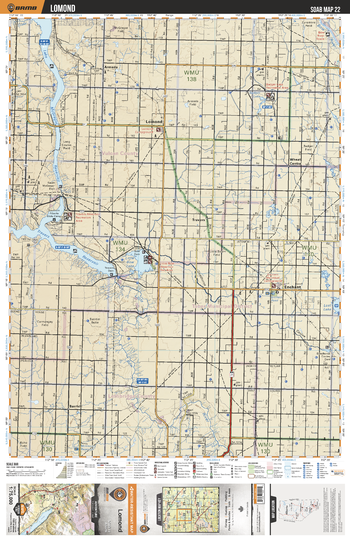
SOAB22 Lomond - Southern Alberta Topo
This recreation topographic map for the Lomond area highlights all the logging and resource roads, multi-use trails for hikers, mountain bikers, horseback riders, cross-country skiers and snowshoers, motorized trails for ATVers and snowmobilers, fishing lakes and rivers, recreation areas, campgrounds, day-use areas, viewpoints, backcountry campsites, work camps, oil & gas sites, backcountry huts and cabins and more. No other map for the area provides you with this level of recreational or topographic detail. Covering 2,465 km2 (950 mi2) in total, this 1:75,000 scale map measures 43 x 57 km (27 x 35.5 mi). Special features include Crown Forest Management Areas, Public Land Use Zones, labelled fish species, enhanced oil & gas data and countless roads, trails and recreational Points of Interest. This map includes Travers Reservoir, Little Bow Lake, McGregor Lake, Enchant, Lomond, Little Bow River, Armada, Badger Lake, Travers, Barrhill and more!
Page Size: 24 x 37 in (610 x 940 mm)
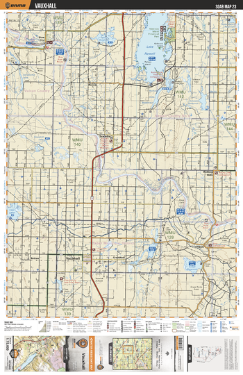
SOAB23 Vauxhall - Southern Alberta Topo
This recreation topographic map for the Vauxhall area highlights all the logging and resource roads, multi-use trails for hikers, mountain bikers, horseback riders, cross-country skiers and snowshoers, motorized trails for ATVers and snowmobilers, fishing lakes and rivers, recreation areas, campgrounds, day-use areas, viewpoints, backcountry campsites, work camps, oil & gas sites, backcountry huts and cabins and more. No other map for the area provides you with this level of recreational or topographic detail. Covering 2,465 km2 (950 mi2) in total, this 1:75,000 scale map measures 43 x 57 km (27 x 35.5 mi). Special features include Crown Forest Management Areas, Public Land Use Zones, labelled fish species, enhanced oil & gas data and countless roads, trails and recreational Points of Interest. This map includes Lake Newell, Kinbrook Island Prov Park, Grantham Lakes, Vauxhall, Lost Lake, Bow River, Scandia, Rainier, Rolling Hills, Bow City and more!
Page Size: 24 x 37 in (610 x 940 mm)
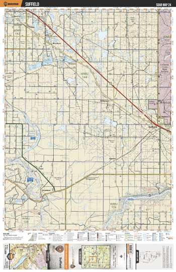
SOAB24 Suffield - Southern Alberta Topo
This recreation topographic map for the Suffield area highlights all the logging and resource roads, multi-use trails for hikers, mountain bikers, horseback riders, cross-country skiers and snowshoers, motorized trails for ATVers and snowmobilers, fishing lakes and rivers, recreation areas, campgrounds, day-use areas, viewpoints, backcountry campsites, work camps, oil & gas sites, backcountry huts and cabins and more. No other map for the area provides you with this level of recreational or topographic detail. Covering 2,465 km2 (950 mi2) in total, this 1:75,000 scale map measures 43 x 57 km (27 x 35.5 mi). Special features include Crown Forest Management Areas, Public Land Use Zones, labelled fish species, enhanced oil & gas data and countless roads, trails and recreational Points of Interest. This map includes South Saskatchewan River, Alderson, Tilley, Suffield, Ralston, Bow River, Scots Lake, Minor Lakes, Bandry, Louisiana Lakes and more!
Page Size: 24 x 37 in (610 x 940 mm)
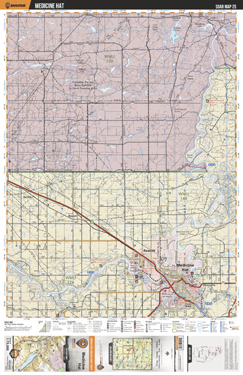
SOAB25 Medicine Hat - Southern Alberta Topo
This recreation topographic map for the Medicine Hat area highlights all the logging and resource roads, multi-use trails for hikers, mountain bikers, horseback riders, cross-country skiers and snowshoers, motorized trails for ATVers and snowmobilers, fishing lakes and rivers, recreation areas, campgrounds, day-use areas, viewpoints, backcountry campsites, work camps, oil & gas sites, backcountry huts and cabins and more. No other map for the area provides you with this level of recreational or topographic detail. Covering 2,465 km2 (950 mi2) in total, this 1:75,000 scale map measures 43 x 57 km (27 x 35.5 mi). Special features include Crown Forest Management Areas, Public Land Use Zones, labelled fish species, enhanced oil & gas data and countless roads, trails and recreational Points of Interest. This map includes Canadian Forces Base Suffield, Medicine Hat, Redcliff, South Saskatchewan River, Drowning Ford, Dennis, Bowell, Veinerville, Finns Lake, Brush Flats and more!
Page Size: 24 x 37 in (610 x 940 mm)
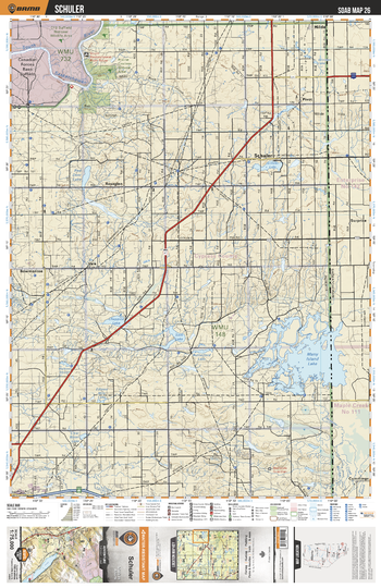
SOAB26 Schuler - Southern Alberta Topo
This recreation topographic map for the Schuler area highlights all the logging and resource roads, multi-use trails for hikers, mountain bikers, horseback riders, cross-country skiers and snowshoers, motorized trails for ATVers and snowmobilers, fishing lakes and rivers, recreation areas, campgrounds, day-use areas, viewpoints, backcountry campsites, work camps, oil & gas sites, backcountry huts and cabins and more. No other map for the area provides you with this level of recreational or topographic detail. Covering 2,465 km2 (950 mi2) in total, this 1:75,000 scale map measures 43 x 57 km (27 x 35.5 mi). Special features include Crown Forest Management Areas, Public Land Use Zones, labelled fish species, enhanced oil & gas data and countless roads, trails and recreational Points of Interest. This map includes Many Island Lake, Chappice Lake, Roseglen, Schuler, Schuler Lake, Pivot, South Saskatchewan River, Prairie Coulees Natural Area, Red Deer Lake, Canadian Forces Base Suffield and more!
Page Size: 24 x 37 in (610 x 940 mm)
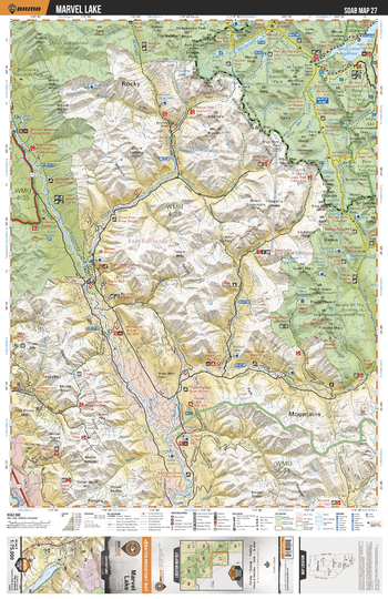
SOAB27 Marvel Lake - Southern Alberta Topo
This recreation topographic map for the Marvel Lake area highlights all the logging and resource roads, multi-use trails for hikers, mountain bikers, horseback riders, cross-country skiers and snowshoers, motorized trails for ATVers and snowmobilers, fishing lakes and rivers, recreation areas, campgrounds, day-use areas, viewpoints, backcountry campsites, work camps, oil & gas sites, backcountry huts and cabins and more. No other map for the area provides you with this level of recreational or topographic detail. Covering 2,465 km2 (950 mi2) in total, this 1:75,000 scale map measures 43 x 57 km (27 x 35.5 mi). Special features include Crown Forest Management Areas, Public Land Use Zones, labelled fish species, enhanced oil & gas data and countless roads, trails and recreational Points of Interest. This map includes Marvel Lake, Kootenay National Park, Kootenay River, Cross River, Spray Lakes Reservoir, Height of Rockies Provincial Park and more!
Page Size: 24 x 37 in (610 x 940 mm)
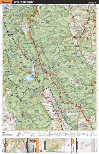
SOAB28 Peter Lougheed Park - Southern Alberta Topo
This recreation topographic map for the Peter Lougheed Park area highlights all the logging and resource roads, multi-use trails for hikers, mountain bikers, horseback riders, cross-country skiers and snowshoers, motorized trails for ATVers and snowmobilers, fishing lakes and rivers, recreation areas, campgrounds, day-use areas, viewpoints, backcountry campsites, work camps, oil & gas sites, backcountry huts and cabins and more. No other map for the area provides you with this level of recreational or topographic detail. Covering 2,465 km2 (950 mi2) in total, this 1:75,000 scale map measures 43 x 57 km (27 x 35.5 mi). Special features include Crown Forest Management Areas, Public Land Use Zones, labelled fish species, enhanced oil & gas data and countless roads, trails and recreational Points of Interest. This map includes Upper Kananaskis Lake, Lower Kananaskis Lake, Elbow Sheep Wildland Prov Park, Elbow River, Elk Lakes Prov Park, Spray Valley Prov Park, Height of the Rockies Prov Park, Peter Lougheed Prov Park, Smith Dorrien Creek, Evan Thomas Creek and more!
Page Size: 24 x 37 in (610 x 940 mm)