


Backroad Mapbooks

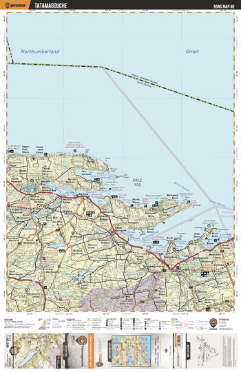
NSNS40 Tatamagouche- Nova Scotia.pdf
This recreation topographic map for Tatamagouche highlights all the logging/resource roads, hunting areas, fishing lakes & streams, campsites, paddling routes for canoeing and kayaking, wildlife viewing areas, multi-use trails for hiking, biking, horseback riding, cross-country skiing and snowshoeing, motorized trails for ATVing and snowmobiling & more. Covering 1,925 km2 (745 mi2), this 1:65,000 scale map measures 38 x 50 km (24 x 31 mi), providing you with more topographic and recreational detail for the Yarmouth area than any other map on the market. Special features include the addition of Crown land areas and countless new roads, trails and recreational Points of Interest. Included on this map are Northumberland Strait, Wallace Ridge, Tatamagouche, Brule, Bayhead, Malagash Point, Fox Harbour Provincial Park, Tatamagouche Bay, Wallace Bay, Mattatall Lake and more!
Page Size: 24 x 37 in (610 x 940 mm)
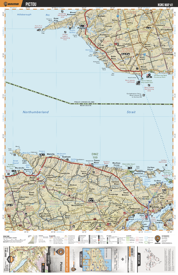
NSNS41 Pictou - Nova Scotia Topo
This recreation topographic map for Pictou highlights all the logging/resource roads, hunting areas, fishing lakes & streams, campsites, paddling routes for canoeing and kayaking, wildlife viewing areas, multi-use trails for hiking, biking, horseback riding, cross-country skiing and snowshoeing, motorized trails for ATVing and snowmobiling & more. Covering 1,925 km2 (745 mi2), this 1:65,000 scale map measures 38 x 50 km (24 x 31 mi), providing you with more topographic and recreational detail for the Yarmouth area than any other map on the market. Special features include the addition of Crown land areas and countless new roads, trails and recreational Points of Interest. Included on this map are Northumberland Strait, Pictou, River John, Cariboo Harbour, Rushton Beach Provincial Park, Waterside Beach Provincial Park, Caribou-Munroes Island Provincial Park, MacKenzie Beach Park, and more!
Page Size: 24 x 37 in (610 x 940 mm)
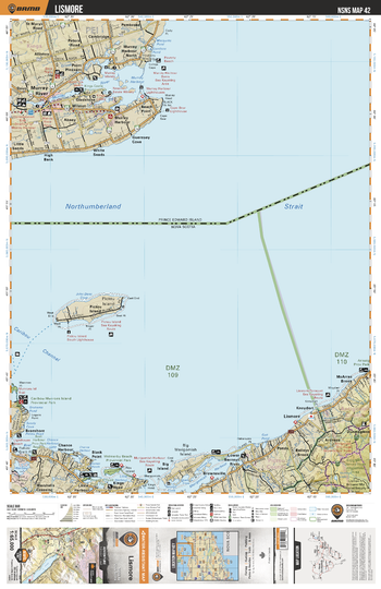
NSNS42 Lismore - Nova Scotia Topo
This recreation topographic map for Lismore highlights all the logging/resource roads, hunting areas, fishing lakes & streams, campsites, paddling routes for canoeing and kayaking, wildlife viewing areas, multi-use trails for hiking, biking, horseback riding, cross-country skiing and snowshoeing, motorized trails for ATVing and snowmobiling & more. Covering 1,925 km2 (745 mi2), this 1:65,000 scale map measures 38 x 50 km (24 x 31 mi), providing you with more topographic and recreational detail for the Yarmouth area than any other map on the market. Special features include the addition of Crown land areas and countless new roads, trails and recreational Points of Interest. Included on this map are Eigg Mtn-James River Wilderness Area, The Ponds Park, Melmerby Beach Provincial Park, Chance Harbour, Big Island, Pictou Island, Lismore, Bailey's Brook, Kings Head Powell's Provincial Park and more!
Page Size: 24 x 37 in (610 x 940 mm)
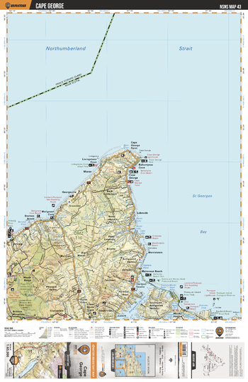
NSNS43 Cape George - Nova Scotia Topo
This recreation topographic map for Cape George highlights all the logging/resource roads, hunting areas, fishing lakes & streams, campsites, paddling routes for canoeing and kayaking, wildlife viewing areas, multi-use trails for hiking, biking, horseback riding, cross-country skiing and snowshoeing, motorized trails for ATVing and snowmobiling & more. Covering 1,925 km2 (745 mi2), this 1:65,000 scale map measures 38 x 50 km (24 x 31 mi), providing you with more topographic and recreational detail for the Yarmouth area than any other map on the market. Special features include the addition of Crown land areas and countless new roads, trails and recreational Points of Interest. Included on this map are St Georges Bay, Antigonish Harbour, Mahoneys Beach Park, Pomquet Beach Provincial Park, Maple Ridge, Cape George, Doctors Brook, Browns Mountain, Monks Head, Cloverville and more!
Page Size: 24 x 37 in (610 x 940 mm)
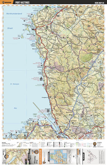
NSNS44 Port Hastings - Nova Scotia Topo
This recreation topographic map for Port Hastings highlights all the logging/resource roads, hunting areas, fishing lakes & streams, campsites, paddling routes for canoeing and kayaking, wildlife viewing areas, multi-use trails for hiking, biking, horseback riding, cross-country skiing and snowshoeing, motorized trails for ATVing and snowmobiling & more. Covering 1,925 km2 (745 mi2), this 1:65,000 scale map measures 38 x 50 km (24 x 31 mi), providing you with more topographic and recreational detail for the Yarmouth area than any other map on the market. Special features include the addition of Crown land areas and countless new roads, trails and recreational Points of Interest. Included on this map are Port Hastings, Cape Jack, West Arm Protected Beach, Strait of Canso, Judique, Dungarry, Port Hood Station Provincial Park, Mabou, MacIntyre Lake, St Georges Bay and more!
Page Size: 24 x 37 in (610 x 940 mm)
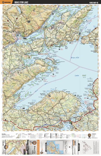
NSNS45 Bras dOr Lake - Nova Scotia Topo
This recreation topographic map for Bras dOr Lake highlights all the logging/resource roads, hunting areas, fishing lakes & streams, campsites, paddling routes for canoeing and kayaking, wildlife viewing areas, multi-use trails for hiking, biking, horseback riding, cross-country skiing and snowshoeing, motorized trails for ATVing and snowmobiling & more. Covering 1,925 km2 (745 mi2), this 1:65,000 scale map measures 38 x 50 km (24 x 31 mi), providing you with more topographic and recreational detail for the Yarmouth area than any other map on the market. Special features include the addition of Crown land areas and countless new roads, trails and recreational Points of Interest. Included on this map are Bras d'Or Lake, Pringle Lake, St Patricks Channel, Whycocomagh Bay, Bucklaw, Red Point, Christmas Island, Red Islands, Grande Greve, Big Harbour Centre and more!
Page Size: 24 x 37 in (610 x 940 mm)
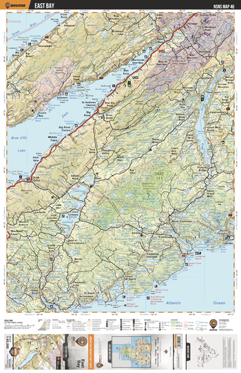
NSNS46 East Bay - Nova Scotia Topo
This recreation topographic map for East Bay highlights all the logging/resource roads, hunting areas, fishing lakes & streams, campsites, paddling routes for canoeing and kayaking, wildlife viewing areas, multi-use trails for hiking, biking, horseback riding, cross-country skiing and snowshoeing, motorized trails for ATVing and snowmobiling & more. Covering 1,925 km2 (745 mi2), this 1:65,000 scale map measures 38 x 50 km (24 x 31 mi), providing you with more topographic and recreational detail for the Yarmouth area than any other map on the market. Special features include the addition of Crown land areas and countless new roads, trails and recreational Points of Interest. Included on this map are Mira River, East Bay, Loch Lomond, Portage, Irish Cove Provincial Park, Big Brook, Great Bras D'Or, Middle River-Framboise Wilderness Area, Fourchu, Big Pond and more!
Page Size: 24 x 37 in (610 x 940 mm)
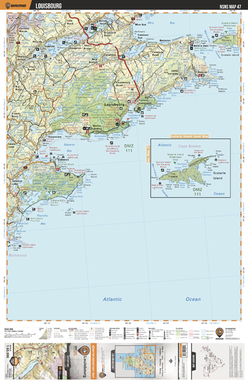
NSNS47 Louisbourg - Nova Scotia Topo
This recreation topographic map for Louisbourg highlights all the logging/resource roads, hunting areas, fishing lakes & streams, campsites, paddling routes for canoeing and kayaking, wildlife viewing areas, multi-use trails for hiking, biking, horseback riding, cross-country skiing and snowshoeing, motorized trails for ATVing and snowmobiling & more. Covering 1,925 km2 (745 mi2), this 1:65,000 scale map measures 38 x 50 km (24 x 31 mi), providing you with more topographic and recreational detail for the Yarmouth area than any other map on the market. Special features include the addition of Crown land areas and countless new roads, trails and recreational Points of Interest. Included on this map are Gabarus Bay, Louisbourg, The Pinnacle, Mira River, Catalone, Mira Bay, Main-a-Dieu, Grand Lake, Belfry Lake, Fourchu Bay and more!
Page Size: 24 x 37 in (610 x 940 mm)
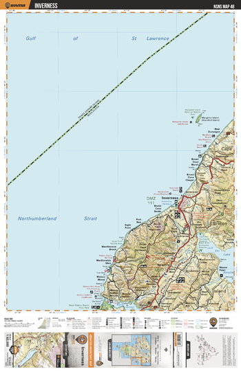
NSNS48 Inverness - Nova Scotia Topo
This recreation topographic map for Inverness highlights all the logging/resource roads, hunting areas, fishing lakes & streams, campsites, paddling routes for canoeing and kayaking, wildlife viewing areas, multi-use trails for hiking, biking, horseback riding, cross-country skiing and snowshoeing, motorized trails for ATVing and snowmobiling & more. Covering 1,925 km2 (745 mi2), this 1:65,000 scale map measures 38 x 50 km (24 x 31 mi), providing you with more topographic and recreational detail for the Yarmouth area than any other map on the market. Special features include the addition of Crown land areas and countless new roads, trails and recreational Points of Interest. Included on this map are Inverness, Margaree Island, Dunvegan, Loch Ban, Lake Ainslie, Smithville, Black River, Mabou Harbour, Strathlorne, Gulf of St Lawrence and more!
Page Size: 24 x 37 in (610 x 940 mm)
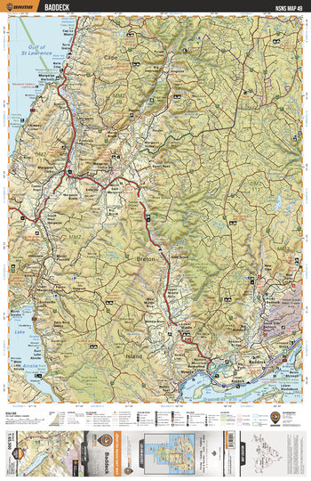
NSNS49 Baddeck - Nova Scotia Topo
This recreation topographic map for Baddeck highlights all the logging/resource roads, hunting areas, fishing lakes & streams, campsites, paddling routes for canoeing and kayaking, wildlife viewing areas, multi-use trails for hiking, biking, horseback riding, cross-country skiing and snowshoeing, motorized trails for ATVing and snowmobiling & more. Covering 1,925 km2 (745 mi2), this 1:65,000 scale map measures 38 x 50 km (24 x 31 mi), providing you with more topographic and recreational detail for the Yarmouth area than any other map on the market. Special features include the addition of Crown land areas and countless new roads, trails and recreational Points of Interest. Included on this map are St Georges Bay, Margaree Harbour, Nyanza Bay, St Patricks Channel, Lake Ainslie, Cape Breton Island, Baddeck, Margaree River, Sugarloaf Mountain, Lake O'Law and more!
Page Size: 24 x 37 in (610 x 940 mm)
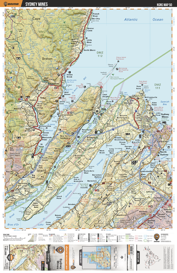
NSNS50 Sydney Mines - Nova Scotia Topo
This recreation topographic map for Sydney Mines highlights all the logging/resource roads, hunting areas, fishing lakes & streams, campsites, paddling routes for canoeing and kayaking, wildlife viewing areas, multi-use trails for hiking, biking, horseback riding, cross-country skiing and snowshoeing, motorized trails for ATVing and snowmobiling & more. Covering 1,925 km2 (745 mi2), this 1:65,000 scale map measures 38 x 50 km (24 x 31 mi), providing you with more topographic and recreational detail for the Yarmouth area than any other map on the market. Special features include the addition of Crown land areas and countless new roads, trails and recreational Points of Interest. Included on this map are Sydney Mines, North Sydney, Sydney River, Cape Breton Island, St Anns Harbour, St Andrews Channel, Spanish Bay, St Anns Bay, Great Bras d'Or, Blacketts Lake and more!
Page Size: 24 x 37 in (610 x 940 mm)
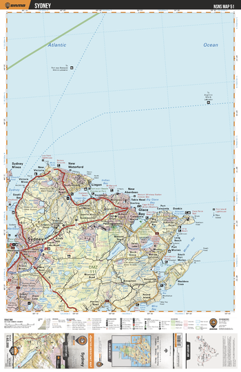
NSNS51 Sydney - Nova Scotia Topo
This recreation topographic map for Sydney highlights all the logging/resource roads, hunting areas, fishing lakes & streams, campsites, paddling routes for canoeing and kayaking, wildlife viewing areas, multi-use trails for hiking, biking, horseback riding, cross-country skiing and snowshoeing, motorized trails for ATVing and snowmobiling & more. Covering 1,925 km2 (745 mi2), this 1:65,000 scale map measures 38 x 50 km (24 x 31 mi), providing you with more topographic and recreational detail for the Yarmouth area than any other map on the market. Special features include the addition of Crown land areas and countless new roads, trails and recreational Points of Interest. Included on this map are Sydney, Glace Bay, Port Morien, Mira Bay, Sydney Mines, Sydney Harbour, New Waterford, Lingan, Indian Bay, Waddens Cove and more!
Page Size: 24 x 37 in (610 x 940 mm)
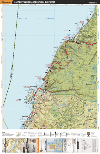
NSNS52 Cape Breton Highlands National Park West - Nova Scotia Topo
This recreation topographic map for Cape Breton Highlands National Park West highlights all the logging/resource roads, hunting areas, fishing lakes & streams, campsites, paddling routes for canoeing and kayaking, wildlife viewing areas, multi-use trails for hiking, biking, horseback riding, cross-country skiing and snowshoeing, motorized trails for ATVing and snowmobiling & more. Covering 1,925 km2 (745 mi2), this 1:65,000 scale map measures 38 x 50 km (24 x 31 mi), providing you with more topographic and recreational detail for the Yarmouth area than any other map on the market. Special features include the addition of Crown land areas and countless new roads, trails and recreational Points of Interest. Included on this map are Cape Breton Highlands National Park, Pleasant Bay, Cheticamp, La Pointe, St Joseph du Moine, French Lake, Red River, Jerome Mountain, Grand Etang, Fishing Cove Lake and more!
Page Size: 24 x 37 in (610 x 940 mm)
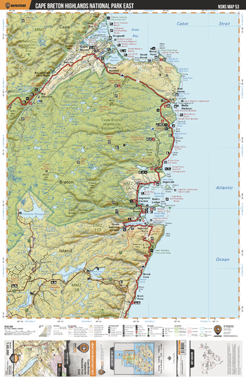
NSNS53 Cape Breton National Park East - Nova Scotia Topo
This recreation topographic map for Cape Breton National Park East highlights all the logging/resource roads, hunting areas, fishing lakes & streams, campsites, paddling routes for canoeing and kayaking, wildlife viewing areas, multi-use trails for hiking, biking, horseback riding, cross-country skiing and snowshoeing, motorized trails for ATVing and snowmobiling & more. Covering 1,925 km2 (745 mi2), this 1:65,000 scale map measures 38 x 50 km (24 x 31 mi), providing you with more topographic and recreational detail for the Yarmouth area than any other map on the market. Special features include the addition of Crown land areas and countless new roads, trails and recreational Points of Interest. Included on this map are Cape Breton Highlands National Park, Cape North, Neils Harbour, Ingonish, Keltic Lodge, Aspy Bay, Browns Lake, Broad Cove, Ingonish Harbour, Cape Smokey Provincial Park and more!
Page Size: 24 x 37 in (610 x 940 mm)
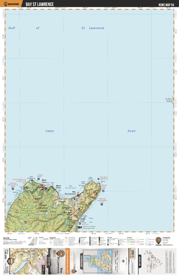
NSNS54 Bay St Lawrence - Nova Scotia Topo
This recreation topographic map for Bay St Lawrence highlights all the logging/resource roads, hunting areas, fishing lakes & streams, campsites, paddling routes for canoeing and kayaking, wildlife viewing areas, multi-use trails for hiking, biking, horseback riding, cross-country skiing and snowshoeing, motorized trails for ATVing and snowmobiling & more. Covering 1,925 km2 (745 mi2), this 1:65,000 scale map measures 38 x 50 km (24 x 31 mi), providing you with more topographic and recreational detail for the Yarmouth area than any other map on the market. Special features include the addition of Crown land areas and countless new roads, trails and recreational Points of Interest. Included on this map are Cabot Strait, Meat Cove, Black Point, Capstick, Sugar Loaf, Pollets Cove Aspy Fault Wilderness Area, Bay St Lawrence, Aspy Bay, St Margaret Village, Cabot's Landing Provincial Park and more!
Page Size: 24 x 37 in (610 x 940 mm)
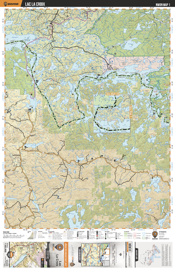
NWON01 Lac La Croix - Northwestern Ontario Topo
This recreation topographic map for Lac La Croix highlights all the logging/resource roads, hunting areas, fishing lakes & streams, campsites, paddling routes for canoeing and kayaking, wildlife viewing areas, multi-use trails for hiking, biking, horseback riding, cross-country skiing and snowshoeing, motorized trails for ATVing and snowmobiling & more. Covering 3,040 km2 (1,175 mi2), this 1:85,000 scale map measures 48 x 63.5 km (30 x 39.5 mi), providing you with more topographic and recreational detail for the Lac La Croix area than any other map on the market. New features include expanded road and trail data and countless recreational Points of Interest. Included on this map are Lac la Croix, Quetico Provincial Park, Thompson Lake and Wolseley Lake, plus parts of Minnesota including the Superior National Forest and Voyageurs National Park.
Page Size: 24 x 37 in (610 x 940 mm)
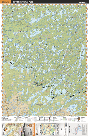
NWON02 Quetico Provincial Park - Northwestern Ontario Topo
This recreation topographic map for Quetico Provincial Park highlights all the logging/resource roads, hunting areas, fishing lakes & streams, campsites, paddling routes for canoeing and kayaking, wildlife viewing areas, multi-use trails for hiking, biking, horseback riding, cross-country skiing and snowshoeing, motorized trails for ATVing and snowmobiling & more. Covering 3,040 km2 (1,175 mi2), this 1:85,000 scale map measures 48 x 63.5 km (30 x 39.5 mi), providing you with more topographic and recreational detail for the Lac La Croix area than any other map on the market. New features include expanded road and trail data and countless recreational Points of Interest. Included on this map are Quetico Provincial Park, Sturgeon Lake, Poohbah Lake, Darky Lake, Agnes Lake, Basswood Lake, Louisa Lake and more!
Page Size: 24 x 37 in (610 x 940 mm)
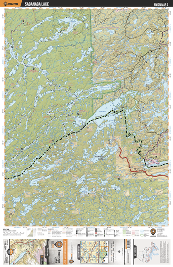
NWON03 Saganaga Lake - Northwestern Ontario Topo
This recreation topographic map for Saganaga Lake highlights all the logging/resource roads, hunting areas, fishing lakes & streams, campsites, paddling routes for canoeing and kayaking, wildlife viewing areas, multi-use trails for hiking, biking, horseback riding, cross-country skiing and snowshoeing, motorized trails for ATVing and snowmobiling & more. Covering 3,040 km2 (1,175 mi2), this 1:85,000 scale map measures 48 x 63.5 km (30 x 39.5 mi), providing you with more topographic and recreational detail for the Lac La Croix area than any other map on the market. New features include expanded road and trail data and countless recreational Points of Interest. Included on this map are Sagana Lake, McKenzie Lake, Le Verendrye Provincial Park, Northern Light Lake, Sydney Lake, Quetico Provincial Park and more!
Page Size: 24 x 37 in (610 x 940 mm)
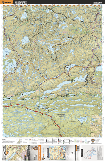
NWON04 Arrow Lake - Northwestern Ontario Topo
This recreation topographic map for Arrow Lake highlights all the logging/resource roads, hunting areas, fishing lakes & streams, campsites, paddling routes for canoeing and kayaking, wildlife viewing areas, multi-use trails for hiking, biking, horseback riding, cross-country skiing and snowshoeing, motorized trails for ATVing and snowmobiling & more. Covering 3,040 km2 (1,175 mi2), this 1:85,000 scale map measures 48 x 63.5 km (30 x 39.5 mi), providing you with more topographic and recreational detail for the Lac La Croix area than any other map on the market. New features include expanded road and trail data and countless recreational Points of Interest. Included on this map are Arrow Lake, Timarsh Lake, Sandstone Lake, Matawin River Nature Reserve, Nelson Lake, North Lake, Southeast Bay and more!
Page Size: 24 x 37 in (610 x 940 mm)
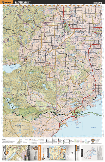
NWON05 Kakabeka Falls - Northwestern Ontario Topo
This recreation topographic map for Kakabeka Falls highlights all the logging/resource roads, hunting areas, fishing lakes & streams, campsites, paddling routes for canoeing and kayaking, wildlife viewing areas, multi-use trails for hiking, biking, horseback riding, cross-country skiing and snowshoeing, motorized trails for ATVing and snowmobiling & more. Covering 3,040 km2 (1,175 mi2), this 1:85,000 scale map measures 48 x 63.5 km (30 x 39.5 mi), providing you with more topographic and recreational detail for the Lac La Croix area than any other map on the market. New features include expanded road and trail data and countless recreational Points of Interest. Included on this map are Kakabeka Falls, North River, Kaministiquia River, Whitefish Lake, La Verendrye River Provincial Park, Arrow River and more!
Page Size: 24 x 37 in (610 x 940 mm)