


Backroad Mapbooks

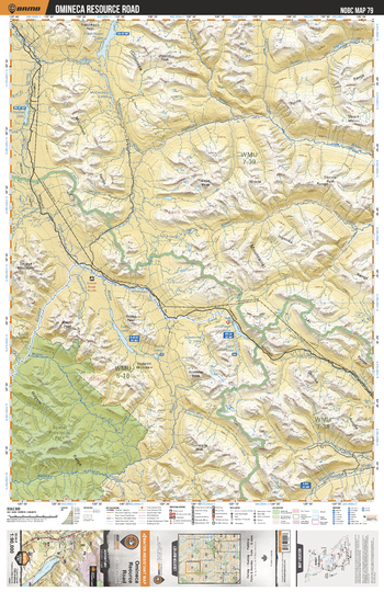
NOBC79 Omineca Resource Road - Northern BC
This recreation topographic map for the Omineca Resource Road area highlights all the logging and resource roads, recreational features and trails for hiking, mountain biking, ATVing, snowmobiling, skiing, snowshoeing, fishing, camping, hunting, canoeing, kayaking, wildlife viewing and more. New features include private land and labelled fish species, plus new roads, recreational trails and Points of Interest. No other map for the area provides you with this level of recreational or topographic detail. Measuring 52.5 x 70 km (32.5 x 43.5 mi), this 1:90,000 scale map covers 3,680 km2 (1,420 mi2) in total and includes Omineca Resource Road, Sustut Provincial Park, Fredrikson Lake, McConnell Lakes, Asitka Lake, Ingenika River, Moosevale Creek, Sustut Lake, Johanson Lake, Mesilinka River and more!
Page Size: 24 x 37 in (610 x 940 mm)
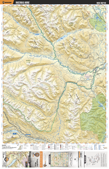
NOBC80 Ingenika Mine - Northern BC
This recreation topographic map for the Ingenika Mine area highlights all the logging and resource roads, recreational features and trails for hiking, mountain biking, ATVing, snowmobiling, skiing, snowshoeing, fishing, camping, hunting, canoeing, kayaking, wildlife viewing and more. New features include private land and labelled fish species, plus new roads, recreational trails and Points of Interest. No other map for the area provides you with this level of recreational or topographic detail. Measuring 52.5 x 70 km (32.5 x 43.5 mi), this 1:90,000 scale map covers 3,680 km2 (1,420 mi2) in total and includes Ingenika Mine, Ed Bird - Estella Lakes Park, Chase Park, Aiken Lake, Tucha Lake, Ingenika River, Pelly Lake, Swannell River, Estella Lakes, Tomias Lake and more!
Page Size: 24 x 37 in (610 x 940 mm)
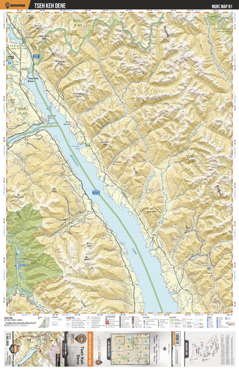
NOBC81 Tseh Keh Dene - Northern BC
This recreation topographic map for the Tseh Keh Dene area highlights all the logging and resource roads, recreational features and trails for hiking, mountain biking, ATVing, snowmobiling, skiing, snowshoeing, fishing, camping, hunting, canoeing, kayaking, wildlife viewing and more. New features include private land and labelled fish species, plus new roads, recreational trails and Points of Interest. No other map for the area provides you with this level of recreational or topographic detail. Measuring 52.5 x 70 km (32.5 x 43.5 mi), this 1:90,000 scale map covers 3,680 km2 (1,420 mi2) in total and includes Tsay Keh Dene, Chase Park, Ospika Cones Ecological Reserve, Williston Lake, Ed Bird Lake, Carina Lake, Davis River, Ospika River and more!
Page Size: 24 x 37 in (610 x 940 mm)
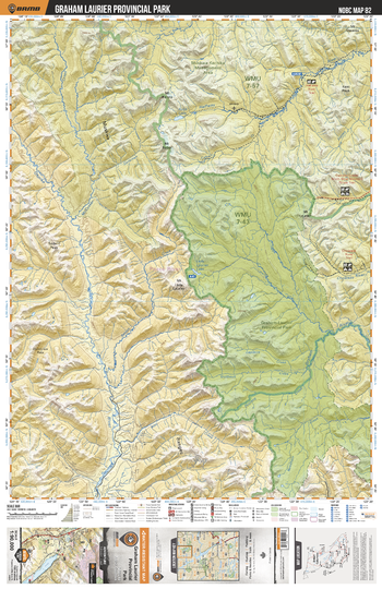
NOBC82 Graham Laurier Provincial Park - Northern BC
This recreation topographic map for the Graham Laurier Provincial Park area highlights all the logging and resource roads, recreational features and trails for hiking, mountain biking, ATVing, snowmobiling, skiing, snowshoeing, fishing, camping, hunting, canoeing, kayaking, wildlife viewing and more. New features include private land and labelled fish species, plus new roads, recreational trails and Points of Interest. No other map for the area provides you with this level of recreational or topographic detail. Measuring 52.5 x 70 km (32.5 x 43.5 mi), this 1:90,000 scale map covers 3,680 km2 (1,420 mi2) in total and includes Graham - Laurier Provincial Park, Muskwa-Kechika Management Area, Ospika River, Halfway River, Graham River, Lady Laurier Lake, Robb Lake, Chowade River and more!
Page Size: 24 x 37 in (610 x 940 mm)
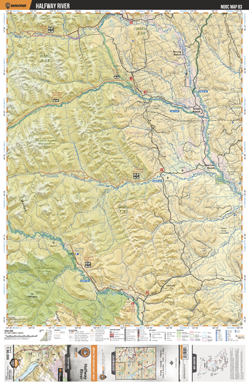
NOBC83 Halfway River - Northern BC
This recreation topographic map for the Halfway River area highlights all the logging and resource roads, recreational features and trails for hiking, mountain biking, ATVing, snowmobiling, skiing, snowshoeing, fishing, camping, hunting, canoeing, kayaking, wildlife viewing and more. New features include private land and labelled fish species, plus new roads, recreational trails and Points of Interest. No other map for the area provides you with this level of recreational or topographic detail. Measuring 52.5 x 70 km (32.5 x 43.5 mi), this 1:90,000 scale map covers 3,680 km2 (1,420 mi2) in total and includes Beatton Ranch, Brady Ranch, Boring Ranch, Graham - Laurier Park, Muskwa-Kechika Management Area, Chowade River, Graham River, Halfway River, Cypress Creek and more!
Page Size: 24 x 37 in (610 x 940 mm)
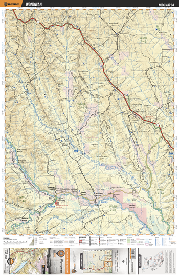
NOBC84 Wonowan - Northern BC
This recreation topographic map for the Wonowan area highlights all the logging and resource roads, recreational features and trails for hiking, mountain biking, ATVing, snowmobiling, skiing, snowshoeing, fishing, camping, hunting, canoeing, kayaking, wildlife viewing and more. New features include private land and labelled fish species, plus new roads, recreational trails and Points of Interest. No other map for the area provides you with this level of recreational or topographic detail. Measuring 52.5 x 70 km (32.5 x 43.5 mi), this 1:90,000 scale map covers 3,680 km2 (1,420 mi2) in total and includes Wonowon, Upper Halfway, Kobes, Cameron River, Davies Lake, Blueberry River, Halfway River, Townsend Creek and more!
Page Size: 24 x 37 in (610 x 940 mm)
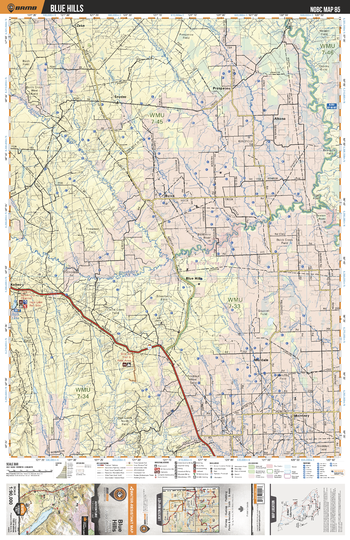
NOBC85 Blue Hills - Northern BC
This recreation topographic map for the Blue Hills area highlights all the logging and resource roads, recreational features and trails for hiking, mountain biking, ATVing, snowmobiling, skiing, snowshoeing, fishing, camping, hunting, canoeing, kayaking, wildlife viewing and more. New features include private land and labelled fish species, plus new roads, recreational trails and Points of Interest. No other map for the area provides you with this level of recreational or topographic detail. Measuring 52.5 x 70 km (32.5 x 43.5 mi), this 1:90,000 scale map covers 3,680 km2 (1,420 mi2) in total and includes Blue Hills, Altona, Buick, Montney, Murdale, Prespatou, Snyder, Whispering Pine Lake, Murdale Lake, Inga Lake, Blueberry River, Aitken Creek, Beatton River and more!
Page Size: 24 x 37 in (610 x 940 mm)
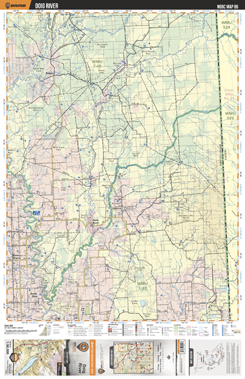
NOBC86 Doig River - Northern BC
This recreation topographic map for the Doig River area highlights all the logging and resource roads, recreational features and trails for hiking, mountain biking, ATVing, snowmobiling, skiing, snowshoeing, fishing, camping, hunting, canoeing, kayaking, wildlife viewing and more. New features include private land and labelled fish species, plus new roads, recreational trails and Points of Interest. No other map for the area provides you with this level of recreational or topographic detail. Measuring 52.5 x 70 km (32.5 x 43.5 mi), this 1:90,000 scale map covers 3,680 km2 (1,420 mi2) in total and includes Doig River, Osborn, Peejay, North Pine, Cecil Lake Ecological Reserve, Beatton River, Doig River, Osborne River and more!
Page Size: 24 x 37 in (610 x 940 mm)
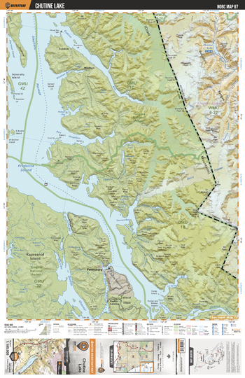
NOBC87 Chutine Lake - Northern BC
This recreation topographic map for the Chutine Lake area highlights all the logging and resource roads, recreational features and trails for hiking, mountain biking, ATVing, snowmobiling, skiing, snowshoeing, fishing, camping, hunting, canoeing, kayaking, wildlife viewing and more. New features include private land and labelled fish species, plus new roads, recreational trails and Points of Interest. No other map for the area provides you with this level of recreational or topographic detail. Measuring 52.5 x 70 km (32.5 x 43.5 mi), this 1:90,000 scale map covers 3,680 km2 (1,420 mi2) in total and includes Chutine Lake, Chutine River, Boundary Ranges, Owens Peak, Noel Peak, Mussell Peak, Mt Ratz, Baird Glacier, Mt Gilroy, Triumph Glacier and more!
Page Size: 24 x 37 in (610 x 940 mm)
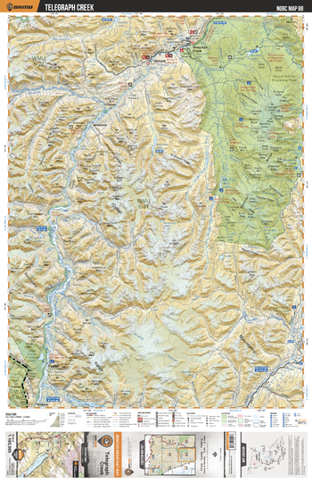
NOBC88 Telegraph Creek - Northern BC
This recreation map for the Telegraph Creek area highlights all the logging and resource roads, recreational features and trails for hiking, mountain biking, ATVing, snowmobiling, skiing, snowshoeing, fishing, camping, hunting, canoeing, kayaking, wildlife viewing and more. New features include private land and labelled fish species, plus new roads, recreational trails and Points of Interest. No other map provides you with this level of recreational and topographic detail for the Telegraph Creek area. Measuring 105 x 140 km (65 x 87 mi), this 1:185,000 scale map covers 14,750 km2 (5,695 mi2) in total and includes Buckley Lake, Choquette Hot Springs, Chutine River, Elwyn Creek Hot Springs, Glenora, Great Glacier Provincial Park, Iskut River Hot Springs, Mess Creek Hot Springs, Mess Lake Hot Springs, Mount Edziza Provincial Park, Sezil Hot Springs, Stikine River, Telegraph Creek and more!
Page Size: 24 x 37 in (610 x 940 mm)
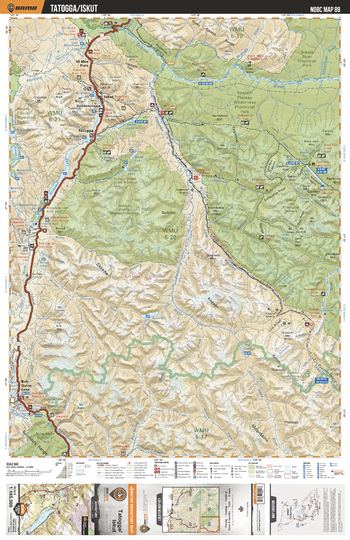
NOBC89 Tatogga/Iskut - Northern BC
This recreation map for the Tatogga/Iskut area highlights all the logging and resource roads, recreational features and trails for hiking, mountain biking, ATVing, snowmobiling, skiing, snowshoeing, fishing, camping, hunting, canoeing, kayaking, wildlife viewing and more. New features include private land and labelled fish species, plus new roads, recreational trails and Points of Interest. No other map for the area provides you with this level of recreational or topographic detail. Measuring 105 x 140 km (65 x 87 mi), this 1:185,000 scale map covers 14,750 km2 (5,695 mi2) in total and includes Spatsizi Plateau Wilderness Prov Park, Cold Fish Lake, Kinaskan Lake, Tatogga, Iskut, Bob Quinn Lake, Tumeka Lake, Spatsizi Headwaters Prov Park, Klappan River, Stikine River, and more!
Page Size: 24 x 37 in (610 x 940 mm)
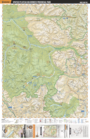
NOBC90 Spatsizi Plateau Wilderness Provincial Park - Northern BC
This recreation map for the Spatsizi Plateau Wilderness Provincial Park area highlights all the logging and resource roads, recreational features and trails for hiking, mountain biking, ATVing, snowmobiling, skiing, snowshoeing, fishing, camping, hunting, canoeing, kayaking, wildlife viewing and more. New features include private land and labelled fish species, plus new roads, recreational trails and Points of Interest. No other map for the area provides you with this level of recreational or topographic detail. Measuring 105 x 140 km (65 x 87 mi), this 1:185,000 scale map covers 14,750 km2 (5,695 mi2) in total and includes Spatsizi Plateau Wilderness Prov Park, Fountain Rapids, Tuaton Lake, Happy Lake, Stikine River, Muskwa-Kechika Management Area, Tatlatui Prov Park, Stikine Rover Prov Park, Chukachida River,Spatsizi River and more!
Page Size: 24 x 37 in (610 x 940 mm)
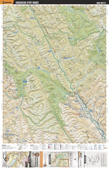
NOBC91 Fort Ware - Northern BC
This recreation map for the Fort Ware area highlights all the logging and resource roads, recreational features and trails for hiking, mountain biking, ATVing, snowmobiling, skiing, snowshoeing, fishing, camping, hunting, canoeing, kayaking, wildlife viewing and more. New features include private land and labelled fish species, plus new roads, recreational trails and Points of Interest. No other map for the area provides you with this level of recreational or topographic detail. Measuring 105 x 140 km (65 x 87 mi), this 1:185,000 scale map covers 14,750 km2 (5,695 mi2) in total and includes Muskwa-Kechika Management Area, Kwadacha Wilderness Prov Park, Fort Ware, Finlay Russel Protected Area, Finlay River, Stelkuz Lake, Fox Lake, Weissener Lake, Dune Za Keyih Prov Park, Fox River and more!
Page Size: 24 x 37 in (610 x 940 mm)
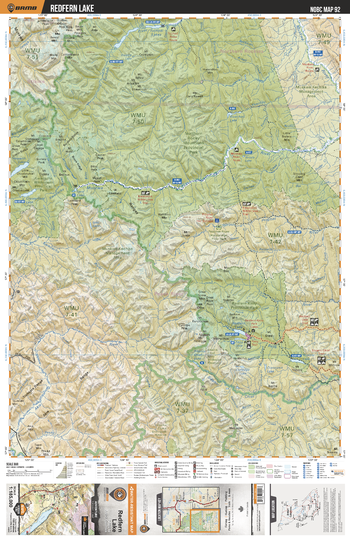
NOBC92 Redfern Lake - Northern BC
This recreation map for the Redfern Lake area highlights all the logging and resource roads, recreational features and trails for hiking, mountain biking, ATVing, snowmobiling, skiing, snowshoeing, fishing, camping, hunting, canoeing, kayaking, wildlife viewing and more. New features include private land and labelled fish species, plus new roads, recreational trails and Points of Interest. No other map for the area provides you with this level of recreational or topographic detail. Measuring 105 x 140 km (65 x 87 mi), this 1:185,000 scale map covers 14,750 km2 (5,695 mi2) in total and includes Northen Rocky Mountains Prov Park, Muskwa River, Tuchodi Lakes, Prohet River Hotsprings Prov Park, Trimble Lake, Mt Withrow, Redfern-Keily Prov Park, Muskwa-Kechika Management Area, Kwadacha Wilderness Prov Park, Redfern Lake and more!
Page Size: 24 x 37 in (610 x 940 mm)
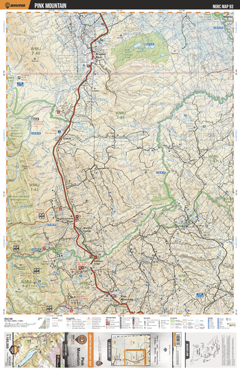
NOBC93 Pink Mountain - Northern BC
This recreation map for the Pink Mountain area highlights all the logging and resource roads, recreational features and trails for hiking, mountain biking, ATVing, snowmobiling, skiing, snowshoeing, fishing, camping, hunting, canoeing, kayaking, wildlife viewing and more. New features include private land and labelled fish species, plus new roads, recreational trails and Points of Interest. No other map for the area provides you with this level of recreational or topographic detail. Measuring 105 x 140 km (65 x 87 mi), this 1:185,000 scale map covers 14,750 km2 (5,695 mi2) in total and includes Prophet River, Pink Mountain, Halfway River, Loranger Creek, Sikanni Cheif, Mason Creek, Buckinghorse River, Trutch, Klua Lakes, Muskwa-Kechika Management Area and more!
Page Size: 24 x 37 in (610 x 940 mm)
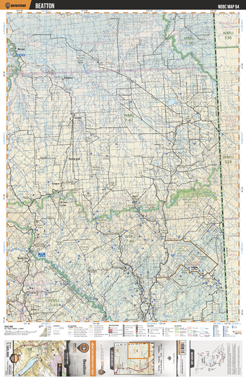
NOBC94 Beatton - Northern BC
This recreation map for the Beatton area highlights all the logging and resource roads, recreational features and trails for hiking, mountain biking, ATVing, snowmobiling, skiing, snowshoeing, fishing, camping, hunting, canoeing, kayaking, wildlife viewing and more. New features include private land and labelled fish species, plus new roads, recreational trails and Points of Interest. No other map for the area provides you with this level of recreational or topographic detail. Measuring 105 x 140 km (65 x 87 mi), this 1:185,000 scale map covers 14,750 km2 (5,695 mi2) in total and includes Beatton, Chinchaga Lakes, Milligan Hills Prov Park, Tamarack, Sikanni, Niteal, Silver Lake, Dahl City, Beatton River, Fontas River and more!
Page Size: 24 x 37 in (610 x 940 mm)
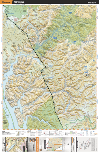
NOBC95 Tulsequah - Northern BC
This recreation map for the Tulsequah area highlights all the logging and resource roads, recreational features and trails for hiking, mountain biking, ATVing, snowmobiling, skiing, snowshoeing, fishing, camping, hunting, canoeing, kayaking, wildlife viewing and more. New features include private land and labelled fish species, plus new roads, recreational trails and Points of Interest. No other map for the area provides you with this level of recreational or topographic detail. Measuring 105 x 140 km (65 x 87 mi), this 1:185,000 scale map covers 14,750 km2 (5,695 mi2) in total and includes Atlin Prov Park, Tulsequah, Sawyer Glacier, Trapper Lake, Tatsamenie Lake, Whiting Lake, Taku River, Tulsequah Lake, King Salmon Lake, Little Trapper Lake and more!
Page Size: 24 x 37 in (610 x 940 mm)
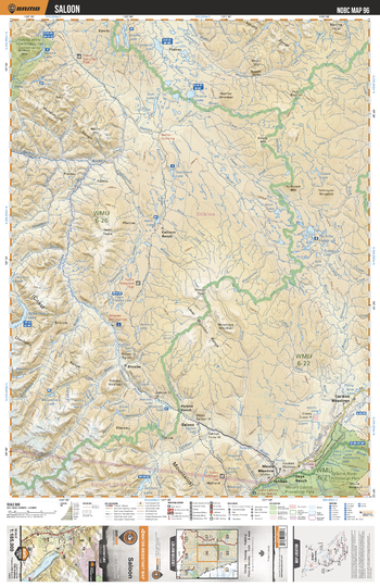
NOBC96 Saloon - Northern BC
This recreation map for the Saloon area highlights all the logging and resource roads, recreational features and trails for hiking, mountain biking, ATVing, snowmobiling, skiing, snowshoeing, fishing, camping, hunting, canoeing, kayaking, wildlife viewing and more. New features include private land and labelled fish species, plus new roads, recreational trails and Points of Interest. No other map for the area provides you with this level of recreational or topographic detail. Measuring 105 x 140 km (65 x 87 mi), this 1:185,000 scale map covers 14,750 km2 (5,695 mi2) in total and includes Stikine River Prov Park, Callison Ranch, Saloon, Thaltan, Cariboo Meadows, Days Ranch, Hiusta Meadow, Hyland Ranch, Sheslay, Sheslay River and more!
Page Size: 24 x 37 in (610 x 940 mm)
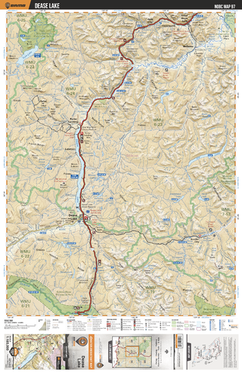
NOBC97 Dease Lake - Northern BC
This recreation map for the Dease Lake area highlights all the logging and resource roads, recreational features and trails for hiking, mountain biking, ATVing, snowmobiling, skiing, snowshoeing, fishing, camping, hunting, canoeing, kayaking, wildlife viewing and more. New features include private land and labelled fish species, plus new roads, recreational trails and Points of Interest. No other map for the area provides you with this level of recreational or topographic detail. Measuring 105 x 140 km (65 x 87 mi), this 1:185,000 scale map covers 14,750 km2 (5,695 mi2) in total and includes Dease Lake, Cry Lake, Porter Landing, Good Hope Lake, Jade City, Boulder City, Stikine River, Tanzilla River, McDame, Tuya Mountains Prov Park and more!
Page Size: 24 x 37 in (610 x 940 mm)
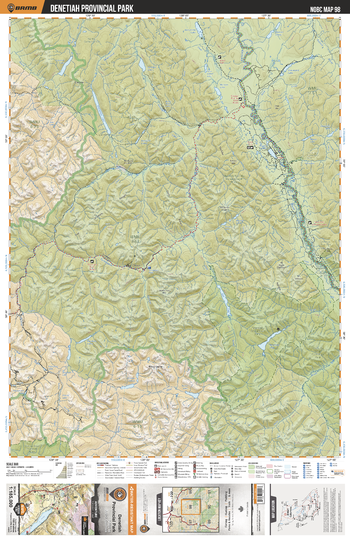
NOBC98 Denetiah Provincial Park - Northern BC
This recreation map for the Denetiah Provincial Park area highlights all the logging and resource roads, recreational features and trails for hiking, mountain biking, ATVing, snowmobiling, skiing, snowshoeing, fishing, camping, hunting, canoeing, kayaking, wildlife viewing and more. New features include private land and labelled fish species, plus new roads, recreational trails and Points of Interest. No other map for the area provides you with this level of recreational or topographic detail. Measuring 105 x 140 km (65 x 87 mi), this 1:185,000 scale map covers 14,750 km2 (5,695 mi2) in total and includes Muskwa-Kechika Management Area, Denetiah Prov Park, Kechika River, Turnagain River, Dall Lake, Denetiah Lake, Dune Za Keyih Prov Park, Scoop Lake, Aeroplane Lake, Looncry Lake and more!
Page Size: 24 x 37 in (610 x 940 mm)