


Backroad Mapbooks

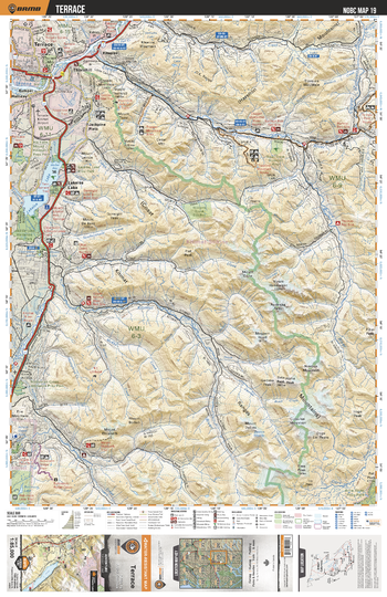
NOBC19 Terrace - Northern BC
This recreation topographic map for the Terrace area highlights all the logging roads, trails and recreation features for fishing, hunting, camping, hiking, mountain biking, canoeing, kayaking, backcountry skiing, wildlife viewing, ATVing, snowmobiling and more. No other map for the area provides you this level of recreational and topographic detail. New features include private land and labelled fish species plus countless new roads, trails and recreational Points of Interest. Covering Lakelse Lake, Terrace, Kitimat River, Copper River, Kitnayakwa River, Jackpine Flats, Nalbeelah Creek Wetlands Prov Park, Hai Lake Mount Herman Prov Park, Mount Elizabeth and more, this map contains new features such as private land and labelled fish species. This 1:85,000 scale map covers 3,040 km2 (1,175 mi2), measuring 50 x 63.5 km (30 x 39.5 mi).
Page Size: 24 x 37 in (610 x 940 mm)
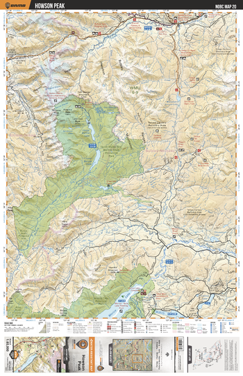
NOBC20 Howson Peak - Northern BC
This recreation topographic map for the Howson Peak area highlights all the logging roads, trails and recreation features for fishing, hunting, camping, hiking, mountain biking, canoeing, kayaking, backcountry skiing, wildlife viewing, ATVing, snowmobiling and more. No other map for the area provides you this level of recreational and topographic detail. New features include private land and labelled fish species plus countless new roads, trails and recreational Points of Interest. Covering Tazdli Wyiez Bin Burnie-Shea Prov Park, Thautil River, Telkwa River, Morice River, Morice Lake, Morice Lake Prov Park, Burnie River, Lower Burnie Lake, Upper Burnie Lake, Mooseskin Johnny Lake and more, this map contains new features such as private land and labelled fish species. This 1:85,000 scale map covers 3,040 km2 (1,175 mi2), measuring 50 x 63.5 km (30 x 39.5 mi).
Page Size: 24 x 37 in (610 x 940 mm)
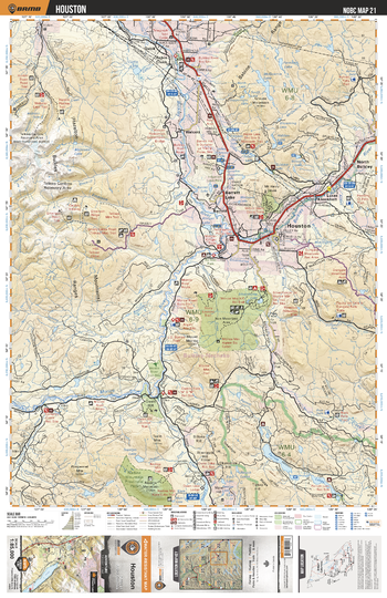
NOBC21 Houston - Northern BC
This recreation topographic map for the Houston area highlights all the logging roads, trails and recreation features for fishing, hunting, camping, hiking, mountain biking, canoeing, kayaking, backcountry skiing, wildlife viewing, ATVing, snowmobiling and more. No other map for the area provides you this level of recreational and topographic detail. New features include private land and labelled fish species plus countless new roads, trails and recreational Points of Interest. Covering Houston, Parrot Lakes, Houston, Bulkley River, North Bulkley, Barrett Lake, Walcott, Morice River, Robin Creek, Nadine Mtn and more, this map contains new features such as private land and labelled fish species. This 1:85,000 scale map covers 3,040 km2 (1,175 mi2), measuring 50 x 63.5 km (30 x 39.5 mi).
Page Size: 24 x 37 in (610 x 940 mm)
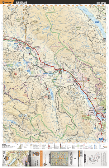
NOBC22 Burns Lake - Northern BC
This recreation topographic map for the Burns Lake area highlights all the logging roads, trails and recreation features for fishing, hunting, camping, hiking, mountain biking, canoeing, kayaking, backcountry skiing, wildlife viewing, ATVing, snowmobiling and more. No other map for the area provides you this level of recreational and topographic detail. New features include private land and labelled fish species plus countless new roads, trails and recreational Points of Interest. Covering Babine Lake, Bulkley River, Burns Lake, Maxan Lake, Rose Lake, Wiley, Topley, Pendleton Bay, Endako River, Decker Lake and more, this map contains new features such as private land and labelled fish species. This 1:85,000 scale map covers 3,040 km2 (1,175 mi2), measuring 50 x 63.5 km (30 x 39.5 mi).
Page Size: 24 x 37 in (610 x 940 mm)
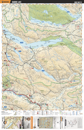
NOBC23 Babine Lake - Northern BC
This recreation topographic map for the Babine Lake area highlights all the logging roads, trails and recreation features for fishing, hunting, camping, hiking, mountain biking, canoeing, kayaking, backcountry skiing, wildlife viewing, ATVing, snowmobiling and more. No other map for the area provides you this level of recreational and topographic detail. New features include private land and labelled fish species plus countless new roads, trails and recreational Points of Interest. Covering Rubyrock Lake, Stuart Lake, Babine Lake, Taltapin Lake, Augier Lake, Pinkut Lake, Boer Mtn Rec Area, Pendleton Bay, Yekooche, Sheraton and more, this map contains new features such as private land and labelled fish species. This 1:85,000 scale map covers 3,040 km2 (1,175 mi2), measuring 50 x 63.5 km (30 x 39.5 mi).
Page Size: 24 x 37 in (610 x 940 mm)
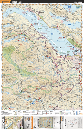
NOBC24 Stuart Lake - Northern BC
This recreation topographic map for the Stuart Lake area highlights all the logging roads, trails and recreation features for fishing, hunting, camping, hiking, mountain biking, canoeing, kayaking, backcountry skiing, wildlife viewing, ATVing, snowmobiling and more. No other map for the area provides you this level of recreational and topographic detail. New features include private land and labelled fish species plus countless new roads, trails and recreational Points of Interest. Covering Stuart Lake, Tezzeron Lake, Pinchi Lake, Camsell Lake, Fort St James, Grassham Lake, Ormond Lake, Sutherland River, Whitefish Lake, Ormond Lake and more, this map contains new features such as private land and labelled fish species. This 1:85,000 scale map covers 3,040 km2 (1,175 mi2), measuring 50 x 63.5 km (30 x 39.5 mi).
Page Size: 24 x 37 in (610 x 940 mm)
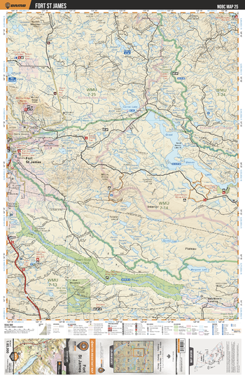
NOBC25 Fort St James - Northern BC
This recreation topographic map for the Fort St James area highlights all the logging roads, trails and recreation features for fishing, hunting, camping, hiking, mountain biking, canoeing, kayaking, backcountry skiing, wildlife viewing, ATVing, snowmobiling and more. No other map for the area provides you this level of recreational and topographic detail. New features include private land and labelled fish species plus countless new roads, trails and recreational Points of Interest. Covering Fort St James, Great Beaver Lake, Stuart River Prov Park, Stuart River, Jumping Lake, Salmon River, Necoslie River, Margaret River, Blue Mtn Demo Forest and more, this map contains new features such as private land and labelled fish species. This 1:85,000 scale map covers 3,040 km2 (1,175 mi2), measuring 50 x 63.5 km (30 x 39.5 mi).
Page Size: 24 x 37 in (610 x 940 mm)
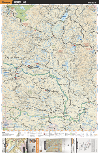
NOBC26 Merton Lake - Northern BC
This recreation topographic map for the Merton Lake area highlights all the logging roads, trails and recreation features for fishing, hunting, camping, hiking, mountain biking, canoeing, kayaking, backcountry skiing, wildlife viewing, ATVing, snowmobiling and more. No other map for the area provides you this level of recreational and topographic detail. New features include private land and labelled fish species plus countless new roads, trails and recreational Points of Interest. Covering Carp Lake Prov Park, Weedon Lake, Salmon River, Merton Lake, Fisher Lake, Bugle Lake, Rusted Camp, Tureen Lake, Teardrop Lake, Sawmill Lake and more, this map contains new features such as private land and labelled fish species. This 1:85,000 scale map covers 3,040 km2 (1,175 mi2), measuring 50 x 63.5 km (30 x 39.5 mi).
Page Size: 24 x 37 in (610 x 940 mm)
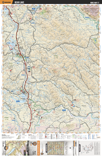
NOBC27 Bear Lake - Northern BC
This recreation topographic map for the Bear Lake area highlights all the logging roads, trails and recreation features for fishing, hunting, camping, hiking, mountain biking, canoeing, kayaking, backcountry skiing, wildlife viewing, ATVing, snowmobiling and more. No other map for the area provides you this level of recreational and topographic detail. New features include private land and labelled fish species plus countless new roads, trails and recreational Points of Interest. Covering Davie Lake, Summit Lake, Fraser River, Bear Lake, Parsnip River, Tacheeda Lake, Fraser River, Crooked River, Kerry Lake, Crystal Lake and more, this map contains new features such as private land and labelled fish species. This 1:85,000 scale map covers 3,040 km2 (1,175 mi2), measuring 50 x 63.5 km (30 x 39.5 mi).
Page Size: 24 x 37 in (610 x 940 mm)
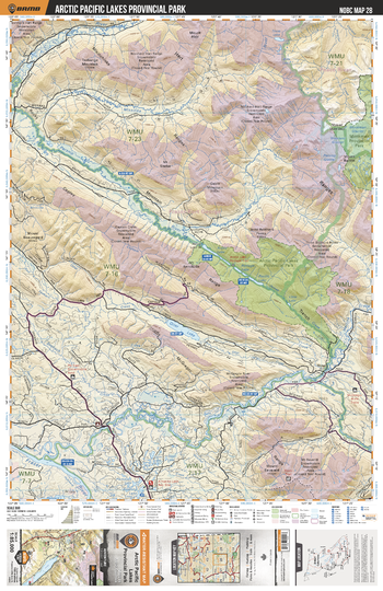
NOBC28 Arctic Pacific Lakes Prov Park - Northern BC
This recreation topographic map for the Arctic Pacific Lakes Prov Park area highlights all the logging roads, trails and recreation features for fishing, hunting, camping, hiking, mountain biking, canoeing, kayaking, backcountry skiing, wildlife viewing, ATVing, snowmobiling and more. No other map for the area provides you this level of recreational and topographic detail. New features include private land and labelled fish species plus countless new roads, trails and recreational Points of Interest. Covering Arctic Pacific Lakes Prov Park, Monkman Prov Park, McGregor River, Fraser River, Otter Lake, Parsnip River, Missinka River, Hominka River, Herrick River, Amanita Lake and more, this map contains new features such as private land and labelled fish species. This 1:85,000 scale map covers 3,040 km2 (1,175 mi2), measuring 50 x 63.5 km (30 x 39.5 mi).
Page Size: 24 x 37 in (610 x 940 mm)
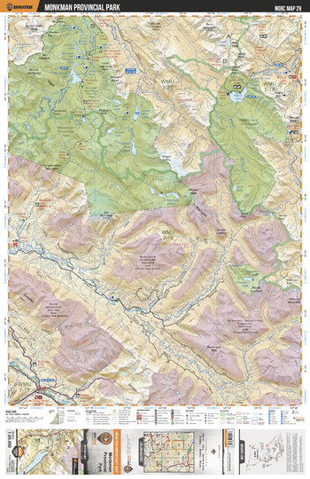
NOBC29 Monkman Provincial Park - Northern BC
This recreation topographic map for the Monkman Provincial Park area highlights all the logging roads, trails and recreation features for fishing, hunting, camping, hiking, mountain biking, canoeing, kayaking, backcountry skiing, wildlife viewing, ATVing, snowmobiling and more. No other map for the area provides you this level of recreational and topographic detail. New features include private land and labelled fish species plus countless new roads, trails and recreational Points of Interest. Covering Monkman Prov Park, Wapiti Lake Prov Park, Wapiti Lake, Herrick Creek, McGregor River, Monkman River, Fontoniko Creek, Wapitik Mtn, Bertram Peak, Onion Lake and more, this map contains new features such as private land and labelled fish species. This 1:85,000 scale map covers 3,040 km2 (1,175 mi2), measuring 50 x 63.5 km (30 x 39.5 mi).
Page Size: 24 x 37 in (610 x 940 mm)
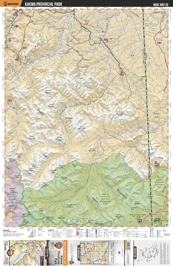
NOBC30 Kakwa Provincial Park - Northern BC
This recreation topographic map for the Kakwa Provincial Park area highlights all the logging roads, trails and recreation features for fishing, hunting, camping, hiking, mountain biking, canoeing, kayaking, backcountry skiing, wildlife viewing, ATVing, snowmobiling and more. No other map for the area provides you this level of recreational and topographic detail. New features include private land and labelled fish species plus countless new roads, trails and recreational Points of Interest. Covering Kakwa Prov Park, Belcourt Falls, Red Deer Creek, Belcourt Lake, Belcourt Creek, Narraway River, Rocky Mtns and more, this map contains new features such as private land and labelled fish species. This 1:85,000 scale map covers 3,040 km2 (1,175 mi2), measuring 50 x 63.5 km (30 x 39.5 mi).
Page Size: 24 x 37 in (610 x 940 mm)
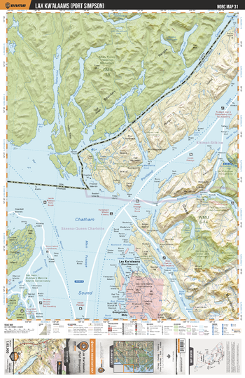
NOBC31 Port Simpson - Northern BC
This recreation topographic map for the Port Simpson area highlights all the logging roads, trails and recreation features for fishing, hunting, camping, hiking, mountain biking, canoeing, kayaking, backcountry skiing, wildlife viewing, ATVing, snowmobiling and more. No other map for the area provides you this level of recreational and topographic detail. New features include private land and labelled fish species plus countless new roads, trails and recreational Points of Interest. Covering Willmore Wilderness Prov Park, Morkill River, Pearse Island, Wales Island, Lax Kw`alaams (Port Simpson), Work Channel, Chatham Sound, Dundas Island, Somerville Island, Portland Inlet and more, this map contains new features such as private land and labelled fish species. This 1:85,000 scale map covers 3,040 km2 (1,175 mi2), measuring 50 x 63.5 km (30 x 39.5 mi).
Page Size: 24 x 37 in (610 x 940 mm)
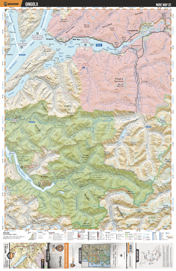
NOBC32 Gingolx - Northern BC
This recreation topographic map for the Gingolx area highlights all the logging roads, trails and recreation features for fishing, hunting, camping, hiking, mountain biking, canoeing, kayaking, backcountry skiing, wildlife viewing, ATVing, snowmobiling and more. No other map for the area provides you this level of recreational and topographic detail. New features include private land and labelled fish species plus countless new roads, trails and recreational Points of Interest. Covering Khutzeymateen Prov Park, Khutzeymateen Inlet, Ishkheenickh River, Amoth Lake, Mill Bay, Portland Inlet, Ginglox, Lexgalts`ap, Nass River, Nass Bay and more, this map contains new features such as private land and labelled fish species. This 1:85,000 scale map covers 3,040 km2 (1,175 mi2), measuring 50 x 63.5 km (30 x 39.5 mi).
Page Size: 24 x 37 in (610 x 940 mm)
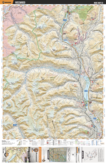
NOBC33 Rosswood - Northern BC
This recreation topographic map for the Rosswood area highlights all the logging roads, trails and recreation features for fishing, hunting, camping, hiking, mountain biking, canoeing, kayaking, backcountry skiing, wildlife viewing, ATVing, snowmobiling and more. No other map for the area provides you this level of recreational and topographic detail. New features include private land and labelled fish species plus countless new roads, trails and recreational Points of Interest. Covering Kitsumkaluum Lake, Rosswood, Sleeping Beauty Mtn Prov Park, Exstew River, Kitsumkalum River, Sterling Mtn, Anhluut`ukwsim Laxmihl Angwinga`asanskwhl (Nisga`a Memorial Lava Bed) Prov Park, Bohler and more, this map contains new features such as private land and labelled fish species. This 1:85,000 scale map covers 3,040 km2 (1,175 mi2), measuring 50 x 63.5 km (30 x 39.5 mi).
Page Size: 24 x 37 in (610 x 940 mm)
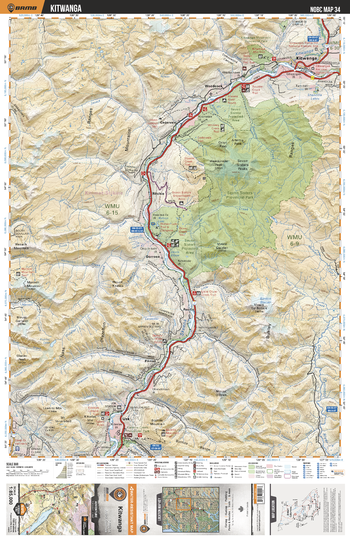
NOBC34 Kitwanga - Northern BC
This recreation topographic map for the Kitwanga area highlights all the logging roads, trails and recreation features for fishing, hunting, camping, hiking, mountain biking, canoeing, kayaking, backcountry skiing, wildlife viewing, ATVing, snowmobiling and more. No other map for the area provides you this level of recreational and topographic detail. New features include private land and labelled fish species plus countless new roads, trails and recreational Points of Interest. Covering Seven Sisters Prov Park, Kitwanga, Ritchie, Pacific, Kleanza Creek Prov Park, Skeena River, Zymoetz River, Kitselas Mtn, Kitselas Canyon, Kitwanga Mtn Prov Park and more, this map contains new features such as private land and labelled fish species. This 1:85,000 scale map covers 3,040 km2 (1,175 mi2), measuring 50 x 63.5 km (30 x 39.5 mi).
Page Size: 24 x 37 in (610 x 940 mm)
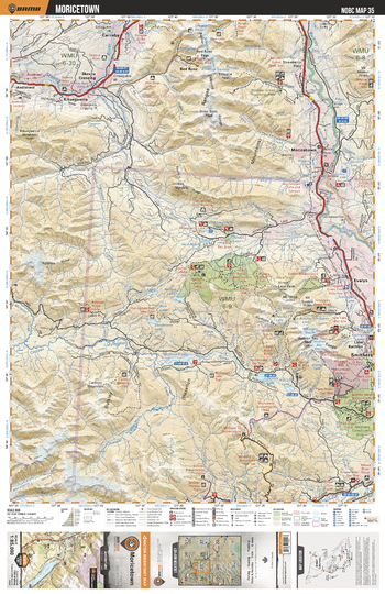
NOBC35 Moricetown - Northern BC
This recreation topographic map for the Moricetown area highlights all the logging roads, trails and recreation features for fishing, hunting, camping, hiking, mountain biking, canoeing, kayaking, backcountry skiing, wildlife viewing, ATVing, snowmobiling and more. No other map for the area provides you this level of recreational and topographic detail. New features include private land and labelled fish species plus countless new roads, trails and recreational Points of Interest. Covering Moricetown, Bulkley River, Evelyn, Smithers, Dennis Lake, Zymoetz River, Kitsequicla Lake, Taltzen Lake, Boulder Creek Prov Park, Red Rose and more, this map contains new features such as private land and labelled fish species. This 1:85,000 scale map covers 3,040 km2 (1,175 mi2), measuring 50 x 63.5 km (30 x 39.5 mi).
Page Size: 24 x 37 in (610 x 940 mm)
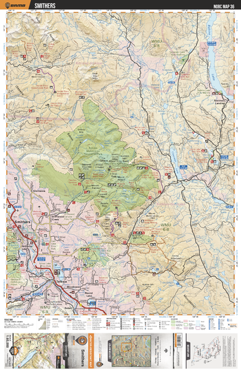
NOBC36 Smithers - Northern BC
This recreation topographic map for the Smithers area highlights all the logging roads, trails and recreation features for fishing, hunting, camping, hiking, mountain biking, canoeing, kayaking, backcountry skiing, wildlife viewing, ATVing, snowmobiling and more. No other map for the area provides you this level of recreational and topographic detail. New features include private land and labelled fish species plus countless new roads, trails and recreational Points of Interest. Covering Babine Mtns Prov Park, Chapman Lake, Babine Lake, Smithers, Telkwa, Tanglechair Lake, Telkwa River, Seymour Lake, Huntington, Round Lake and more, this map contains new features such as private land and labelled fish species. This 1:85,000 scale map covers 3,040 km2 (1,175 mi2), measuring 50 x 63.5 km (30 x 39.5 mi).
Page Size: 24 x 37 in (610 x 940 mm)
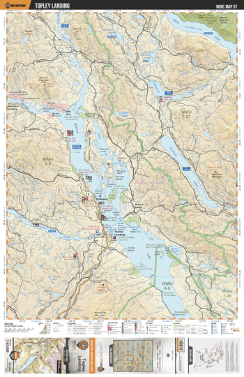
NOBC37 Topley Landing - Northern BC
This recreation topographic map for the Topley Landing area highlights all the logging roads, trails and recreation features for fishing, hunting, camping, hiking, mountain biking, canoeing, kayaking, backcountry skiing, wildlife viewing, ATVing, snowmobiling and more. No other map for the area provides you this level of recreational and topographic detail. New features include private land and labelled fish species plus countless new roads, trails and recreational Points of Interest. Covering Takla Lake, Babine Lake, Granisle, Tochcha Lake, Topley Landing, Fulton Lake, Old Fort, Natowite Lake, Long Island, Paul Lake and more, this map contains new features such as private land and labelled fish species. This 1:85,000 scale map covers 3,040 km2 (1,175 mi2), measuring 50 x 63.5 km (30 x 39.5 mi).
Page Size: 24 x 37 in (610 x 940 mm)
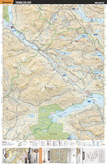
NOBC38 Trembleur Lake - Northern BC
This recreation topographic map for the Trembleur Lake area highlights all the logging roads, trails and recreation features for fishing, hunting, camping, hiking, mountain biking, canoeing, kayaking, backcountry skiing, wildlife viewing, ATVing, snowmobiling and more. No other map for the area provides you this level of recreational and topographic detail. New features include private land and labelled fish species plus countless new roads, trails and recreational Points of Interest. Covering Takla Lake, Tchentlo Lake, Trembleur Lake, Rubyrock Lake Prov Park, Middle River, Kloch Lake, Takatoot Lake, Elliot Lake, Leo Creek and more, this map contains new features such as private land and labelled fish species. This 1:85,000 scale map covers 3,040 km2 (1,175 mi2), measuring 50 x 63.5 km (30 x 39.5 mi).
Page Size: 24 x 37 in (610 x 940 mm)