


Backroad Mapbooks

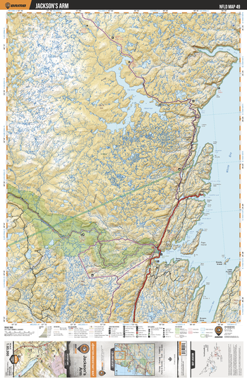
NLNL49 Jackson's Arm - Newfoundland and Labrador Topo
This recreation topographic map for Jackson's Arm highlights all the logging/resource roads, hunting areas, fishing lakes & streams, campsites, paddling routes for canoeing and kayaking, wildlife viewing areas, multi-use trails for hiking, biking, horseback riding, cross-country skiing and snowshoeing, motorized trails for ATVing and snowmobiling & more. Covering 3,040 km2 (1,170 mi2), this 1:85,000 scale map measures 48 x 63.5 km (30 x 39.5 mi), providing you with more topographic and recreational detail for the Fortune area than any other map on the market. Special features include countless roads, trails and recreational Points of Interest. Included on this map are Jackson's Arm, White Bay, Main River Waterway Provincial Park, Main River, Hampden Bay, Sop's Arm Park and more!
Page Size: 24 x 37 in (610 x 940 mm)
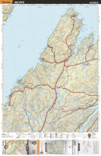
NLNL50 Baie Verte - Newfoundland and Labrador Topo
This recreation topographic map for Baie Verte highlights all the logging/resource roads, hunting areas, fishing lakes & streams, campsites, paddling routes for canoeing and kayaking, wildlife viewing areas, multi-use trails for hiking, biking, horseback riding, cross-country skiing and snowshoeing, motorized trails for ATVing and snowmobiling & more. Covering 3,040 km2 (1,170 mi2), this 1:85,000 scale map measures 48 x 63.5 km (30 x 39.5 mi), providing you with more topographic and recreational detail for the Fortune area than any other map on the market. Special features include countless roads, trails and recreational Points of Interest. Included on this map are Baie Verte, White Bay, Flat Water Pond, Wild Cove Pond, Flatwood Pond Provincial Park, Baie Verte, Verte River and more!
Page Size: 24 x 37 in (610 x 940 mm)
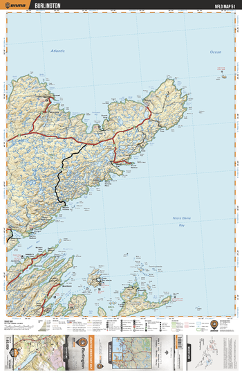
NLNL51 Burlington - Newfoundland and Labrador Topo
This recreation topographic map for Burlington highlights all the logging/resource roads, hunting areas, fishing lakes & streams, campsites, paddling routes for canoeing and kayaking, wildlife viewing areas, multi-use trails for hiking, biking, horseback riding, cross-country skiing and snowshoeing, motorized trails for ATVing and snowmobiling & more. Covering 3,040 km2 (1,170 mi2), this 1:85,000 scale map measures 48 x 63.5 km (30 x 39.5 mi), providing you with more topographic and recreational detail for the Fortune area than any other map on the market. Special features include countless roads, trails and recreational Points of Interest. Included on this map are Burlington, Green Bay, Notre Dame Bay, Red Cliff Pond, Stakes Pond and more!
Page Size: 24 x 37 in (610 x 940 mm)
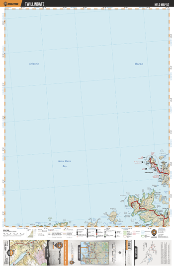
NLNL52 Twillingate - Newfoundland and Labrador Topo
This recreation topographic map for Twillingate highlights all the logging/resource roads, hunting areas, fishing lakes & streams, campsites, paddling routes for canoeing and kayaking, wildlife viewing areas, multi-use trails for hiking, biking, horseback riding, cross-country skiing and snowshoeing, motorized trails for ATVing and snowmobiling & more. Covering 3,040 km2 (1,170 mi2), this 1:85,000 scale map measures 48 x 63.5 km (30 x 39.5 mi), providing you with more topographic and recreational detail for the Fortune area than any other map on the market. Special features include countless roads, trails and recreational Points of Interest. Included on this map are Twillingate, Friday Bay, Chance Harbour, Dildo Run Provincial Park and more!
Page Size: 24 x 37 in (610 x 940 mm)
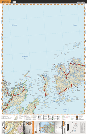
NLNL53 Fogo - Newfoundland and Labrador Topo
This recreation topographic map for Fogo highlights all the logging/resource roads, hunting areas, fishing lakes & streams, campsites, paddling routes for canoeing and kayaking, wildlife viewing areas, multi-use trails for hiking, biking, horseback riding, cross-country skiing and snowshoeing, motorized trails for ATVing and snowmobiling & more. Covering 3,040 km2 (1,170 mi2), this 1:85,000 scale map measures 48 x 63.5 km (30 x 39.5 mi), providing you with more topographic and recreational detail for the Fortune area than any other map on the market. Special features include countless roads, trails and recreational Points of Interest. Included on this map are Fogo, Notre Dame Bay, Dildo Run Provincial Park, Shoal Bay, Hamilton Sound and more!
Page Size: 24 x 37 in (610 x 940 mm)
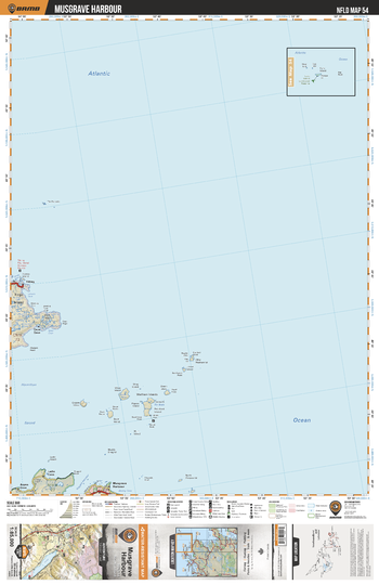
NLNL54 Musgrave Harbour - Newfoundland and Labrador Topo
This recreation topographic map for Musgrave Harbour highlights all the logging/resource roads, hunting areas, fishing lakes & streams, campsites, paddling routes for canoeing and kayaking, wildlife viewing areas, multi-use trails for hiking, biking, horseback riding, cross-country skiing and snowshoeing, motorized trails for ATVing and snowmobiling & more. Covering 3,040 km2 (1,170 mi2), this 1:85,000 scale map measures 48 x 63.5 km (30 x 39.5 mi), providing you with more topographic and recreational detail for the Fortune area than any other map on the market. Special features include countless roads, trails and recreational Points of Interest. Included on this map are Musgrave Harbour, Fogo Island, Tilting, Wadham Islands and more!
Page Size: 24 x 37 in (610 x 940 mm)
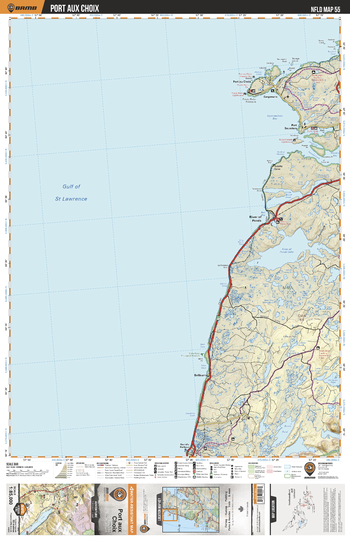
NLNL55 Port aux Choix - Newfoundland and Labrador Topo
This recreation topographic map for Port aux Choix highlights all the logging/resource roads, hunting areas, fishing lakes & streams, campsites, paddling routes for canoeing and kayaking, wildlife viewing areas, multi-use trails for hiking, biking, horseback riding, cross-country skiing and snowshoeing, motorized trails for ATVing and snowmobiling & more. Covering 3,040 km2 (1,170 mi2), this 1:85,000 scale map measures 48 x 63.5 km (30 x 39.5 mi), providing you with more topographic and recreational detail for the Fortune area than any other map on the market. Special features include countless roads, trails and recreational Points of Interest. Included on this map are Port aux Choix, River Of Ponds Lake, Brians Pond, Little Brook Pond, Hawkes Bay, Ingornachoix Bay and more!
Page Size: 24 x 37 in (610 x 940 mm)
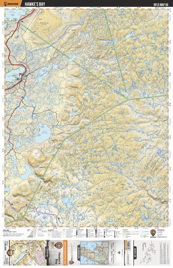
NLNL56 Hawke's Bay - Newfoundland and Labrador Topo
This recreation topographic map for Hawke's Bay highlights all the logging/resource roads, hunting areas, fishing lakes & streams, campsites, paddling routes for canoeing and kayaking, wildlife viewing areas, multi-use trails for hiking, biking, horseback riding, cross-country skiing and snowshoeing, motorized trails for ATVing and snowmobiling & more. Covering 3,040 km2 (1,170 mi2), this 1:85,000 scale map measures 48 x 63.5 km (30 x 39.5 mi), providing you with more topographic and recreational detail for the Fortune area than any other map on the market. Special features include countless roads, trails and recreational Points of Interest. Included on this map are Hawke's Bay, Torrent River Nature Park, West Lake, Soufflets River, East River, Cloud River and more!
Page Size: 24 x 37 in (610 x 940 mm)
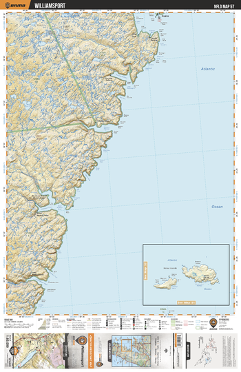
NLNL57 Williamsport - Newfoundland and Labrador Topo
This recreation topographic map for Williamsport highlights all the logging/resource roads, hunting areas, fishing lakes & streams, campsites, paddling routes for canoeing and kayaking, wildlife viewing areas, multi-use trails for hiking, biking, horseback riding, cross-country skiing and snowshoeing, motorized trails for ATVing and snowmobiling & more. Covering 3,040 km2 (1,170 mi2), this 1:85,000 scale map measures 48 x 63.5 km (30 x 39.5 mi), providing you with more topographic and recreational detail for the Fortune area than any other map on the market. Special features include countless roads, trails and recreational Points of Interest. Included on this map are Williamsport, Souffets River, Little Harbour Deep River, Canada Bay and more!
Page Size: 24 x 37 in (610 x 940 mm)
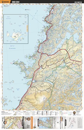
NLNL58 Bird Cove - Newfoundland and Labrador Topo
This recreation topographic map for Bird Cove highlights all the logging/resource roads, hunting areas, fishing lakes & streams, campsites, paddling routes for canoeing and kayaking, wildlife viewing areas, multi-use trails for hiking, biking, horseback riding, cross-country skiing and snowshoeing, motorized trails for ATVing and snowmobiling & more. Covering 3,040 km2 (1,170 mi2), this 1:85,000 scale map measures 48 x 63.5 km (30 x 39.5 mi), providing you with more topographic and recreational detail for the Fortune area than any other map on the market. Special features include countless roads, trails and recreational Points of Interest. Included on this map are Bird Cove, Ten Mile Lake, Round Lake, Castors River, Doctors Pond, Leg Pond, St Margaret Bay, St John Bay and more!
Page Size: 24 x 37 in (610 x 940 mm)
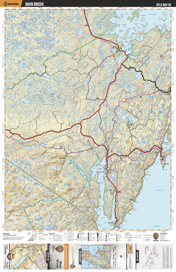
NLNL59 Main Brook - Newfoundland and Labrador Topo
This recreation topographic map for Main Brook highlights all the logging/resource roads, hunting areas, fishing lakes & streams, campsites, paddling routes for canoeing and kayaking, wildlife viewing areas, multi-use trails for hiking, biking, horseback riding, cross-country skiing and snowshoeing, motorized trails for ATVing and snowmobiling & more. Covering 3,040 km2 (1,170 mi2), this 1:85,000 scale map measures 48 x 63.5 km (30 x 39.5 mi), providing you with more topographic and recreational detail for the Fortune area than any other map on the market. Special features include countless roads, trails and recreational Points of Interest. Included on this map are Main Brook, Salmon River, Coles Pond, Hare Bay, Twin Lakes, Cloud River and more!
Page Size: 24 x 37 in (610 x 940 mm)
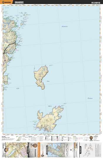
NLNL60 Grandois - Newfoundland and Labrador Topo
This recreation topographic map for Grandois highlights all the logging/resource roads, hunting areas, fishing lakes & streams, campsites, paddling routes for canoeing and kayaking, wildlife viewing areas, multi-use trails for hiking, biking, horseback riding, cross-country skiing and snowshoeing, motorized trails for ATVing and snowmobiling & more. Covering 3,040 km2 (1,170 mi2), this 1:85,000 scale map measures 48 x 63.5 km (30 x 39.5 mi), providing you with more topographic and recreational detail for the Fortune area than any other map on the market. Special features include countless roads, trails and recreational Points of Interest. Included on this map are Grandios, Croque Harbour, Pilier Bay, Groais Island, Bell Island and more!
Page Size: 24 x 37 in (610 x 940 mm)
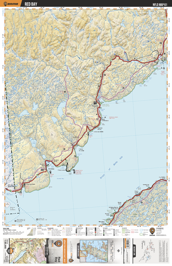
NLNL61 Red Bay - Newfoundland and Labrador Topo
This recreation topographic map for Red Bay highlights all the logging/resource roads, hunting areas, fishing lakes & streams, campsites, paddling routes for canoeing and kayaking, wildlife viewing areas, multi-use trails for hiking, biking, horseback riding, cross-country skiing and snowshoeing, motorized trails for ATVing and snowmobiling & more. Covering 3,040 km2 (1,170 mi2), this 1:85,000 scale map measures 48 x 63.5 km (30 x 39.5 mi), providing you with more topographic and recreational detail for the Fortune area than any other map on the market. Special features include countless roads, trails and recreational Points of Interest. Included on this map are Red Bay, Lost River, Pinware River, Forteau Bay, Pinware River Provincial Park, Forteau River, Strait Of Belle Isle and more!
Page Size: 24 x 37 in (610 x 940 mm)
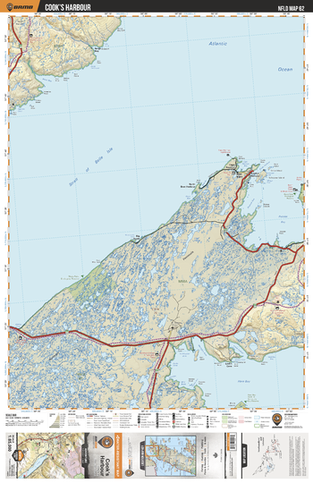
NLNL62 Cook's Harbour - Newfoundland and Labrador Topo
This recreation topographic map for Cook's Harbour highlights all the logging/resource roads, hunting areas, fishing lakes & streams, campsites, paddling routes for canoeing and kayaking, wildlife viewing areas, multi-use trails for hiking, biking, horseback riding, cross-country skiing and snowshoeing, motorized trails for ATVing and snowmobiling & more. Covering 3,040 km2 (1,170 mi2), this 1:85,000 scale map measures 48 x 63.5 km (30 x 39.5 mi), providing you with more topographic and recreational detail for the Fortune area than any other map on the market. Special features include countless roads, trails and recreational Points of Interest. Included on this map are Cook's Harbour, Hare Bay, Pistolet Bay, Black Bay, Watts Point Ecological Reserve, Burnt Cape Ecological Reserve and more!
Page Size: 24 x 37 in (610 x 940 mm)
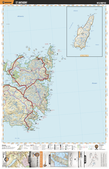
NLNL63 St Anthony - Newfoundland and Labrador Topo
This recreation topographic map for St Anthony highlights all the logging/resource roads, hunting areas, fishing lakes & streams, campsites, paddling routes for canoeing and kayaking, wildlife viewing areas, multi-use trails for hiking, biking, horseback riding, cross-country skiing and snowshoeing, motorized trails for ATVing and snowmobiling & more. Covering 3,040 km2 (1,170 mi2), this 1:85,000 scale map measures 48 x 63.5 km (30 x 39.5 mi), providing you with more topographic and recreational detail for the Fortune area than any other map on the market. Special features include countless roads, trails and recreational Points of Interest. Included on this map are St Anthony, Pistolet Bay Provincial Park, Parker River, Pistolet Bay and more!
Page Size: 24 x 37 in (610 x 940 mm)
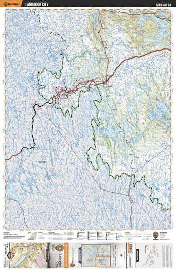
NLNL64 Labrador City - Newfoundland and Labrador Topo
This recreation topographic map for Labrador City highlights all the logging/resource roads, hunting areas, fishing lakes & streams, campsites, paddling routes for canoeing and kayaking, wildlife viewing areas, multi-use trails for hiking, biking, horseback riding, cross-country skiing and snowshoeing, motorized trails for ATVing and snowmobiling & more. Covering 49,475 km2 (19,100 mi2), this 1:330,000 scale map measures 193 x 256.5 km (120 x 159 mi), providing you with more topographic and recreational detail for the Fortune area than any other map on the market. Special features include countless roads, trails and recreational Points of Interest. Included on this map are Labrador City, Summit River, Lac Joseph, Ashuanipi Lake, Julienne Lake, Shabogamo Lake, Menihek Lakes, Ossokmanuan Reservoir.
Page Size: 24 x 37 in (610 x 940 mm)
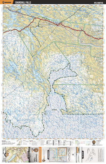
NLNL65 Churchill Falls - Newfoundland and Labrador Topo
This recreation topographic map for Churchill Falls Labrador highlights all the logging/resource roads, hunting areas, fishing lakes & streams, campsites, paddling routes for canoeing and kayaking, wildlife viewing areas, multi-use trails for hiking, biking, horseback riding, cross-country skiing and snowshoeing, motorized trails for ATVing and snowmobiling & more. Covering 49,475 km2 (19,100 mi2), this 1:330,000 scale map measures 193 x 256.5 km (120 x 159 mi), providing you with more topographic and recreational detail for the Fortune area than any other map on the market. Special features include countless roads, trails and recreational Points of Interest. Included on this map are Churchill Falls, Churchill River, Ossokmanuan Reservoir, Atikonak Lake, Lac Joseph, Elizabeth River and more!
Page Size: 24 x 37 in (610 x 940 mm)
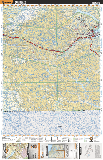
NLNL66 Grande Lake - Newfoundland and Labrador Topo
This recreation topographic map for Grande Lake Labrador highlights all the logging/resource roads, hunting areas, fishing lakes & streams, campsites, paddling routes for canoeing and kayaking, wildlife viewing areas, multi-use trails for hiking, biking, horseback riding, cross-country skiing and snowshoeing, motorized trails for ATVing and snowmobiling & more. Covering 49,475 km2 (19,100 mi2), this 1:330,000 scale map measures 193 x 256.5 km (120 x 159 mi), providing you with more topographic and recreational detail for the Fortune area than any other map on the market. Special features include countless roads, trails and recreational Points of Interest. Included on this map are Grand Lake, Wilson Lake, Goose River, Beaver River, Churchill River, Mecatina River, Fourmont Lake, Dominion Lake, Lake Melville and more!
Page Size: 24 x 37 in (610 x 940 mm)
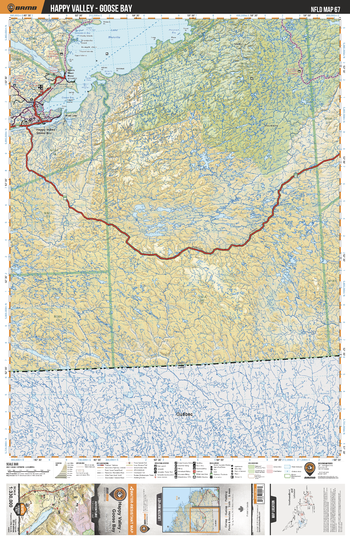
NLNL67 Happy Valley - Goose Bay - Newfoundland and Labrador Topo
This recreation topographic map for Happy Valley - Goose Bay Labrador highlights all the logging/resource roads, hunting areas, fishing lakes & streams, campsites, paddling routes for canoeing and kayaking, wildlife viewing areas, multi-use trails for hiking, biking, horseback riding, cross-country skiing and snowshoeing, motorized trails for ATVing and snowmobiling & more. Covering 49,475 km2 (19,100 mi2), this 1:330,000 scale map measures 193 x 256.5 km (120 x 159 mi), providing you with more topographic and recreational detail for the Fortune area than any other map on the market. Special features include countless roads, trails and recreational Points of Interest. Included on this map are Happy Valley Goose Bay, Lake Melville, Goose Bay, Mealy Mountain, Kenamu River, Eagle River, Grand Lake, Sebaskachu River and more!
Page Size: 24 x 37 in (610 x 940 mm)
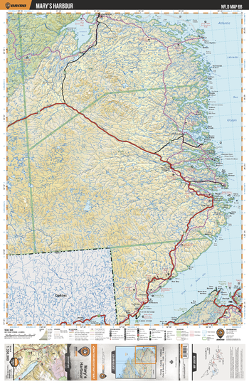
NLNL68 Mary's Harbour - Newfoundland and Labrador Topo
This recreation topographic map for Mary's Harbour Labrador highlights all the logging/resource roads, hunting areas, fishing lakes & streams, campsites, paddling routes for canoeing and kayaking, wildlife viewing areas, multi-use trails for hiking, biking, horseback riding, cross-country skiing and snowshoeing, motorized trails for ATVing and snowmobiling & more. Covering 49,475 km2 (19,100 mi2), this 1:330,000 scale map measures 193 x 256.5 km (120 x 159 mi), providing you with more topographic and recreational detail for the Fortune area than any other map on the market. Special features include countless roads, trails and recreational Points of Interest. Included on this map are Mary's Harbour, Maly Mountain, Sandwich Bay, Eagle River, White Bear River, Strait of Bell Isle, Pisolet Provincial Park, Pineware River Provincial Park and more!
Page Size: 24 x 37 in (610 x 940 mm)