


Backroad Mapbooks

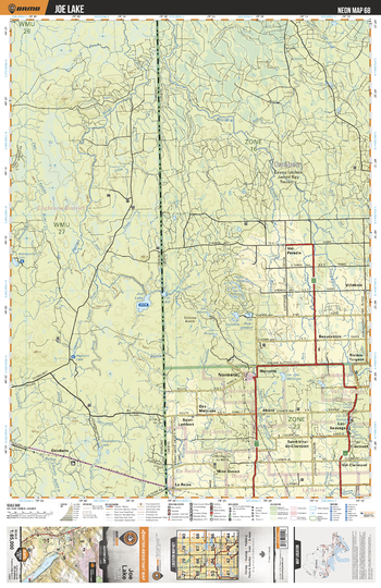
NEON68 Joe Lake - Northeastern Ontario Topo
This recreation topographic map for Joe Lake highlights all the logging/resource roads, hunting areas, fishing lakes & streams, campsites, paddling routes for canoeing and kayaking, wildlife viewing areas, multi-use trails for hiking, biking, horseback riding, cross-country skiing and snowshoeing, motorized trails for ATVing and snowmobiling & more. Covering 3,040 km2 (1,170 mi2), this 1:85,000 scale map measures 48 x 63.5 km (30 x 39.5 mi), providing you with more topographic and recreational detail for the Meldrum Bay area than any other map on the market. New features include Crown land areas, countless new roads and trails plus additional recreational Points of Interest. Included on this map are Patten River, Goodwen, Aylen River, Joe Lake, Abbotsford Lake, Abbotsford Creek, East Kabika River, Little Clive River, Hepburn Lake, South Patten River and more!
Page Size: 24 x 37 in (610 x 940 mm)
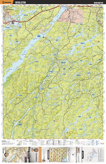
NEON69 Geraldton - Northeastern Ontario Topo
This recreation topographic map for Geraldton highlights all the logging/resource roads, hunting areas, fishing lakes & streams, campsites, paddling routes for canoeing and kayaking, wildlife viewing areas, multi-use trails for hiking, biking, horseback riding, cross-country skiing and snowshoeing, motorized trails for ATVing and snowmobiling & more. Covering 3,040 km2 (1,170 mi2), this 1:85,000 scale map measures 48 x 63.5 km (30 x 39.5 mi), providing you with more topographic and recreational detail for the Meldrum Bay area than any other map on the market. New features include Crown land areas, countless new roads and trails plus additional recreational Points of Interest. Included on this map are Geraldton, Long Lake, Macleod Provincial Park, McKay Lake, Steel River, Steel Lake, Little Pic River and more!
Page Size: 24 x 37 in (610 x 940 mm)
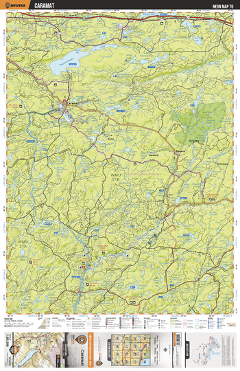
NEON70 Caramat - Northeastern Ontario Topo
This recreation topographic map for Caramat highlights all the logging/resource roads, hunting areas, fishing lakes & streams, campsites, paddling routes for canoeing and kayaking, wildlife viewing areas, multi-use trails for hiking, biking, horseback riding, cross-country skiing and snowshoeing, motorized trails for ATVing and snowmobiling & more. Covering 3,040 km2 (1,170 mi2), this 1:85,000 scale map measures 48 x 63.5 km (30 x 39.5 mi), providing you with more topographic and recreational detail for the Meldrum Bay area than any other map on the market. New features include Crown land areas, countless new roads and trails plus additional recreational Points of Interest. Included on this map are Caramat, Pagwachuan Lake, Pagwachuan River, Klotz Lake, Caramat Lake, Slim Jim Lake Conservation Reservation and more!
Page Size: 24 x 37 in (610 x 940 mm)
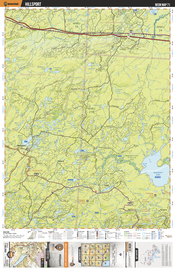
NEON71 Hillsport - Northeastern Ontario Topo
This recreation topographic map for Hillsport highlights all the logging/resource roads, hunting areas, fishing lakes & streams, campsites, paddling routes for canoeing and kayaking, wildlife viewing areas, multi-use trails for hiking, biking, horseback riding, cross-country skiing and snowshoeing, motorized trails for ATVing and snowmobiling & more. Covering 3,040 km2 (1,170 mi2), this 1:85,000 scale map measures 48 x 63.5 km (30 x 39.5 mi), providing you with more topographic and recreational detail for the Meldrum Bay area than any other map on the market. New features include Crown land areas, countless new roads and trails plus additional recreational Points of Interest. Included on this map are Hillsport, Nagagami Lake, White Otter Lake, Osawin River, Nagagami Lake Provincial Park, Otasawian River and more!
Page Size: 24 x 37 in (610 x 940 mm)
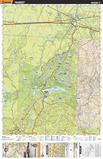
NEON72 Palmquist - Northeastern Ontario Topo
This recreation topographic map for Palmquist highlights all the logging/resource roads, hunting areas, fishing lakes & streams, campsites, paddling routes for canoeing and kayaking, wildlife viewing areas, multi-use trails for hiking, biking, horseback riding, cross-country skiing and snowshoeing, motorized trails for ATVing and snowmobiling & more. Covering 3,040 km2 (1,170 mi2), this 1:85,000 scale map measures 48 x 63.5 km (30 x 39.5 mi), providing you with more topographic and recreational detail for the Meldrum Bay area than any other map on the market. New features include Crown land areas, countless new roads and trails plus additional recreational Points of Interest. Included on this map are Palmquist, Shekak River, Nagagamisis Lake, Nagagamisis Provincial Park, Nagagami Lake Provincial Park and more!
Page Size: 24 x 37 in (610 x 940 mm)
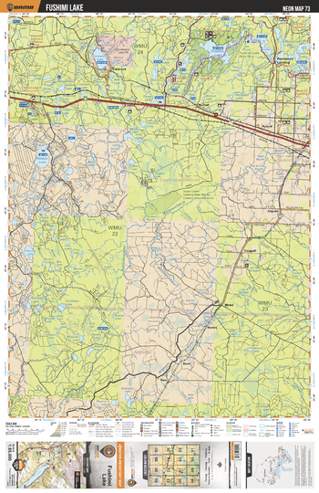
NEON73 Fushimi Lake - Northeastern Ontario Topo
This recreation topographic map for Fushimi Lake highlights all the logging/resource roads, hunting areas, fishing lakes & streams, campsites, paddling routes for canoeing and kayaking, wildlife viewing areas, multi-use trails for hiking, biking, horseback riding, cross-country skiing and snowshoeing, motorized trails for ATVing and snowmobiling & more. Covering 3,040 km2 (1,170 mi2), this 1:85,000 scale map measures 48 x 63.5 km (30 x 39.5 mi), providing you with more topographic and recreational detail for the Meldrum Bay area than any other map on the market. New features include Crown land areas, countless new roads and trails plus additional recreational Points of Interest. Included on this map are Fushimi Lake, Constance Lake, Nassau Lake, Valentine Lake, Mattawishkwia River, Valentine River and more!
Page Size: 24 x 37 in (610 x 940 mm)
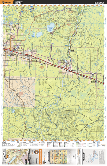
NEON74 Hearst - Northeastern Ontario Topo
This recreation topographic map for Hearst highlights all the logging/resource roads, hunting areas, fishing lakes & streams, campsites, paddling routes for canoeing and kayaking, wildlife viewing areas, multi-use trails for hiking, biking, horseback riding, cross-country skiing and snowshoeing, motorized trails for ATVing and snowmobiling & more. Covering 3,040 km2 (1,170 mi2), this 1:85,000 scale map measures 48 x 63.5 km (30 x 39.5 mi), providing you with more topographic and recreational detail for the Meldrum Bay area than any other map on the market. New features include Crown land areas, countless new roads and trails plus additional recreational Points of Interest. Included on this map are Hearst, Shannon Lake, Mattawishkwia Lakes, Missinaibi Provincial Park, Missinaibi River, Edwards Lake and more!
Page Size: 24 x 37 in (610 x 940 mm)
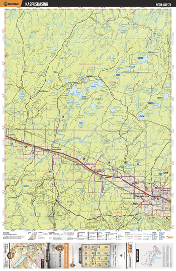
NEON75 Kapuskasing - Northeastern Ontario Topo
This recreation topographic map for Kapuskasing highlights all the logging/resource roads, hunting areas, fishing lakes & streams, campsites, paddling routes for canoeing and kayaking, wildlife viewing areas, multi-use trails for hiking, biking, horseback riding, cross-country skiing and snowshoeing, motorized trails for ATVing and snowmobiling & more. Covering 3,040 km2 (1,170 mi2), this 1:85,000 scale map measures 48 x 63.5 km (30 x 39.5 mi), providing you with more topographic and recreational detail for the Meldrum Bay area than any other map on the market. New features include Crown land areas, countless new roads and trails plus additional recreational Points of Interest. Included on this map are Kapuskasing, Allan Lake, Zadi Lake, Opasatika River, Bear Tooth Lake, Val Rita Harty Park and more!
Page Size: 24 x 37 in (610 x 940 mm)
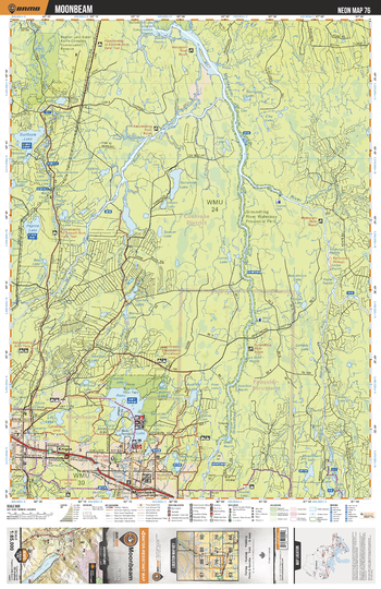
NEON76 Moonbeam - Northeastern Ontario Topo
This recreation topographic map for Moonbeam highlights all the logging/resource roads, hunting areas, fishing lakes & streams, campsites, paddling routes for canoeing and kayaking, wildlife viewing areas, multi-use trails for hiking, biking, horseback riding, cross-country skiing and snowshoeing, motorized trails for ATVing and snowmobiling & more. Covering 3,040 km2 (1,170 mi2), this 1:85,000 scale map measures 48 x 63.5 km (30 x 39.5 mi), providing you with more topographic and recreational detail for the Meldrum Bay area than any other map on the market. New features include Crown land areas, countless new roads and trails plus additional recreational Points of Interest. Included on this map are Moonbeam, Remi Lake, Audrey Lake, Lily Lake, Groundhog River, Groundhog River Waterway Provincial Park and more!
Page Size: 24 x 37 in (610 x 940 mm)
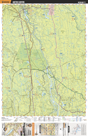
NEON77 Abitibi Canyon - Northeastern Ontario Topo
This recreation topographic map for Abitibi Canyon highlights all the logging/resource roads, hunting areas, fishing lakes & streams, campsites, paddling routes for canoeing and kayaking, wildlife viewing areas, multi-use trails for hiking, biking, horseback riding, cross-country skiing and snowshoeing, motorized trails for ATVing and snowmobiling & more. Covering 3,040 km2 (1,170 mi2), this 1:85,000 scale map measures 48 x 63.5 km (30 x 39.5 mi), providing you with more topographic and recreational detail for the Meldrum Bay area than any other map on the market. New features include Crown land areas, countless new roads and trails plus additional recreational Points of Interest. Included on this map are Abitibi Canyon, Abitibi River, Little Abitibi River, Mattagami River, Beniah Lake, Takwata Lake and more!
Page Size: 24 x 37 in (610 x 940 mm)
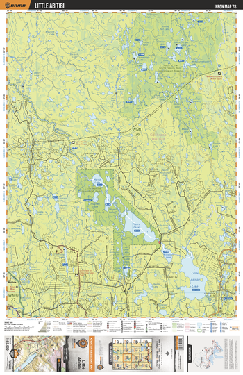
NEON78 Little Abitibi - Northeastern Ontario Topo
This recreation topographic map for Little Abitibi highlights all the logging/resource roads, hunting areas, fishing lakes & streams, campsites, paddling routes for canoeing and kayaking, wildlife viewing areas, multi-use trails for hiking, biking, horseback riding, cross-country skiing and snowshoeing, motorized trails for ATVing and snowmobiling & more. Covering 3,040 km2 (1,170 mi2), this 1:85,000 scale map measures 48 x 63.5 km (30 x 39.5 mi), providing you with more topographic and recreational detail for the Meldrum Bay area than any other map on the market. New features include Crown land areas, countless new roads and trails plus additional recreational Points of Interest. Included on this map are Little Abitibi, Little Abitibi Provincial Park, Harris Lake, Pierre Lake, Hughes Lake, Sangster Lake and more!
Page Size: 24 x 37 in (610 x 940 mm)
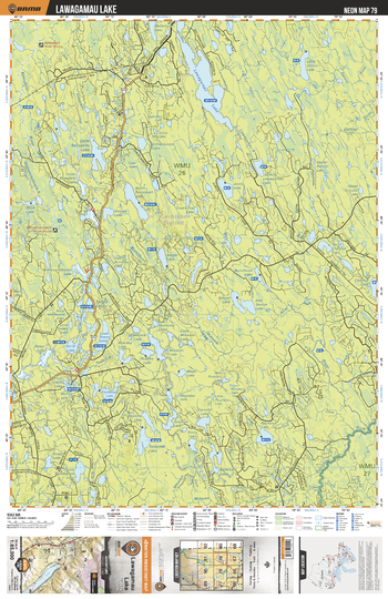
NEON79 Lawagamu Lake - Northeastern Ontario Topo
This recreation topographic map for Lawagamu Lake highlights all the logging/resource roads, hunting areas, fishing lakes & streams, campsites, paddling routes for canoeing and kayaking, wildlife viewing areas, multi-use trails for hiking, biking, horseback riding, cross-country skiing and snowshoeing, motorized trails for ATVing and snowmobiling & more. Covering 3,040 km2 (1,170 mi2), this 1:85,000 scale map measures 48 x 63.5 km (30 x 39.5 mi), providing you with more topographic and recreational detail for the Meldrum Bay area than any other map on the market. New features include Crown land areas, countless new roads and trails plus additional recreational Points of Interest. Included on this map are Lawagamau Lake, Lawagamau River, Little Detour Lake, Floodwood Lake, Lower Tweed Lake and more!
Page Size: 24 x 37 in (610 x 940 mm)
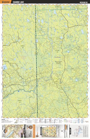
NEON80 Chabbie Lake - Northeastern Ontario Topo
This recreation topographic map for Chabbie Lake highlights all the logging/resource roads, hunting areas, fishing lakes & streams, campsites, paddling routes for canoeing and kayaking, wildlife viewing areas, multi-use trails for hiking, biking, horseback riding, cross-country skiing and snowshoeing, motorized trails for ATVing and snowmobiling & more. Covering 3,040 km2 (1,170 mi2), this 1:85,000 scale map measures 48 x 63.5 km (30 x 39.5 mi), providing you with more topographic and recreational detail for the Meldrum Bay area than any other map on the market. New features include Crown land areas, countless new roads and trails plus additional recreational Points of Interest. Included on this map are Chabbie Lake, Burntbush River, Turcotte River, Monaghan Lake, Atkinson Lake and more!
Page Size: 24 x 37 in (610 x 940 mm)
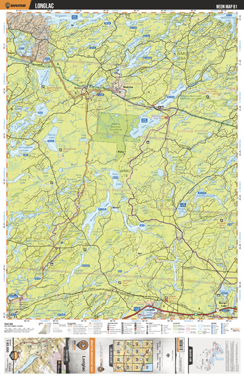
NEON81 Longlac - Northeastern Ontario Topo
This recreation topographic map for Longlac highlights all the logging/resource roads, hunting areas, fishing lakes & streams, campsites, paddling routes for canoeing and kayaking, wildlife viewing areas, multi-use trails for hiking, biking, horseback riding, cross-country skiing and snowshoeing, motorized trails for ATVing and snowmobiling & more. Covering 3,040 km2 (1,170 mi2), this 1:85,000 scale map measures 48 x 63.5 km (30 x 39.5 mi), providing you with more topographic and recreational detail for the Meldrum Bay area than any other map on the market. New features include Crown land areas, countless new roads and trails plus additional recreational Points of Interest. Included on this map are Longlac, Nakina Moraine Provincial Park, Murky Lake, Fleming Lake, Springwater Lake, Burrows Lake and more!
Page Size: 24 x 37 in (610 x 940 mm)
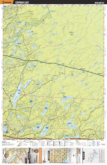
NEON82 Chipman Lake - Northeastern Ontario Topo
This recreation topographic map for Chipman Lake highlights all the logging/resource roads, hunting areas, fishing lakes & streams, campsites, paddling routes for canoeing and kayaking, wildlife viewing areas, multi-use trails for hiking, biking, horseback riding, cross-country skiing and snowshoeing, motorized trails for ATVing and snowmobiling & more. Covering 3,040 km2 (1,170 mi2), this 1:85,000 scale map measures 48 x 63.5 km (30 x 39.5 mi), providing you with more topographic and recreational detail for the Meldrum Bay area than any other map on the market. New features include Crown land areas, countless new roads and trails plus additional recreational Points of Interest. Included on this map are Chipman Lake, Shacabac Lake, Kenogami River, Fernow Lake, Flint Lake, Klotz Lake, Buell Lake and more!
Page Size: 24 x 37 in (610 x 940 mm)
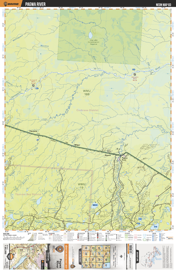
NEON83 Pagwa River - Northeastern Ontario Topo
This recreation topographic map for Pagwa River highlights all the logging/resource roads, hunting areas, fishing lakes & streams, campsites, paddling routes for canoeing and kayaking, wildlife viewing areas, multi-use trails for hiking, biking, horseback riding, cross-country skiing and snowshoeing, motorized trails for ATVing and snowmobiling & more. Covering 3,040 km2 (1,170 mi2), this 1:85,000 scale map measures 48 x 63.5 km (30 x 39.5 mi), providing you with more topographic and recreational detail for the Meldrum Bay area than any other map on the market. New features include Crown land areas, countless new roads and trails plus additional recreational Points of Interest. Included on this map are Pagwa River, Eureka Lake, Sunshine Lake, Flint River, Kenogami River and more!
Page Size: 24 x 37 in (610 x 940 mm)
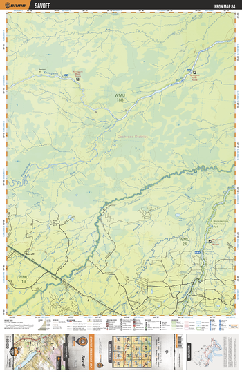
NEON84 Savoff - Northeastern Ontario Topo
This recreation topographic map for Savoff highlights all the logging/resource roads, hunting areas, fishing lakes & streams, campsites, paddling routes for canoeing and kayaking, wildlife viewing areas, multi-use trails for hiking, biking, horseback riding, cross-country skiing and snowshoeing, motorized trails for ATVing and snowmobiling & more. Covering 3,040 km2 (1,170 mi2), this 1:85,000 scale map measures 48 x 63.5 km (30 x 39.5 mi), providing you with more topographic and recreational detail for the Meldrum Bay area than any other map on the market. New features include Crown land areas, countless new roads and trails plus additional recreational Points of Interest. Included on this map are Savoff, Kenogami River, Otasawian River, Pagwachuan River, Nagagamisis Provincial Park and more!
Page Size: 24 x 37 in (610 x 940 mm)
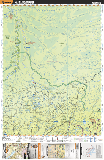
NEON85 Kabinakagami River - Northeastern Ontario Topo
This recreation topographic map for Kabinakagami River highlights all the logging/resource roads, hunting areas, fishing lakes & streams, campsites, paddling routes for canoeing and kayaking, wildlife viewing areas, multi-use trails for hiking, biking, horseback riding, cross-country skiing and snowshoeing, motorized trails for ATVing and snowmobiling & more. Covering 3,040 km2 (1,170 mi2), this 1:85,000 scale map measures 48 x 63.5 km (30 x 39.5 mi), providing you with more topographic and recreational detail for the Meldrum Bay area than any other map on the market. New features include Crown land areas, countless new roads and trails plus additional recreational Points of Interest. Included on this map are Kabinakagami River, Nagagamisis Provincial Park, Otasawian River, Nagagami River and more!
Page Size: 24 x 37 in (610 x 940 mm)
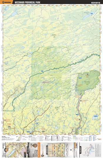
NEON86 Missinaibi Provincial Park - Northeastern Ontario Topo
This recreation topographic map for Missinaibi Provincial Park highlights all the logging/resource roads, hunting areas, fishing lakes & streams, campsites, paddling routes for canoeing and kayaking, wildlife viewing areas, multi-use trails for hiking, biking, horseback riding, cross-country skiing and snowshoeing, motorized trails for ATVing and snowmobiling & more. Covering 3,040 km2 (1,170 mi2), this 1:85,000 scale map measures 48 x 63.5 km (30 x 39.5 mi), providing you with more topographic and recreational detail for the Meldrum Bay area than any other map on the market. New features include Crown land areas, countless new roads and trails plus additional recreational Points of Interest. Included on this map are Missinaibi Provincial Park, Missinaibi River, Pivabiska River, Coal River, Ritchie Lake and more!
Page Size: 24 x 37 in (610 x 940 mm)
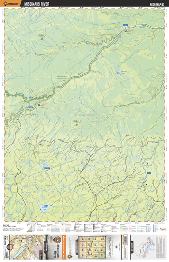
NEON87 Missinaibi River - Northeastern Ontario Topo
This recreation topographic map for Missinaibi River highlights all the logging/resource roads, hunting areas, fishing lakes & streams, campsites, paddling routes for canoeing and kayaking, wildlife viewing areas, multi-use trails for hiking, biking, horseback riding, cross-country skiing and snowshoeing, motorized trails for ATVing and snowmobiling & more. Covering 3,040 km2 (1,170 mi2), this 1:85,000 scale map measures 48 x 63.5 km (30 x 39.5 mi), providing you with more topographic and recreational detail for the Meldrum Bay area than any other map on the market. New features include Crown land areas, countless new roads and trails plus additional recreational Points of Interest. Included on this map are Missinaibi River, Missinaibi Provincial Park, Hilmer Lake, Opasatika River and more!
Page Size: 24 x 37 in (610 x 940 mm)