


Backroad Mapbooks

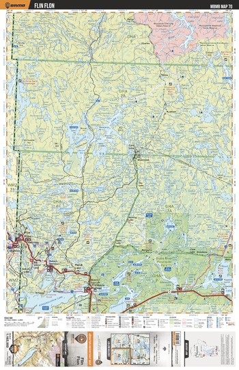
MBMB70 Flin Flon - Manitoba Backroad Mapbook Topo
This recreation topographic map for Flin Flon highlights all the logging/resource roads, hunting areas, fishing lakes & streams, campsites, paddling routes for canoeing and kayaking, wildlife viewing areas, multi-use trails for hiking, biking, horseback riding, cross-country skiing and snowshoeing, motorized trails for ATVing and snowmobiling & more. Covering 12,370 km2 (4,775 mi2), this 1:165,000 scale map measures 96.5 x 128 km (60 x 79.5 mi), providing you with more topographic and recreational detail for the Birch River area than any other map on the market. New features include Crown land areas and labeled fish species, plus countless new trails, roads and recreational Points of Interest. Included on this map are Grass River Prov Park, Flin Flon, Athapapuskow Lake, Cold Lake, Kississing Lake, Reed Lake, Payuk Lake, Kipahigan Lake, Iskwasum Lake, Cranberry Portage and more!
Page Size: 24 x 37 in (610 x 940 mm)
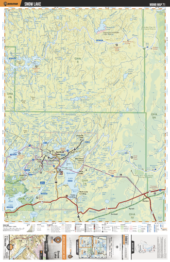
MBMB71 Snow Lake - Manitoba Backroad Mapbook Topo
This recreation topographic map for Snow Lake highlights all the logging/resource roads, hunting areas, fishing lakes & streams, campsites, paddling routes for canoeing and kayaking, wildlife viewing areas, multi-use trails for hiking, biking, horseback riding, cross-country skiing and snowshoeing, motorized trails for ATVing and snowmobiling & more. Covering 12,370 km2 (4,775 mi2), this 1:165,000 scale map measures 96.5 x 128 km (60 x 79.5 mi), providing you with more topographic and recreational detail for the Birch River area than any other map on the market. New features include Crown land areas and labeled fish species, plus countless new trails, roads and recreational Points of Interest. Included on this map are Wekusko Lake, Grass River, Snow Lake, Reed Lake, Fife Lake, Stall Lake, Herb Lake, Burntwood Lake, Apeganau Lake, Burntwood River and more!
Page Size: 24 x 37 in (610 x 940 mm)
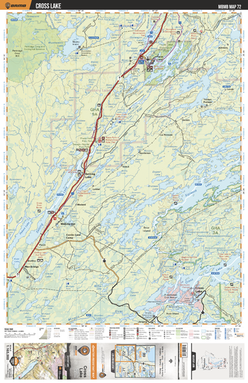
MBMB72 Cross Lake - Manitoba Backroad Mapbook Topo
This recreation topographic map for Cross Lake highlights all the logging/resource roads, hunting areas, fishing lakes & streams, campsites, paddling routes for canoeing and kayaking, wildlife viewing areas, multi-use trails for hiking, biking, horseback riding, cross-country skiing and snowshoeing, motorized trails for ATVing and snowmobiling & more. Covering 12,370 km2 (4,775 mi2), this 1:165,000 scale map measures 96.5 x 128 km (60 x 79.5 mi), providing you with more topographic and recreational detail for the Birch River area than any other map on the market. New features include Crown land areas and labeled fish species, plus countless new trails, roads and recreational Points of Interest. Included on this map are Setting Lake, Cross Lake, Sipiwesk Lake, Paint Lake, Wintering Lake, Wuskwatim Lake, Grass River, Pakwa Lake, Bear Island, Nelson Riverd and more!
Page Size: 24 x 37 in (610 x 940 mm)
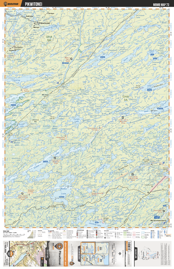
MBMB73 Pikwitonei - Manitoba Backroad Mapbook Topo
This recreation topographic map for Pikwitonei highlights all the logging/resource roads, hunting areas, fishing lakes & streams, campsites, paddling routes for canoeing and kayaking, wildlife viewing areas, multi-use trails for hiking, biking, horseback riding, cross-country skiing and snowshoeing, motorized trails for ATVing and snowmobiling & more. Covering 12,370 km2 (4,775 mi2), this 1:165,000 scale map measures 96.5 x 128 km (60 x 79.5 mi), providing you with more topographic and recreational detail for the Birch River area than any other map on the market. New features include Crown land areas and labeled fish species, plus countless new trails, roads and recreational Points of Interest. Included on this map are Cross Lake, Walker Lake, Bear Lake, Nelson River, Clearwater River, Cauchon Lake, Pikwitonei, Partridge Crop Lake, Mistasinni River, Carrot River and more!
Page Size: 24 x 37 in (610 x 940 mm)
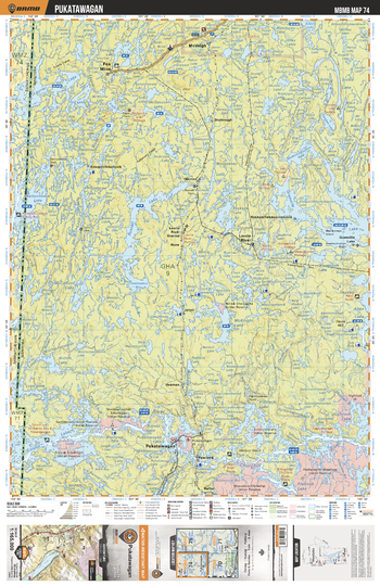
MBMB74 Pukatawagan - Manitoba Backroad Mapbook Topo
This recreation topographic map for Pukatawagan highlights all the logging/resource roads, hunting areas, fishing lakes & streams, campsites, paddling routes for canoeing and kayaking, wildlife viewing areas, multi-use trails for hiking, biking, horseback riding, cross-country skiing and snowshoeing, motorized trails for ATVing and snowmobiling & more. Covering 12,370 km2 (4,775 mi2), this 1:165,000 scale map measures 96.5 x 128 km (60 x 79.5 mi), providing you with more topographic and recreational detail for the Birch River area than any other map on the market. New features include Crown land areas and labeled fish species, plus countless new trails, roads and recreational Points of Interest. Included on this map are Granville Lake, Pukatawagan, McKnight Lake, Russel Lake, McGavock Lake, Fox Mine, Pawistik, Laurie River, McVeigh, Laurie River and more!
Page Size: 24 x 37 in (610 x 940 mm)
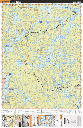
MBMB75 Leaf Rapids - Manitoba Backroad Mapbook Topo
This recreation topographic map for Leaf Rapids highlights all the logging/resource roads, hunting areas, fishing lakes & streams, campsites, paddling routes for canoeing and kayaking, wildlife viewing areas, multi-use trails for hiking, biking, horseback riding, cross-country skiing and snowshoeing, motorized trails for ATVing and snowmobiling & more. Covering 12,370 km2 (4,775 mi2), this 1:165,000 scale map measures 96.5 x 128 km (60 x 79.5 mi), providing you with more topographic and recreational detail for the Birch River area than any other map on the market. New features include Crown land areas and labeled fish species, plus countless new trails, roads and recreational Points of Interest. Included on this map are Leaf Rapids, Suwannee Lake, Prayer River, Highrock, Notigi, Ruttan Mine, Eden Lake, Churchill River, Rat Lake, Rat River and more!
Page Size: 24 x 37 in (610 x 940 mm)
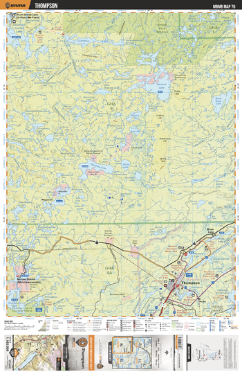
MBMB76 Thompson - Manitoba Backroad Mapbook Topo
This recreation topographic map for Thompson highlights all the logging/resource roads, hunting areas, fishing lakes & streams, campsites, paddling routes for canoeing and kayaking, wildlife viewing areas, multi-use trails for hiking, biking, horseback riding, cross-country skiing and snowshoeing, motorized trails for ATVing and snowmobiling & more. Covering 12,370 km2 (4,775 mi2), this 1:165,000 scale map measures 96.5 x 128 km (60 x 79.5 mi), providing you with more topographic and recreational detail for the Birch River area than any other map on the market. New features include Crown land areas and labeled fish species, plus countless new trails, roads and recreational Points of Interest. Included on this map are Thompson, Baldock Lake, Nelson House, Burntwood River, Harding Lake, Leftrook Lake, White Stone Lake, Uhlman Lake, South Indian Lake, Amish Park Reserve and more!
Page Size: 24 x 37 in (610 x 940 mm)
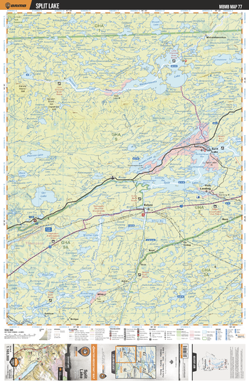
MBMB77 Split Lake - Manitoba Backroad Mapbook Topo
This recreation topographic map for Split Lake highlights all the logging/resource roads, hunting areas, fishing lakes & streams, campsites, paddling routes for canoeing and kayaking, wildlife viewing areas, multi-use trails for hiking, biking, horseback riding, cross-country skiing and snowshoeing, motorized trails for ATVing and snowmobiling & more. Covering 12,370 km2 (4,775 mi2), this 1:165,000 scale map measures 96.5 x 128 km (60 x 79.5 mi), providing you with more topographic and recreational detail for the Birch River area than any other map on the market. New features include Crown land areas and labeled fish species, plus countless new trails, roads and recreational Points of Interest. Included on this map are Split Lake, York Landing, Waskalowaka Lake, Assean Lake, Limestone Lake, Pelletier Lake, Orr Lake, Burntwood River, Nelson River, Armstrong Lake and more!
Page Size: 24 x 37 in (610 x 940 mm)
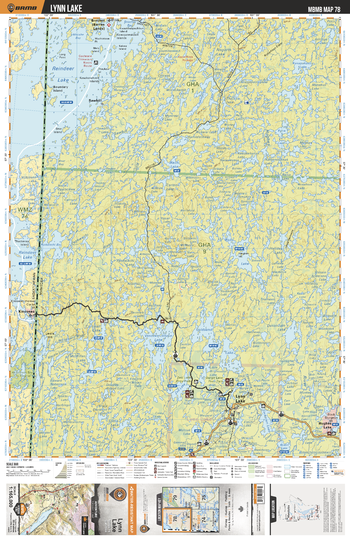
MBMB78 Lynn Lake - Manitoba Backroad Mapbook Topo
This recreation topographic map for Lynn Lake highlights all the logging/resource roads, hunting areas, fishing lakes & streams, campsites, paddling routes for canoeing and kayaking, wildlife viewing areas, multi-use trails for hiking, biking, horseback riding, cross-country skiing and snowshoeing, motorized trails for ATVing and snowmobiling & more. Covering 12,370 km2 (4,775 mi2), this 1:165,000 scale map measures 96.5 x 128 km (60 x 79.5 mi), providing you with more topographic and recreational detail for the Birch River area than any other map on the market. New features include Crown land areas and labeled fish species, plus countless new trails, roads and recreational Points of Interest. Included on this map are Reindeer Lake, Carlson Lake, Lynn Lake, Burge Lake Prov Park, Vandekerckhove Lake, Carswell Lake, Hughes Lake, Goldsand Lake, Hughes River, Cockeram Lake and more!
Page Size: 24 x 37 in (610 x 940 mm)
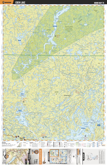
MBMB79 Eden Lake - Manitoba Backroad Mapbook Topo
This recreation topographic map for Eden Lake highlights all the logging/resource roads, hunting areas, fishing lakes & streams, campsites, paddling routes for canoeing and kayaking, wildlife viewing areas, multi-use trails for hiking, biking, horseback riding, cross-country skiing and snowshoeing, motorized trails for ATVing and snowmobiling & more. Covering 12,370 km2 (4,775 mi2), this 1:165,000 scale map measures 96.5 x 128 km (60 x 79.5 mi), providing you with more topographic and recreational detail for the Birch River area than any other map on the market. New features include Crown land areas and labeled fish species, plus countless new trails, roads and recreational Points of Interest. Included on this map are Sand Lakes Prov Park, Big Sand Lake, Southern Indian Lake, Barrington Lake, James Lake, Melvin Lake, Kakapawanis, Eden Lake, Jordan Lake, Denison Lake and more!
Page Size: 24 x 37 in (610 x 940 mm)
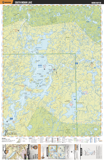
MBMB80 South Indian Lake - Manitoba Backroad Mapbook Topo
This recreation topographic map for South Indian Lake highlights all the logging/resource roads, hunting areas, fishing lakes & streams, campsites, paddling routes for canoeing and kayaking, wildlife viewing areas, multi-use trails for hiking, biking, horseback riding, cross-country skiing and snowshoeing, motorized trails for ATVing and snowmobiling & more. Covering 12,370 km2 (4,775 mi2), this 1:165,000 scale map measures 96.5 x 128 km (60 x 79.5 mi), providing you with more topographic and recreational detail for the Birch River area than any other map on the market. New features include Crown land areas and labeled fish species, plus countless new trails, roads and recreational Points of Interest. Included on this map are Southern Indian Lake, Gauer Lake, Sand Lakes Prov Park, Missinipi Lake, Thorsteinson Lake, Amisk Park Reserve, Torrance Lake, Churchill River, Little Sand River, Moss Lake and more!
Page Size: 24 x 37 in (610 x 940 mm)
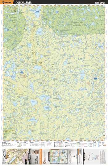
MBMB81 Churchill River - Manitoba Backroad Mapbook Topo
This recreation topographic map for Churchill River highlights all the logging/resource roads, hunting areas, fishing lakes & streams, campsites, paddling routes for canoeing and kayaking, wildlife viewing areas, multi-use trails for hiking, biking, horseback riding, cross-country skiing and snowshoeing, motorized trails for ATVing and snowmobiling & more. Covering 12,370 km2 (4,775 mi2), this 1:165,000 scale map measures 96.5 x 128 km (60 x 79.5 mi), providing you with more topographic and recreational detail for the Birch River area than any other map on the market. New features include Crown land areas and labeled fish species, plus countless new trails, roads and recreational Points of Interest. Included on this map are Numaykoos Lake Prov Park, Sand Lakes Prov Park, Churchill River, Etawney Lake, Buckland Lake, Northern Indian Lake, Holmes Lake, Lac Paille, Solmundsson Lake, Christie Lake and more!
Page Size: 24 x 37 in (610 x 940 mm)
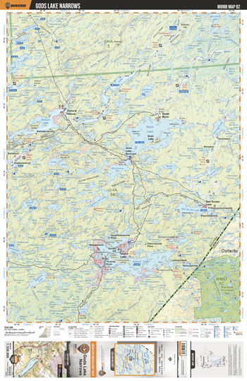
MBMB82 Gods Lake Narrows - Manitoba Backroad Mapbook Topo
This recreation topographic map for Gods Lake Narrows highlights all the logging/resource roads, hunting areas, fishing lakes & streams, campsites, paddling routes for canoeing and kayaking, wildlife viewing areas, multi-use trails for hiking, biking, horseback riding, cross-country skiing and snowshoeing, motorized trails for ATVing and snowmobiling & more. Covering 49,475 km2 (19,100 mi2), this 1:330,000 scale map measures 193 x 256.5 km (120 x 159 mi), providing you with more topographic and recreational detail for the Gods Lake Narrows area than any other map on the market. New features include Crown land areas and labeled fish species, plus countless new trails, roads and recreational Points of Interest. Included on this map are Bigstone Lake, Edmund Lake, Garden Hill, Gods Lake, Gods River, Hays River, Island Lake, Oxford House, Oxford Lake, Red Sucker Lake, Wasachewan Bay, Wasagamack and more!
Page Size: 24 x 37 in (610 x 940 mm)
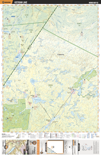
MBMB83 Kistigan Lake - Manitoba Backroad Mapbook Topo
This recreation topographic map for Kistigan Lake highlights all the logging/resource roads, hunting areas, fishing lakes & streams, campsites, paddling routes for canoeing and kayaking, wildlife viewing areas, multi-use trails for hiking, biking, horseback riding, cross-country skiing and snowshoeing, motorized trails for ATVing and snowmobiling & more. Covering 49,475 km2 (19,100 mi2), this 1:330,000 scale map measures 193 x 256.5 km (120 x 159 mi), providing you with more topographic and recreational detail for the Gods Lake Narrows area than any other map on the market. New features include Crown land areas and labeled fish species, plus countless new trails, roads and recreational Points of Interest. Included on this map are Kistigan Lake, Red Sucker River, Gods River, Stull River, Little Skull Lake, Kapaskichipaks River, Red Cross Lake and more!
Page Size: 24 x 37 in (610 x 940 mm)
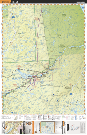
MBMB84 Gillam - Manitoba Backroad Mapbook Topo
This recreation topographic map for Gillam highlights all the logging/resource roads, hunting areas, fishing lakes & streams, campsites, paddling routes for canoeing and kayaking, wildlife viewing areas, multi-use trails for hiking, biking, horseback riding, cross-country skiing and snowshoeing, motorized trails for ATVing and snowmobiling & more. Covering 49,475 km2 (19,100 mi2), this 1:330,000 scale map measures 193 x 256.5 km (120 x 159 mi), providing you with more topographic and recreational detail for the Gods Lake Narrows area than any other map on the market. New features include Crown land areas and labeled fish species, plus countless new trails, roads and recreational Points of Interest. Included on this map are Wapusk National Park, Churchill Wildlife Management Area, Stephens Lake, Nelson River, Gillam, Numaykoos Lake Prov Park, Ilford, Hayes River, Bigstone River, Bragshaw Lake and more!
Page Size: 24 x 37 in (610 x 940 mm)
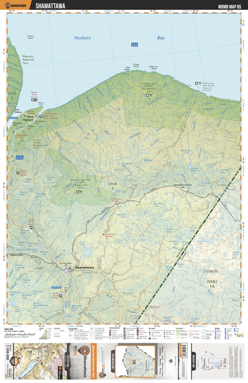
MBMB85 Shamattawa - Manitoba Backroad Mapbook Topo
This recreation topographic map for Shamattawa highlights all the logging/resource roads, hunting areas, fishing lakes & streams, campsites, paddling routes for canoeing and kayaking, wildlife viewing areas, multi-use trails for hiking, biking, horseback riding, cross-country skiing and snowshoeing, motorized trails for ATVing and snowmobiling & more. Covering 49,475 km2 (19,100 mi2), this 1:330,000 scale map measures 193 x 256.5 km (120 x 159 mi), providing you with more topographic and recreational detail for the Gods Lake Narrows area than any other map on the market. New features include Crown land areas and labeled fish species, plus countless new trails, roads and recreational Points of Interest. Included on this map are Hudson Bay, Wapusk National Park, Gods River, Kaskatamagan Sipi Wildlife Management Unit, Cape Tatnam Wildlife Management Area, Churchill Wildlife Management Area, York Factory, Shamattawa, Hayes River, Kaskattama River and more!
Page Size: 24 x 37 in (610 x 940 mm)
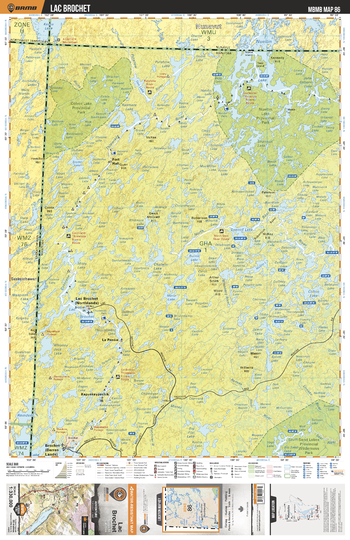
MBMB86 Lac Brochet - Manitoba Backroad Mapbook Topo
This recreation topographic map for Lac Brochet highlights all the logging/resource roads, hunting areas, fishing lakes & streams, campsites, paddling routes for canoeing and kayaking, wildlife viewing areas, multi-use trails for hiking, biking, horseback riding, cross-country skiing and snowshoeing, motorized trails for ATVing and snowmobiling & more. Covering 49,475 km2 (19,100 mi2), this 1:330,000 scale map measures 193 x 256.5 km (120 x 159 mi), providing you with more topographic and recreational detail for the Gods Lake Narrows area than any other map on the market. New features include Crown land areas and labeled fish species, plus countless new trails, roads and recreational Points of Interest. Included on this map are Sand Lakes Prov Park, Lac Brochet, Nueltin Lake, Thlewiaza River, Shannon Lake, North Seal River, Clifton Lake, Maria Lake, Misty Lake, Cochrane River and more!
Page Size: 24 x 37 in (610 x 940 mm)
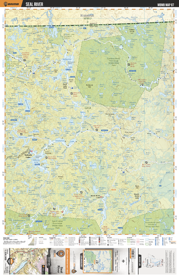
MBMB87 Seal River - Manitoba Backroad Mapbook Topo
This recreation topographic map for Seal River highlights all the logging/resource roads, hunting areas, fishing lakes & streams, campsites, paddling routes for canoeing and kayaking, wildlife viewing areas, multi-use trails for hiking, biking, horseback riding, cross-country skiing and snowshoeing, motorized trails for ATVing and snowmobiling & more. Covering 49,475 km2 (19,100 mi2), this 1:330,000 scale map measures 193 x 256.5 km (120 x 159 mi), providing you with more topographic and recreational detail for the Gods Lake Narrows area than any other map on the market. New features include Crown land areas and labeled fish species, plus countless new trails, roads and recreational Points of Interest. Included on this map are Caribou River Prov Park, Numaykoos Lake Prov Park, Sand Lakes Prov Park, Tadowle Lake, Duck Lake Post, North Knife Lake, South Knife Lake, Seal River, Ashley Lake, Caribou River and more!
Page Size: 24 x 37 in (610 x 940 mm)
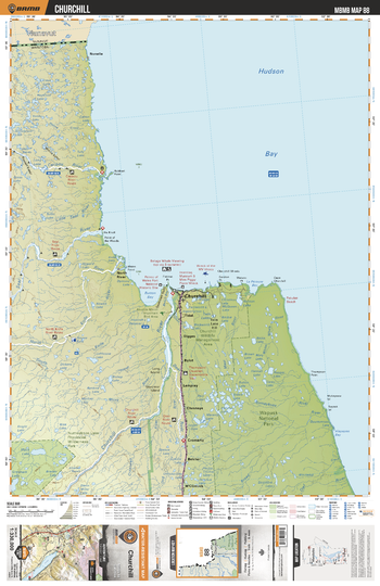
MBMB88 Churchill - Manitoba Backroad Mapbook Topo
This recreation topographic map for Churchill highlights all the logging/resource roads, hunting areas, fishing lakes & streams, campsites, paddling routes for canoeing and kayaking, wildlife viewing areas, multi-use trails for hiking, biking, horseback riding, cross-country skiing and snowshoeing, motorized trails for ATVing and snowmobiling & more. Covering 49,475 km2 (19,100 mi2), this 1:330,000 scale map measures 193 x 256.5 km (120 x 159 mi), providing you with more topographic and recreational detail for the Gods Lake Narrows area than any other map on the market. New features include Crown land areas and labeled fish species, plus countless new trails, roads and recreational Points of Interest. Included on this map are Hudson Bay, Wapusk National Park, Churchill, Numaykoos Lake Prov Park, Churchill River, Button Bay, Caribou River, Seal River, North Knife River, South Knife River and more!
Page Size: 24 x 37 in (610 x 940 mm)
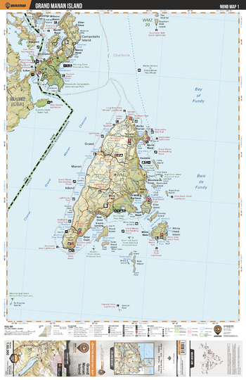
NBNB01 Grand Manan Island - New Brunswick Topo
This recreation topographic map for Grand Manan Island highlights all the logging/resource roads, hunting areas, fishing lakes & streams, campsites, paddling routes for canoeing and kayaking, wildlife viewing areas, multi-use trails for hiking, biking, horseback riding, cross-country skiing and snowshoeing, motorized trails for ATVing and snowmobiling & more. Covering 1,950 km2 (750 mi2), this 1:65,000 scale map measures 38 x 51 km (23.5 x 32 mi), providing you with more topographic and recreational detail for the Grand Manan Island area than any other map on the market. New features include enhanced Crown land data and countless updates to roads, trails and recreational Points of Interest. This map includes the Bay of Fundy, Campobello Island, Deep Cove, Grand Harbour, Grand Manan Channel, Grand Manan Island, North Head, Rocky Corner, Roosevelt Campobello International Park, Ross Island, Seal Cove, The Anchorage Provincial Park, White Head Island, Wood Island and part of the state of Maine, including Quoddy Head State Park.
Page Size: 24 x 37 in (610 x 940 mm)