


Backroad Mapbooks

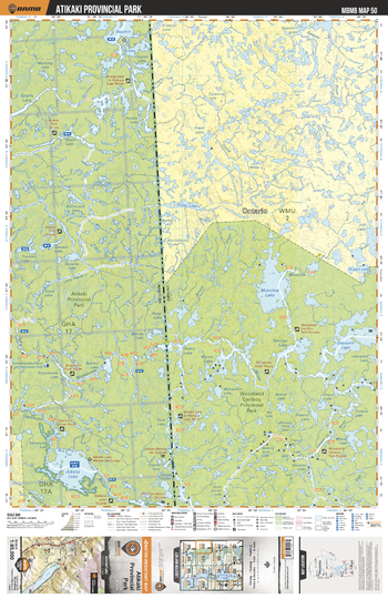
MBMB50 Atikaki Provincial Park - Manitoba Backroad Mapbook Topo
This recreation topographic map for Atikaki Provincial Park highlights all the logging/resource roads, hunting areas, fishing lakes & streams, campsites, paddling routes for canoeing and kayaking, wildlife viewing areas, multi-use trails for hiking, biking, horseback riding, cross-country skiing and snowshoeing, motorized trails for ATVing and snowmobiling & more. Covering 3,040 km2 (1,175 mi2), this 1:85,000 scale map measures 50 x 63.5 km (30 x 39.5 mi), providing you with more topographic and recreational detail for the Melita area than any other map on the market. New features include Crown land areas and labeled fish species, plus countless new trails, roads and recreational Points of Interest. Included in this map are Atikaki Provincial Park, Musclow Lake, Aikens Lake, Bloodvein River, Woodland Caribou Provincial Park, Gammon River and more.
Page Size: 24 x 37 in (610 x 940 mm)
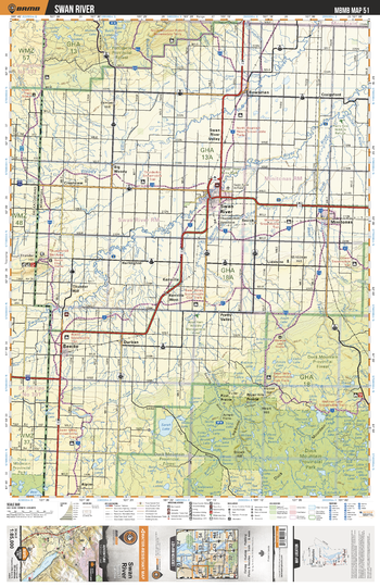
MBMB51 Swan River - Manitoba Backroad Mapbook Topo
This recreation topographic map for Swan River highlights all the logging/resource roads, hunting areas, fishing lakes & streams, campsites, paddling routes for canoeing and kayaking, wildlife viewing areas, multi-use trails for hiking, biking, horseback riding, cross-country skiing and snowshoeing, motorized trails for ATVing and snowmobiling & more. Covering 3,040 km2 (1,175 mi2), this 1:85,000 scale map measures 50 x 63.5 km (30 x 39.5 mi), providing you with more topographic and recreational detail for the Melita area than any other map on the market. New features include Crown land areas and labeled fish species, plus countless new trails, roads and recreational Points of Interest. Included in this map are Duck Mountain Prov Park, Benito, Swan River, Bowsman, Minitonas, Sarah Lake, Woody River, Roaring Rive, Durban, Craigsford and more.
Page Size: 24 x 37 in (610 x 940 mm)
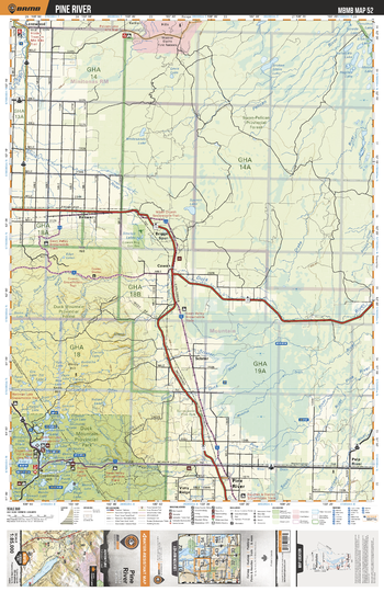
MBMB52 Pine River - Manitoba Backroad Mapbook Topo
This recreation topographic map for Pine River highlights all the logging/resource roads, hunting areas, fishing lakes & streams, campsites, paddling routes for canoeing and kayaking, wildlife viewing areas, multi-use trails for hiking, biking, horseback riding, cross-country skiing and snowshoeing, motorized trails for ATVing and snowmobiling & more. Covering 3,040 km2 (1,175 mi2), this 1:85,000 scale map measures 50 x 63.5 km (30 x 39.5 mi), providing you with more topographic and recreational detail for the Melita area than any other map on the market. New features include Crown land areas and labeled fish species, plus countless new trails, roads and recreational Points of Interest. Included in this map are Duck Mountain Prov Park, Pine River, Briggs Spur, Kettle Hills, Pelican River, Spence Lake, Sinclair River, Duck River, Sclater River, Springwater Prov Park and more.
Page Size: 24 x 37 in (610 x 940 mm)
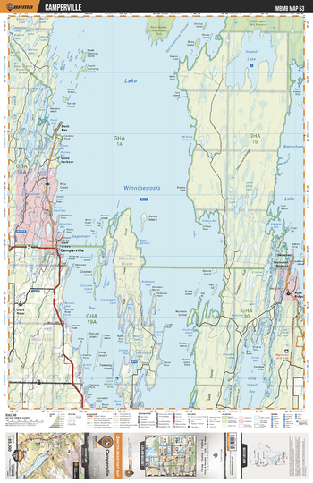
MBMB53 Camperville - Manitoba Backroad Mapbook Topo
This recreation topographic map for Camperville highlights all the logging/resource roads, hunting areas, fishing lakes & streams, campsites, paddling routes for canoeing and kayaking, wildlife viewing areas, multi-use trails for hiking, biking, horseback riding, cross-country skiing and snowshoeing, motorized trails for ATVing and snowmobiling & more. Covering 3,040 km2 (1,175 mi2), this 1:85,000 scale map measures 50 x 63.5 km (30 x 39.5 mi), providing you with more topographic and recreational detail for the Melita area than any other map on the market. New features include Crown land areas and labeled fish species, plus countless new trails, roads and recreational Points of Interest. Included in this map are Waterhen Lake, Lake Winnipegosis, Long Island Bay, Sagemace Bay, Inland Lake, Old Steamboat Channel, Duck Bay, Camperville, Deer Point, Salt Point and more.
Page Size: 24 x 37 in (610 x 940 mm)
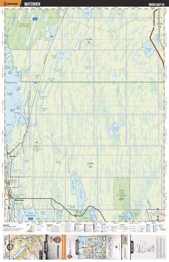
MBMB54 Waterhen - Manitoba Backroad Mapbook Topo
This recreation topographic map for Waterhen highlights all the logging/resource roads, hunting areas, fishing lakes & streams, campsites, paddling routes for canoeing and kayaking, wildlife viewing areas, multi-use trails for hiking, biking, horseback riding, cross-country skiing and snowshoeing, motorized trails for ATVing and snowmobiling & more. Covering 3,040 km2 (1,175 mi2), this 1:85,000 scale map measures 50 x 63.5 km (30 x 39.5 mi), providing you with more topographic and recreational detail for the Melita area than any other map on the market. New features include Crown land areas and labeled fish species, plus countless new trails, roads and recreational Points of Interest. Included in this map are Waterhen Lake, Waterhen, Proulx Lake, Mire Lake, Basket Lake, Rocky Lake, Archies Lake, Chitek Lake Park Reserve, Strong Lake, Mallard and more.
Page Size: 24 x 37 in (610 x 940 mm)
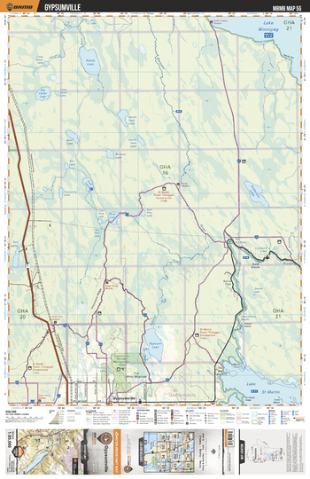
MBMB55 Gypsumville - Manitoba Backroad Mapbook Topo
This recreation topographic map for Gypsumville highlights all the logging/resource roads, hunting areas, fishing lakes & streams, campsites, paddling routes for canoeing and kayaking, wildlife viewing areas, multi-use trails for hiking, biking, horseback riding, cross-country skiing and snowshoeing, motorized trails for ATVing and snowmobiling & more. Covering 3,040 km2 (1,175 mi2), this 1:85,000 scale map measures 50 x 63.5 km (30 x 39.5 mi), providing you with more topographic and recreational detail for the Melita area than any other map on the market. New features include Crown land areas and labeled fish species, plus countless new trails, roads and recreational Points of Interest. Included in this map are Lake St Martin, Lake Winnipeg, Gypsum Lake, Gypsumville, Tan Lake, Pine Lakes, Anderson Lake, Dauphin River, Warpath River, Reedy Lake and more.
Page Size: 24 x 37 in (610 x 940 mm)
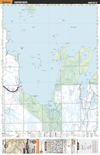
MBMB56 Dauphin River - Manitoba Backroad Mapbook Topo
This recreation topographic map for Dauphin River highlights all the logging/resource roads, hunting areas, fishing lakes & streams, campsites, paddling routes for canoeing and kayaking, wildlife viewing areas, multi-use trails for hiking, biking, horseback riding, cross-country skiing and snowshoeing, motorized trails for ATVing and snowmobiling & more. Covering 3,040 km2 (1,175 mi2), this 1:85,000 scale map measures 50 x 63.5 km (30 x 39.5 mi), providing you with more topographic and recreational detail for the Melita area than any other map on the market. New features include Crown land areas and labeled fish species, plus countless new trails, roads and recreational Points of Interest. Included in this map are Lake Winipeg, Sturgeon Bay, Reindeer Island Eco Reserve, Kinwow Park Reserve, Sturgeon Bay Park Reserve, Lake St Michael, Dauphin River, Kinwow Bay, Brodskys Harbour, McBeth Lake and more.
Page Size: 24 x 37 in (610 x 940 mm)
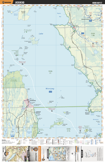
MBMB57 Jackhead - Manitoba Backroad Mapbook Topo
This recreation topographic map for Jackhead highlights all the logging/resource roads, hunting areas, fishing lakes & streams, campsites, paddling routes for canoeing and kayaking, wildlife viewing areas, multi-use trails for hiking, biking, horseback riding, cross-country skiing and snowshoeing, motorized trails for ATVing and snowmobiling & more. Covering 3,040 km2 (1,175 mi2), this 1:85,000 scale map measures 50 x 63.5 km (30 x 39.5 mi), providing you with more topographic and recreational detail for the Melita area than any other map on the market. New features include Crown land areas and labeled fish species, plus countless new trails, roads and recreational Points of Interest. Included in this map are Lake Winnipeg, Pigeon Bay, Pigeon River, Bloodvein Bay, Fisher Bay Park Reserve, Tamarack Island, Jackhead, Kinwow Bay Park Reserve, Barens Island, Commissioner Island and more.
Page Size: 24 x 37 in (610 x 940 mm)
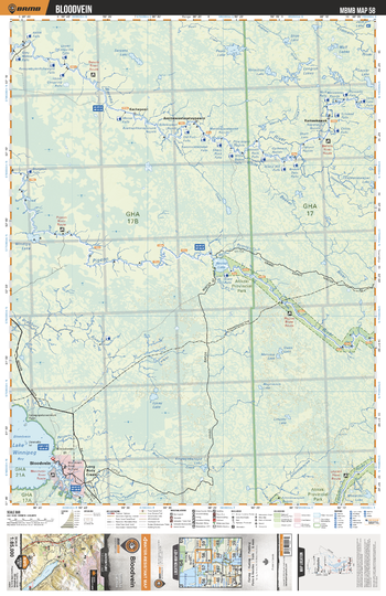
MBMB58 Bloodvein - Manitoba Backroad Mapbook Topo
This recreation topographic map for Bloodvein highlights all the logging/resource roads, hunting areas, fishing lakes & streams, campsites, paddling routes for canoeing and kayaking, wildlife viewing areas, multi-use trails for hiking, biking, horseback riding, cross-country skiing and snowshoeing, motorized trails for ATVing and snowmobiling & more. Covering 3,040 km2 (1,175 mi2), this 1:85,000 scale map measures 50 x 63.5 km (30 x 39.5 mi), providing you with more topographic and recreational detail for the Melita area than any other map on the market. New features include Crown land areas and labeled fish species, plus countless new trails, roads and recreational Points of Interest. Included in this map are Atikaki Prov Park, Pigeon River, Bloodvein, Long Body Creek, Round Lake, Berens River, White Beaver River, Windigo Lake, Lake Winnipeg, Longish Lakes and more.
Page Size: 24 x 37 in (610 x 940 mm)
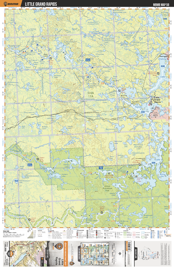
MBMB59 Little Grand Rapids - Manitoba Backroad Mapbook Topo
This recreation topographic map for Little Grand Rapids highlights all the logging/resource roads, hunting areas, fishing lakes & streams, campsites, paddling routes for canoeing and kayaking, wildlife viewing areas, multi-use trails for hiking, biking, horseback riding, cross-country skiing and snowshoeing, motorized trails for ATVing and snowmobiling & more. Covering 3,040 km2 (1,175 mi2), this 1:85,000 scale map measures 50 x 63.5 km (30 x 39.5 mi), providing you with more topographic and recreational detail for the Melita area than any other map on the market. New features include Crown land areas and labeled fish species, plus countless new trails, roads and recreational Points of Interest. Included in this map are Little Grand Rapids, Pigeon River, Leyond River, Fishing Lake, Family Lake, Viking Lake, Vickers Lake, Braybrook Lake and more.
Page Size: 24 x 37 in (610 x 940 mm)
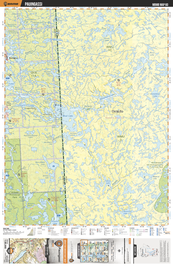
MBMB60 Pauingassi - Manitoba Backroad Mapbook Topo
This recreation topographic map for Pauingassi highlights all the logging/resource roads, hunting areas, fishing lakes & streams, campsites, paddling routes for canoeing and kayaking, wildlife viewing areas, multi-use trails for hiking, biking, horseback riding, cross-country skiing and snowshoeing, motorized trails for ATVing and snowmobiling & more. Covering 3,040 km2 (1,175 mi2), this 1:85,000 scale map measures 50 x 63.5 km (30 x 39.5 mi), providing you with more topographic and recreational detail for the Melita area than any other map on the market. New features include Crown land areas and labeled fish species, plus countless new trails, roads and recreational Points of Interest. Included in this map are Pauingassi, Atikaki Provincial Park, Dogskin Lake, Moar Lake, Dogskin River, White Eye Lake, Berens River and more.
Page Size: 24 x 37 in (610 x 940 mm)
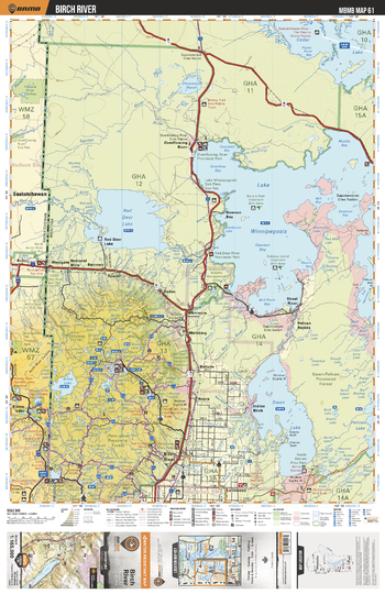
MBMB61 Birch River - Manitoba Backroad Mapbook Topo
This recreation topographic map for Birch River highlights all the logging/resource roads, hunting areas, fishing lakes & streams, campsites, paddling routes for canoeing and kayaking, wildlife viewing areas, multi-use trails for hiking, biking, horseback riding, cross-country skiing and snowshoeing, motorized trails for ATVing and snowmobiling & more. Covering 12,370 km2 (4,775 mi2), this 1:165,000 scale map measures 96.5 x 128 km (60 x 79.5 mi), providing you with more topographic and recreational detail for the Birch River area than any other map on the market. New features include Crown land areas and labeled fish species, plus countless new trails, roads and recreational Points of Interest. Included on this map are Baden, Bell Lake Provincial Park, Bellsite, Birch River, Cedar Lake, Dawson Bay, Indian Birch, Kettle Stones Provincial Park, Lake Winnipegosis, Lenswood, Mafeking, North Steeprock Lake Provincial Park, Overflowing River, Pelican Rapids, Porcupine Provincial Forest, Red Deer Lake, Shoal River, Swan Lake, Whitefish Lake Provincial Park, Whitmore and more!
Page Size: 24 x 37 in (610 x 940 mm)
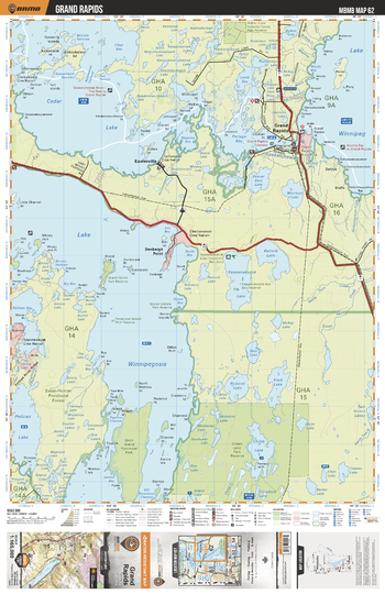
MBMB62 Grand Rapids - Manitoba Backroad Mapbook Topo
This recreation topographic map for Grand Rapids highlights all the logging/resource roads, hunting areas, fishing lakes & streams, campsites, paddling routes for canoeing and kayaking, wildlife viewing areas, multi-use trails for hiking, biking, horseback riding, cross-country skiing and snowshoeing, motorized trails for ATVing and snowmobiling & more. Covering 12,370 km2 (4,775 mi2), this 1:165,000 scale map measures 96.5 x 128 km (60 x 79.5 mi), providing you with more topographic and recreational detail for the Birch River area than any other map on the market. New features include Crown land areas and labeled fish species, plus countless new trails, roads and recreational Points of Interest. Included on this map are Lake Winnipeg, Cedar Lake, Lake Winnipegosis, Birch Island Park Reserve, Chitek Lake Park Reserve, Grand Rapids, Pelican Lake, Denbeigh Point, Easterville, Hybord and more!
Page Size: 24 x 37 in (610 x 940 mm)
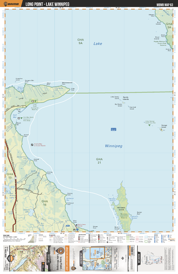
MBMB63 Lake Winnipeg - Manitoba Backroad Mapbook Topo
This recreation topographic map for Lake Winnipeg highlights all the logging/resource roads, hunting areas, fishing lakes & streams, campsites, paddling routes for canoeing and kayaking, wildlife viewing areas, multi-use trails for hiking, biking, horseback riding, cross-country skiing and snowshoeing, motorized trails for ATVing and snowmobiling & more. Covering 12,370 km2 (4,775 mi2), this 1:165,000 scale map measures 96.5 x 128 km (60 x 79.5 mi), providing you with more topographic and recreational detail for the Birch River area than any other map on the market. New features include Crown land areas and labeled fish species, plus countless new trails, roads and recreational Points of Interest. Included on this map are Lake Winnipeg, Long Point Eco Reserve, Poplar/Nanowin Rivers Park Reserve, Reindeer Island Eco Reserve, Goose Lake, Two Rivers Lakes, Sandy Islands, George Island, and more!
Page Size: 24 x 37 in (610 x 940 mm)
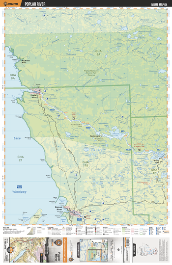
MBMB64 Poplar River - Manitoba Backroad Mapbook Topo
This recreation topographic map for Poplar River highlights all the logging/resource roads, hunting areas, fishing lakes & streams, campsites, paddling routes for canoeing and kayaking, wildlife viewing areas, multi-use trails for hiking, biking, horseback riding, cross-country skiing and snowshoeing, motorized trails for ATVing and snowmobiling & more. Covering 12,370 km2 (4,775 mi2), this 1:165,000 scale map measures 96.5 x 128 km (60 x 79.5 mi), providing you with more topographic and recreational detail for the Birch River area than any other map on the market. New features include Crown land areas and labeled fish species, plus countless new trails, roads and recreational Points of Interest. Included on this map are Poplar/Nanowin Rivers Park Reserve, Lake Winnipeg, Opekamank, Wrong Lake, Berens River, Poplar River, Big Black River, Weaver Lake, Etomami River, Nanowin River and more!
Page Size: 24 x 37 in (610 x 940 mm)
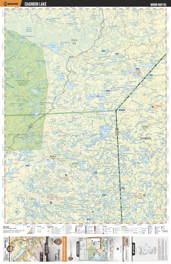
MBMB65 Charron Lake - Manitoba Backroad Mapbook Topo
This recreation topographic map for Charron Lake highlights all the logging/resource roads, hunting areas, fishing lakes & streams, campsites, paddling routes for canoeing and kayaking, wildlife viewing areas, multi-use trails for hiking, biking, horseback riding, cross-country skiing and snowshoeing, motorized trails for ATVing and snowmobiling & more. Covering 12,370 km2 (4,775 mi2), this 1:165,000 scale map measures 96.5 x 128 km (60 x 79.5 mi), providing you with more topographic and recreational detail for the Birch River area than any other map on the market. New features include Crown land areas and labeled fish species, plus countless new trails, roads and recreational Points of Interest. Included on this map are Poplar/Nanowin Rivers Park Reserve, Matawa Place, Charron Lake, Assinika River, Eardley Lake, Harrop Lake, Poplar River, Elliot Lake, Lily Pad Lake, Hudwin Lake and more!
Page Size: 24 x 37 in (610 x 940 mm)
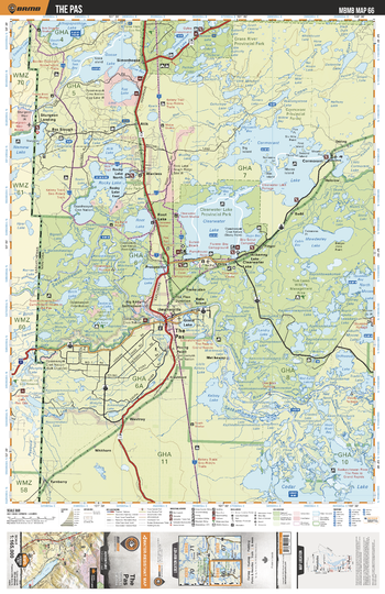
MBMB66 The Pas - Manitoba Backroad Mapbook Topo
This recreation topographic map for The Pas highlights all the logging/resource roads, hunting areas, fishing lakes & streams, campsites, paddling routes for canoeing and kayaking, wildlife viewing areas, multi-use trails for hiking, biking, horseback riding, cross-country skiing and snowshoeing, motorized trails for ATVing and snowmobiling & more. Covering 12,370 km2 (4,775 mi2), this 1:165,000 scale map measures 96.5 x 128 km (60 x 79.5 mi), providing you with more topographic and recreational detail for the Birch River area than any other map on the market. New features include Crown land areas and labeled fish species, plus countless new trails, roads and recreational Points of Interest. Included on this map are Clearwater Lake Prov Park, Cormorant Lake, The Pas, Kelsey Lake, Goose Lake, Rocky Lake, Namew Lake, Mawdesley Lake, Simonhouse Lake, Grass River Prov Park and more!
Page Size: 24 x 37 in (610 x 940 mm)
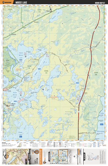
MBMB67 Moose Lake - Manitoba Backroad Mapbook Topo
This recreation topographic map for Moose Lake highlights all the logging/resource roads, hunting areas, fishing lakes & streams, campsites, paddling routes for canoeing and kayaking, wildlife viewing areas, multi-use trails for hiking, biking, horseback riding, cross-country skiing and snowshoeing, motorized trails for ATVing and snowmobiling & more. Covering 12,370 km2 (4,775 mi2), this 1:165,000 scale map measures 96.5 x 128 km (60 x 79.5 mi), providing you with more topographic and recreational detail for the Birch River area than any other map on the market. New features include Crown land areas and labeled fish species, plus countless new trails, roads and recreational Points of Interest. Included on this map are North Moose Lake, South Moose Lake, Cedar Lake, Talbot Lake, William Lake, Little Limestone Lake Park Reserve, Hargrave Lake, McClarty Lake, Moose Lake, Davidson Lake and more!
Page Size: 24 x 37 in (610 x 940 mm)
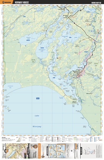
MBMB68 Norway House - Manitoba Backroad Mapbook Topo
This recreation topographic map for Norway House highlights all the logging/resource roads, hunting areas, fishing lakes & streams, campsites, paddling routes for canoeing and kayaking, wildlife viewing areas, multi-use trails for hiking, biking, horseback riding, cross-country skiing and snowshoeing, motorized trails for ATVing and snowmobiling & more. Covering 12,370 km2 (4,775 mi2), this 1:165,000 scale map measures 96.5 x 128 km (60 x 79.5 mi), providing you with more topographic and recreational detail for the Birch River area than any other map on the market. New features include Crown land areas and labeled fish species, plus countless new trails, roads and recreational Points of Interest. Included on this map are Lake Winnipeg, Playgreen Lake, Nelson River, Kiskittogisu Lake, Kiskitto Lake, Whiskey Jack Landing, Minago River, Limestone Bay, Norway House, Little Playgreen Lake and more!
Page Size: 24 x 37 in (610 x 940 mm)
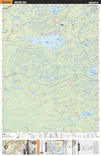
MBMB69 Molson Lake - Manitoba Backroad Mapbook Topo
This recreation topographic map for Molson Lake highlights all the logging/resource roads, hunting areas, fishing lakes & streams, campsites, paddling routes for canoeing and kayaking, wildlife viewing areas, multi-use trails for hiking, biking, horseback riding, cross-country skiing and snowshoeing, motorized trails for ATVing and snowmobiling & more. Covering 12,370 km2 (4,775 mi2), this 1:165,000 scale map measures 96.5 x 128 km (60 x 79.5 mi), providing you with more topographic and recreational detail for the Birch River area than any other map on the market. New features include Crown land areas and labeled fish species, plus countless new trails, roads and recreational Points of Interest. Included on this map are Molon Lake, Stevenson Lake, Gunisao, Butterfly Lake, Lawford Lake, Robinson Lake, Hayes River, Logan Lake, Ponask Lake, Gunisao River and more!
Page Size: 24 x 37 in (610 x 940 mm)