


Backroad Mapbooks

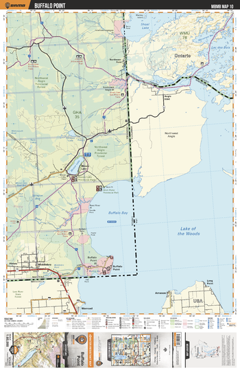
MBMB10 Buffalo Point - Manitoba Backroad Mapbook Topo
This recreation topographic map for Buffalo Point highlights all the logging/resource roads, hunting areas, fishing lakes & streams, campsites, paddling routes for canoeing and kayaking, wildlife viewing areas, multi-use trails for hiking, biking, horseback riding, cross-country skiing and snowshoeing, motorized trails for ATVing and snowmobiling & more. Covering 3,040 km2 (1,175 mi2), this 1:85,000 scale map measures 50 x 63.5 km (30 x 39.5 mi), providing you with more topographic and recreational detail for the Melita area than any other map on the market. New features include Crown land areas and labeled fish species, plus countless new trails, roads and recreational Points of Interest. Included in this map are Buffalo Bay, Buffalo Point, Middlebro, Moose Lake, Northwest Point, Sandilands Prov Forest, Reed River, Sprague Bog, Birch Point Prov Park, Sprague Lake and more.
Page Size: 24 x 37 in (610 x 940 mm)
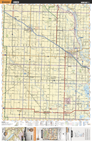
MBMB11 Virden - Manitoba Backroad Mapbook Topo
This recreation topographic map for Virden highlights all the logging/resource roads, hunting areas, fishing lakes & streams, campsites, paddling routes for canoeing and kayaking, wildlife viewing areas, multi-use trails for hiking, biking, horseback riding, cross-country skiing and snowshoeing, motorized trails for ATVing and snowmobiling & more. Covering 3,040 km2 (1,175 mi2), this 1:85,000 scale map measures 50 x 63.5 km (30 x 39.5 mi), providing you with more topographic and recreational detail for the Melita area than any other map on the market. New features include Crown land areas and labeled fish species, plus countless new trails, roads and recreational Points of Interest. Included in this map are Virden, Pipestone, Reston, Elkhorn, Kirkella, Assiniboine River, Pipestone Creek, Oak Lake Reserve, Routledge, Two Creeks and more.
Page Size: 24 x 37 in (610 x 940 mm)
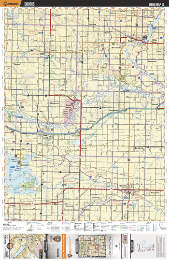
MBMB12 Souris - Manitoba Backroad Mapbook Topo
This recreation topographic map for Souris highlights all the logging/resource roads, hunting areas, fishing lakes & streams, campsites, paddling routes for canoeing and kayaking, wildlife viewing areas, multi-use trails for hiking, biking, horseback riding, cross-country skiing and snowshoeing, motorized trails for ATVing and snowmobiling & more. Covering 3,040 km2 (1,175 mi2), this 1:85,000 scale map measures 50 x 63.5 km (30 x 39.5 mi), providing you with more topographic and recreational detail for the Melita area than any other map on the market. New features include Crown land areas and labeled fish species, plus countless new trails, roads and recreational Points of Interest. Included in this map are Souris, Rivers, Wheatland, Oak Lake, Denbow, Sioux Valley, Lake Wahtopanah, Little Saskatchewan River, Assiniboine River, Souris River and more.
Page Size: 24 x 37 in (610 x 940 mm)
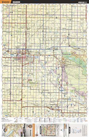
MBMB13 Brandon - Manitoba Backroad Mapbook Topo
This recreation topographic map for Brandon highlights all the logging/resource roads, hunting areas, fishing lakes & streams, campsites, paddling routes for canoeing and kayaking, wildlife viewing areas, multi-use trails for hiking, biking, horseback riding, cross-country skiing and snowshoeing, motorized trails for ATVing and snowmobiling & more. Covering 3,040 km2 (1,175 mi2), this 1:85,000 scale map measures 50 x 63.5 km (30 x 39.5 mi), providing you with more topographic and recreational detail for the Melita area than any other map on the market. New features include Crown land areas and labeled fish species, plus countless new trails, roads and recreational Points of Interest. Included in this map are Shilo, Douglas Marsh, Brandon, Brandon Hills, Grand Valley Prov Park, Assiniboine River, Souris River, Wawanesa, Little Souris River and more.
Page Size: 24 x 37 in (610 x 940 mm)
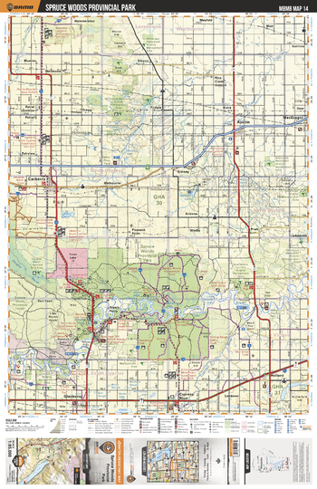
MBMB14 Spruce Woods Provincial Park - Manitoba Backroad Mapbook Topo
This recreation topographic map for Spruce Woods Provincial Park highlights all the logging/resource roads, hunting areas, fishing lakes & streams, campsites, paddling routes for canoeing and kayaking, wildlife viewing areas, multi-use trails for hiking, biking, horseback riding, cross-country skiing and snowshoeing, motorized trails for ATVing and snowmobiling & more. Covering 3,040 km2 (1,175 mi2), this 1:85,000 scale map measures 50 x 63.5 km (30 x 39.5 mi), providing you with more topographic and recreational detail for the Melita area than any other map on the market. New features include Crown land areas and labeled fish species, plus countless new trails, roads and recreational Points of Interest. Included in this map are Spruce Woods Prov Park, Assiniboine River, Sidney, Steels Ferry, Cypress River, Whitemud Watershed Wildlife Management Area, Pine Creek, Carberry, Austin, MacGregor and more.
Page Size: 24 x 37 in (610 x 940 mm)
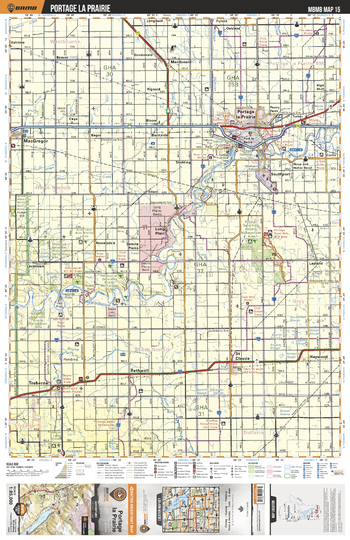
MBMB15 Portage la Prairie - Manitoba Backroad Mapbook Topo
This recreation topographic map for Portage la Prairie highlights all the logging/resource roads, hunting areas, fishing lakes & streams, campsites, paddling routes for canoeing and kayaking, wildlife viewing areas, multi-use trails for hiking, biking, horseback riding, cross-country skiing and snowshoeing, motorized trails for ATVing and snowmobiling & more. Covering 3,040 km2 (1,175 mi2), this 1:85,000 scale map measures 50 x 63.5 km (30 x 39.5 mi), providing you with more topographic and recreational detail for the Melita area than any other map on the market. New features include Crown land areas and labeled fish species, plus countless new trails, roads and recreational Points of Interest. Included in this map are Portage la Prairie, Dakota Plains, MacGregor, Haywood, Rathwell, Trehern, Portage Sandhills Wildlife Management Area, Assiniboine River, St Claude, Boyne River and more.
Page Size: 24 x 37 in (610 x 940 mm)
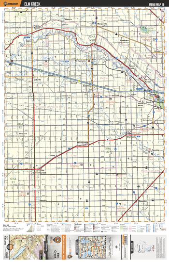
MBMB16 Elm Creek - Manitoba Backroad Mapbook Topo
This recreation topographic map for Elm Creek highlights all the logging/resource roads, hunting areas, fishing lakes & streams, campsites, paddling routes for canoeing and kayaking, wildlife viewing areas, multi-use trails for hiking, biking, horseback riding, cross-country skiing and snowshoeing, motorized trails for ATVing and snowmobiling & more. Covering 3,040 km2 (1,175 mi2), this 1:85,000 scale map measures 50 x 63.5 km (30 x 39.5 mi), providing you with more topographic and recreational detail for the Melita area than any other map on the market. New features include Crown land areas and labeled fish species, plus countless new trails, roads and recreational Points of Interest. Included in this map are Assiniboine River, Beaudry, St Eustache, Grant's Lake Wildlife Management Area, Elm Creek, La Salle River, Oakville, Fannystelle, Starbuck, Springstein and more.
Page Size: 24 x 37 in (610 x 940 mm)
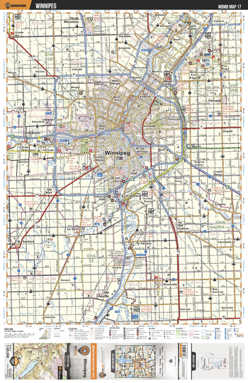
MBMB17 Winnipeg - Manitoba Backroad Mapbook Topo
This recreation topographic map for Winnipeg highlights all the logging/resource roads, hunting areas, fishing lakes & streams, campsites, paddling routes for canoeing and kayaking, wildlife viewing areas, multi-use trails for hiking, biking, horseback riding, cross-country skiing and snowshoeing, motorized trails for ATVing and snowmobiling & more. Covering 3,040 km2 (1,175 mi2), this 1:85,000 scale map measures 50 x 63.5 km (30 x 39.5 mi), providing you with more topographic and recreational detail for the Melita area than any other map on the market. New features include Crown land areas and labeled fish species, plus countless new trails, roads and recreational Points of Interest. Included in this map are Winnipeg, Assiniboine River, Ste Agathe, Stony Mountain, Bird Hills Prov Park, Oakbank, Red River, Lorette, Sanford, Niverville and more.
Page Size: 24 x 37 in (610 x 940 mm)
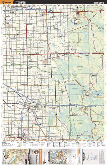
MBMB18 Steinbach - Manitoba Backroad Mapbook Topo
This recreation topographic map for Steinbach highlights all the logging/resource roads, hunting areas, fishing lakes & streams, campsites, paddling routes for canoeing and kayaking, wildlife viewing areas, multi-use trails for hiking, biking, horseback riding, cross-country skiing and snowshoeing, motorized trails for ATVing and snowmobiling & more. Covering 3,040 km2 (1,175 mi2), this 1:85,000 scale map measures 50 x 63.5 km (30 x 39.5 mi), providing you with more topographic and recreational detail for the Melita area than any other map on the market. New features include Crown land areas and labeled fish species, plus countless new trails, roads and recreational Points of Interest. Included in this map are Agassiz Prov Forest, Sandilands Prov Forest, Brokenhead Swamp, Reynolds Ponds, Blumenort, Steinbach, Beausejour, Garson Quarry, Brokenhead River, Ste Anne and more.
Page Size: 24 x 37 in (610 x 940 mm)
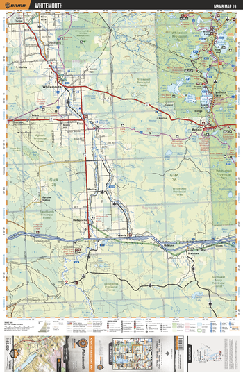
MBMB19 Whitemouth - Manitoba Backroad Mapbook Topo
This recreation topographic map for Whitemouth highlights all the logging/resource roads, hunting areas, fishing lakes & streams, campsites, paddling routes for canoeing and kayaking, wildlife viewing areas, multi-use trails for hiking, biking, horseback riding, cross-country skiing and snowshoeing, motorized trails for ATVing and snowmobiling & more. Covering 3,040 km2 (1,175 mi2), this 1:85,000 scale map measures 50 x 63.5 km (30 x 39.5 mi), providing you with more topographic and recreational detail for the Melita area than any other map on the market. New features include Crown land areas and labeled fish species, plus countless new trails, roads and recreational Points of Interest. Included in this map are Whiteshell Prov Park, Brereton Lake, Jessica Lake, White Lake, Red Rock Lake, Whitemouth, East Braintree, Birch River, Whitemouth River, Oldenberg and more.
Page Size: 24 x 37 in (610 x 940 mm)
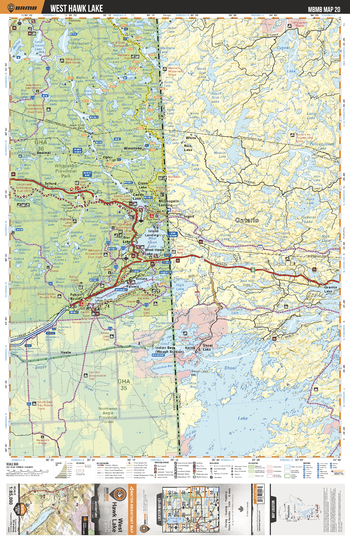
MBMB20 West Hawk Lake - Manitoba Backroad Mapbook Topo
This recreation topographic map for West Hawk Lake highlights all the logging/resource roads, hunting areas, fishing lakes & streams, campsites, paddling routes for canoeing and kayaking, wildlife viewing areas, multi-use trails for hiking, biking, horseback riding, cross-country skiing and snowshoeing, motorized trails for ATVing and snowmobiling & more. Covering 3,040 km2 (1,175 mi2), this 1:85,000 scale map measures 50 x 63.5 km (30 x 39.5 mi), providing you with more topographic and recreational detail for the Melita area than any other map on the market. New features include Crown land areas and labeled fish species, plus countless new trails, roads and recreational Points of Interest. Included in this map are Whiteshell Prov Park, West Hawk Lake, Falcon Lake, Whtieshell Game Bird Refuge, Caddy Lake, Star Lake, Lone Island Lake, Whiteshell River, Rennie River, Falcon River and more.
Page Size: 24 x 37 in (610 x 940 mm)
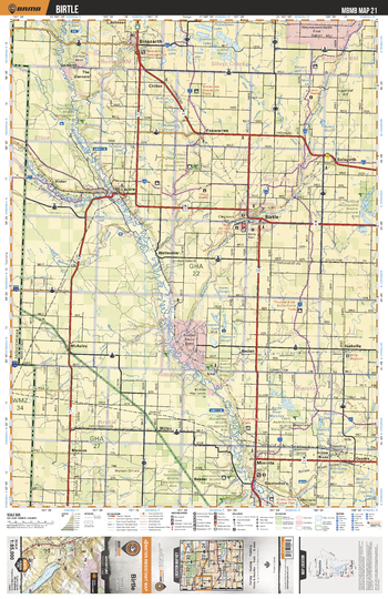
MBMB21 Birtle - Manitoba Backroad Mapbook Topo
This recreation topographic map for Birtle highlights all the logging/resource roads, hunting areas, fishing lakes & streams, campsites, paddling routes for canoeing and kayaking, wildlife viewing areas, multi-use trails for hiking, biking, horseback riding, cross-country skiing and snowshoeing, motorized trails for ATVing and snowmobiling & more. Covering 3,040 km2 (1,175 mi2), this 1:85,000 scale map measures 50 x 63.5 km (30 x 39.5 mi), providing you with more topographic and recreational detail for the Melita area than any other map on the market. New features include Crown land areas and labeled fish species, plus countless new trails, roads and recreational Points of Interest. Included in this map are Birtle, Foxwarren, Binscarth, Miniota, Birdtail Creek, Assiniboine River, Arrow River Marshes, Qu'Appelle River, Solsgirth, McAuley and more.
Page Size: 24 x 37 in (610 x 940 mm)
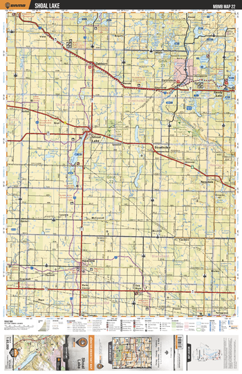
MBMB22 Shoal Lake - Manitoba Backroad Mapbook Topo
This recreation topographic map for Shoal Lake highlights all the logging/resource roads, hunting areas, fishing lakes & streams, campsites, paddling routes for canoeing and kayaking, wildlife viewing areas, multi-use trails for hiking, biking, horseback riding, cross-country skiing and snowshoeing, motorized trails for ATVing and snowmobiling & more. Covering 3,040 km2 (1,175 mi2), this 1:85,000 scale map measures 50 x 63.5 km (30 x 39.5 mi), providing you with more topographic and recreational detail for the Melita area than any other map on the market. New features include Crown land areas and labeled fish species, plus countless new trails, roads and recreational Points of Interest. Included in this map are Oakburn, Shoal Lake, Strathclair, Newdale, Hamiota, North Salt Lake, North Thomas Lake, Sandy Lake, Little Saskatchewan River, Oak River and more.
Page Size: 24 x 37 in (610 x 940 mm)
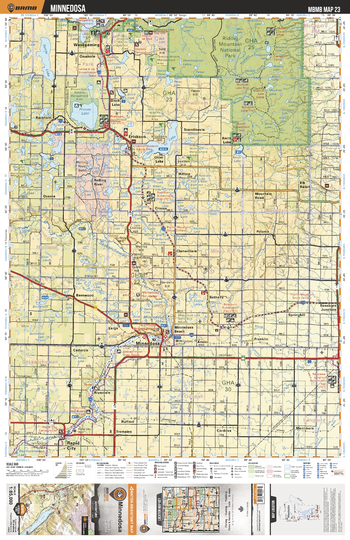
MBMB23 Minnedosa - Manitoba Backroad Mapbook Topo
This recreation topographic map for Minnedosa highlights all the logging/resource roads, hunting areas, fishing lakes & streams, campsites, paddling routes for canoeing and kayaking, wildlife viewing areas, multi-use trails for hiking, biking, horseback riding, cross-country skiing and snowshoeing, motorized trails for ATVing and snowmobiling & more. Covering 3,040 km2 (1,175 mi2), this 1:85,000 scale map measures 50 x 63.5 km (30 x 39.5 mi), providing you with more topographic and recreational detail for the Melita area than any other map on the market. New features include Crown land areas and labeled fish species, plus countless new trails, roads and recreational Points of Interest. Included in this map are Riding Mountain National Park, Proven Lake, Otter Lake, Wasagaming, Minnedosa, Rapid City, Kerrs Lake, Bottle Lake, Rolling River, Little Saskatchewan River and more.
Page Size: 24 x 37 in (610 x 940 mm)
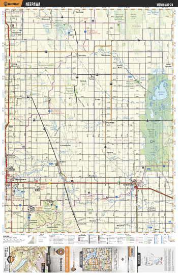
MBMB24 Neepawa - Manitoba Backroad Mapbook Topo
This recreation topographic map for Neepawa highlights all the logging/resource roads, hunting areas, fishing lakes & streams, campsites, paddling routes for canoeing and kayaking, wildlife viewing areas, multi-use trails for hiking, biking, horseback riding, cross-country skiing and snowshoeing, motorized trails for ATVing and snowmobiling & more. Covering 3,040 km2 (1,175 mi2), this 1:85,000 scale map measures 50 x 63.5 km (30 x 39.5 mi), providing you with more topographic and recreational detail for the Melita area than any other map on the market. New features include Crown land areas and labeled fish species, plus countless new trails, roads and recreational Points of Interest. Included in this map are Jackfish Lake, Big Grass Marsh Game Bird Refuge, Gladstone, Neepawa, Whitemud River, Carberry Junction, Lake Irwin, Riding Mountain, Big Grass River, Plumas and more.
Page Size: 24 x 37 in (610 x 940 mm)
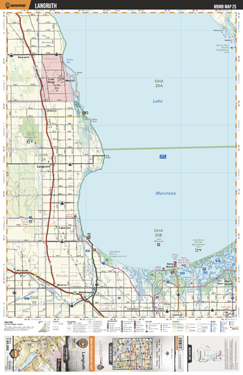
MBMB25 Langruth - Manitoba Backroad Mapbook Topo
This recreation topographic map for Langruth highlights all the logging/resource roads, hunting areas, fishing lakes & streams, campsites, paddling routes for canoeing and kayaking, wildlife viewing areas, multi-use trails for hiking, biking, horseback riding, cross-country skiing and snowshoeing, motorized trails for ATVing and snowmobiling & more. Covering 3,040 km2 (1,175 mi2), this 1:85,000 scale map measures 50 x 63.5 km (30 x 39.5 mi), providing you with more topographic and recreational detail for the Melita area than any other map on the market. New features include Crown land areas and labeled fish species, plus countless new trails, roads and recreational Points of Interest. Included in this map are Lake Manitoba, Langruth, Westbourne, Delta Beach, Whitemud River, Delta Marsh, Marius, Little Ridge, Lakeland, Simpson Bay and more.
Page Size: 24 x 37 in (610 x 940 mm)
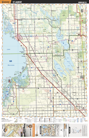
MBMB26 St Laurent - Manitoba Backroad Mapbook Topo
This recreation topographic map for St Laurent highlights all the logging/resource roads, hunting areas, fishing lakes & streams, campsites, paddling routes for canoeing and kayaking, wildlife viewing areas, multi-use trails for hiking, biking, horseback riding, cross-country skiing and snowshoeing, motorized trails for ATVing and snowmobiling & more. Covering 3,040 km2 (1,175 mi2), this 1:85,000 scale map measures 50 x 63.5 km (30 x 39.5 mi), providing you with more topographic and recreational detail for the Melita area than any other map on the market. New features include Crown land areas and labeled fish species, plus countless new trails, roads and recreational Points of Interest. Included in this map are Lake Manitoba, North Shoal Lake, East Shoal Lake, West Shoal Lake, St Laurent, Lindale Lake, Goulet Lakes, Lake Francis, St Ambroise, Warren and more.
Page Size: 24 x 37 in (610 x 940 mm)
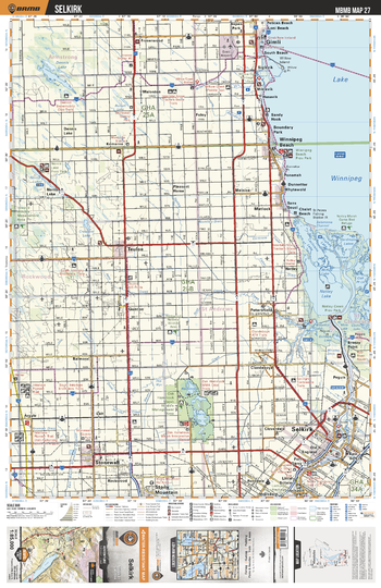
MBMB27 Selkirk - Manitoba Backroad Mapbook Topo
This recreation topographic map for Selkirk highlights all the logging/resource roads, hunting areas, fishing lakes & streams, campsites, paddling routes for canoeing and kayaking, wildlife viewing areas, multi-use trails for hiking, biking, horseback riding, cross-country skiing and snowshoeing, motorized trails for ATVing and snowmobiling & more. Covering 3,040 km2 (1,175 mi2), this 1:85,000 scale map measures 50 x 63.5 km (30 x 39.5 mi), providing you with more topographic and recreational detail for the Melita area than any other map on the market. New features include Crown land areas and labeled fish species, plus countless new trails, roads and recreational Points of Interest. Included in this map are Lake Winnipeg, Hammock Marsh, Selkirk, Netley Lake, Winnipeg Beach, Gimli, Dennis Lake, Teulon, Sonewall, Stony Mountain and more.
Page Size: 24 x 37 in (610 x 940 mm)
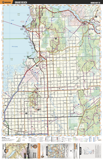
MBMB28 Grand Beach - Manitoba Backroad Mapbook Topo
This recreation topographic map for Grand Beach highlights all the logging/resource roads, hunting areas, fishing lakes & streams, campsites, paddling routes for canoeing and kayaking, wildlife viewing areas, multi-use trails for hiking, biking, horseback riding, cross-country skiing and snowshoeing, motorized trails for ATVing and snowmobiling & more. Covering 3,040 km2 (1,175 mi2), this 1:85,000 scale map measures 50 x 63.5 km (30 x 39.5 mi), providing you with more topographic and recreational detail for the Melita area than any other map on the market. New features include Crown land areas and labeled fish species, plus countless new trails, roads and recreational Points of Interest. Included in this map are Lake Winnipeg, Traverse Bay, Winnipeg River, Brokenhead River, Milner Ridge, Grand Beach, Thalberg, Brightstone Sand Hills, Pine Falls, Mars Hill Wildlife Management Area and more.
Page Size: 24 x 37 in (610 x 940 mm)
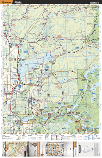
MBMB29 Pinawa - Manitoba Backroad Mapbook Topo
This recreation topographic map for Pinawa highlights all the logging/resource roads, hunting areas, fishing lakes & streams, campsites, paddling routes for canoeing and kayaking, wildlife viewing areas, multi-use trails for hiking, biking, horseback riding, cross-country skiing and snowshoeing, motorized trails for ATVing and snowmobiling & more. Covering 3,040 km2 (1,175 mi2), this 1:85,000 scale map measures 50 x 63.5 km (30 x 39.5 mi), providing you with more topographic and recreational detail for the Melita area than any other map on the market. New features include Crown land areas and labeled fish species, plus countless new trails, roads and recreational Points of Interest. Included in this map are Lac du Bonnet, Natalie Lake, Pinawa, Dorothy Lake, Whiteshell river, Heart Lake, Whiteshell Prov Park, Nopiming Prov Park, Silver Falls, George Lake and more.
Page Size: 24 x 37 in (610 x 940 mm)