top of page
VIBC63 Ha-Iltzuk Icefield - Vancouver Island BC Topo
Backroad Mapbooks
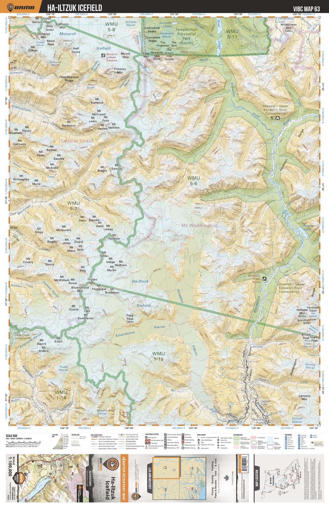
This recreation topographic map for Ha-Iltzuk Icefield highlights all the logging roads, trails and recreational Points of Interest including hunting, camping, hiking, mountain biking, canoeing, kayaking, backcountry skiing, wildlife viewing, ATVing, snowmobiling and more. No other map for the area provides you with this level of recreational or topographic detail. Covering 4,315 km2 (1,665 mi2) in total, 1:100,000 scale map measures 57 x 75 km (35 x 46.5 mi) and covers Monarch Icefield, Silverthrone Glacier, Klinaklini Glacier, Kingcome Glacier, Fang Peak, Pashleth Glacier, Lomolo Glacier and more!
Page Size: 24 x 37 in (610 x 940 mm)
Buy this map on MapTrove.ca
bottom of page