VIBC58 Broughton Island - Vancouver Island BC Topo
Backroad Mapbooks
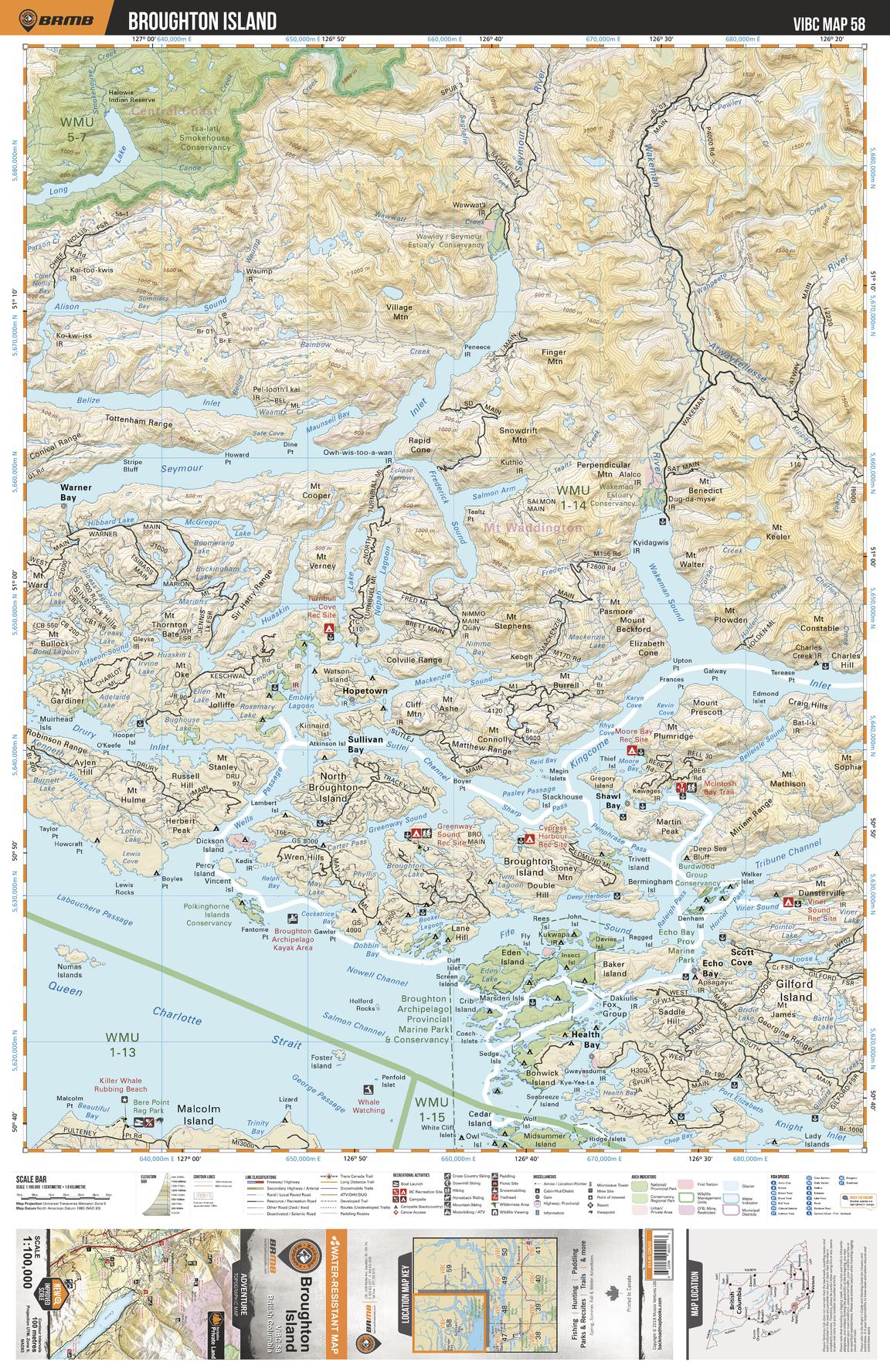
This recreation topographic map for Broughton Island highlights all the logging roads, trails and recreational Points of Interest including hunting, camping, hiking, mountain biking, canoeing, kayaking, backcountry skiing, wildlife viewing, ATVing, snowmobiling and more. No other map provides you with this level of recreational and topographic detail for the Broughton Island area. Covering 4,315 km2 (1,665 mi2) in total, 1:100,000 scale map measures 57 x 75 km (35 x 46.5 mi) and covers Broughton Archipelago Provincial Marine Park, Drury Inlet, Echo Bay, Health Bay, Hopetown, Kingcome Inlet, Polkinghorne Island Conservancy, Queen Charlotte Strait, Seymour Inlet, Warner Bay, Wakeman Sound and more!
Page Size: 24 x 37 in (610 x 940 mm)
Buy this map on MapTrove.ca