top of page
VCBC42 Birkenhead Lake - Vancouver Coast & Mountains BC Topo
Backroad Mapbooks
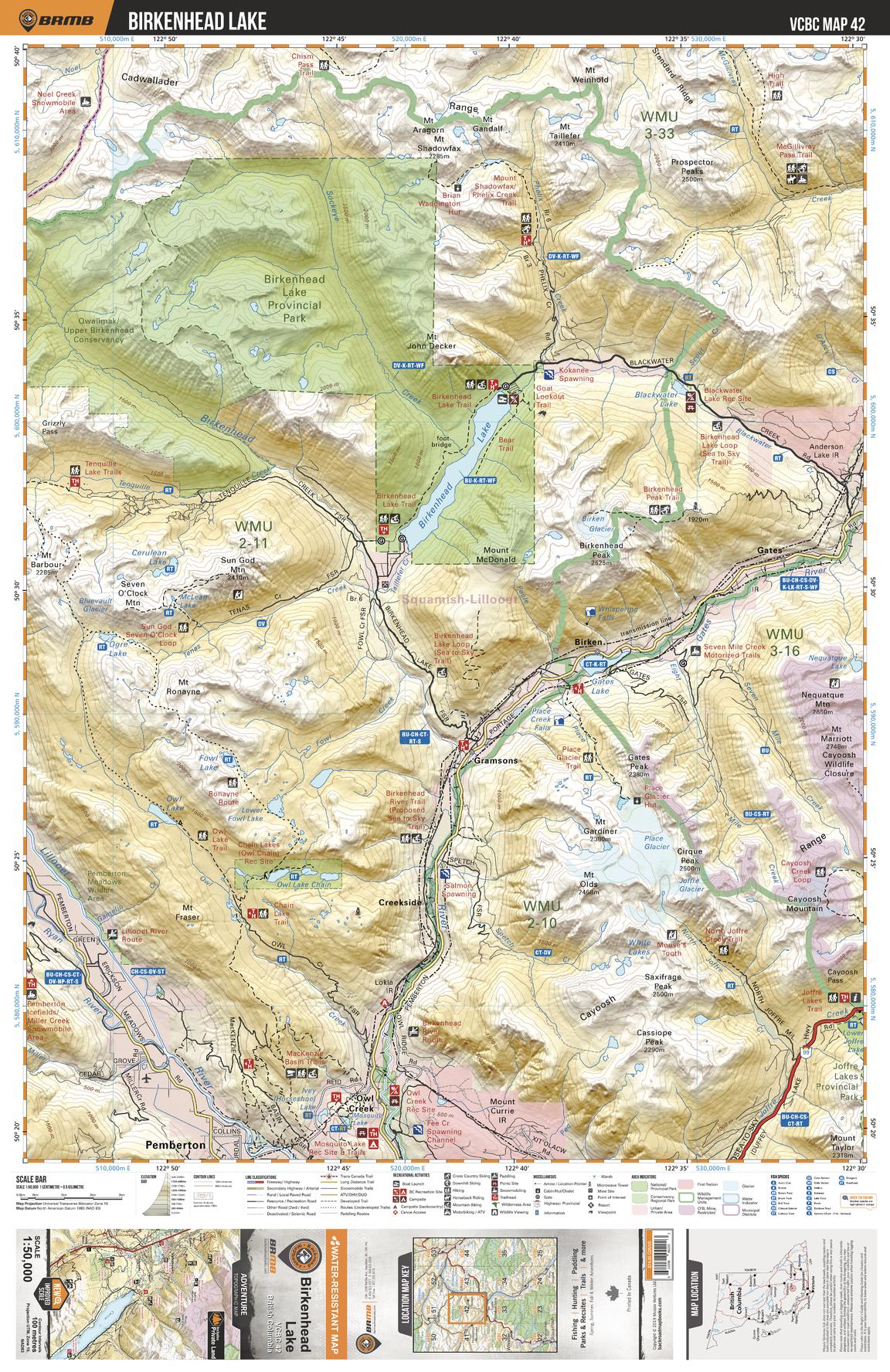
This recreation topographic map for the Birkenhead Lake area highlights all the logging roads, trails and recreational Points of Interest including hunting, camping, hiking, mountain biking, canoeing, kayaking, backcountry skiing, wildlife viewing, ATVing, snowmobiling and more. No other map for the area provides you with this level of recreational or topographic detail. Covering 1,090 km2 (420 mi2), this 1:50,000 scale map measures 29 x 38 km (18 x 24 mi) and covers Birkenhead Lake, Birkenhead Lake Provincial Park, Joffre Lakes Provincial Park, Lillooet River, Birkenhead River, Gates River and more!
Page Size: 24 x 37 in (610 x 940 mm)
Buy this map on MapTrove.ca
bottom of page