TOBC38 Raft River - Thompson Okanagan BC Topo Map
Backroad Mapbooks
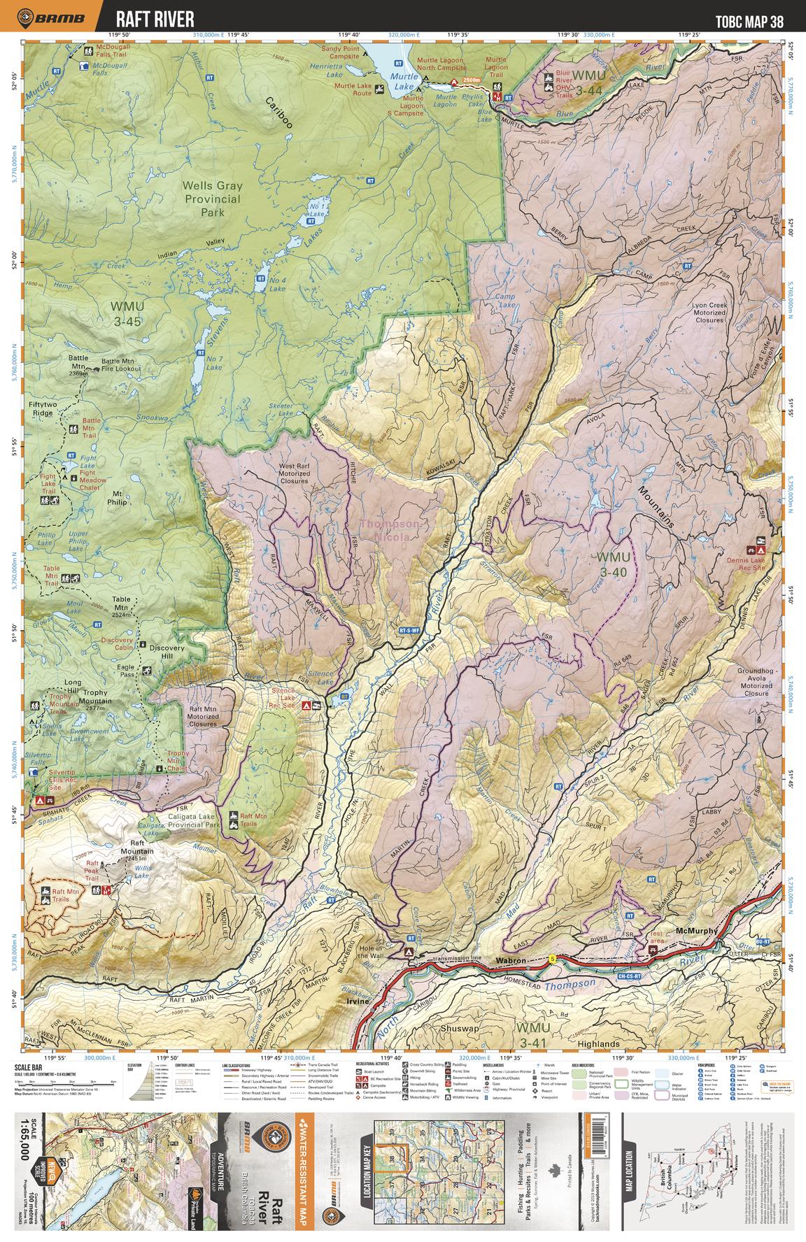
This recreation topographic map for the Raft River area highlights all the logging roads, trails and recreational Points of Interest including hunting, camping, hiking, mountain biking, canoeing, kayaking, backcountry skiing, snowshoeing, cross-country skiing, wildlife viewing, ATVing, snowmobiling and more. No other map for the area provides you with this level of recreational or topographic detail. Special features include private land and countless roads, trails and recreational Points of Interest. Covering 1,950 km2 (750 mi2) in total, this 1:65,000 scale map measures 38 x 51 km (23.5 x 32 mi) and includes Raft River, Wells Gray Provincial Park, North Thompson River, Mad River, Murtle Lake, Callgata Lake Provincial Park and more!
Page Size: 24 x 37 in (610 x 940 mm)
Buy this map on MapTrove.ca