SOAB07 Pakowki Lake - Southern Alberta Topo
Backroad Mapbooks
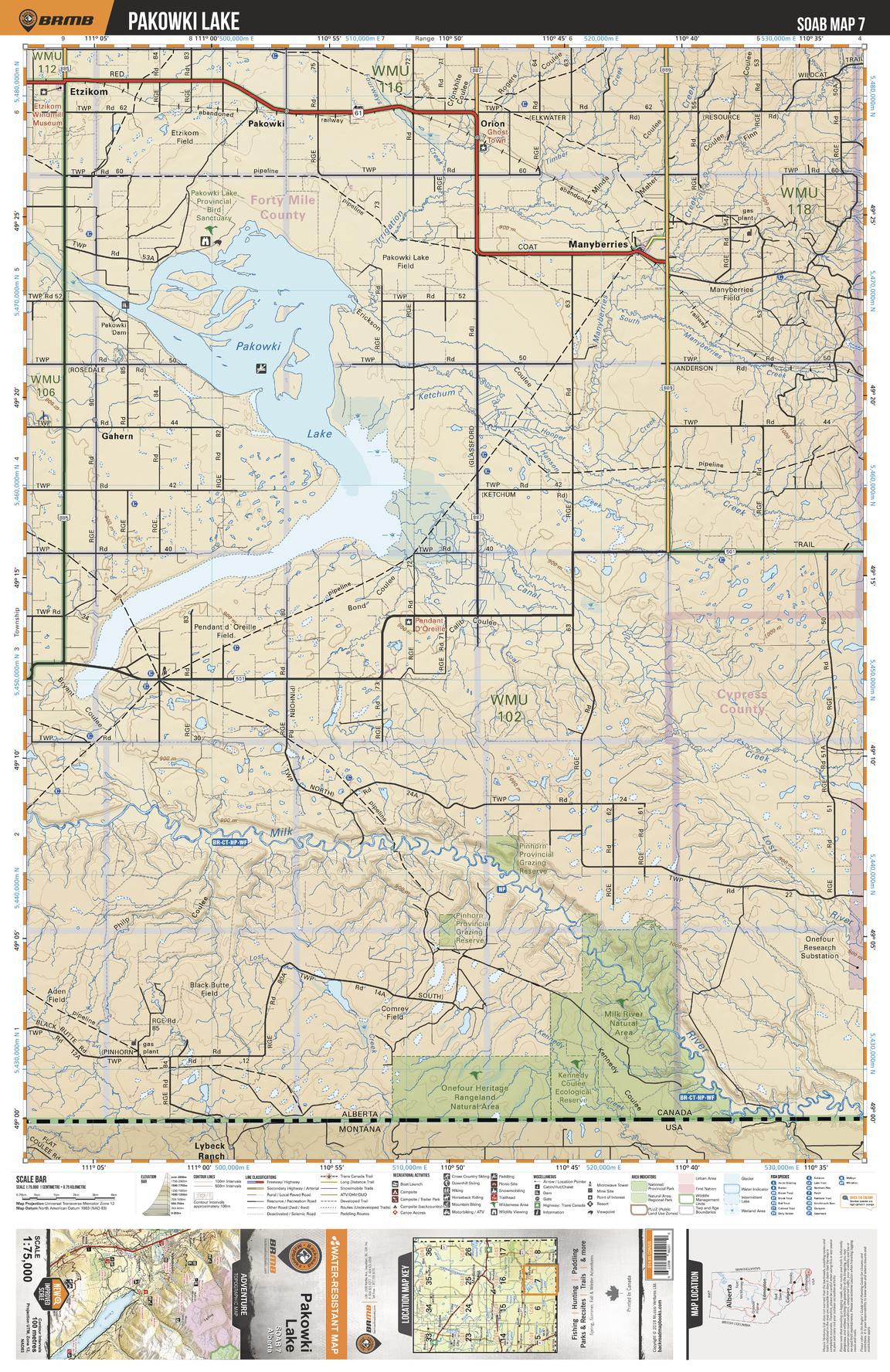
This recreation topographic map for the Pakowki Lake area highlights all the logging and resource roads, multi-use trails for hikers, mountain bikers, horseback riders, cross-country skiers and snowshoers, motorized trails for ATVers and snowmobilers, fishing lakes and rivers, recreation areas, campgrounds, day-use areas, viewpoints, backcountry campsites, work camps, oil & gas sites, backcountry huts and cabins and more. No other map for the area provides you with this level of recreational or topographic detail. Covering 2,465 km2 (950 mi2) in total, this 1:75,000 scale map measures 43 x 57 km (27 x 35.5 mi). Special features include Crown Forest Management Areas, Public Land Use Zones, labelled fish species, enhanced oil & gas data and countless roads, trails and recreational Points of Interest. This map includes Pakowki Lake, Manyberries, Pakowki, Etzikom, Gahern, Milk River, Kennedy Coulee Eco Reserve, Pinhorn Provincial Grazing Reserve, Milk River Natural Area, Onefour Heritage Rangeland and more!
Page Size: 24 x 37 in (610 x 940 mm)
Buy this map on MapTrove.ca