NWON76 North Caribou Lake - Northwestern Ontario Topo
Backroad Mapbooks
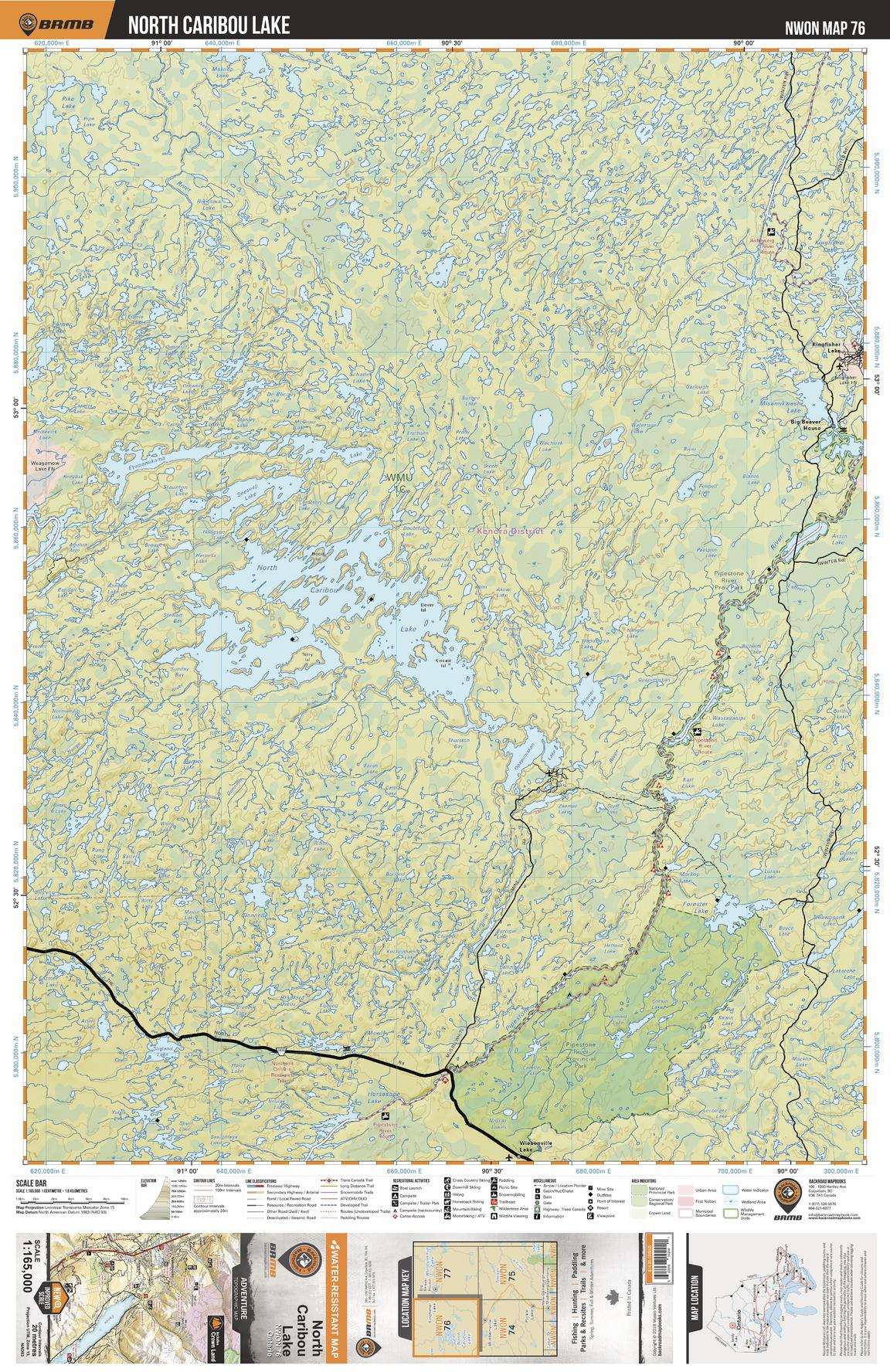
This recreation topographic map for North Caribou Lake highlights all the logging/resource roads, hunting areas, fishing lakes & streams, campsites, paddling routes for canoeing and kayaking, wildlife viewing areas, motorized trails for ATVing and snowmobiling & more. Covering 12,170 km2 (4,700 mi2), this 1:165,000 scale map measures 96 x 127 km (60 x 79 mi), providing you with more topographic and recreational detail for the Pickle Lake area than any other map on the market. New features include expanded road and trail data and countless recreational Points of Interest. Included on this map are North Caribou Lake, Pipestone River Provincial Park, Pipestone River, Forester Lake, Horseshoe Lake, Lemont Lake, Karl Lake, Misamikwash Lake and more!
Page Size: 24 x 37 in (610 x 940 mm)
Buy this map on MapTrove.ca