NWON41 Obonga-Ottertooth Park - Northwestern Ontario Topo
Backroad Mapbooks
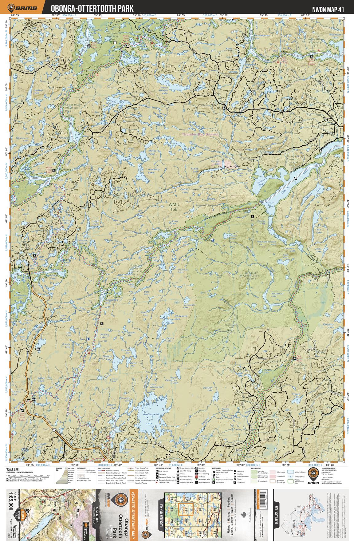
This recreation topographic map for Obonga-Ottertooth Park highlights all the logging/resource roads, hunting areas, fishing lakes & streams, campsites, paddling routes for canoeing and kayaking, wildlife viewing areas, multi-use trails for hiking, biking, horseback riding, cross-country skiing and snowshoeing, motorized trails for ATVing and snowmobiling & more. Covering 3,040 km2 (1,175 mi2), this 1:85,000 scale map measures 48 x 63.5 km (30 x 39.5 mi), providing you with more topographic and recreational detail for the Lac La Croix area than any other map on the market. New features include expanded road and trail data and countless recreational Points of Interest. Included on this map are Obonga-Ottertooth Park, Wabakimi Provincial Park, Kopka River, Ottertooth Conservation Reserve, Gull River Provincial Park, Holinshead Lake and more!
Page Size: 24 x 37 in (610 x 940 mm)
Buy this map on MapTrove.ca