NSNS54 Bay St Lawrence - Nova Scotia Topo
Backroad Mapbooks
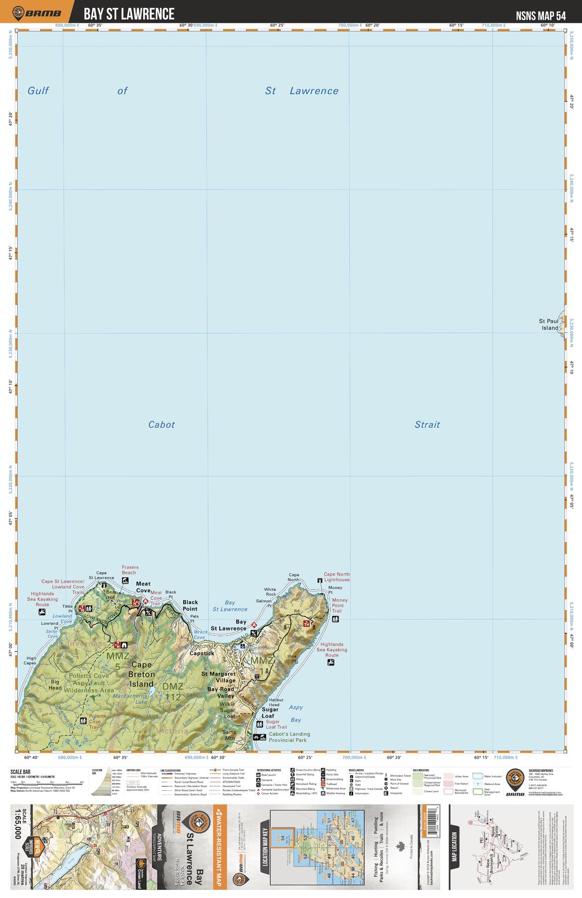
This recreation topographic map for Bay St Lawrence highlights all the logging/resource roads, hunting areas, fishing lakes & streams, campsites, paddling routes for canoeing and kayaking, wildlife viewing areas, multi-use trails for hiking, biking, horseback riding, cross-country skiing and snowshoeing, motorized trails for ATVing and snowmobiling & more. Covering 1,925 km2 (745 mi2), this 1:65,000 scale map measures 38 x 50 km (24 x 31 mi), providing you with more topographic and recreational detail for the Yarmouth area than any other map on the market. Special features include the addition of Crown land areas and countless new roads, trails and recreational Points of Interest. Included on this map are Cabot Strait, Meat Cove, Black Point, Capstick, Sugar Loaf, Pollets Cove Aspy Fault Wilderness Area, Bay St Lawrence, Aspy Bay, St Margaret Village, Cabot's Landing Provincial Park and more!
Page Size: 24 x 37 in (610 x 940 mm)
Buy this map on MapTrove.ca