NOBC79 Omineca Resource Road - Northern BC
Backroad Mapbooks
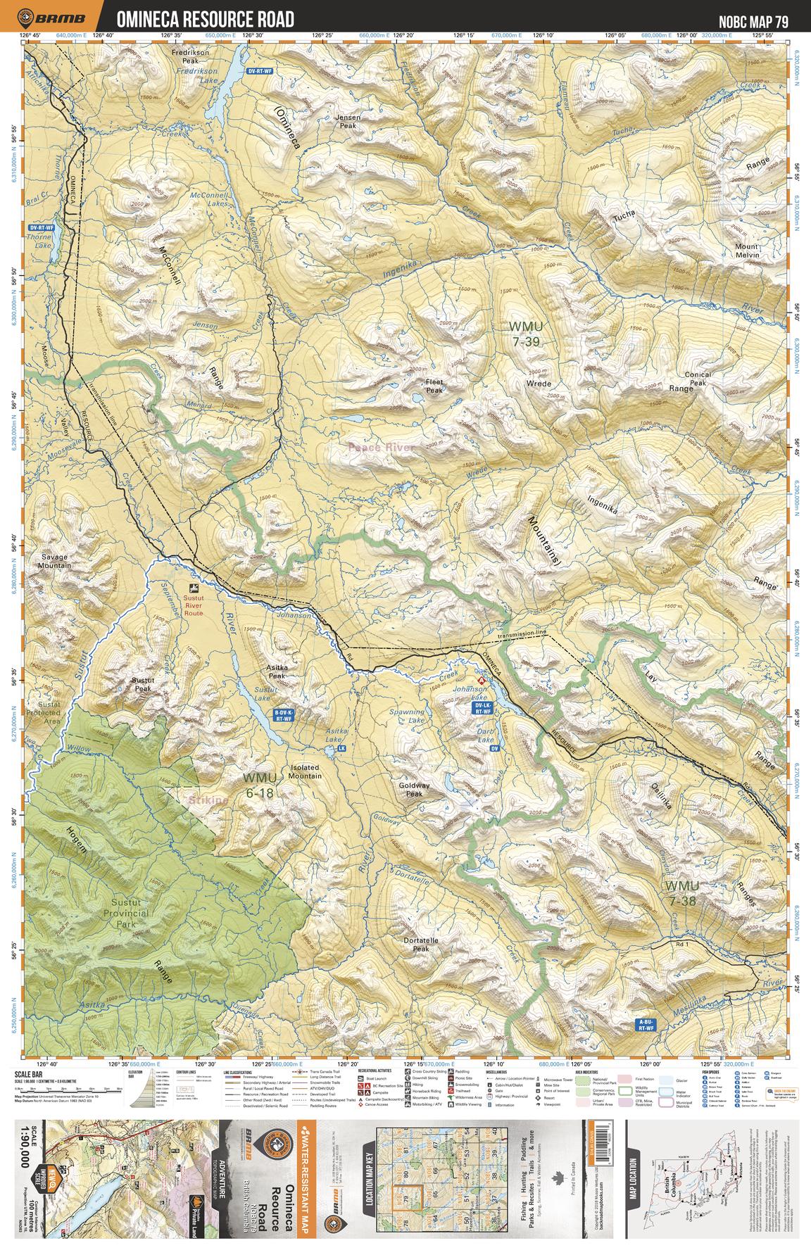
This recreation topographic map for the Omineca Resource Road area highlights all the logging and resource roads, recreational features and trails for hiking, mountain biking, ATVing, snowmobiling, skiing, snowshoeing, fishing, camping, hunting, canoeing, kayaking, wildlife viewing and more. New features include private land and labelled fish species, plus new roads, recreational trails and Points of Interest. No other map for the area provides you with this level of recreational or topographic detail. Measuring 52.5 x 70 km (32.5 x 43.5 mi), this 1:90,000 scale map covers 3,680 km2 (1,420 mi2) in total and includes Omineca Resource Road, Sustut Provincial Park, Fredrikson Lake, McConnell Lakes, Asitka Lake, Ingenika River, Moosevale Creek, Sustut Lake, Johanson Lake, Mesilinka River and more!
Page Size: 24 x 37 in (610 x 940 mm)
Buy this map on MapTrove.ca