NOBC54 Manson River - Northern BC
Backroad Mapbooks
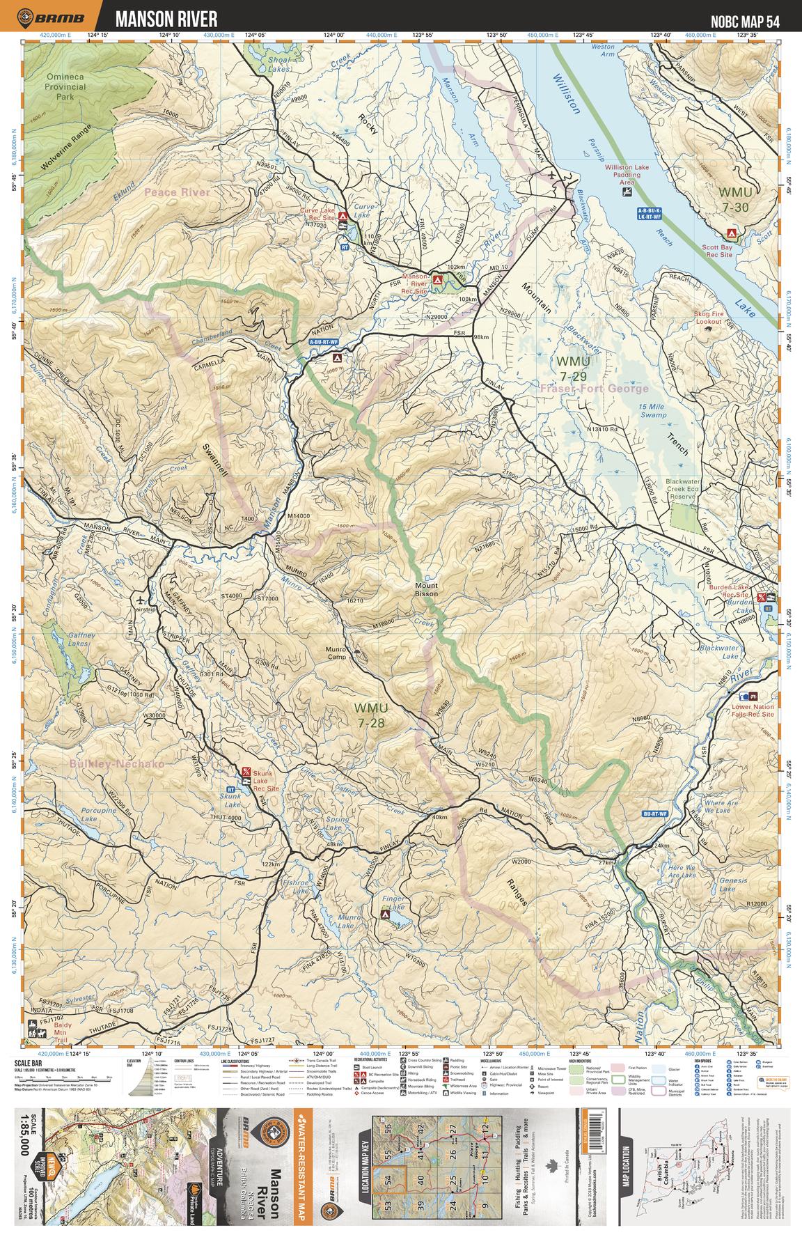
This recreation topographic map for the Manson River area highlights all the logging roads, trails and recreation features for fishing, hunting, camping, hiking, mountain biking, canoeing, kayaking, backcountry skiing, wildlife viewing, ATVing, snowmobiling and more. No other map for the area provides you this level of recreational and topographic detail. New features include private land and labelled fish species plus countless new roads, trails and recreational Points of Interest. Covering Williston Lake, Manson Reach, Manson River, Curve Lake, Omineca Prov Park, Nation River, Skunk Lake, Burden Lake, Blackwater Creek, Blackwater Creek Eco Reserve and more, this map contains new features such as private land and labelled fish species. This 1:85,000 scale map covers 3,040 km2 (1,175 mi2), measuring 50 x 63.5 km (30 x 39.5 mi).
Page Size: 24 x 37 in (610 x 940 mm)
Buy this map on MapTrove.ca